
Writing about my solo River Ayr Way walks from Glenbuck to Muirkirk, then Muirkirk to Sorn has helped me relive beautiful moments of those two separate walking days in October 2023.
This is why I write here on my blog, so I can enjoy every moment again. There will come a time in my life when I might not be able to walk long distances, so having my personal blog means I can look back and smile at the memories all over again.
The River Ayr Way is Scotland’s first source to sea walk and is listed as one of Scotland’s Great Trails. Stretching from Glenbuck Loch to the sea at Ayr, it covers around 41 miles (66 kilometres), mostly following the flow of the River Ayr across East Ayrshire and South Ayrshire.
I split the River Ayr Way walk into three sections, following directions on Walkhighlands: River Ayr Way:
- Glenbuck to Sorn – I walked this over two different days in October 2023:
- Sorn to Stair – I walked this one day in April 2023
- Stair to Ayr – I walked this one day in July 2023
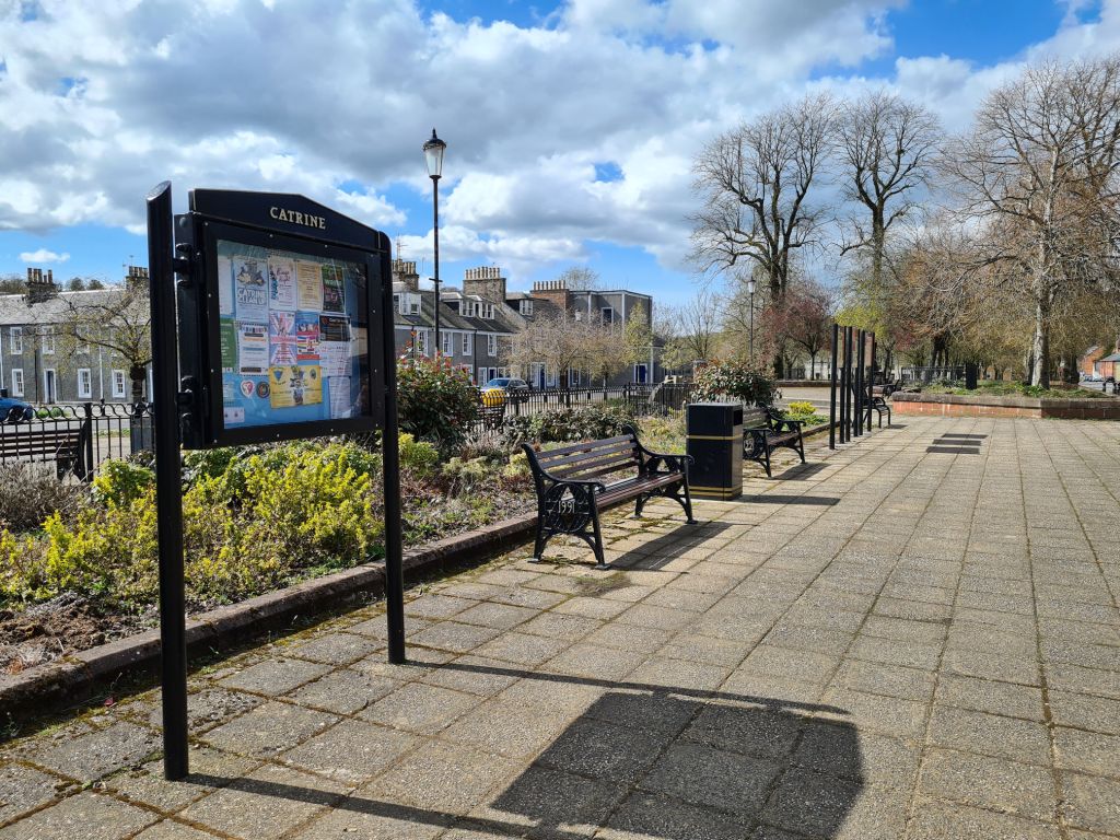
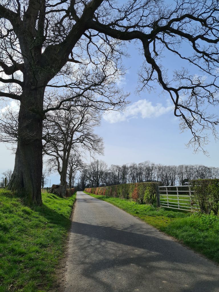
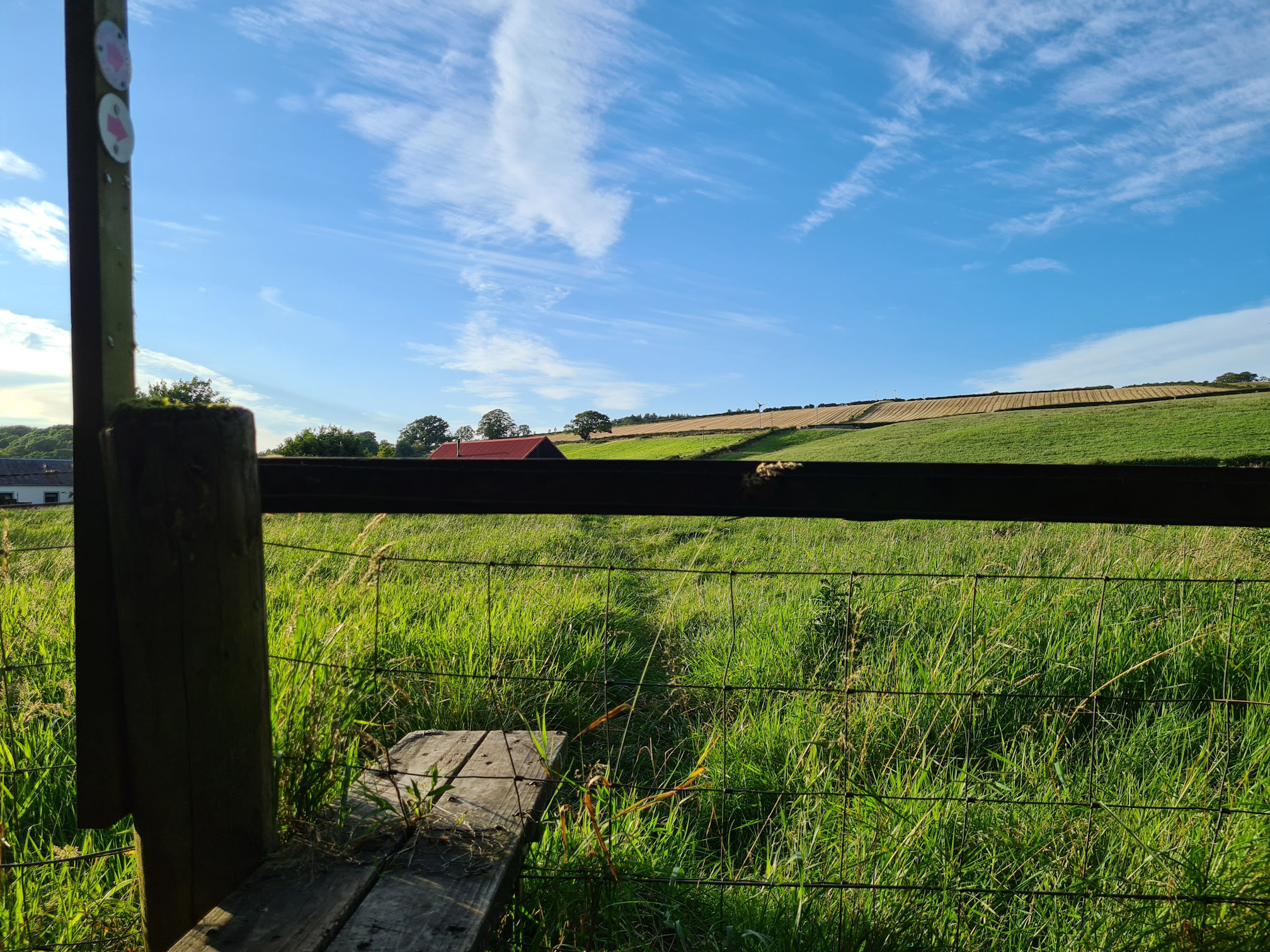
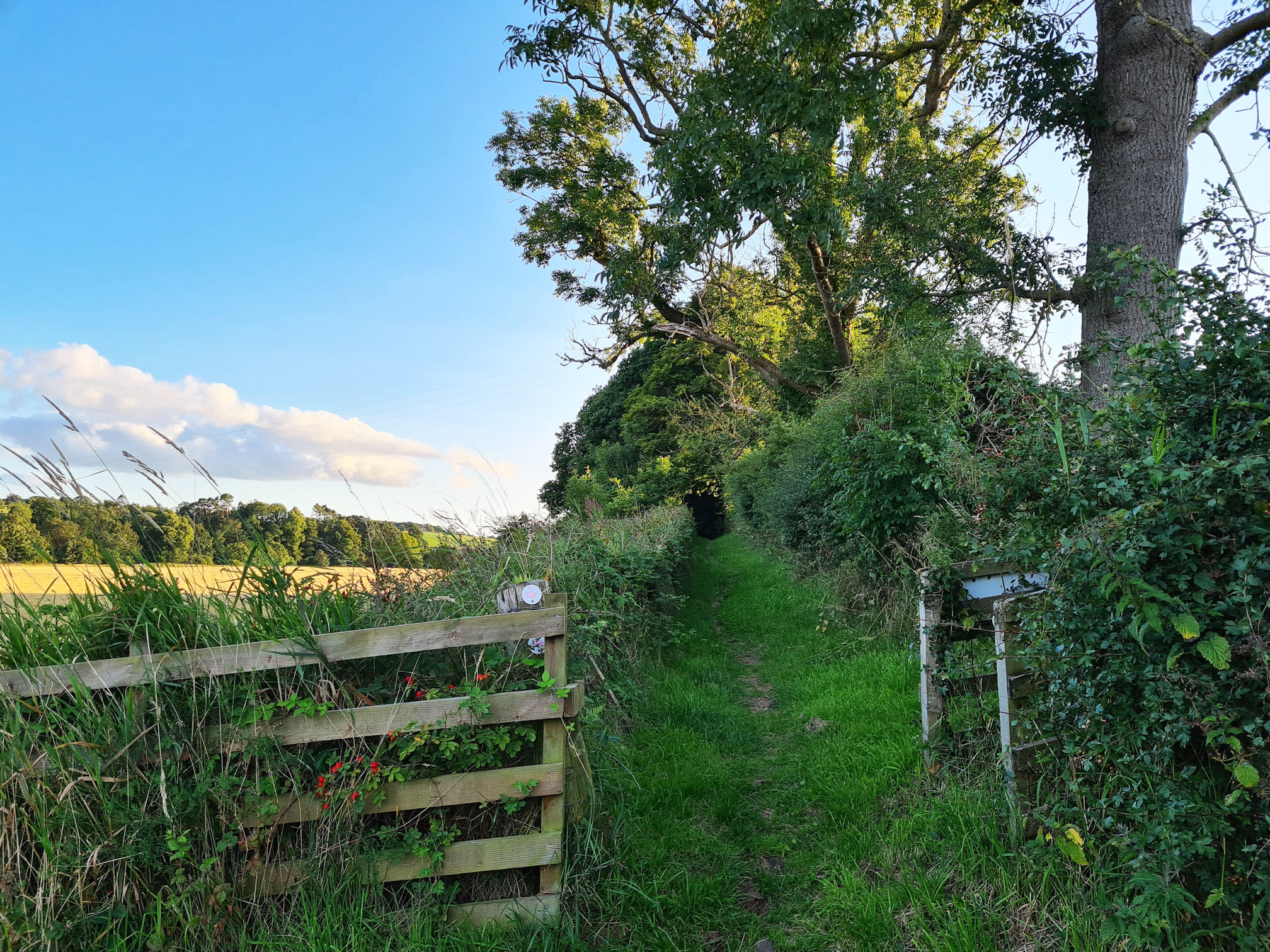
Sorn village
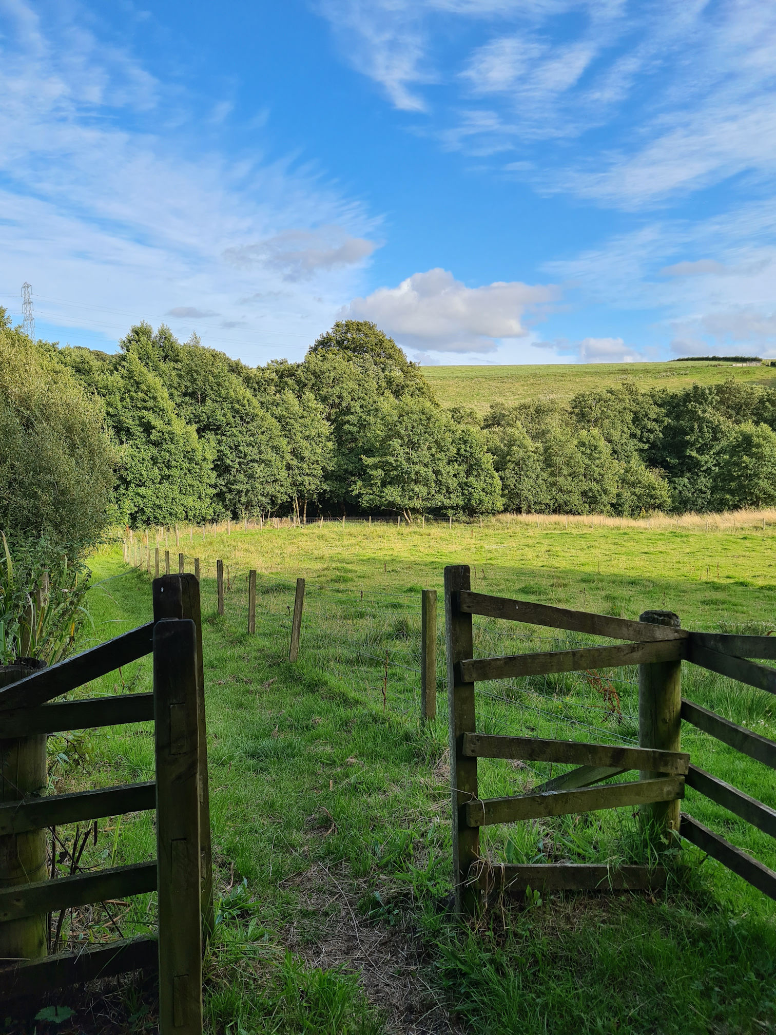
It was a warm sunny spring day in April 2023 when Alan dropped me off at the Sorn Old Bridge across from Sorn Parish Church. We stopped at a small lay-by where he could park for a few minutes.
The plan was that I’d text him when I was at my finishing point, hopefully Stair. If anything happened, such as me getting lost or injured, my Knight in Shining Armour would rescue me.
As I mentioned in my earlier stories, I walked the River Ayr Way in a different order, so in reality this walk was the first part and also my first solo long walk with the distance today being around 11 miles (18 kilometres). I had been hibernating too much over winter and didn’t know how far my legs would take me today. I was determined to go the distance though!
I started out on my new adventure and was feeling excited, but also a little anxious as Alan is usually the navigator. On this day, I was working it out by myself…
I printed out the directions from the Walkhighlands website as this was safer than possibly not having a signal on my phone to access the website, app or even a low battery. I did have a portable charger with me, but I needed my phone fully charged as I use it as my main camera and video recorder, which can drain the battery very quickly!
I loved walking across the Sorn Old Bridge, built in the early 18th century. After walking a short distance, I was already stopping, taking photos, and felt like the character Bilbo in Lord of the Rings off on a new adventure across our very own shire.
What a beautiful start to my day! I was sad that Alan couldn’t join me though, as it would have been nice to share these memories together.
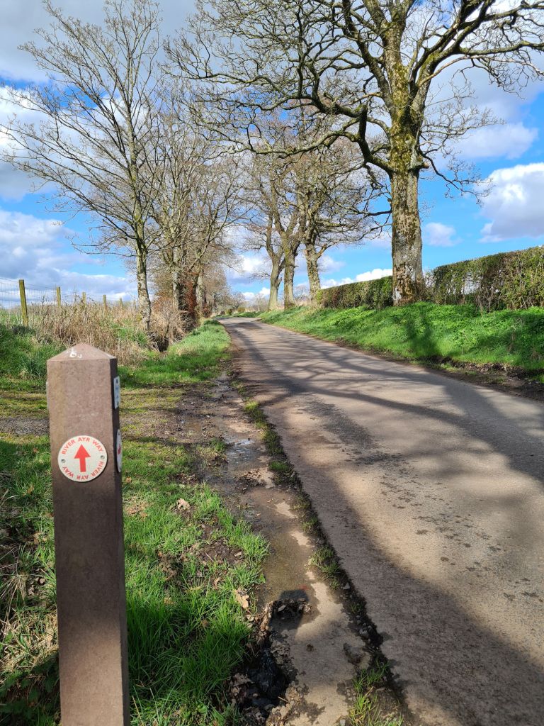
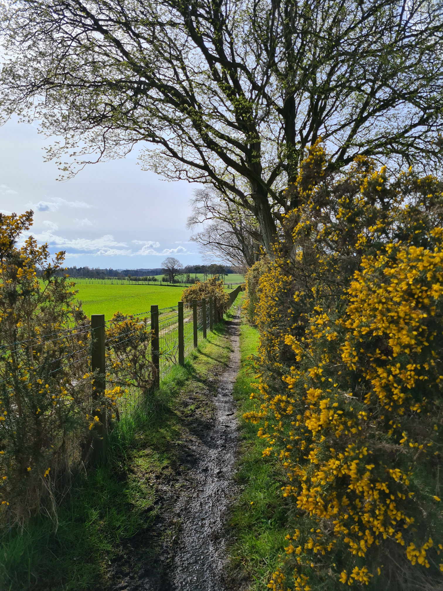
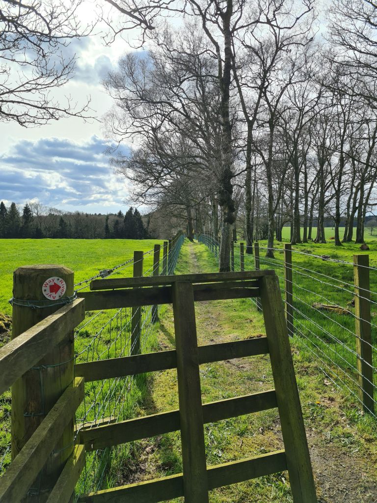
After a short uphill trek along a road, I spotted a sign for the walk on the right, a small, red arrow. Sometimes a large blue arrow in a plastic pocket signposted the way too, which is more obvious from a distance as some of the red arrows on this walk are slightly faded.
The beginnings of spring was just what I needed after the winter months, and it was a sunny day, yay! I did choose my walking day wisely though and checked the Met Office website for the weather forecast.
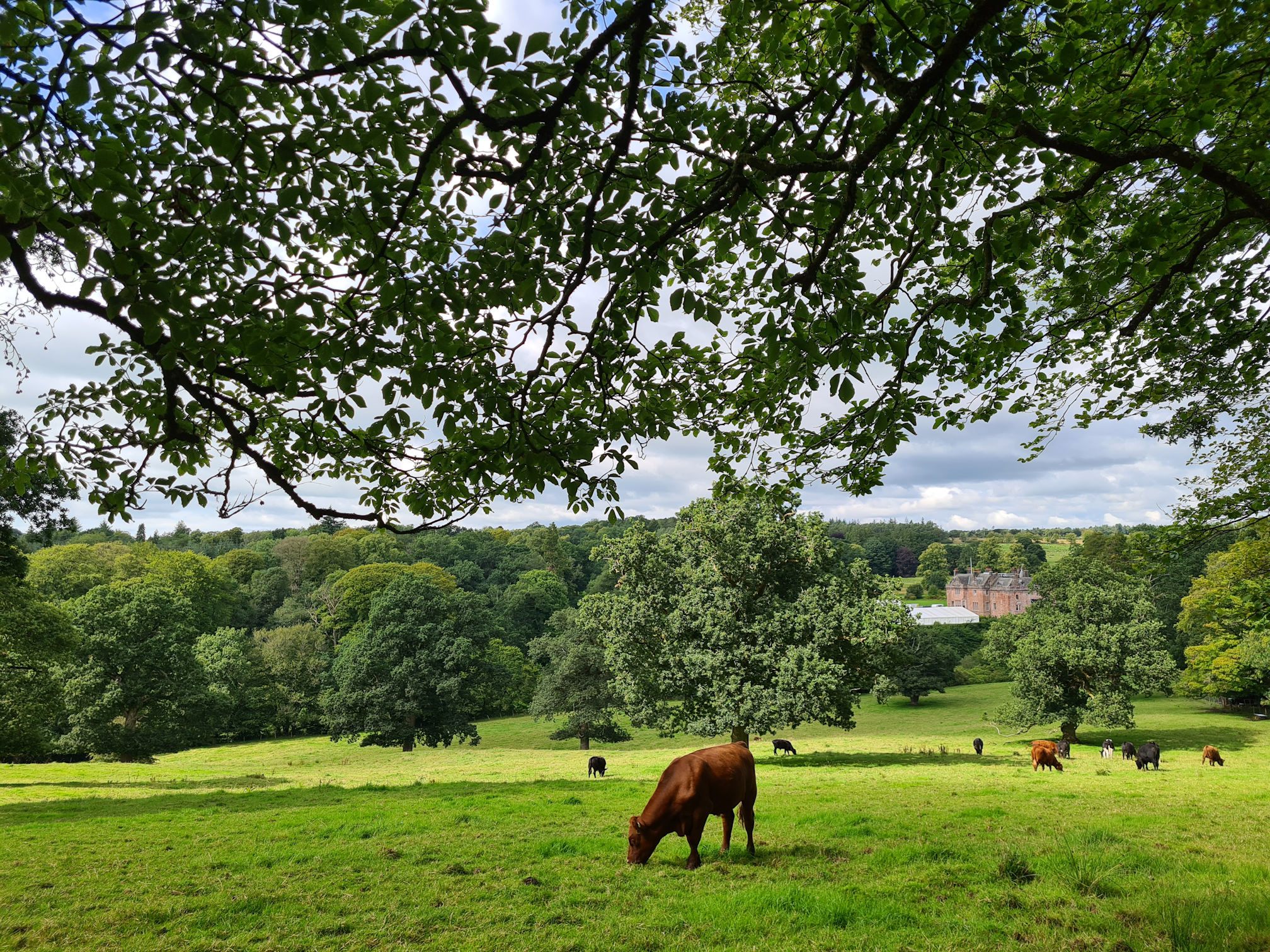
I turned to look across the field beside the footpath and saw a large building in the distance. This was my first time seeing Sorn Castle, and I was already wondering if I could explore it one day, but it’s only for private hire and events such as weddings.
I have a summer photo too as I visited this walk again with my friend, and also with Alan to capture more video footage. The transformation from spring to summer is amazing don’t you think? It’s like walking a new trail. This is why I never tire going to the same place more than once.
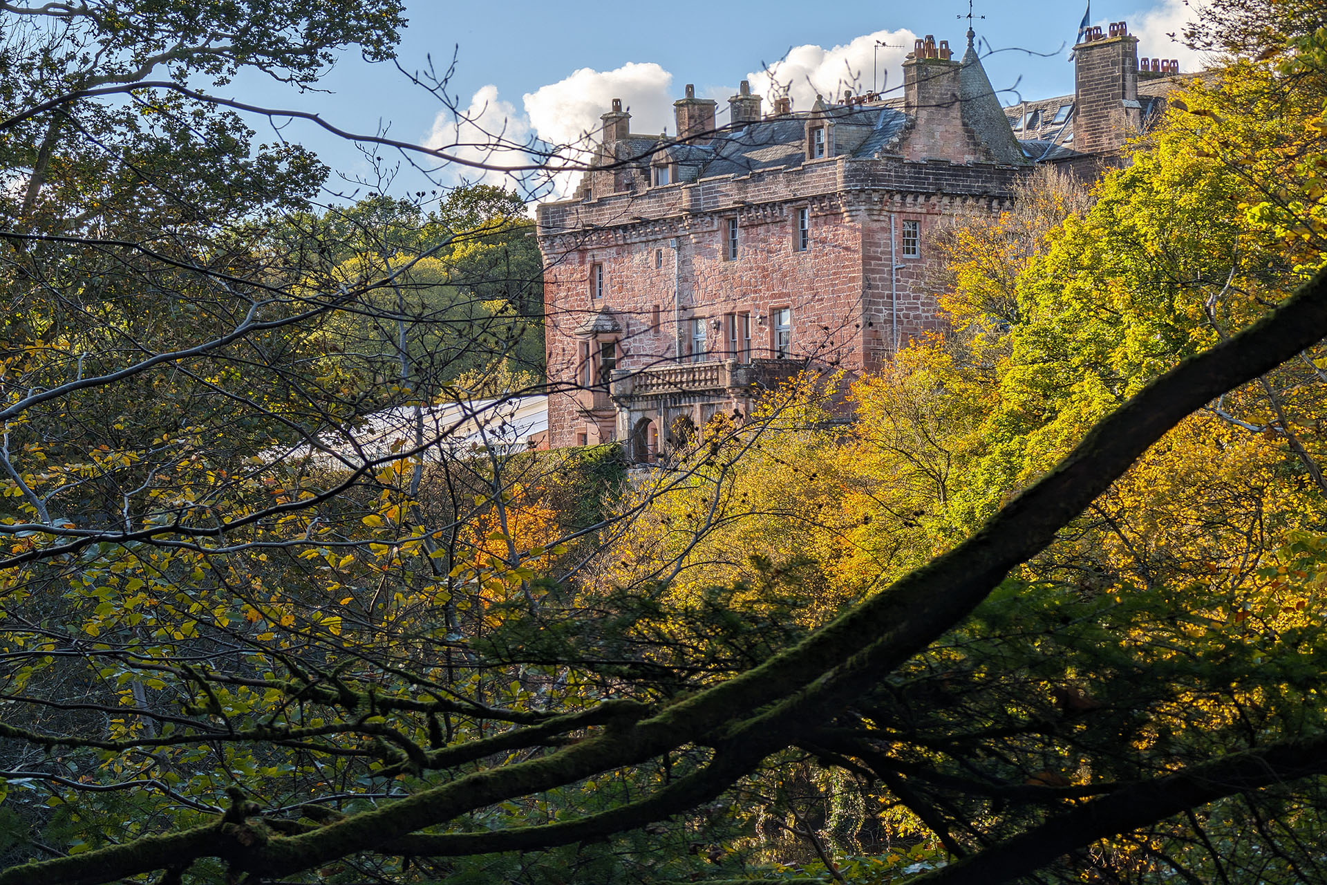
When I took this summer photo, little did I know that filming was taking place at Sorn Castle as one of the locations for the Agatha Christie two-part TV programme ‘Murder is Easy’, set in 1954. Beautiful place for filming!
Alan took this zoomed in photo of Sorn Castle on one of our autumn visits, so pretty!
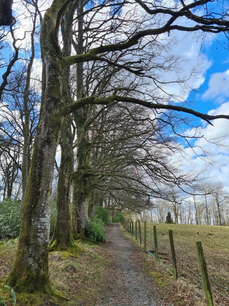
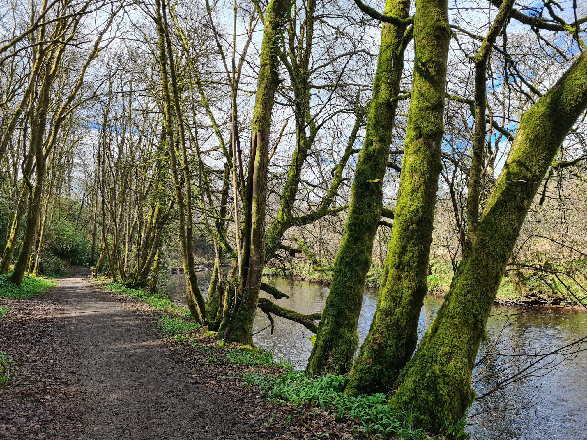
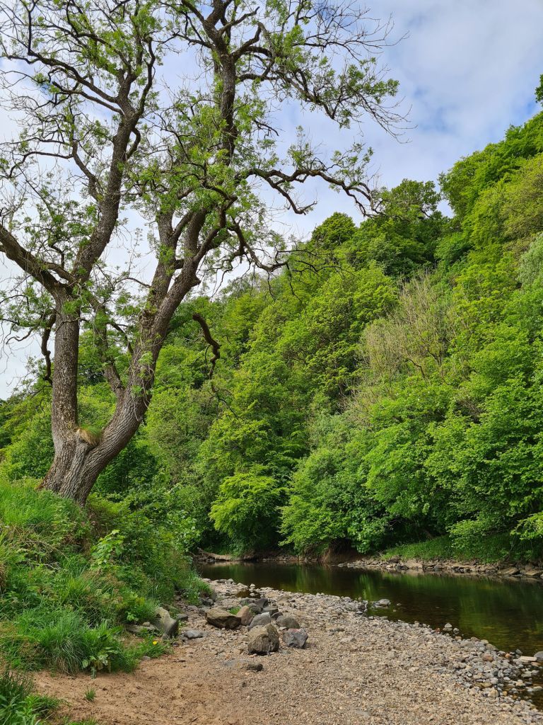
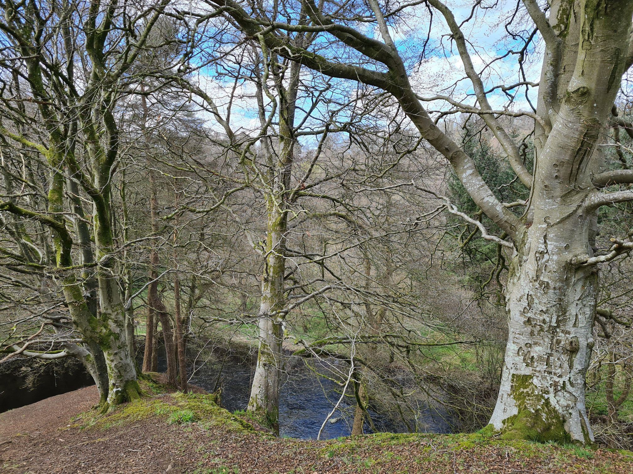
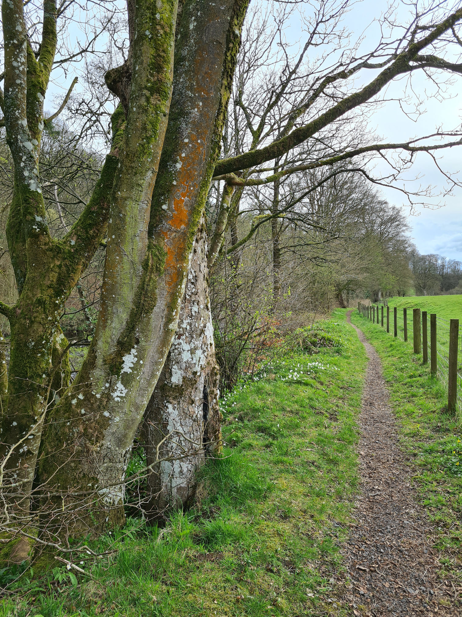
The tall bare trees cast their shadows on the woodland footpath, which quickly took me down towards the River Ayr. Wow, this walk was already lifting my spirits!
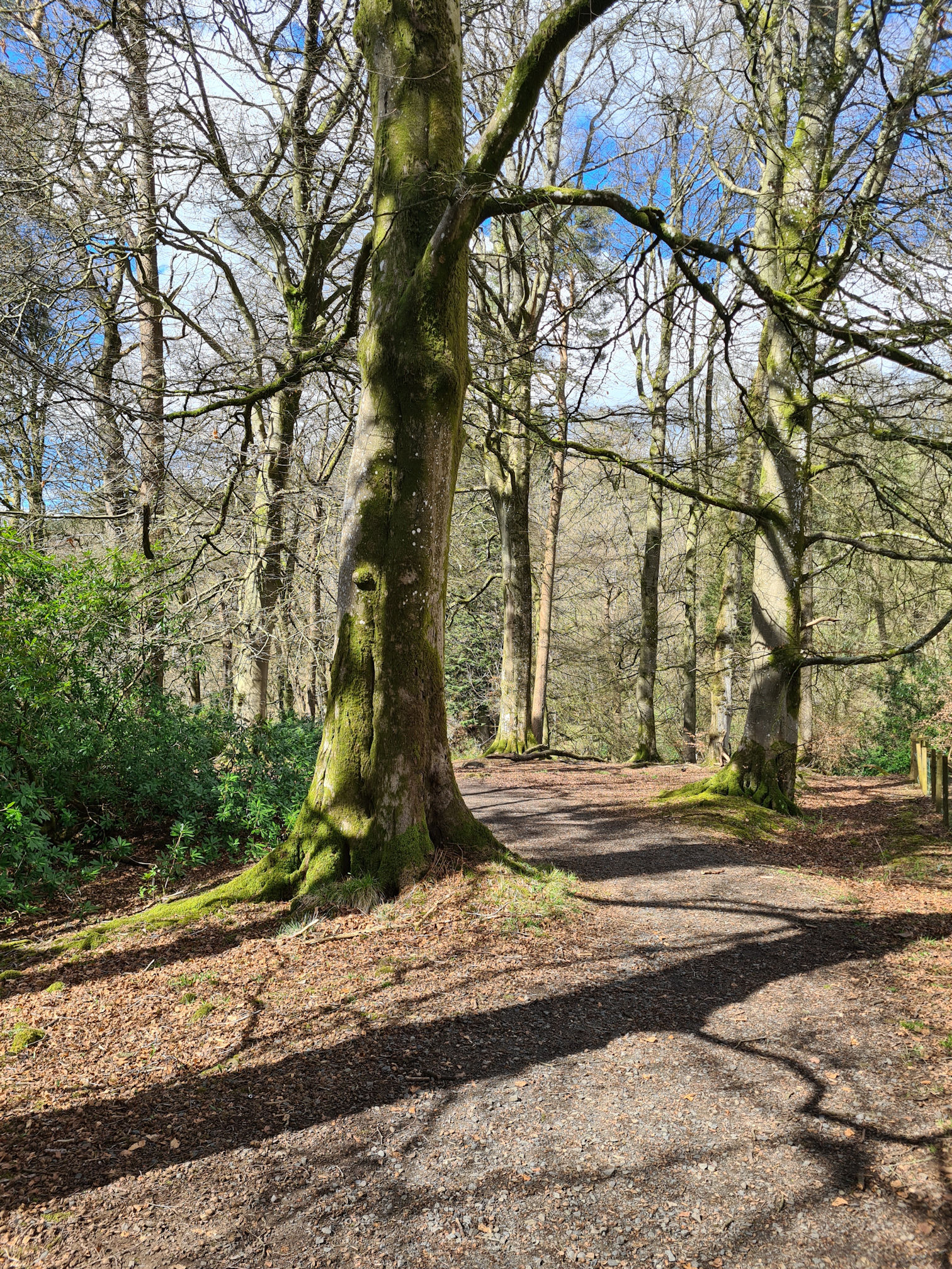
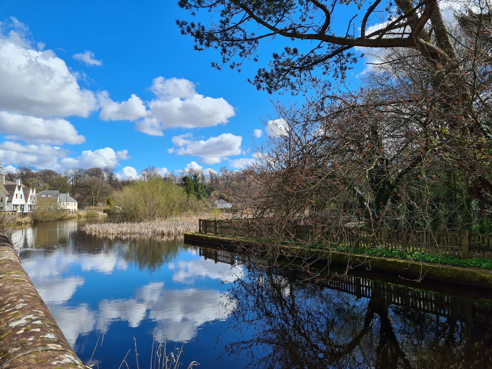
When I reached the wooden footbridge beside the River Ayr I had a spring in my step, excited to see what happens next.
With no time restrictions today, I stopped, admired, and captured every moment. These are the best days out when I can relax my mind and take in all the wonders of nature around me.
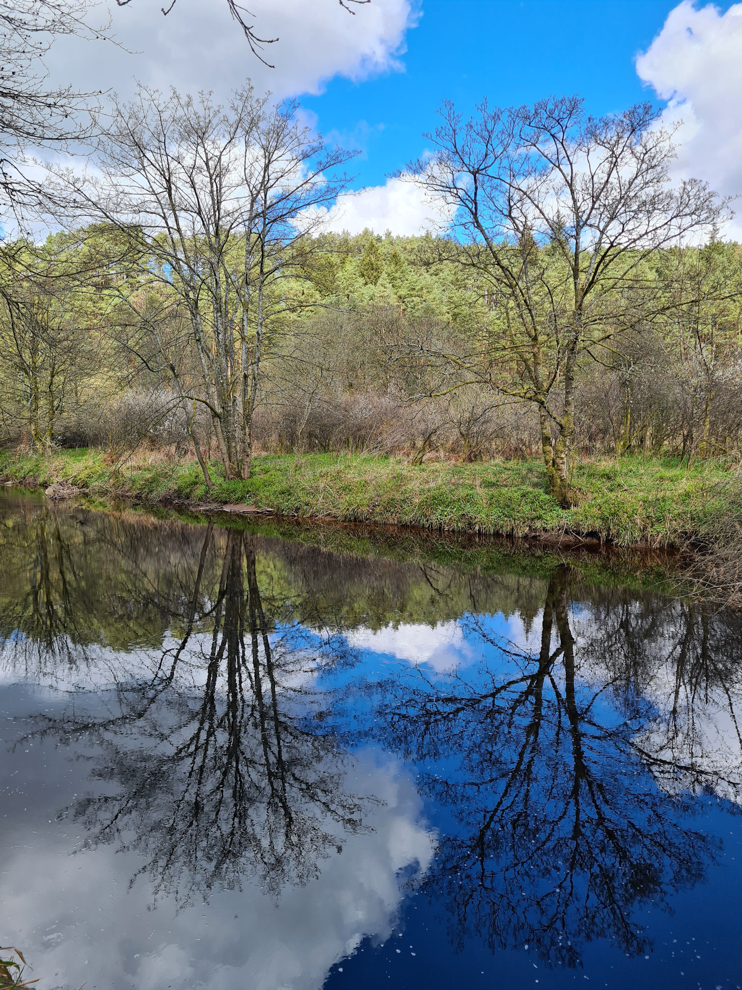
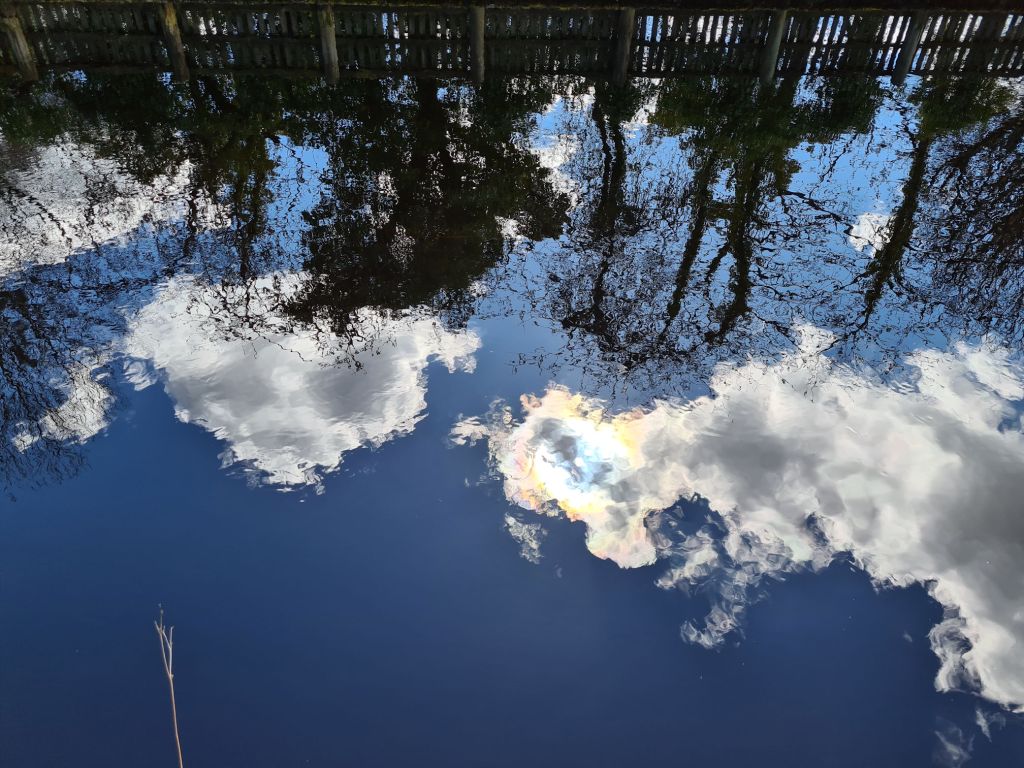
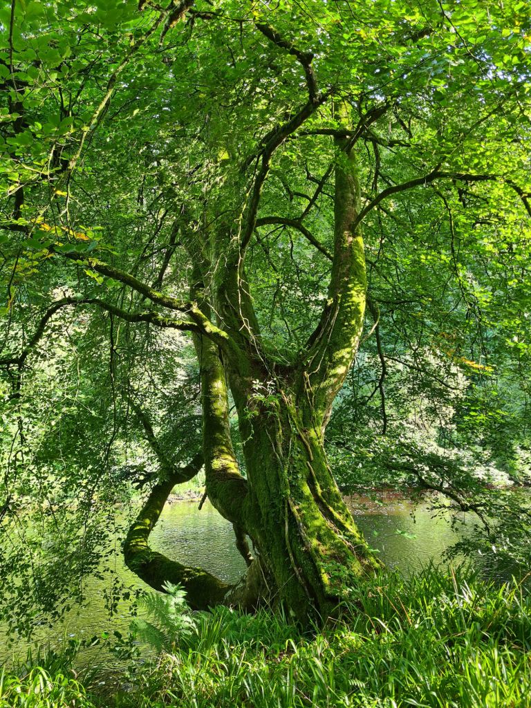
“Oh wow”, I said aloud as I suddenly stopped and gazed upon the sky and tree reflections in the mirror-like water. Reflections are pretty amazing, like an upside down world full of magic and mystery.
Pretty white wood anemone flowers were gathering in clusters here and there. It was new beginnings for the landscape, and also for me as I was long distance walking again.
Catrine village
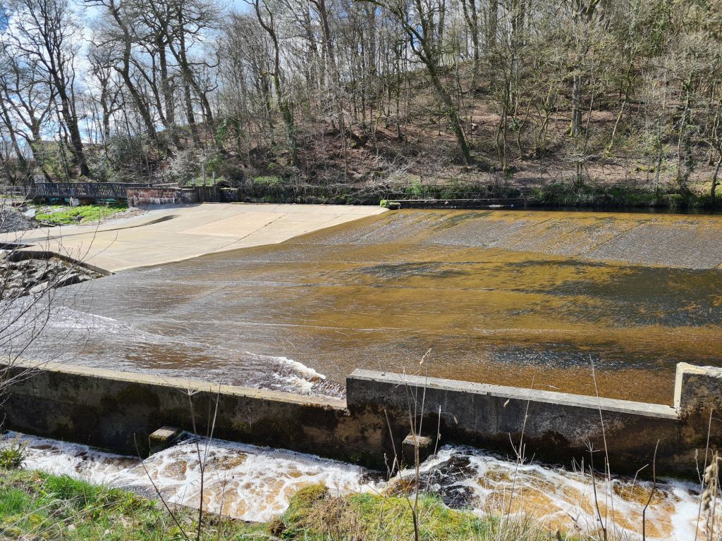
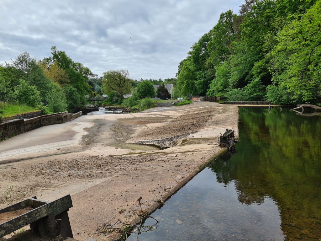
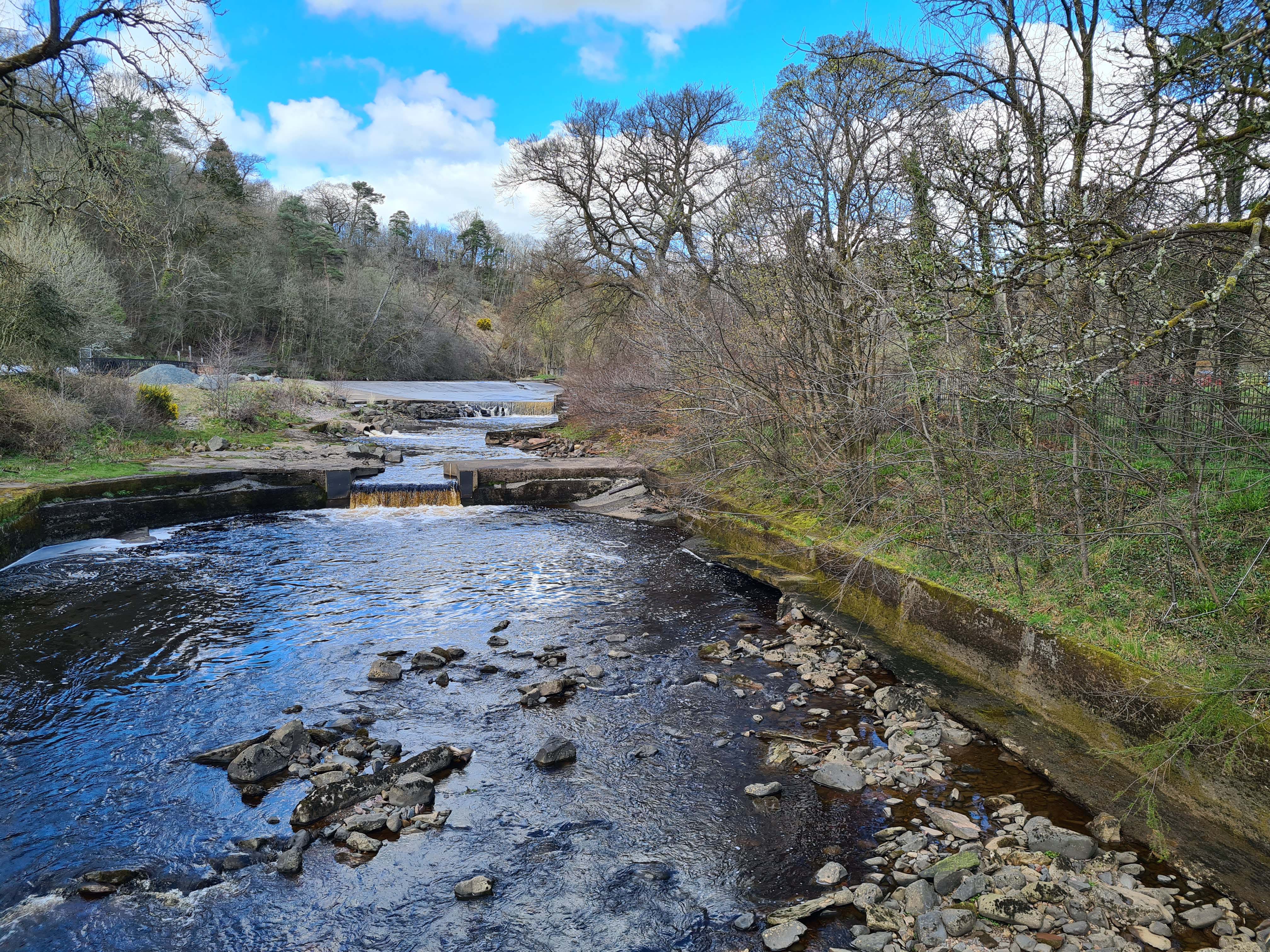
I reached the Catrine Weir which was part of a water system that powered machinery in the old cotton mills and bleaching works. I pronounce Catrine as ‘Cat-rin’ but you will often hear the people who live here pronounce their village as ‘Caw-turn’.
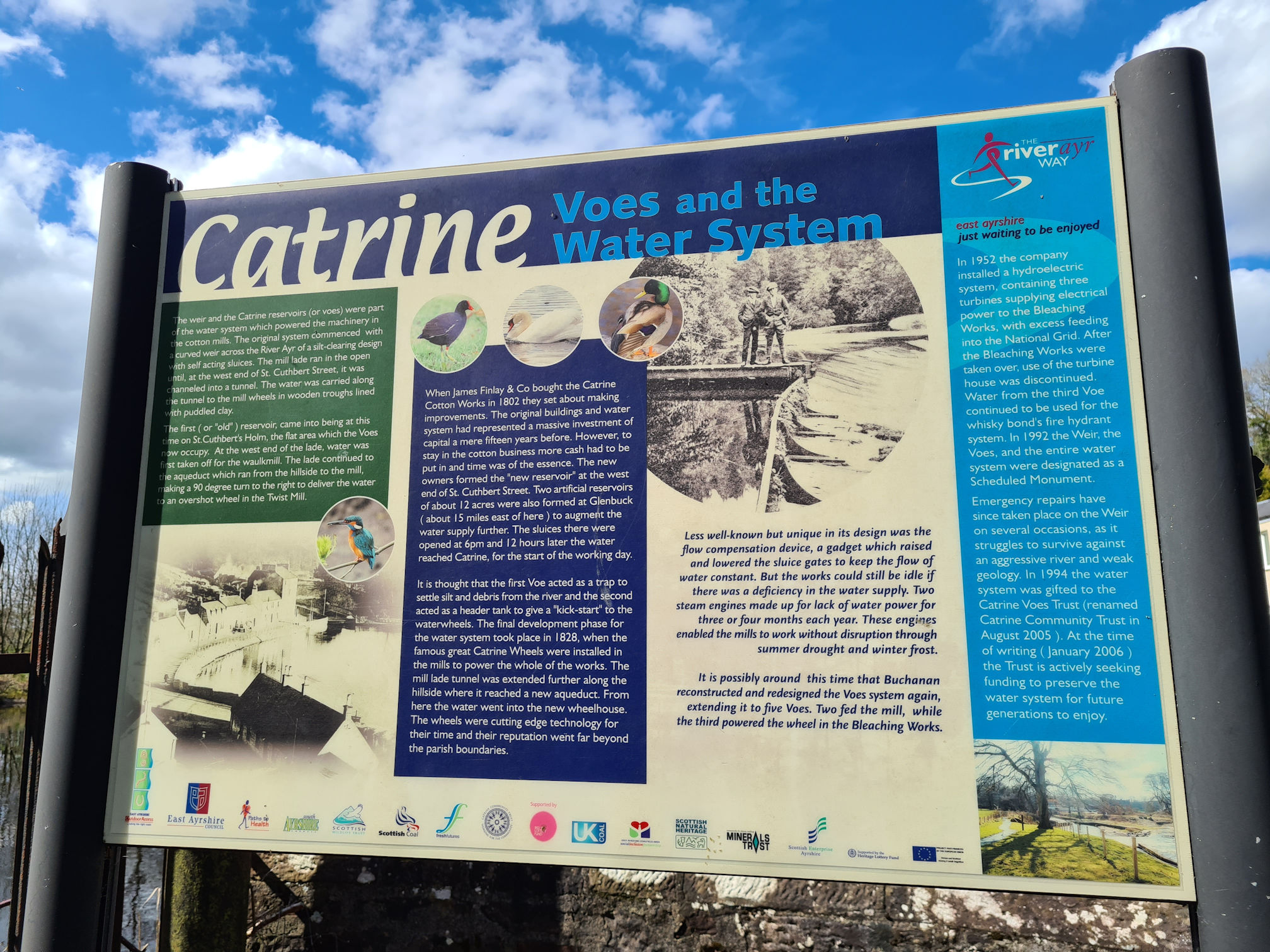
In 1992 the Catrine Weir and Voes were designated as a Scheduled Monument, which means it’s of national importance to understanding the history and will be looked after to preserve its future.
You might remember I mentioned in my story from Glenbuck to Muirkirk, that Glenbuck Loch was formed in 1802, creating a reservoir with the construction of two dams to ensure a constant water supply to power the cotton mills in the village of Catrine.
Glenbuck Loch is around 19 walking miles (30.9 kilometres) from Catrine, so the water had a long way to travel to power the mills!
I soon came to a footbridge across the river with the large blue arrow signposting the River Ayr Way. The wire fencing across the bridge made it tricky to navigate taking a photo of the river, but I managed to position my camera lens through one of the wire holes.
I was now walking away from the River Ayr along St Cuthbert’s Street in Catrine. The row of terraced flats were empty and looking very run down, but when I visited again in the summer I was happy to see housing improvement works were taking place. I could see the front of the buildings had a coat of paint.
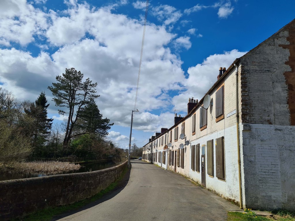
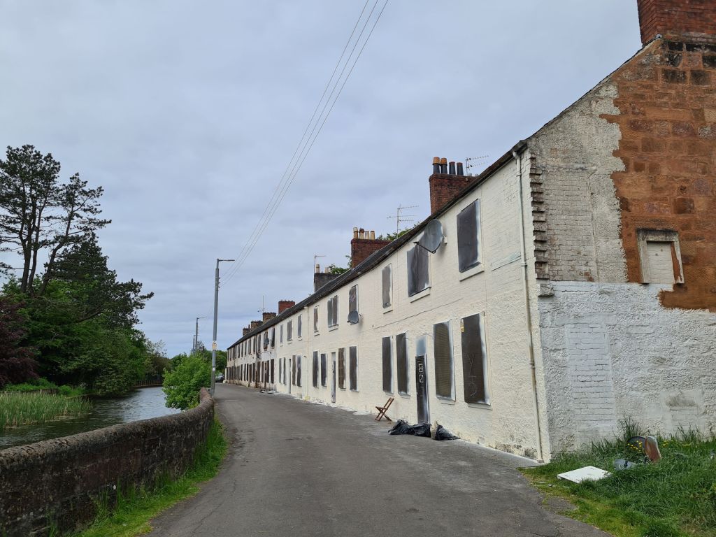
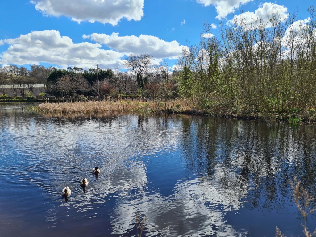
The Catrine Voes along this street were looking so pretty today. These were also reservoirs that supplied water for the cotton mills and now a local nature reserve.
After walking past the Catrine Voes, I saw a blue River Ayr Way arrow pointing to a road junction beside the River Ayr again. When I reached Laigh Road, I was unsure what way to go and read the directions from the Walkhighlands guide more than once. It was telling me to “keep left” at Laigh Road, but that would mean I was walking against the river flow.
I decided to turn right, hoping for a clue that I made the right decision on this mystery trail. To be fair, this was my first time in Catrine and also my first unknown solo walk. I was wishing I had a photo guide I could follow. I might create one as I have lots of photos of the walk.
I think I should have walked a different way at the Catrine Voes as I walked past them and not through them via another footpath. It turns out either way would have taken me to St Germain Street though, the main road through Catrine.
I soon reached Mill Square where there’s information boards about the history of Catrine and other walks around the village. Tap or click to see larger photos.
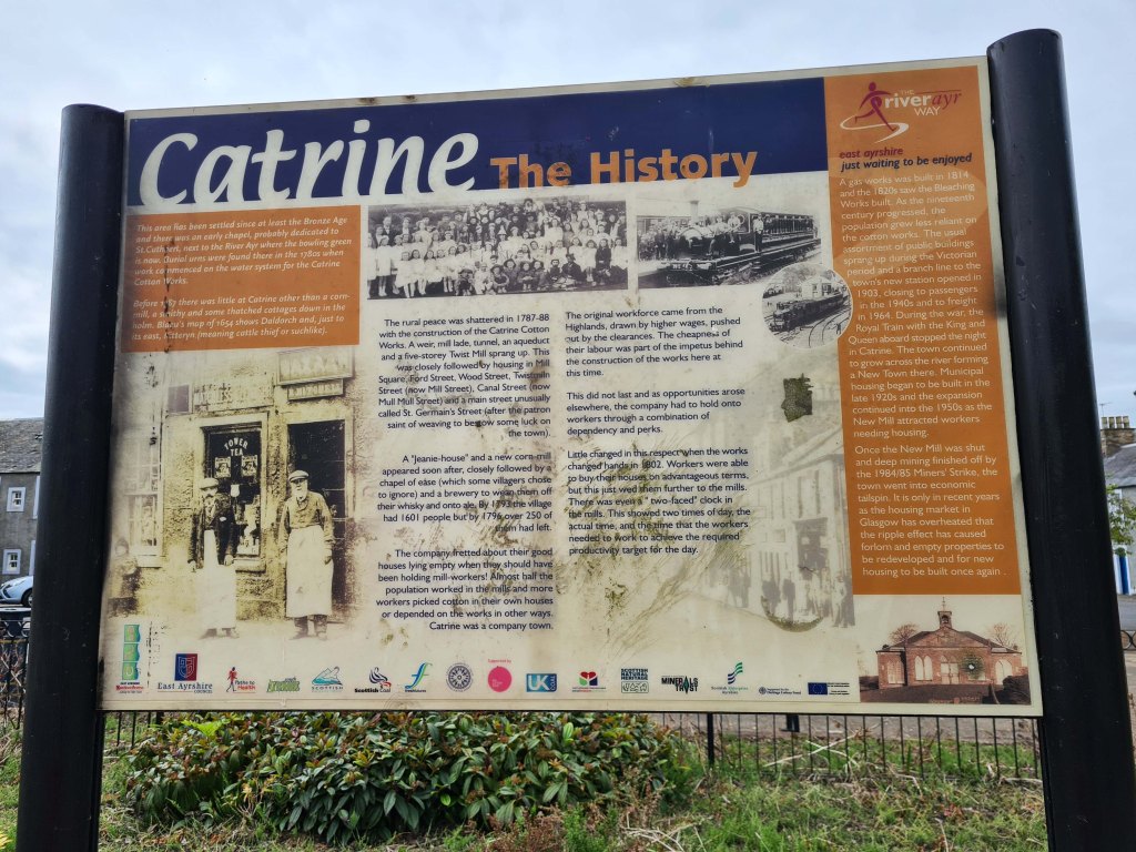
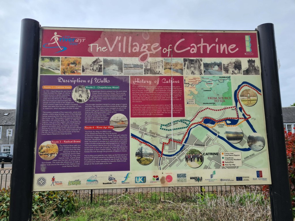
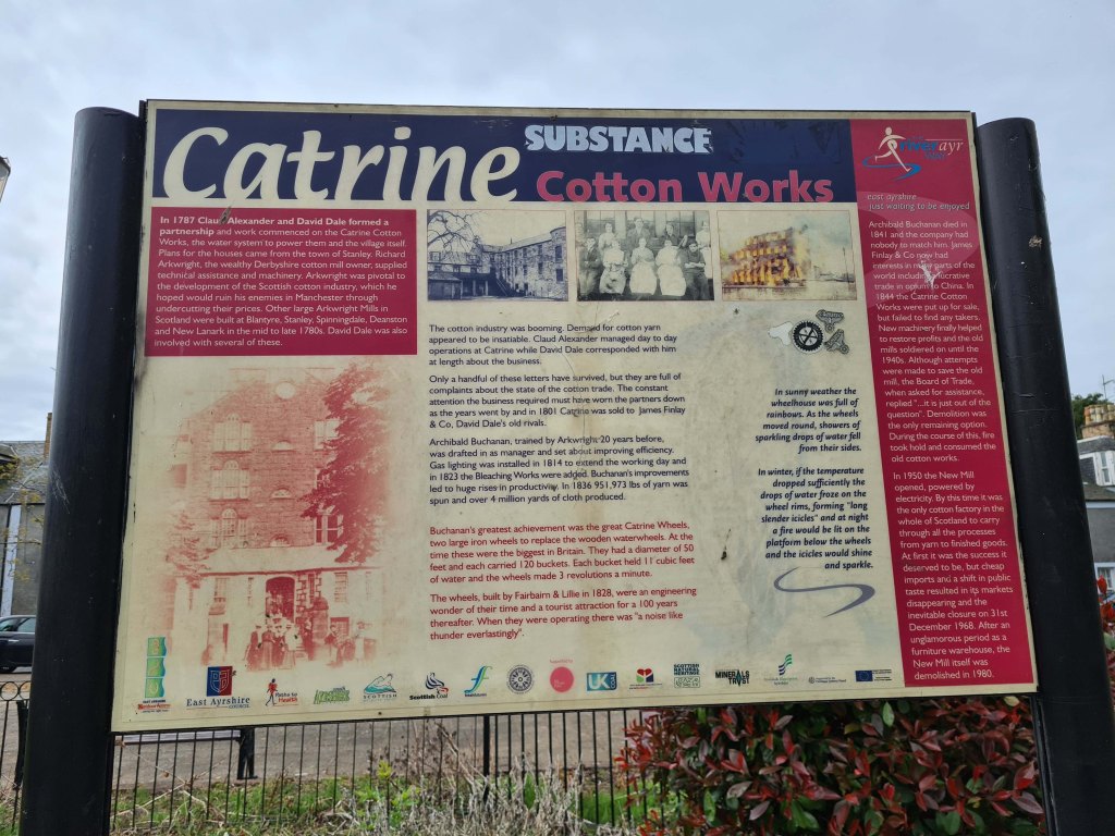
Mill Square is where one of the main mills was located in times past, when Catrine was a thriving industrial village like much of Ayrshire’s past.
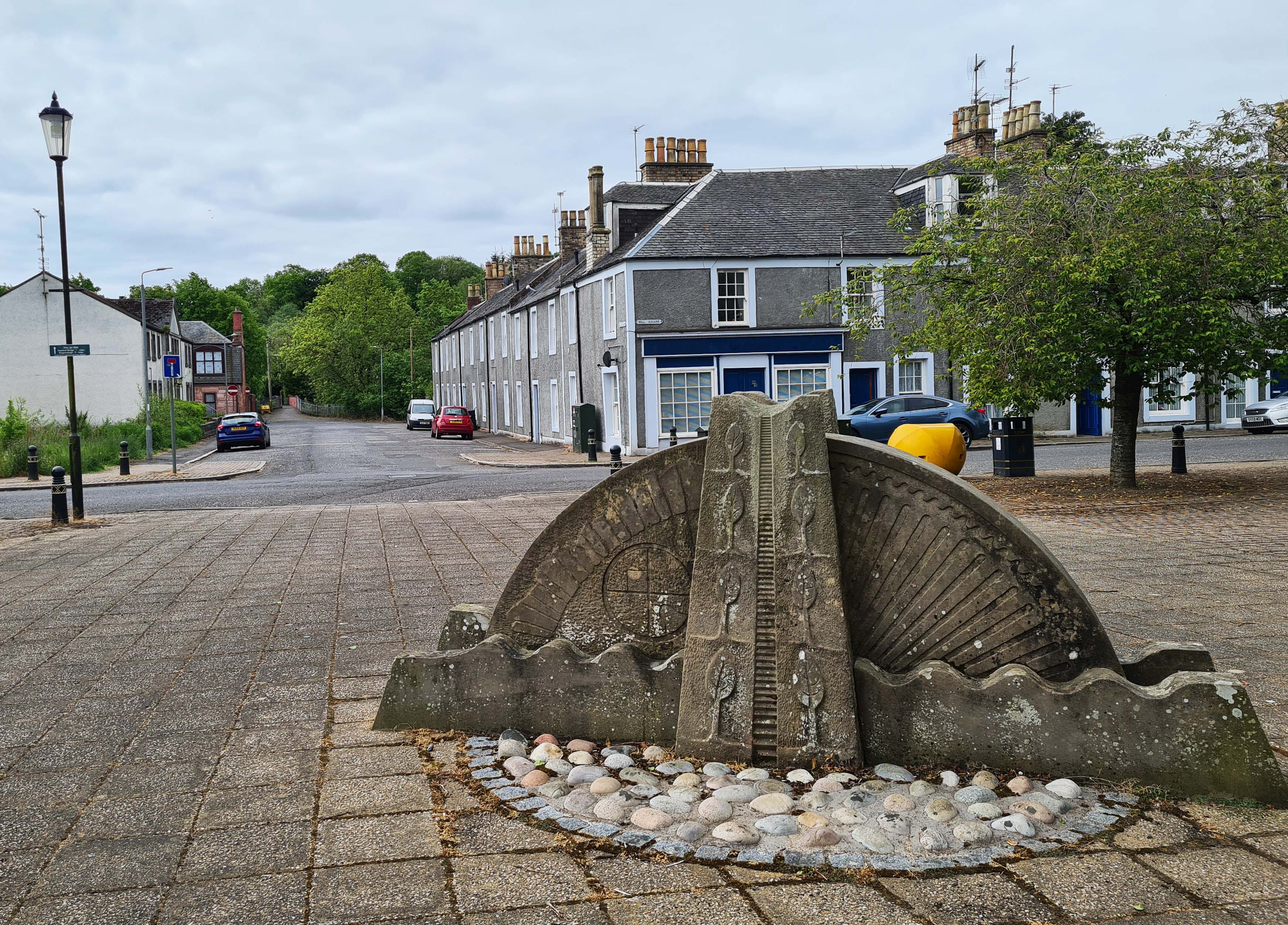
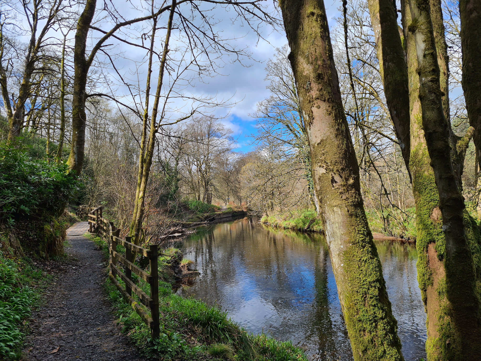
From the stone mill wheel it was straight ahead along Bridge Street towards a footbridge across the river again.
Following the signs I was back following the River Ayr. I was calmer now as I knew I was walking the right way. Every time I saw the River Ayr Way signposting I was so relieved!
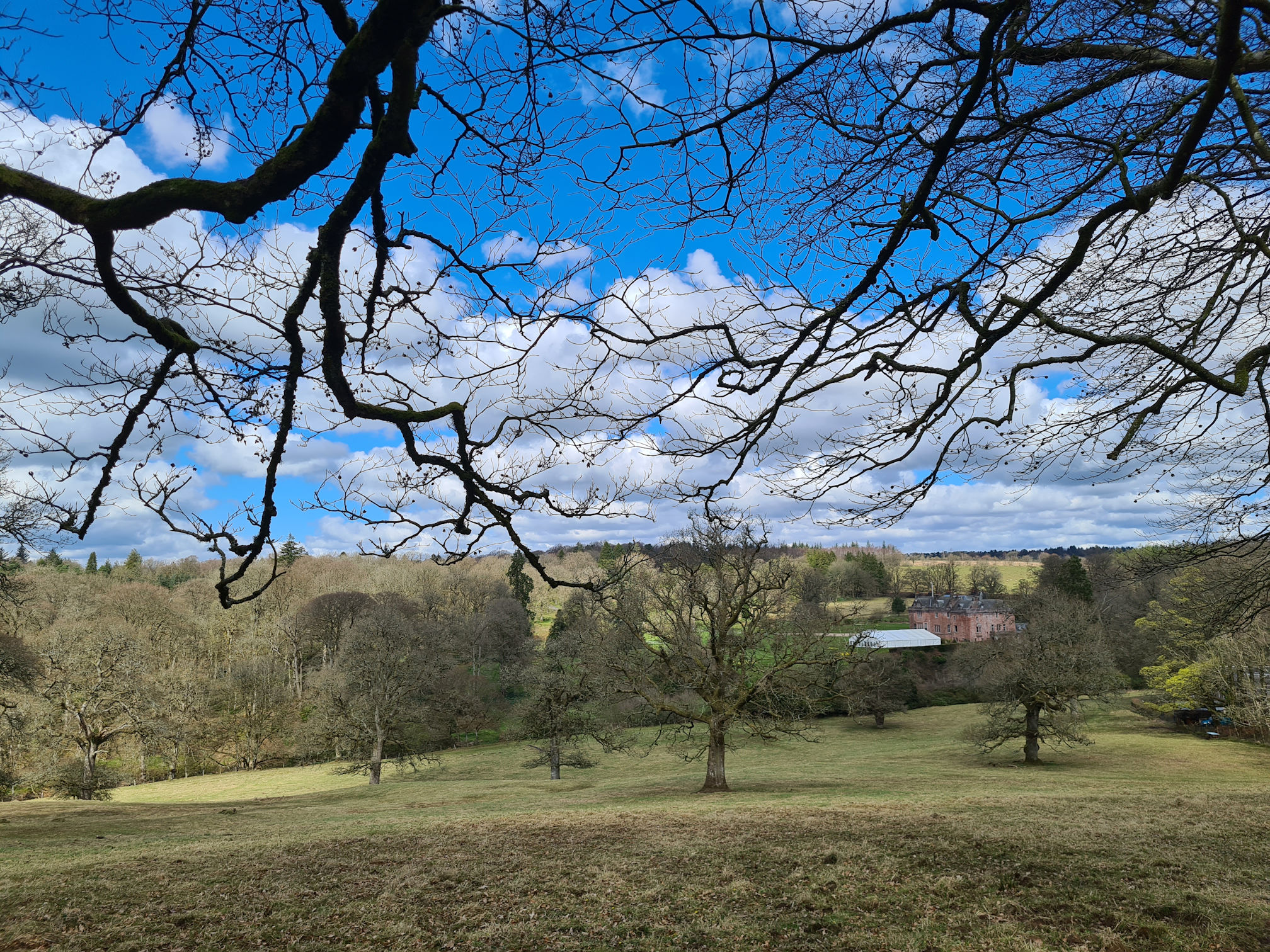
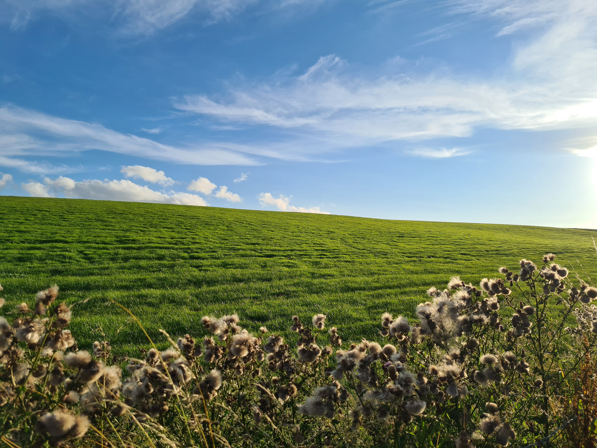
These trees on a small hill caught my eye, and as always my mind wondered if there was a nice countryside view at the other side. The clouds are such a beautiful backdrop!
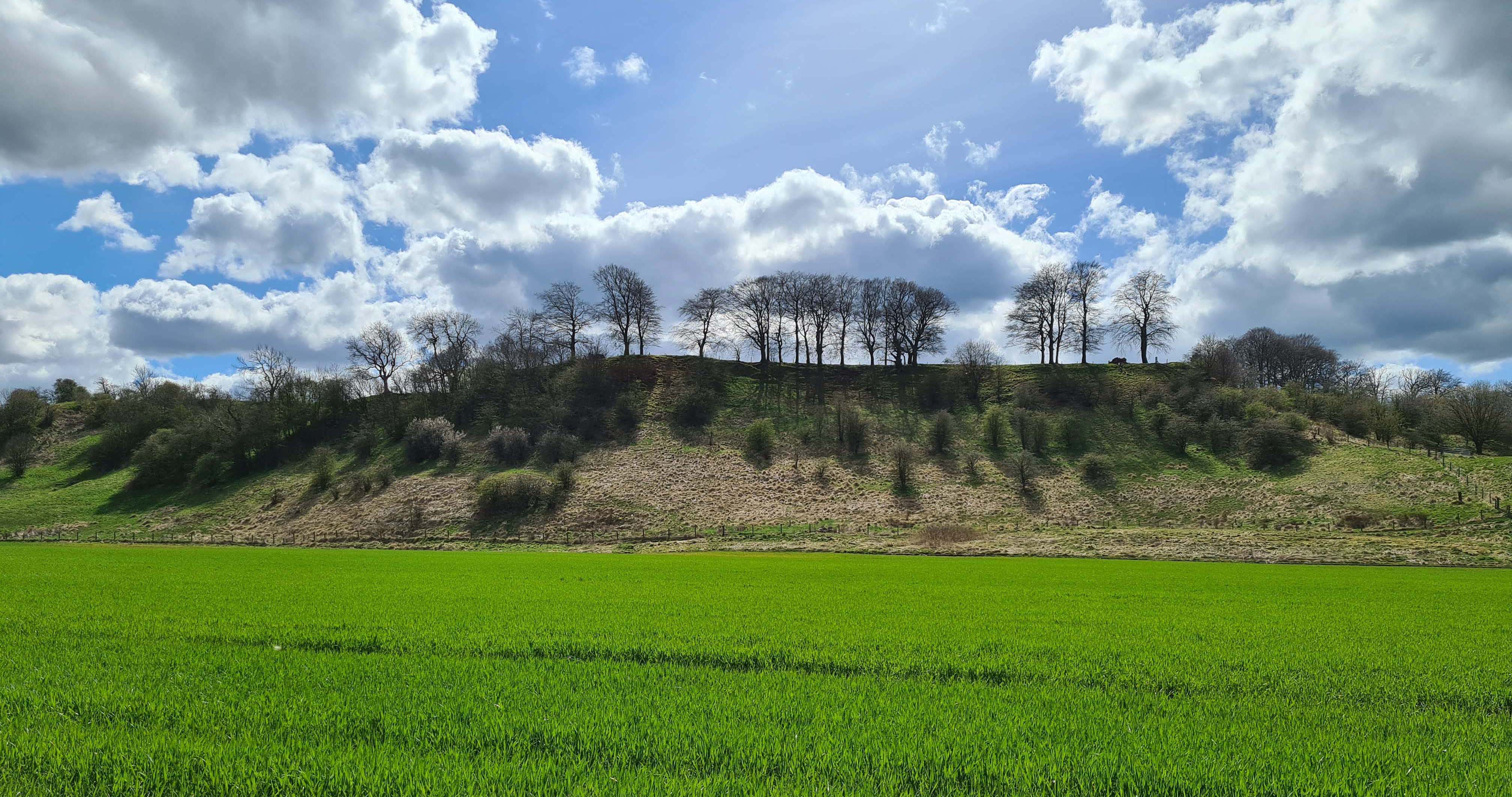
In the summer months when I returned, the Hawthorn bushes were blooming beautifully white. When the wind picked up and blew the blossom into the air, it looked like it was snowing!
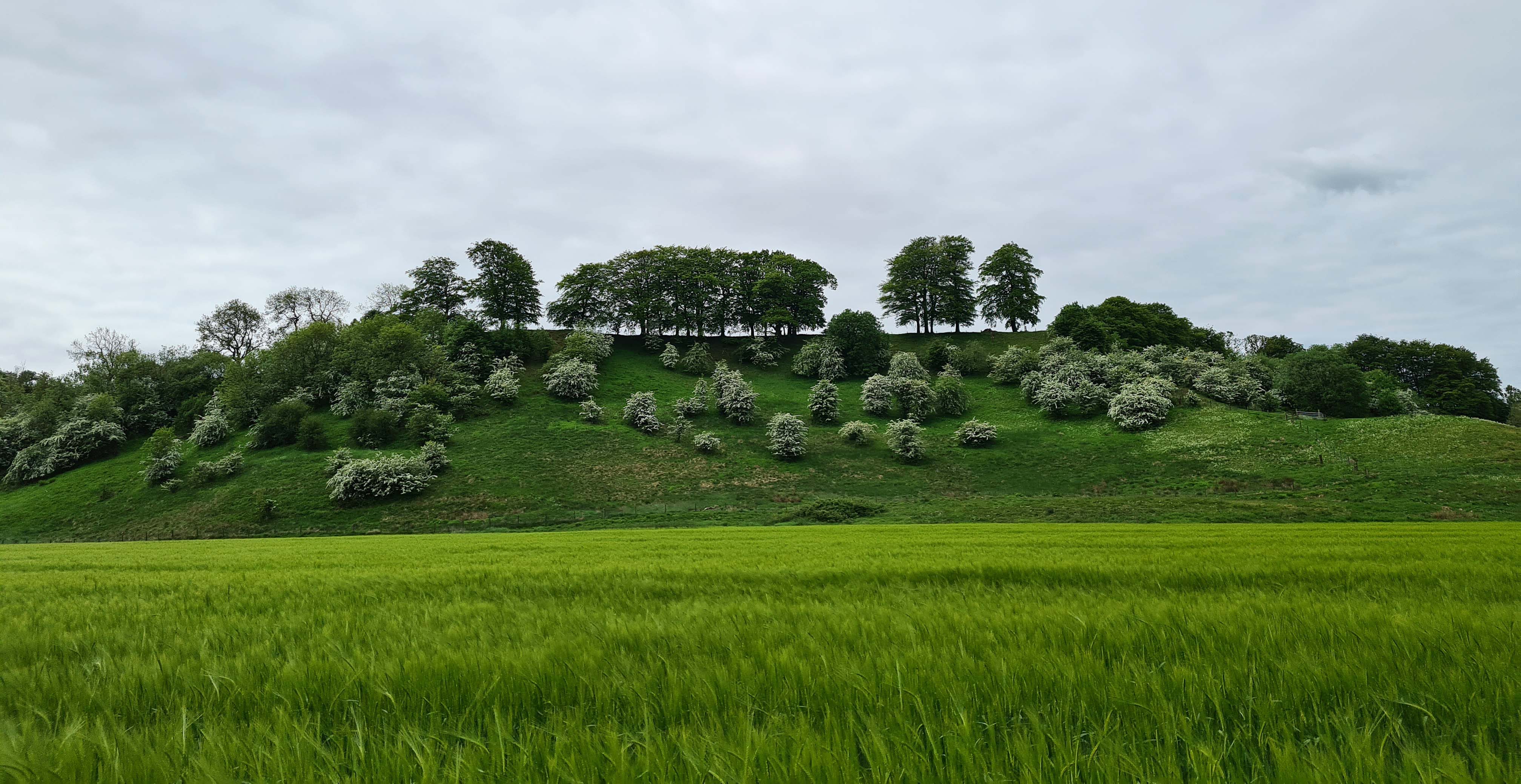
This was the first time I saw this, or maybe it was being in the right place at the right time and paying closer attention to my surroundings.
Some more photos along this path in spring and summer.
I reached wooden steps that would take me up to a high path above the river.
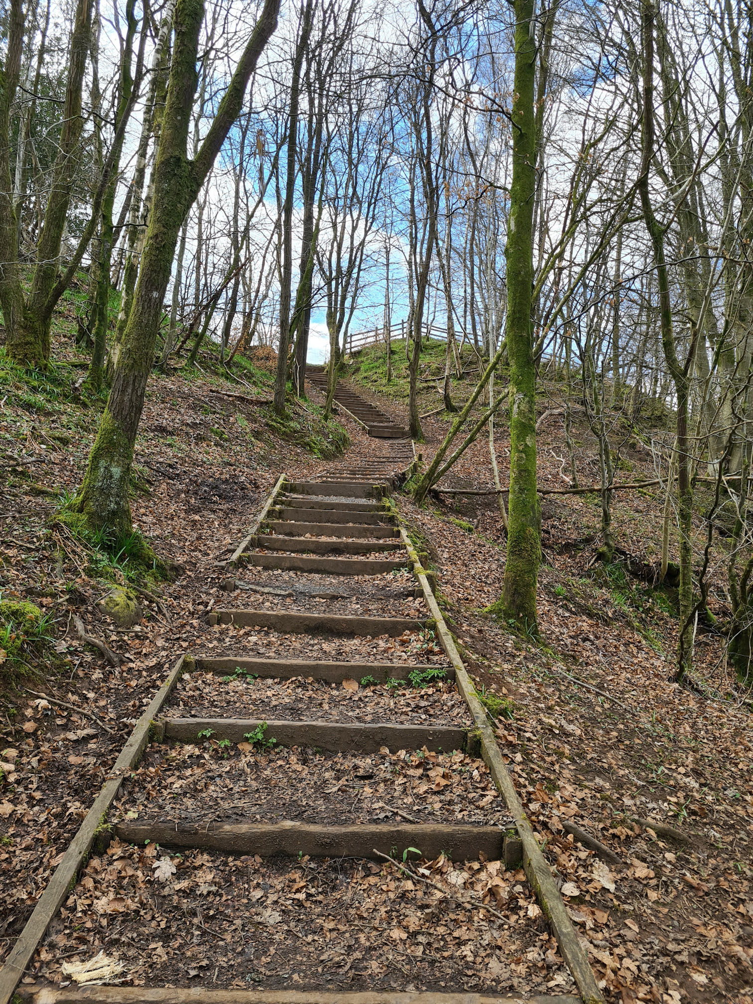
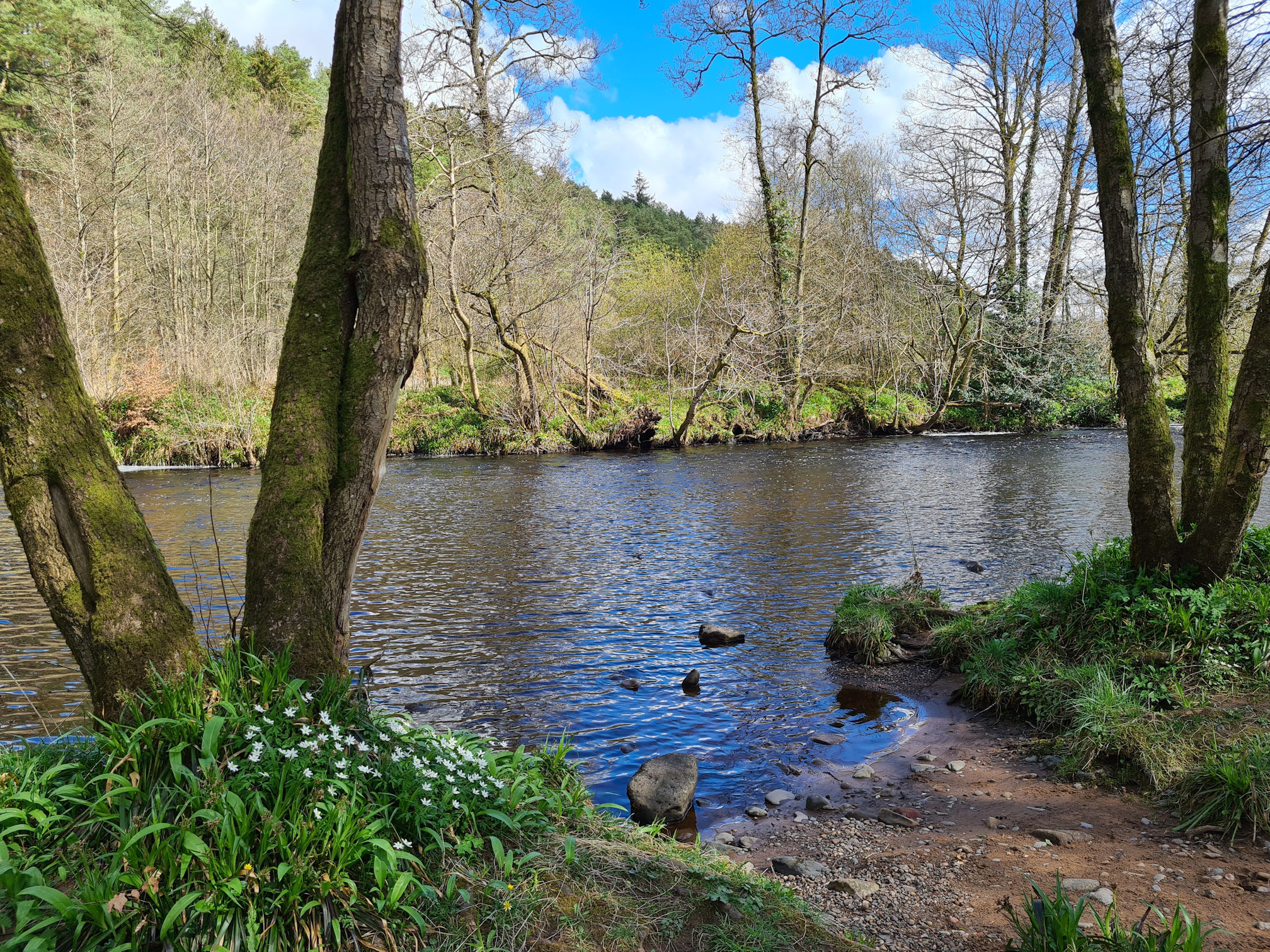
Before my usual huffing and puffing up the steps though, a gorgeous river view was waiting to be captured. I love the mossy boulders!
The view looking up the river was just as pretty!
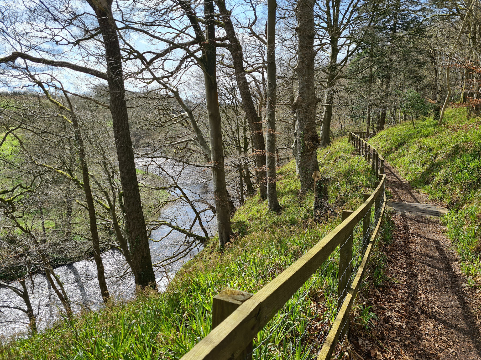
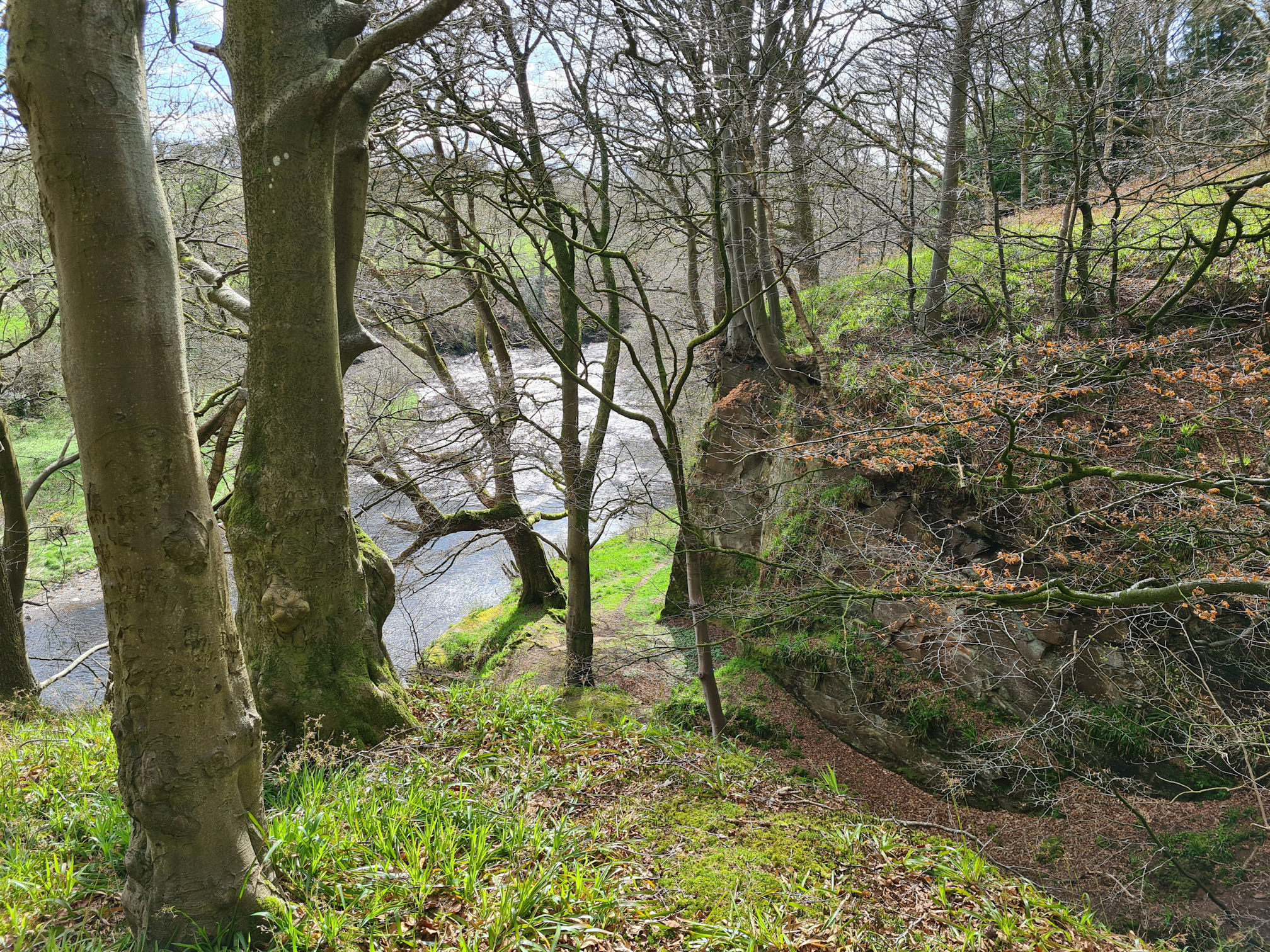
The river was now below me as I continued along the high woodland footpath.
Howford bridges
The next point of interest was walking underneath the Howford Road Bridge (A76), which opened in 1962.
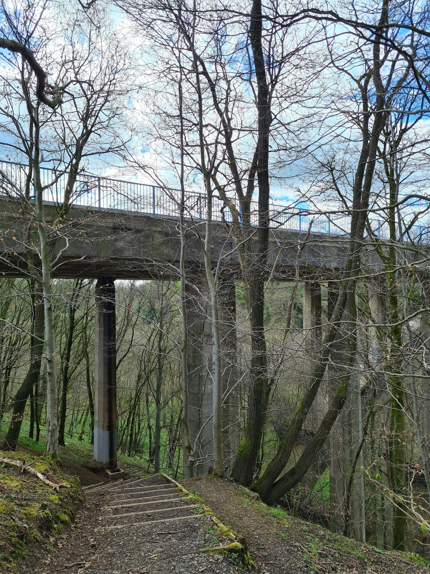
As underneath bridges go, yes sadly there was graffiti, litter, and fly-tipping. My focus shifted to thinking about the architecture of the bridge as I loved looking up at its huge, impressive structure.
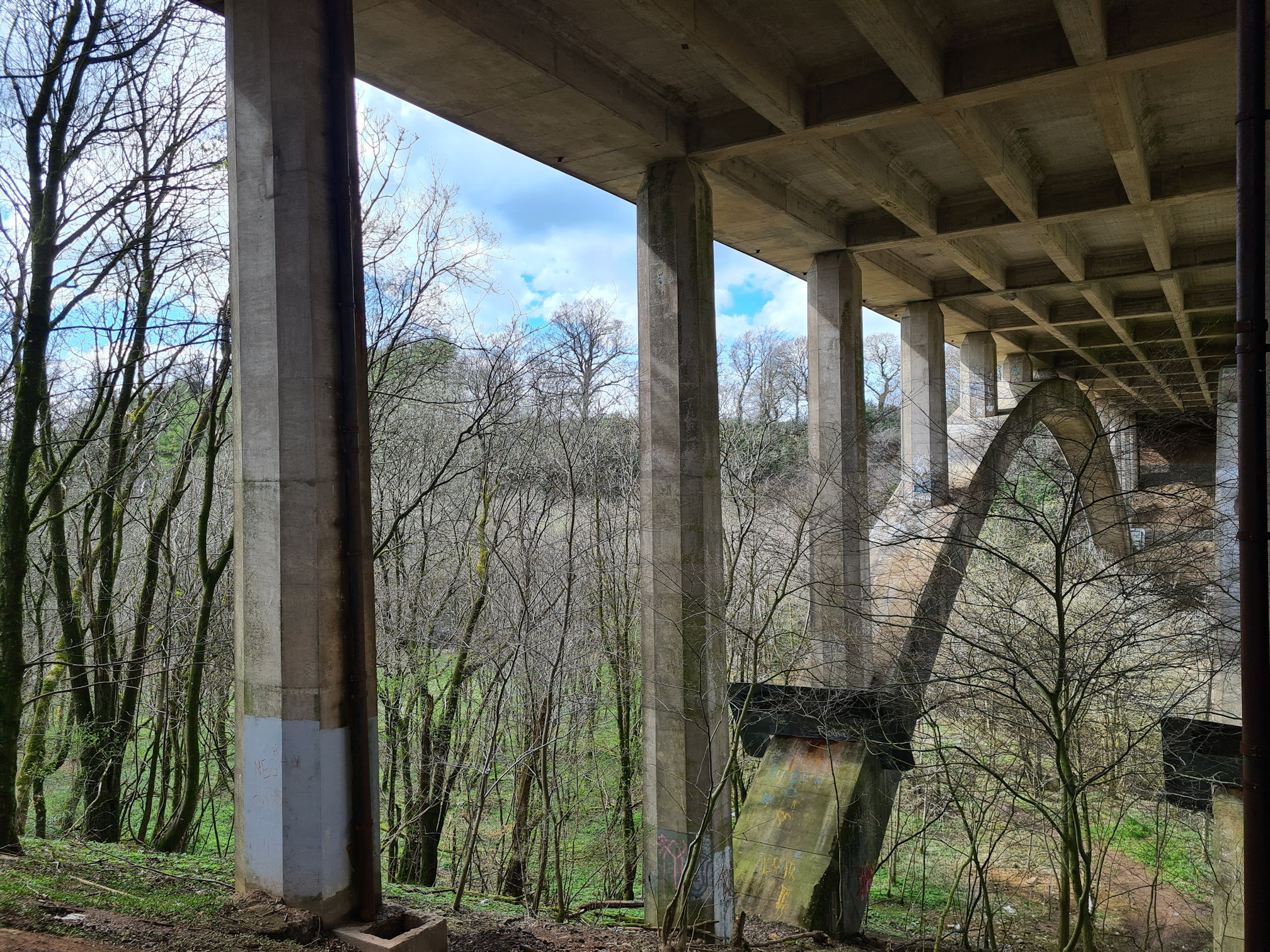
I then walked across the late 18th century Old Howford Bridge, showing a magnificent view of its replacement road bridge. The Howford Road Bridge’s reinforced concrete arch has a 300 foot span, and the bridge sits 90 feet above the River Ayr. Wow!
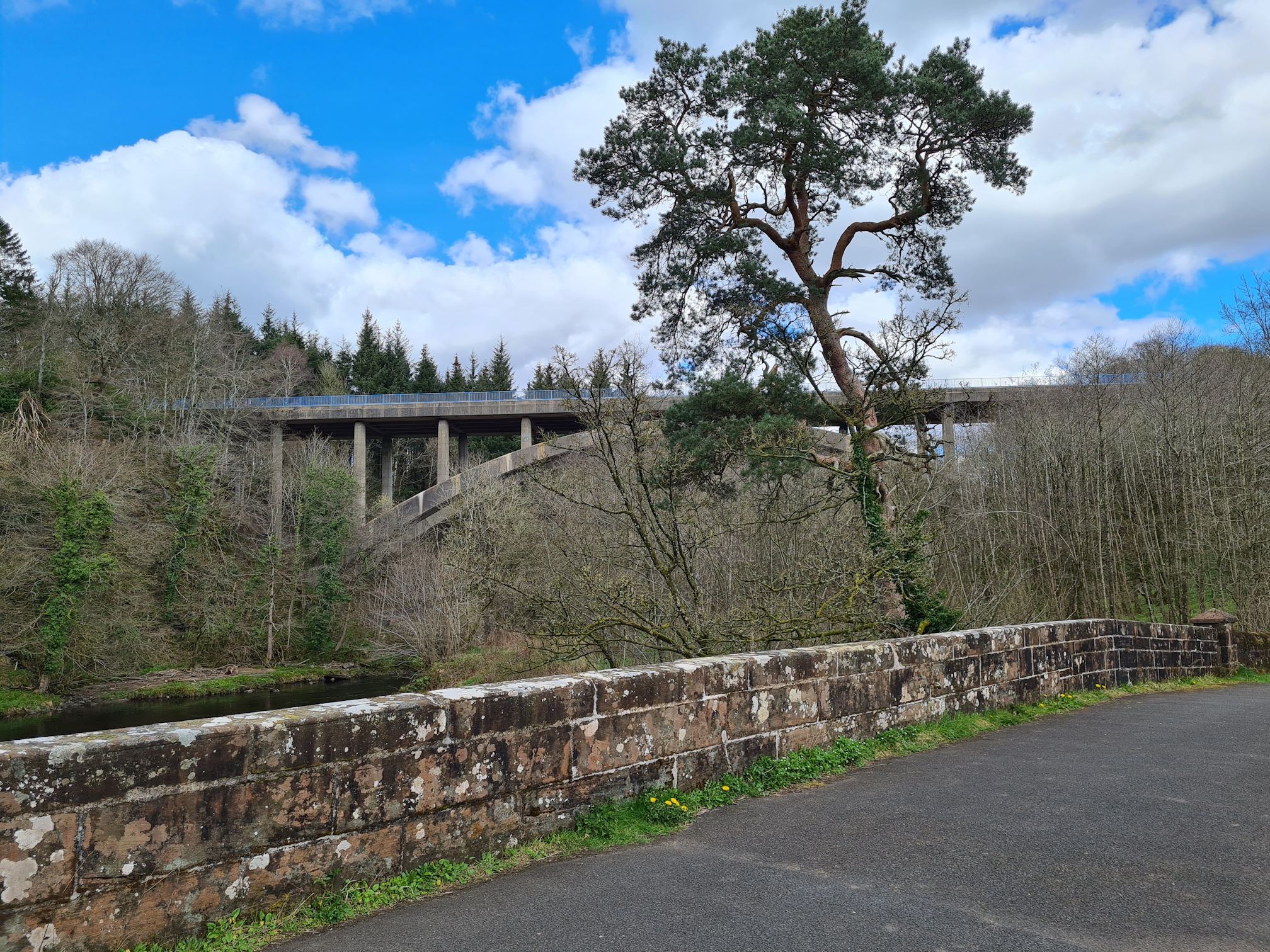
The tall tree dominates the skyline which I think is a Scots Pine. I must admit I do get confused with trees as even the same species can be unique in shape. The leaves look more needle-like in this photo so I’m guessing Scots Pine.
There’s a beautiful Scots Pine near where I live, shaped differently to this one. I love walking past it, and if it’s a windy day I like to stop and listen to the wind blowing in and around the branches. The sound is strangely haunting, but also very refreshing and relaxing.
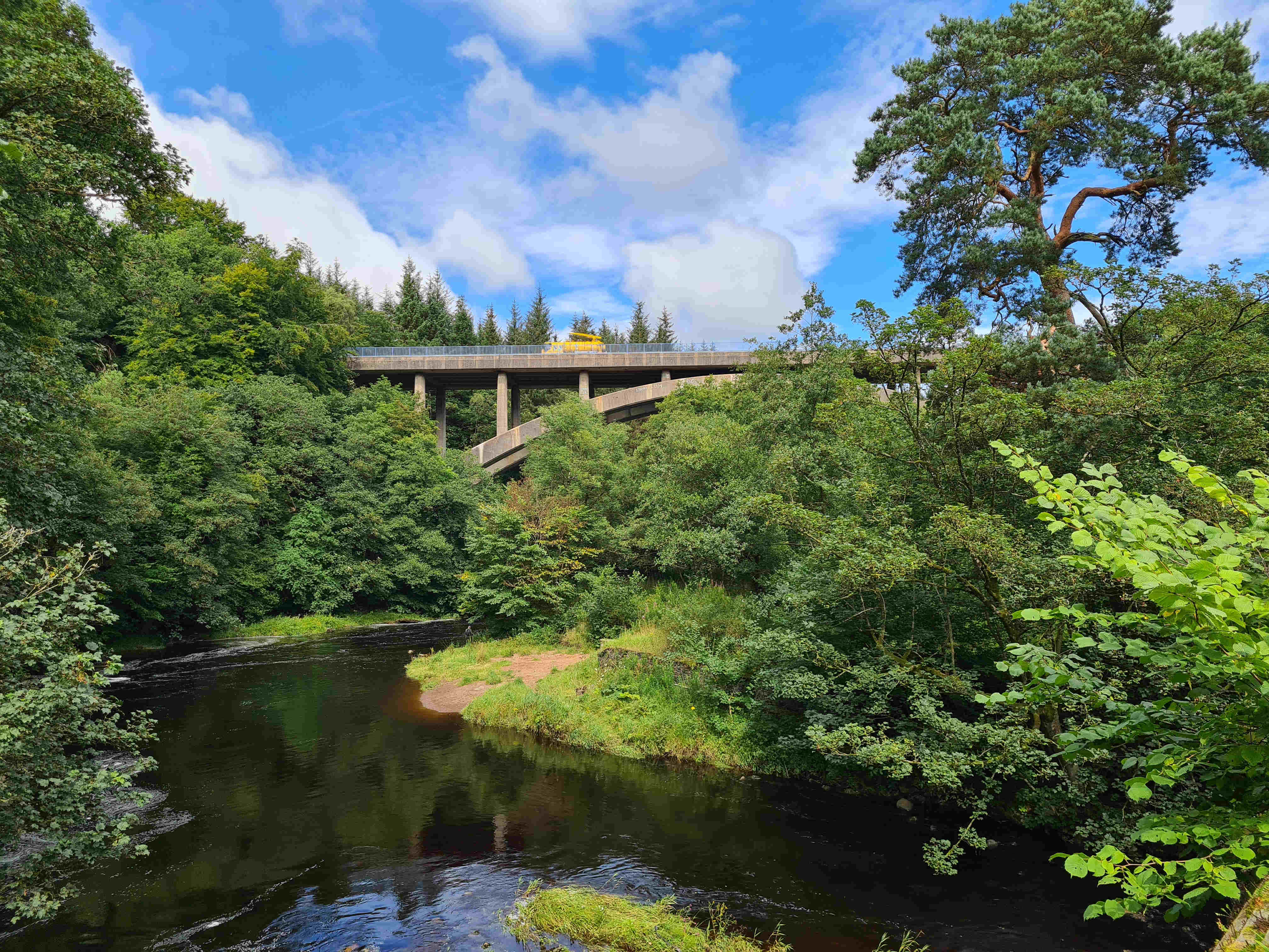
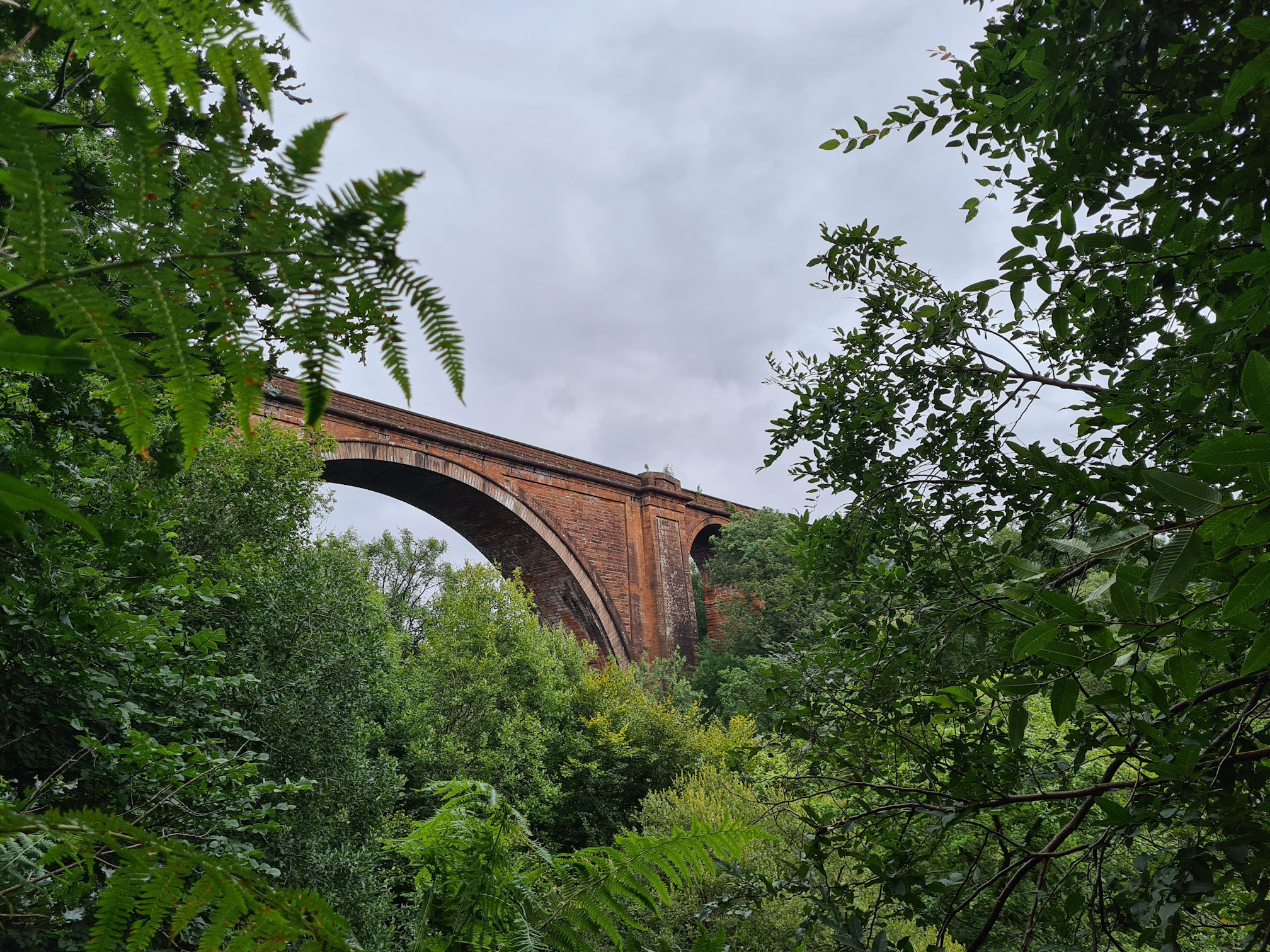
This is a photo of the Howford Road Bridge in summer with the thriving trees and foliage hiding much of the bridge. It’s a popular area for local fishing too.
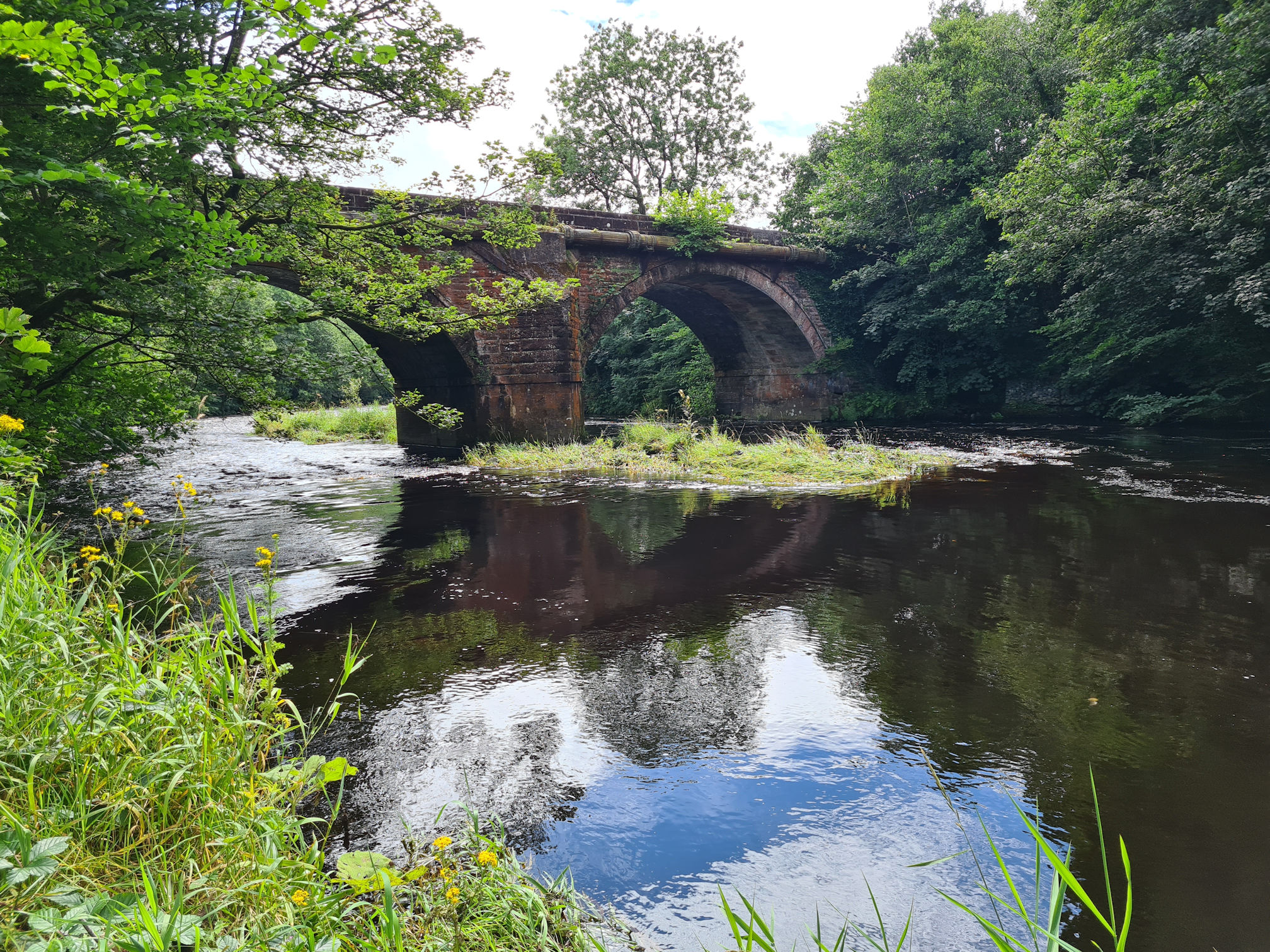
In the summer, I found a path down to the river to see the Old Howford Bridge from a lower angle. The old bridge supported the former main road hundreds of years before the new road, and Howford Road Bridge was built.
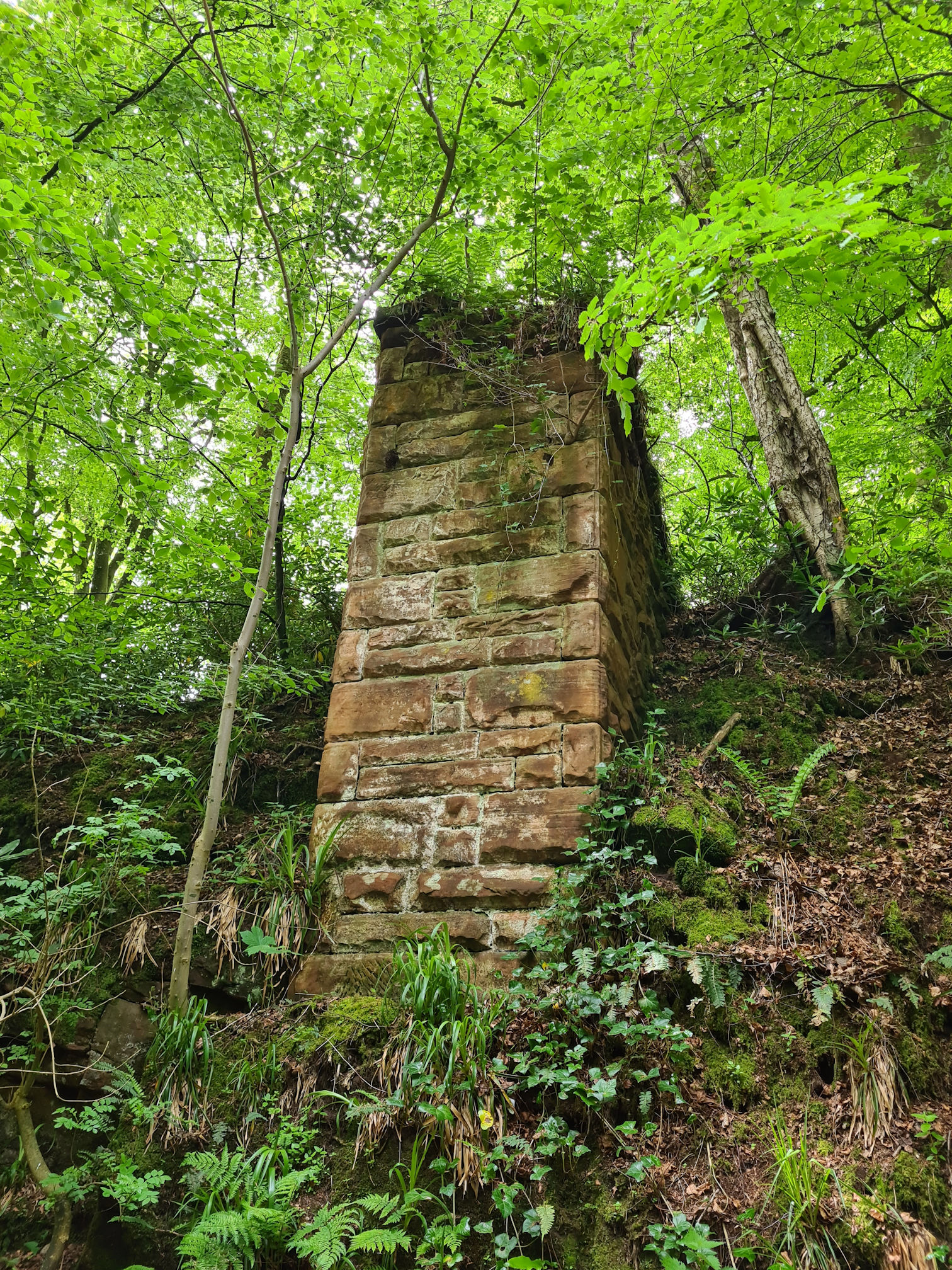
I was wondering if I was going the right way again though. After the Old Howford Bridge, I was looking for the next point of interest. The Walkhighlands website mentioned a pair of sandstone abutments that once supported a footbridge. I knew if I walked past these, I was on the right track.
Yay, found them!
Thinking back, I seemed to be anxious about getting lost, but I usually like wandering new places and occasionally getting lost. I think this day it was because I didn’t want to add extra mileage to my legs in training.
It was already going to be a long, challenging walk for me. My mind was thinking I could shorten the walk and stop at Failford if I needed to, but it would be even better if I could keep going to Stair.
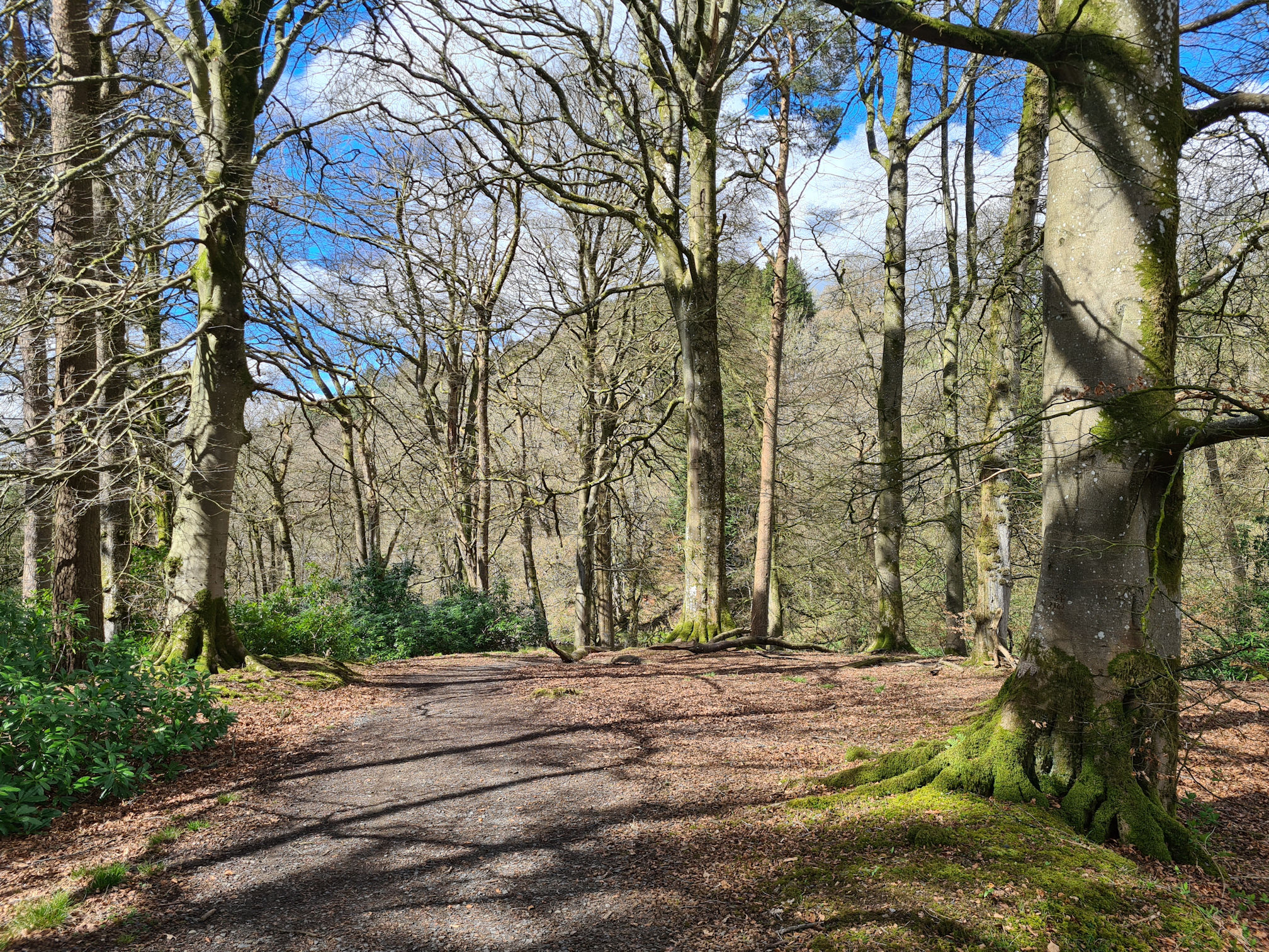
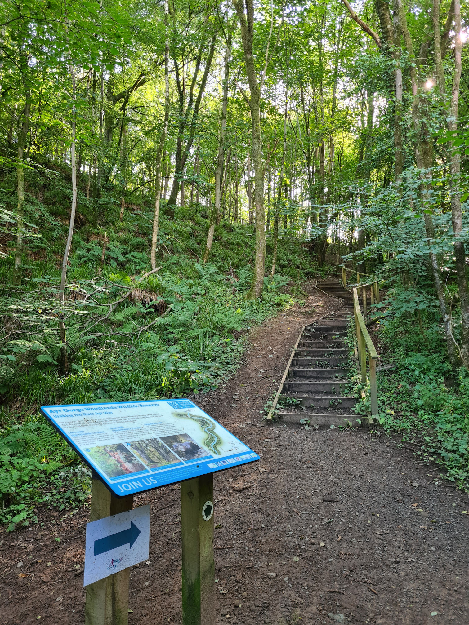
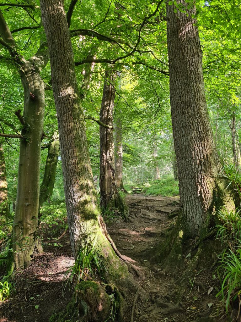
I soon reached the next red arrow which led me downwards into the stunning Mauchline Gorge Woodlands towards the river again.
Mauchline gorge woodlands
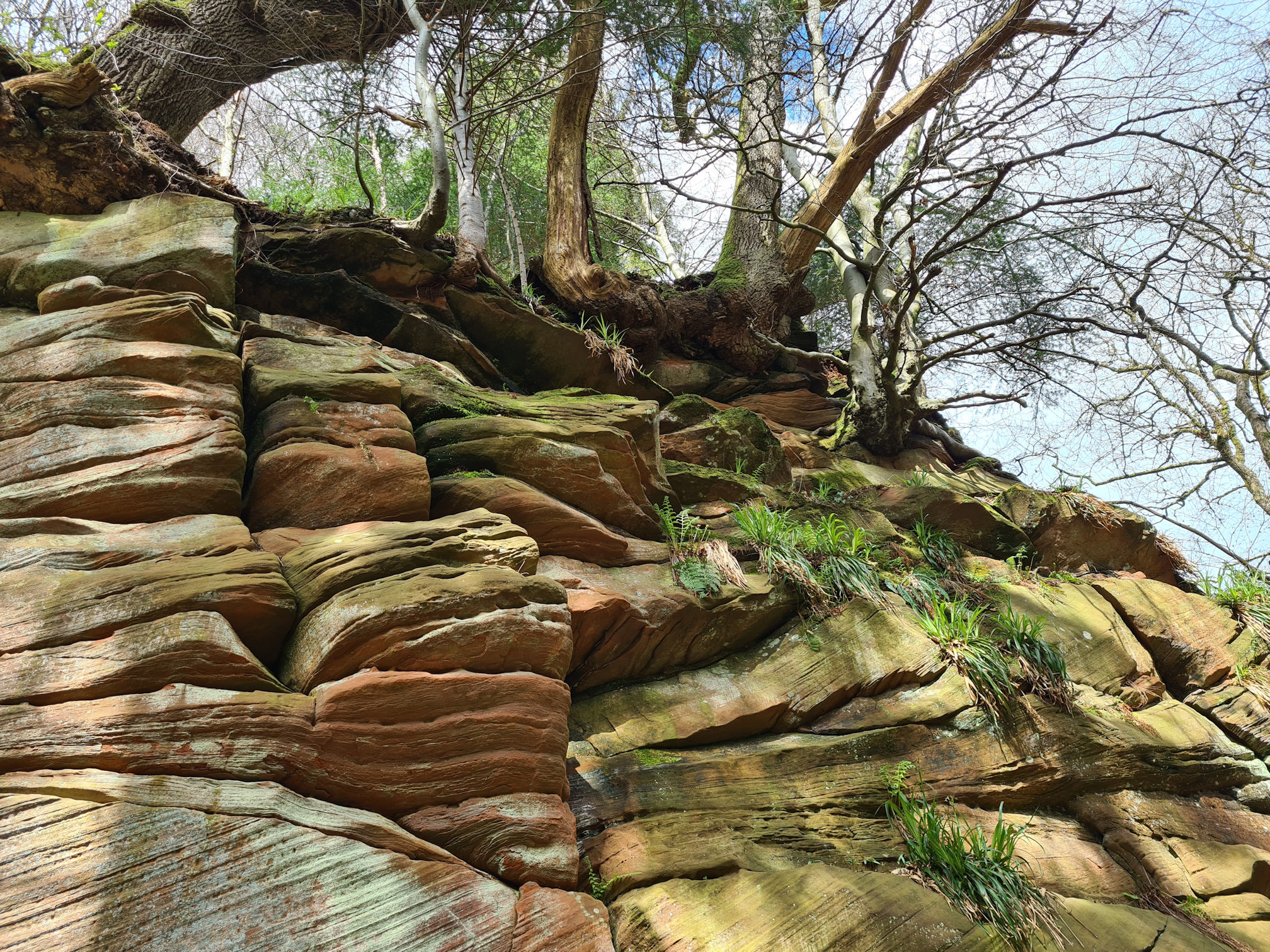
I was excited to be walking through the Mauchline Gorge Woodlands, and beautiful they are. Side paths were popping up all over the place that I wanted to explore, but I knew I must follow the main path.
I was hoping to see the Ballochmyle cup and ring marks, circular carved indentations in the rock that are linked with the late Neolithic and Bronze Age. I was told about them years ago, and that they can be found on a vertical cliff in this area. I always meant to visit and now I was here I didn’t know where to look.
I couldn’t find any markings on the vertical cliff I walked past, so I will come back another time and explore further. More information is recorded on the Canmore website which I’ll link at the end.
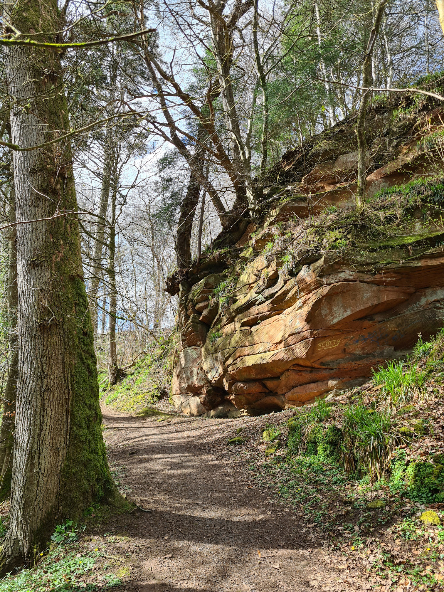
Wow, I love sandstone and how the weather-beaten rock naturally changes its shape over time. Nature takes over with trees, fern and other foliage growing out of the stone.
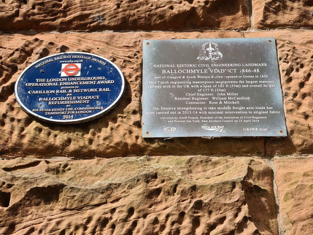
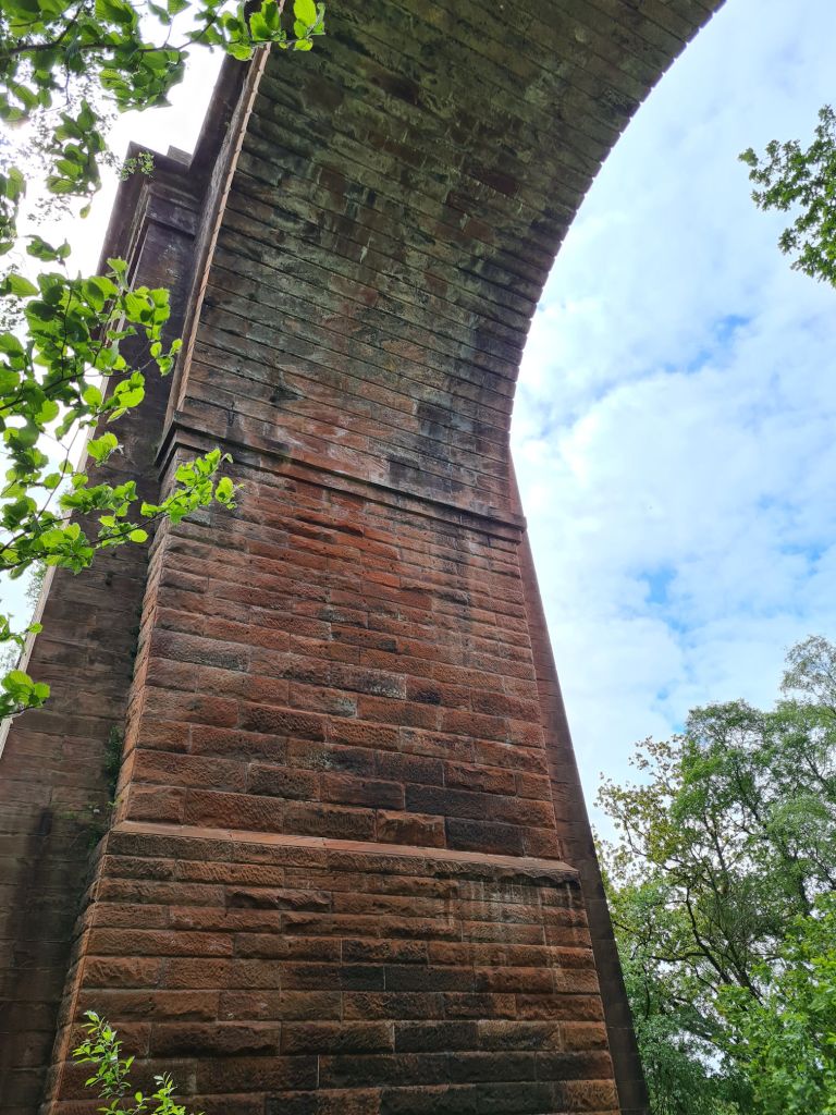
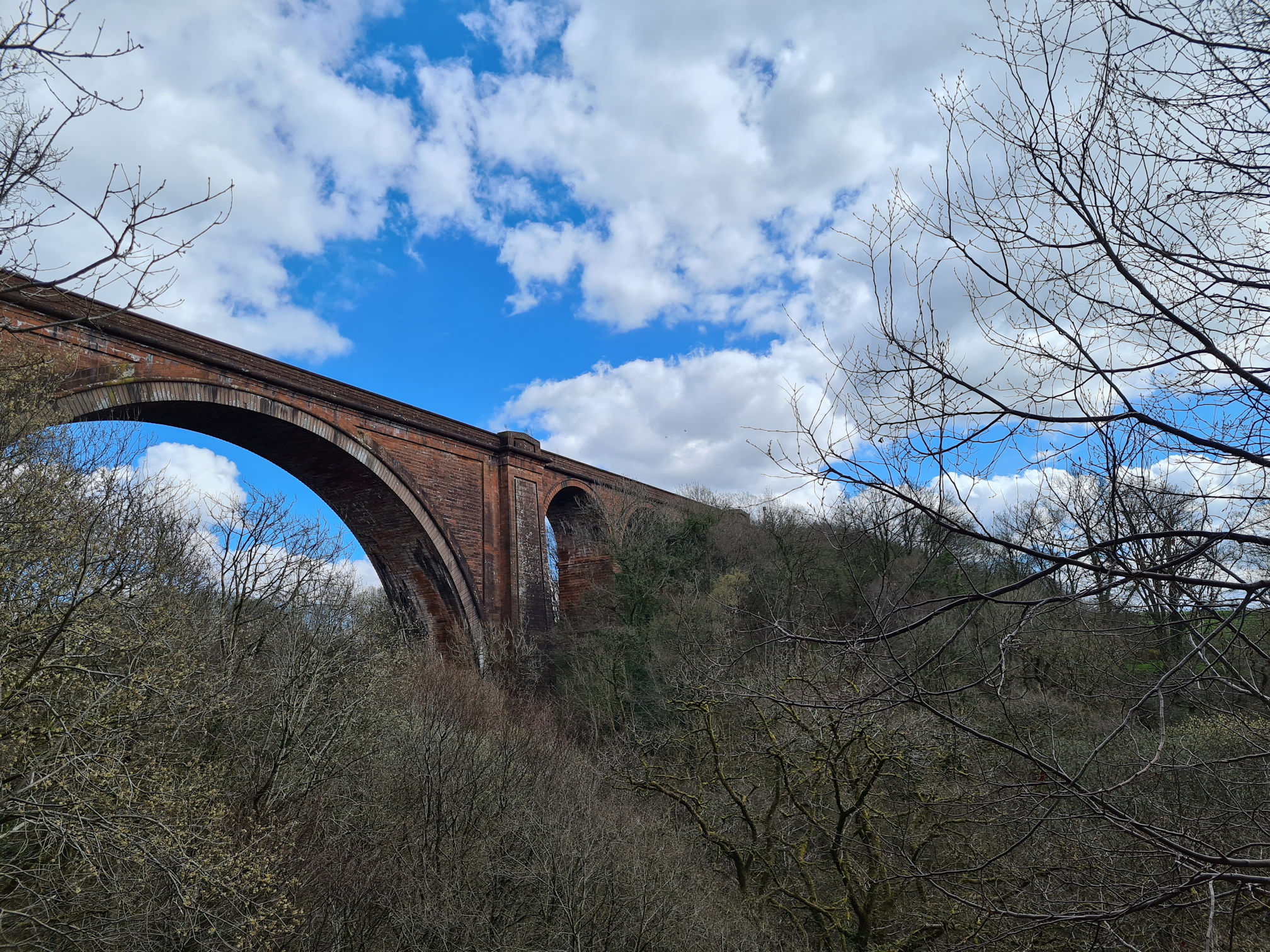
Ballochmyle viaduct
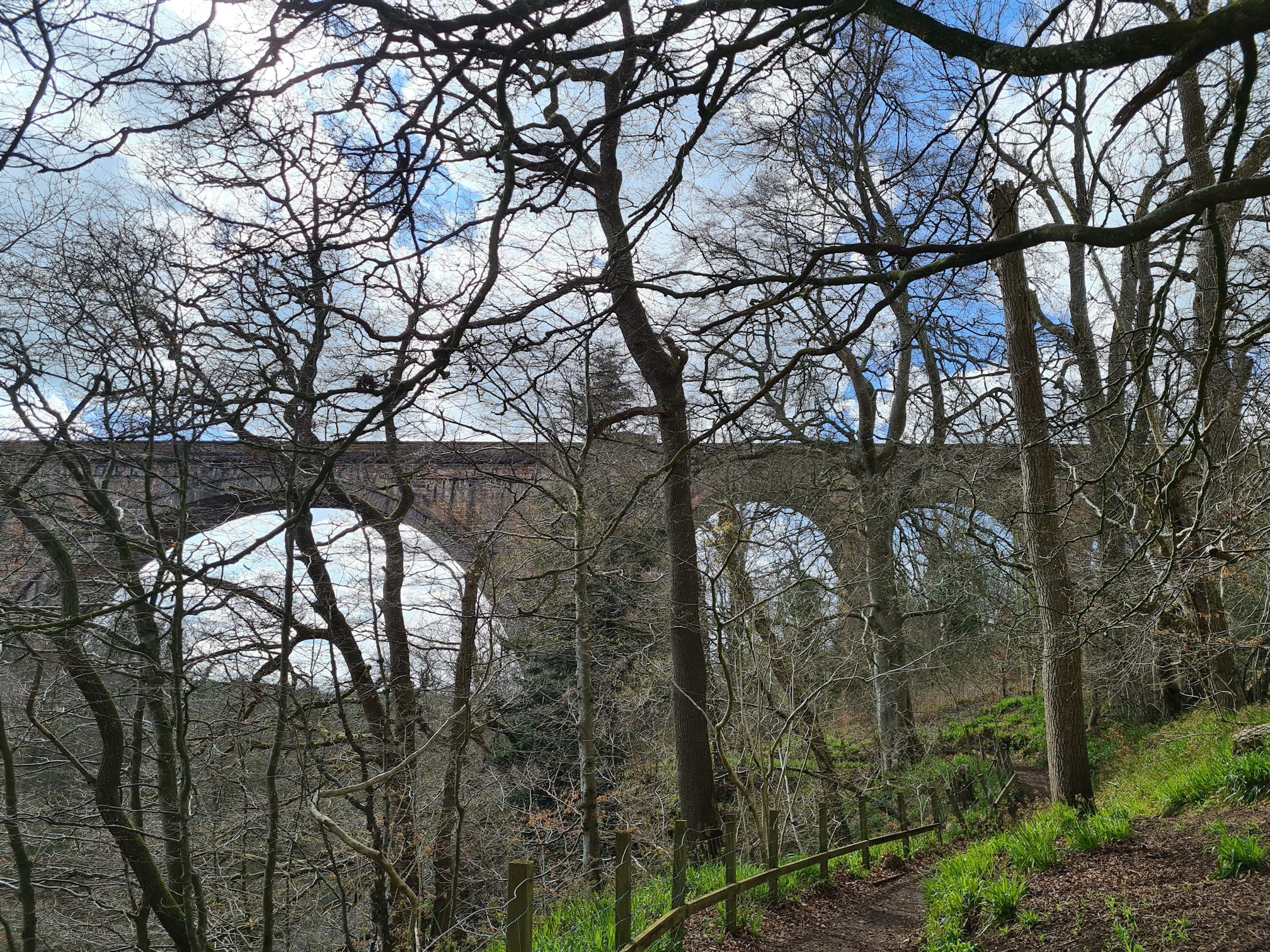
As I was walking through these beautiful woodlands I was approaching yet another bridge, and an impressive one at that! I knew I would see the 19th century Ballochmyle Railway Viaduct today and was very excited to walk underneath it.
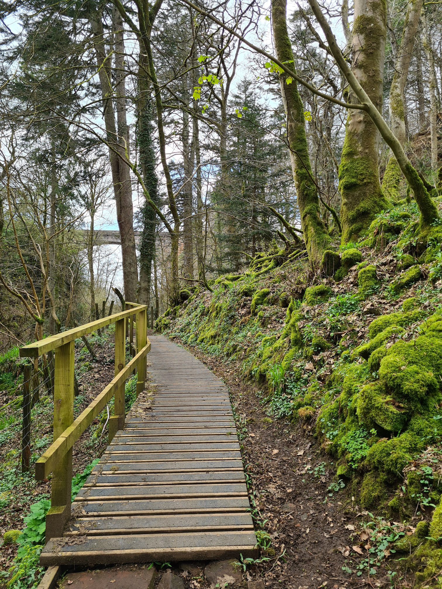
The bare trees blocked a full view from the path unfortunately, and I was hoping to see a train cross the viaduct.
The viaduct carries the Glasgow to Carlisle route. I’ve only visited Carlisle once, many years ago with work friends. I remember loving the train journey and the festive spirit in Carlisle as we browsed the shops looking for a Christmas outfit to wear at our work’s Christmas party night. A trip to Carlisle for the first time was just as exciting for me as the party night.
The Ballochmyle Viaduct has seven arches with a central span of 181 feet (55.2 metres). The central arch is thought to be the largest masonry railway arch in the UK!
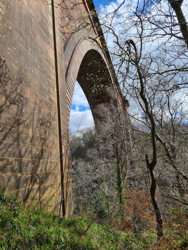
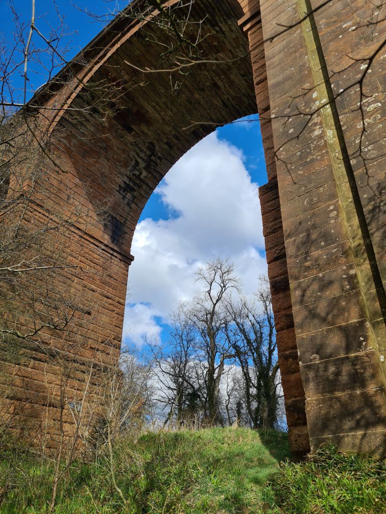
Further along the path there was a gap where I could see the viaduct better, yay! Still no train though.
There’s a scene in the movie Mission: Impossible (1996) where a train crosses the Ballochmyle Viaduct just before the actors Tom Cruise and John Voight battle on the roof. I think parts of the countryside train scenes were also filmed in East Ayrshire.
It came into my mind as I was standing here that I would need to come back and create a proper landscape video of the River Ayr Way for my YouTube channel.
I returned to the Ballochmyle Viaduct when I took my friend on this walk, but we literally missed a train passing by a few minutes! I visited again in the summer with Alan, making sure we timed it with a train crossing. We waited patiently in the woodlands for the train. My River Ayr Way: Sorn to Stair video is linked at the end and shows the train passing at last.
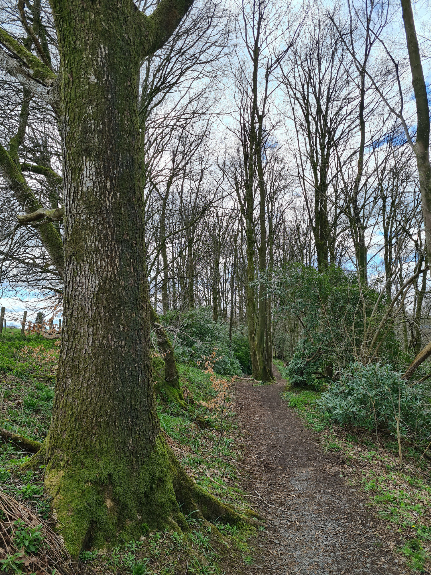
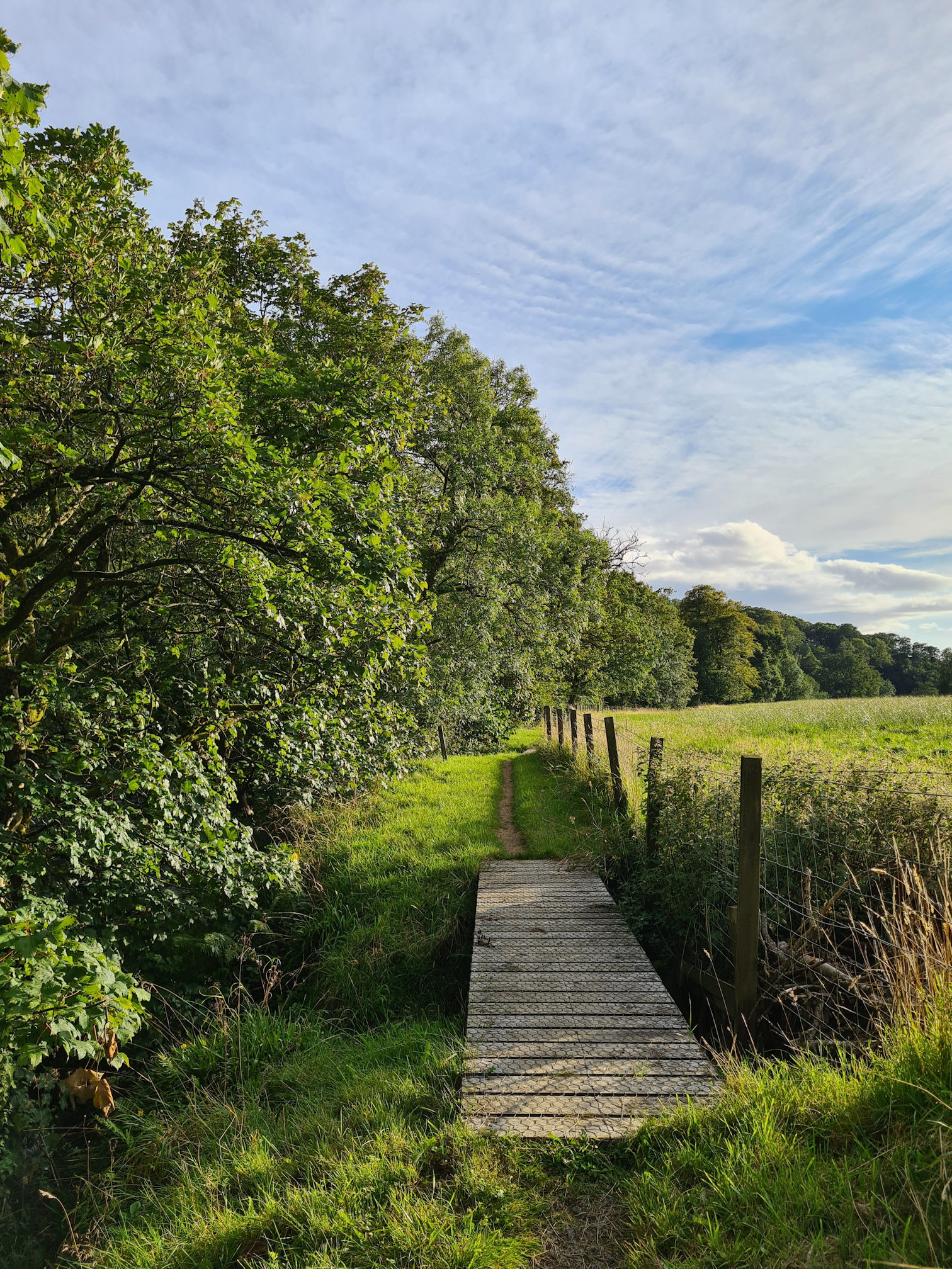
The path continued through these beautiful woodlands, following the flow of the River Ayr.
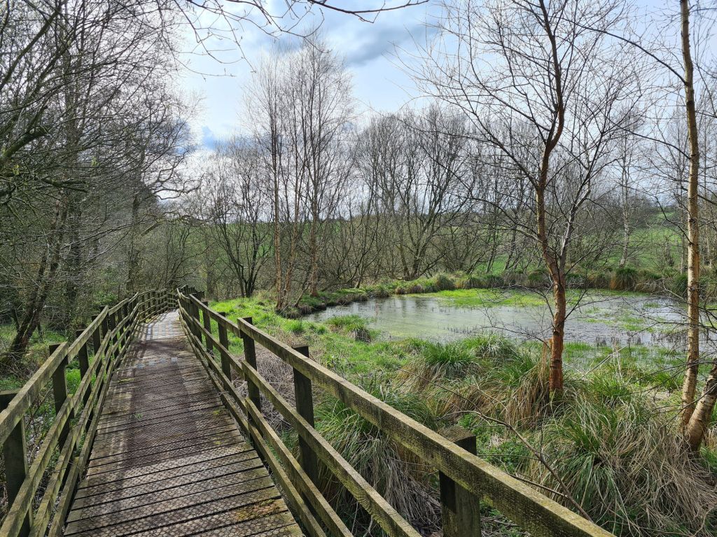
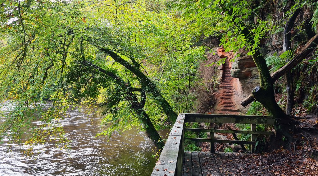
Just as I thought it couldn’t get much better, I crossed the next footbridge and looked through the wooden slats beneath me… it was scarily a long way down.
I carefully peeked over the bridge to see a deep gorgeous gorge. I felt a little giddy when I saw how far a drop it was. I quickly snapped a photo and video clip, praying I wouldn’t drop my phone!
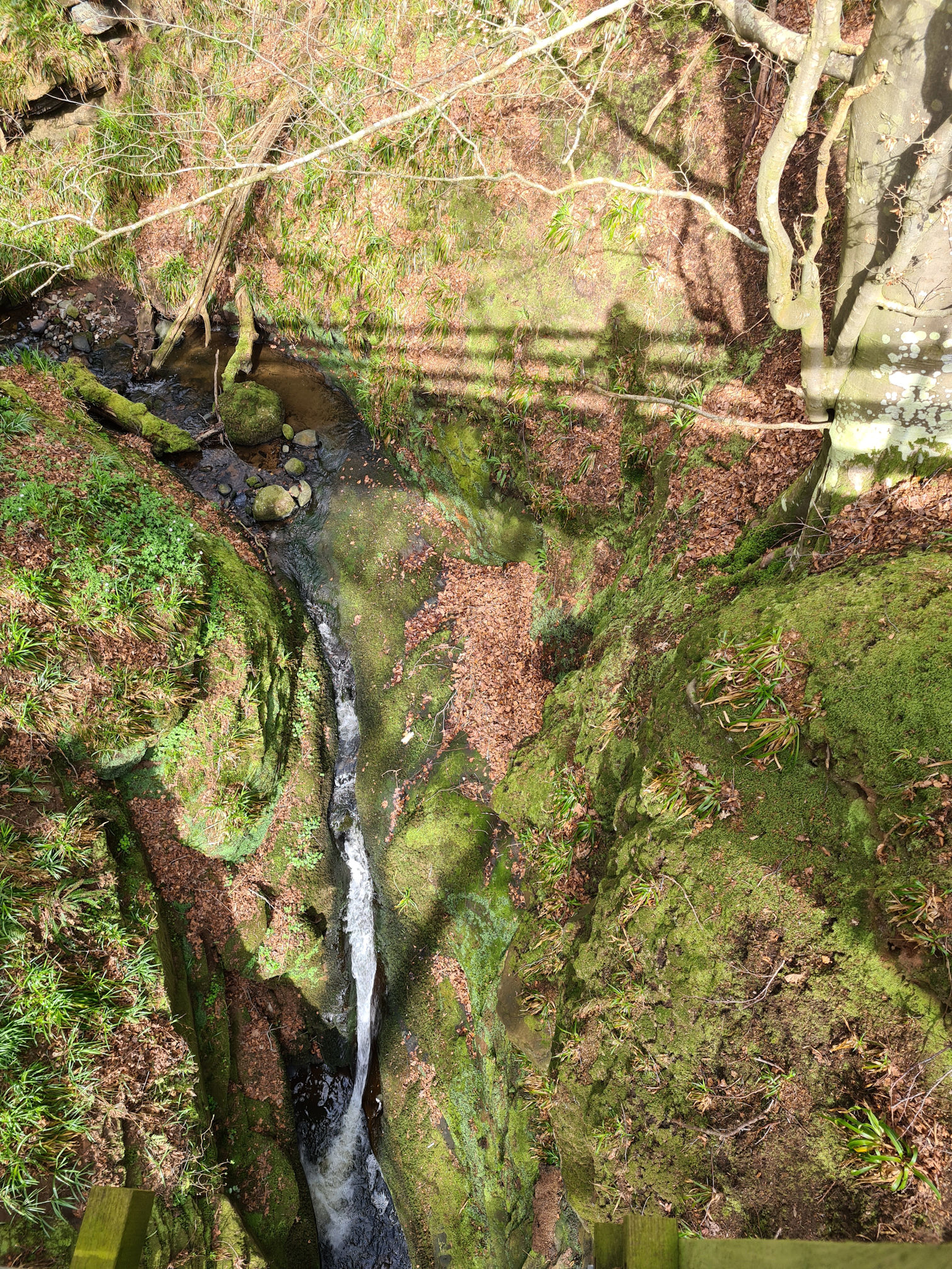
I could see a narrow trodden path on the other side of the bridge. There must be a way down I thought, another reason for me to return!
As much as I wanted to hang around here longer, I picked up my pace and followed the path. I still had a long way to go and only walked about four miles (seven kilometres) so far!
After leaving the woods I was walking through farmland and arrived at Haugh Farm. I felt like I shouldn’t be there as it seemed as if I was in the back garden of farm houses. I stopped and almost turned back, but as I passed the doors of the houses a right angled turn between the houses and an outbuilding took me out of the farmyard and on to a country road. Phew, I didn’t want to turn back as I was sure I followed the red arrows.
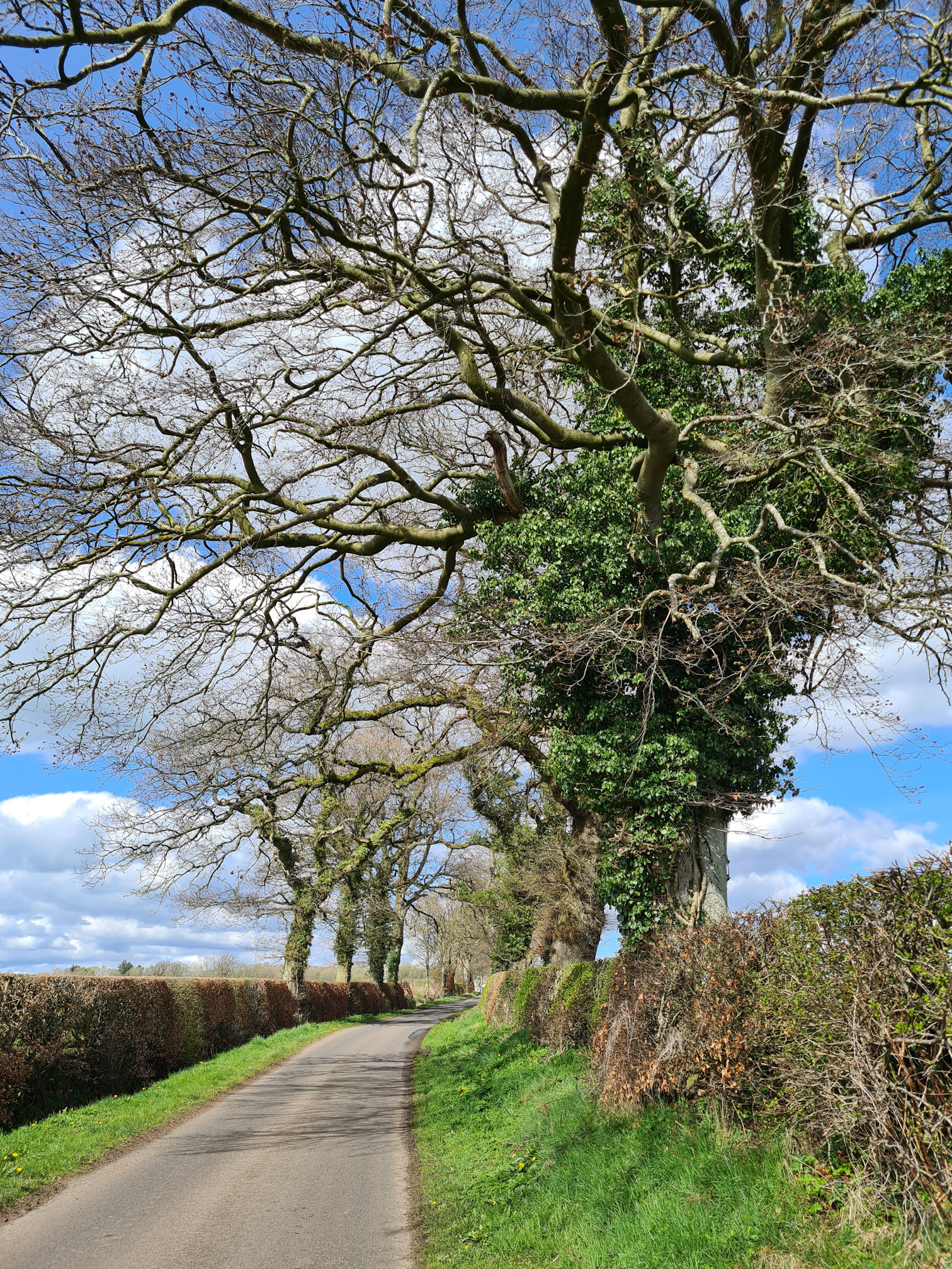
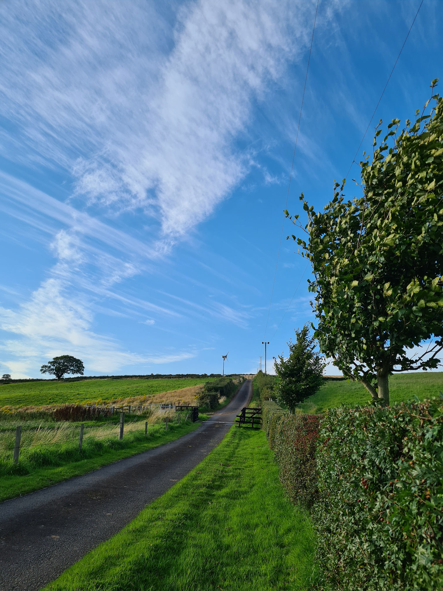
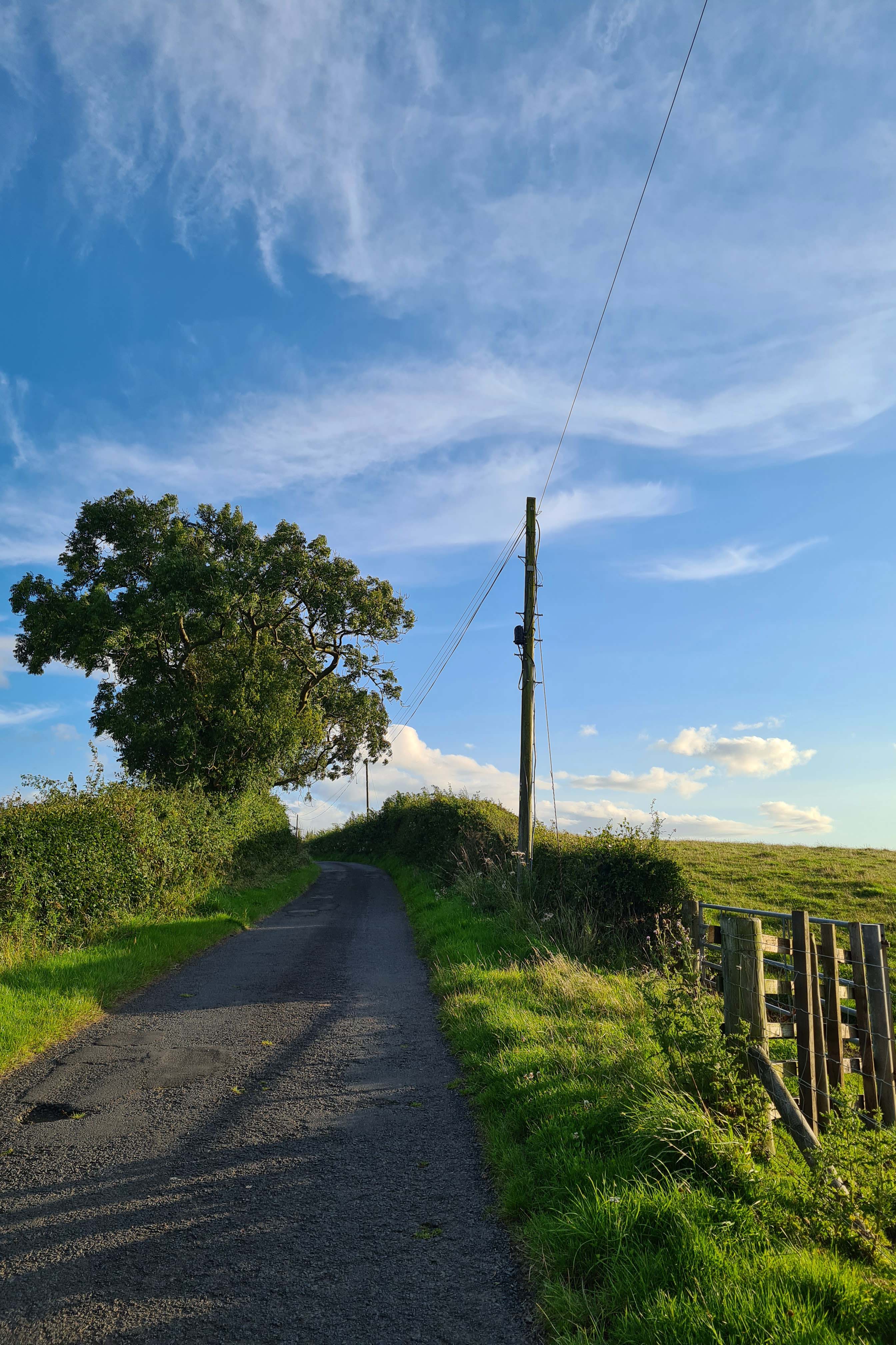
Country road walking away from the river
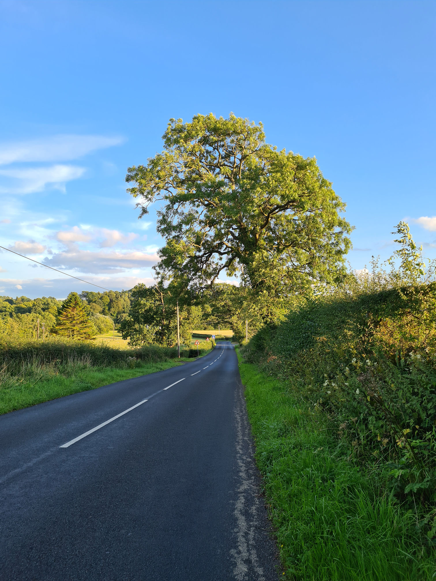
I was completely away from the River Ayr now and it was country road walking for a while. I didn’t mind on a beautiful day like this, with old character trees lining the road and making me feel happy.
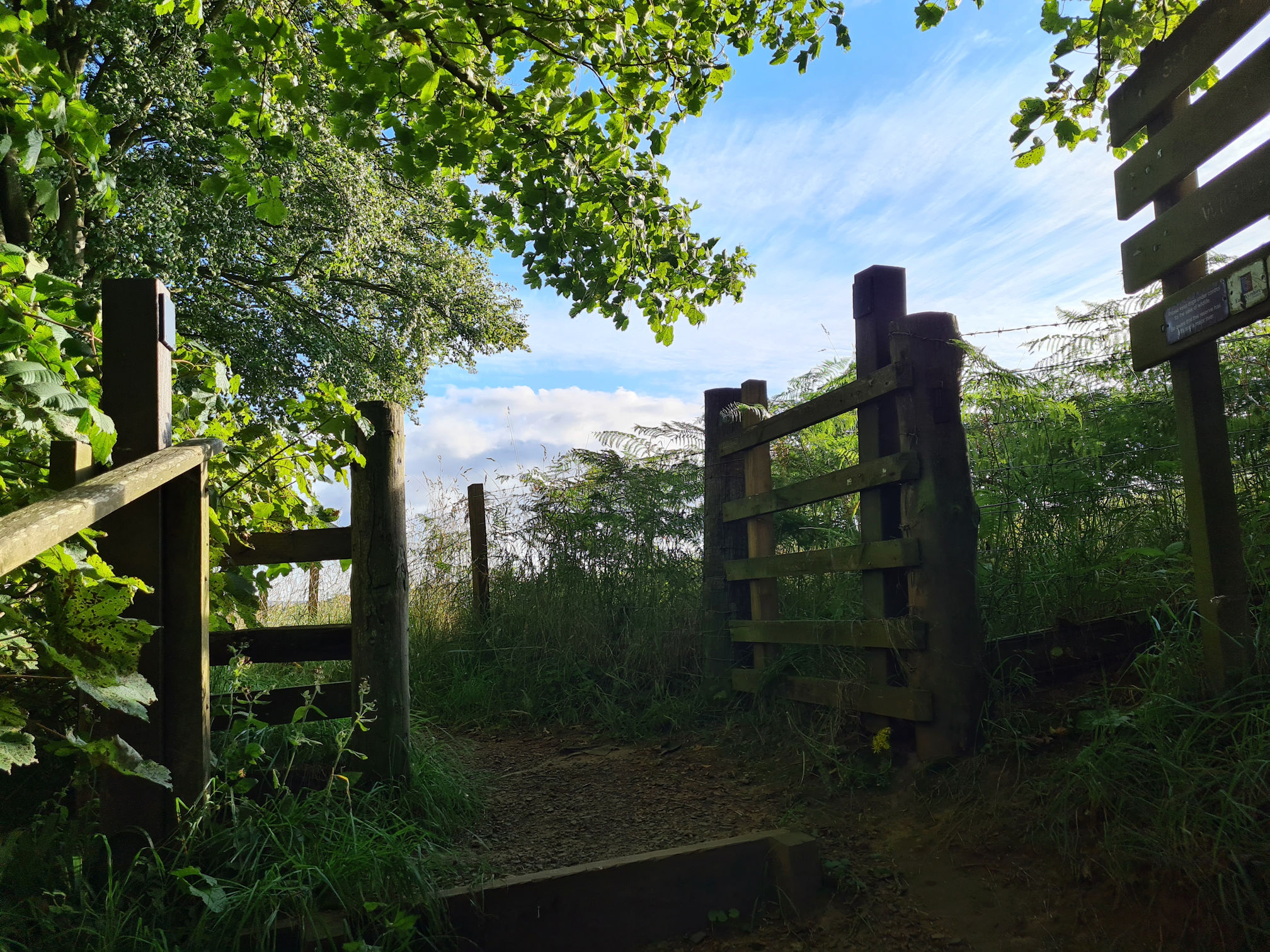
I followed the directions from Haugh Farm for around one mile (1.5 kilometres), until I reached a gate that took me away from the road.
Barskimming Estate
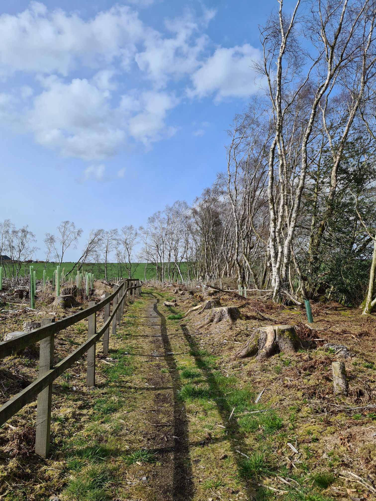
I was now following a narrow grassy path between two fences, weaving around the private grounds of the Barskimming Estate. Even though I was still nowhere near the River Ayr, I enjoyed the countryside views.
In spring parts of the land looked sadly desolate with a graveyard of felled trees. In summer though, it was such a different picture, beautifully green and thriving.
After around two miles (three kilometres), I reached the B743 road where I turned left to get to the hamlet of Failford.
There’s no footpath, so I walked on the grass verge on the right facing the oncoming traffic. I was wary and careful walking around bends in the road as cars were passing fast. Thankfully it was a short walk to Failford.
Hamlet of Failford
I was intending to stop at Failford, but my legs at this point said they could possibly go a bit further so I messaged Alan to say I would keep walking to Stair.
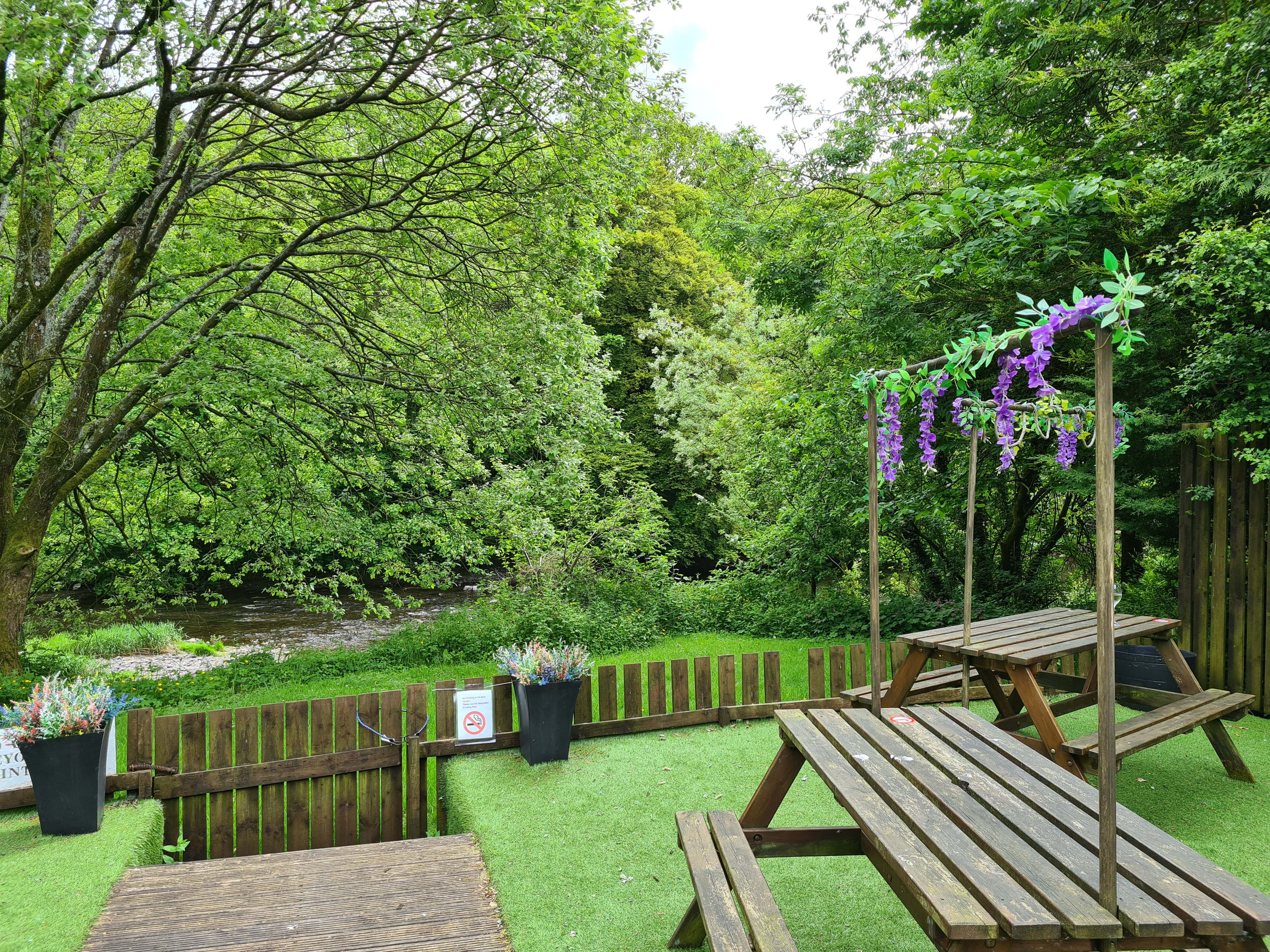
The Failford Inn, if it’s open, is a lovely wee place to stop. My friend and I stopped here for something to eat later in the year and there’s a lovely wee garden at the back beside the River Ayr.
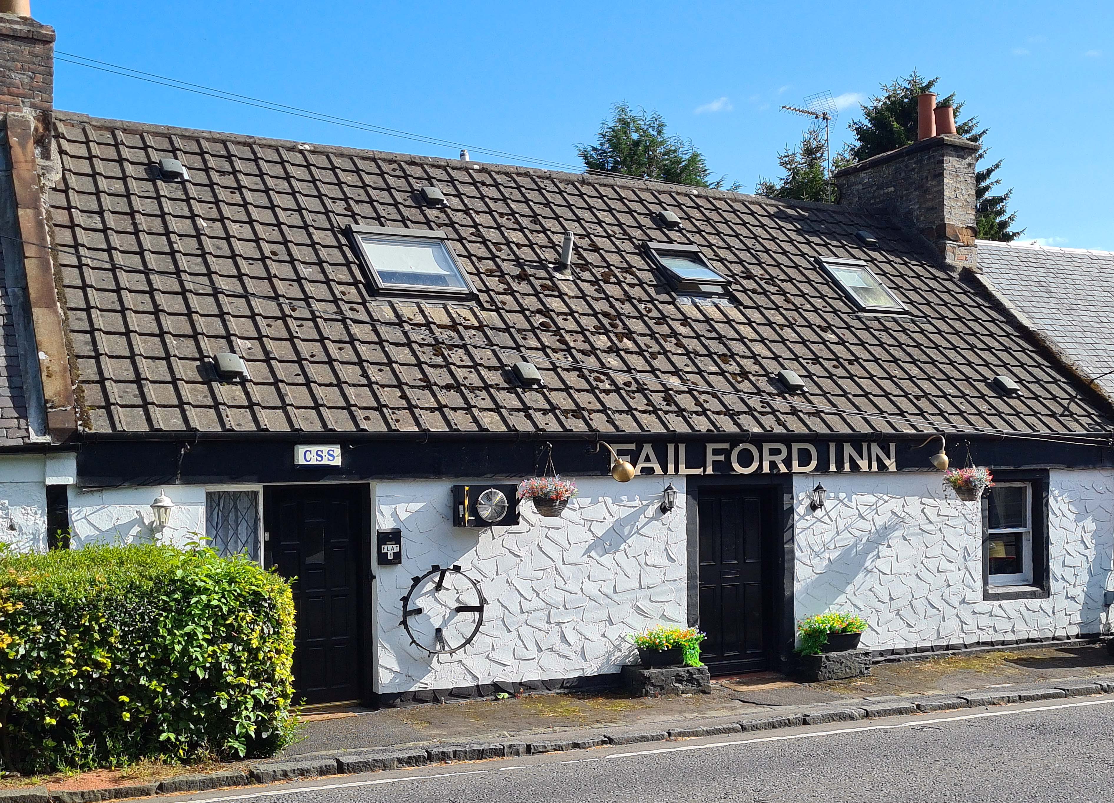
I think it’s only open at the weekend, so it’s best to check their Facebook page first.
Highland Mary Monument
Before I carry on through the Ayr Gorge Woodlands, there’s a monument in memory of Highland Mary just before you walk into the gorge. It’s only about a five minute walk on the other side of the road where a path leads you underneath the bridge, then up the steps to the monument.
Mary Campbell, also known as Highland Mary, had a brief affair with Robert Burns, Scotland’s national poet. It is thought that they exchanged bibles and had traditional Scottish matrimonial vows on the banks of the River Ayr, here in Failford. He wrote a few poems about Mary as well.
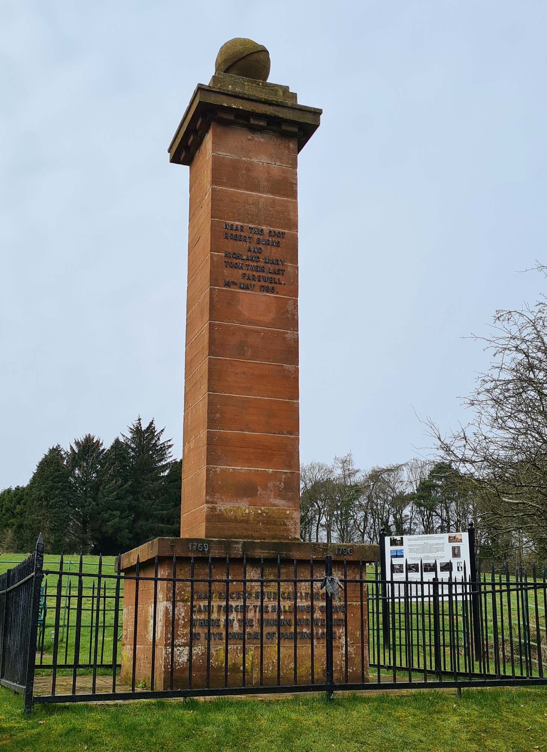
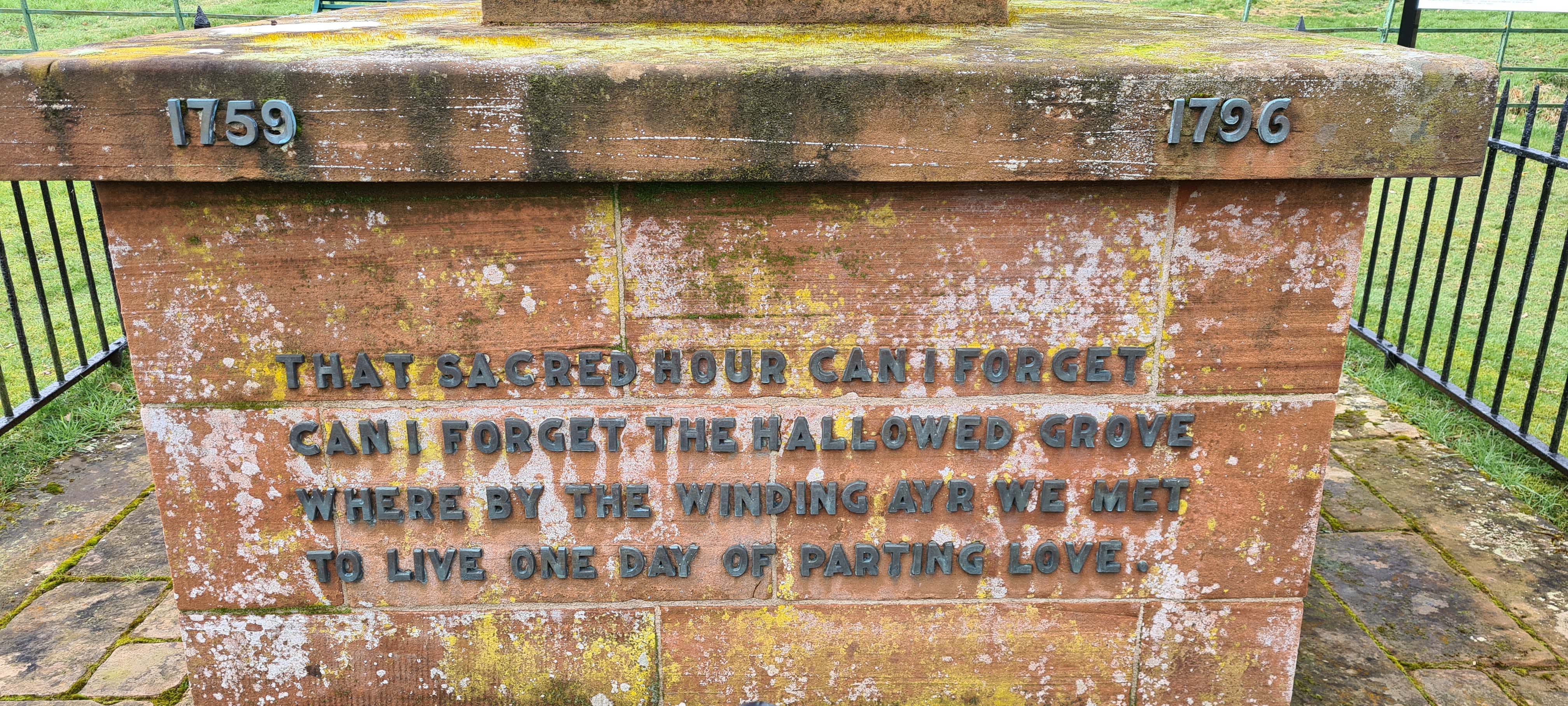
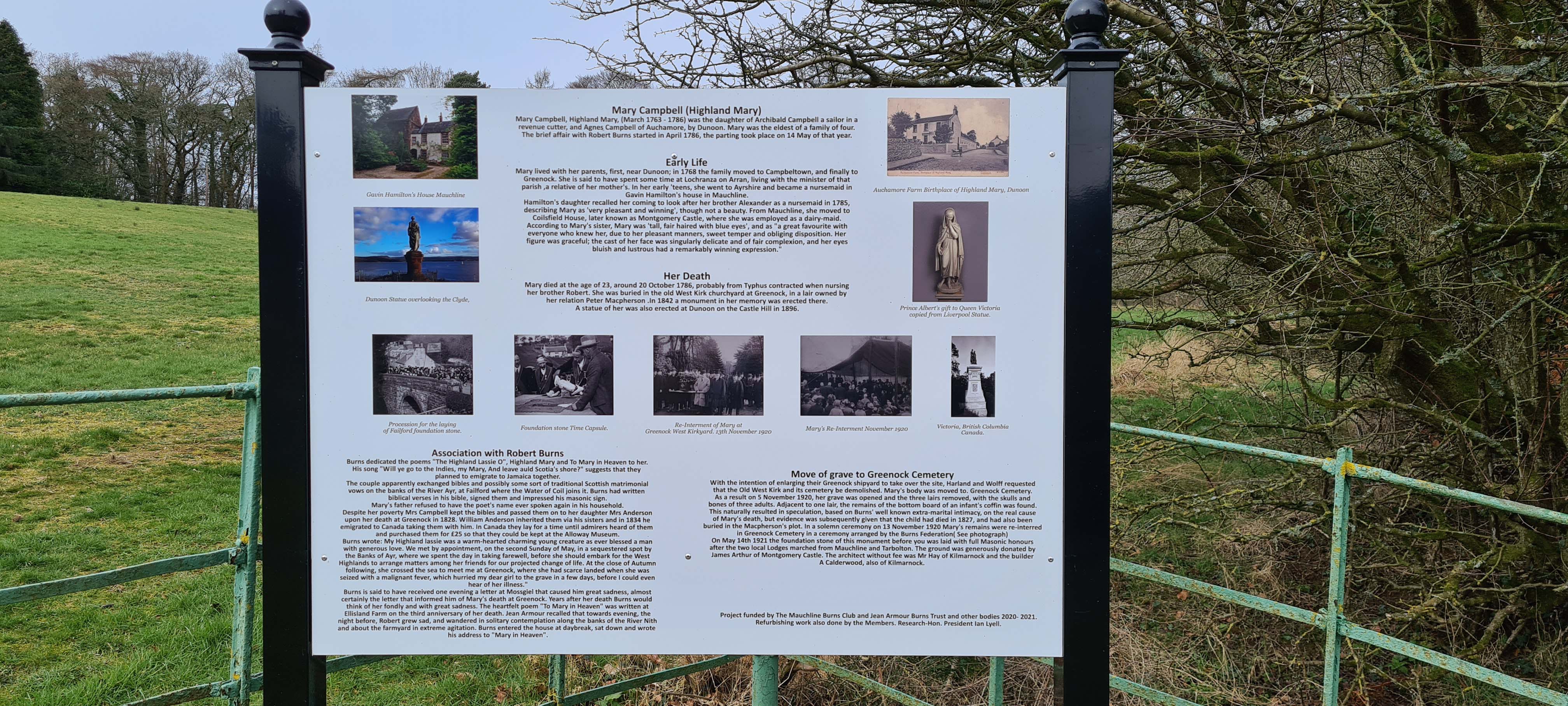
The lower inscription on the monument reads:
1759 to 1796
That sacred hour can I forget
Robert Burns
Can I forget the hallowed grove
Where by the winding Ayr we met
To live one day of parting love
Ayr Gorge Woodlands
As I stepped into another beautiful Ayrshire woodland I was remembering my first visit to Failford and the Ayr Gorge Woodlands.
I was familiar with the paths here and already had lots of photos, so this meant I could keep walking without stopping as much.
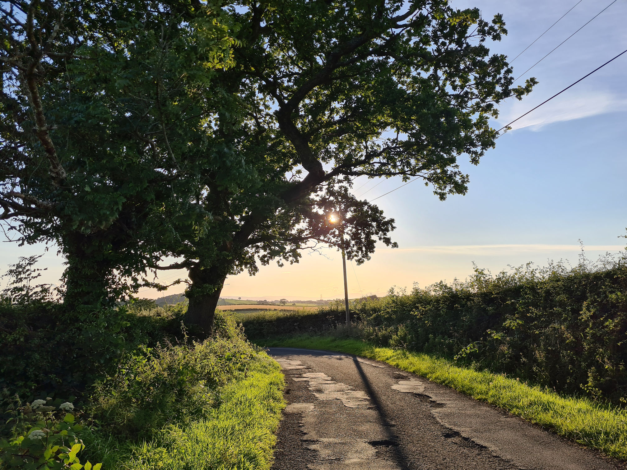
Just as well I already had photos, as on this walking day I was losing the sunlight with the woodlands now in the shade. Our star the sun can certainly affect the mood of a beautiful place, and feels a little scarier as darkness creeps in.
On a summer revisit, I noticed a large grassy near the entrance on the left beside the River Ayr. This would be a perfect place to pitch up if you were wild camping on the full walk, and if the Failford Inn was open for refreshments even better!
Always remember to respect the land, leave no trace and follow the Scottish Outdoor Access Code.
My photos of next part of the walk will be a mix of seasons. The River Ayr Way is mostly well signposted with the small red or large blue arrow, but there’s also other side paths around the woodlands.
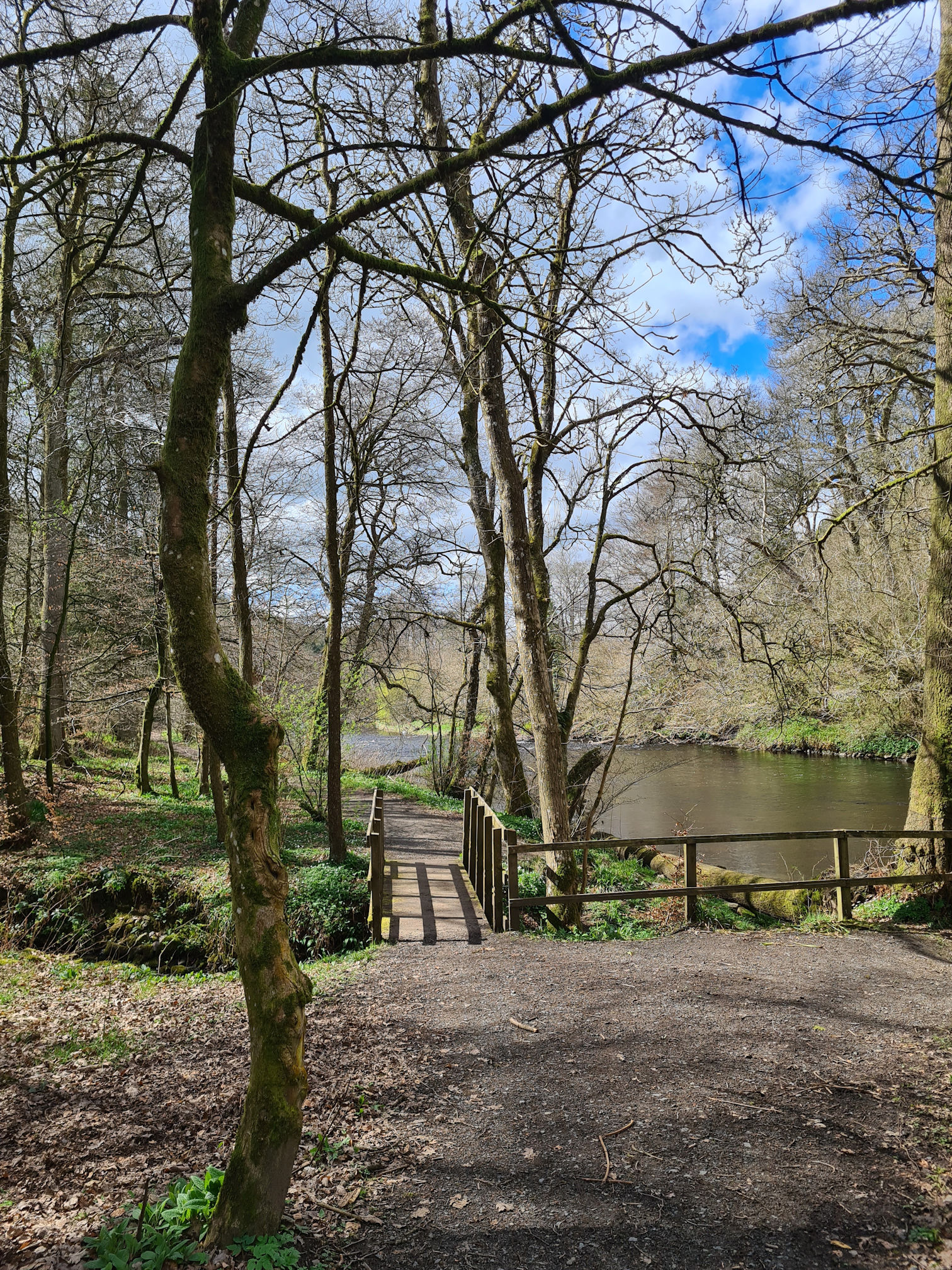
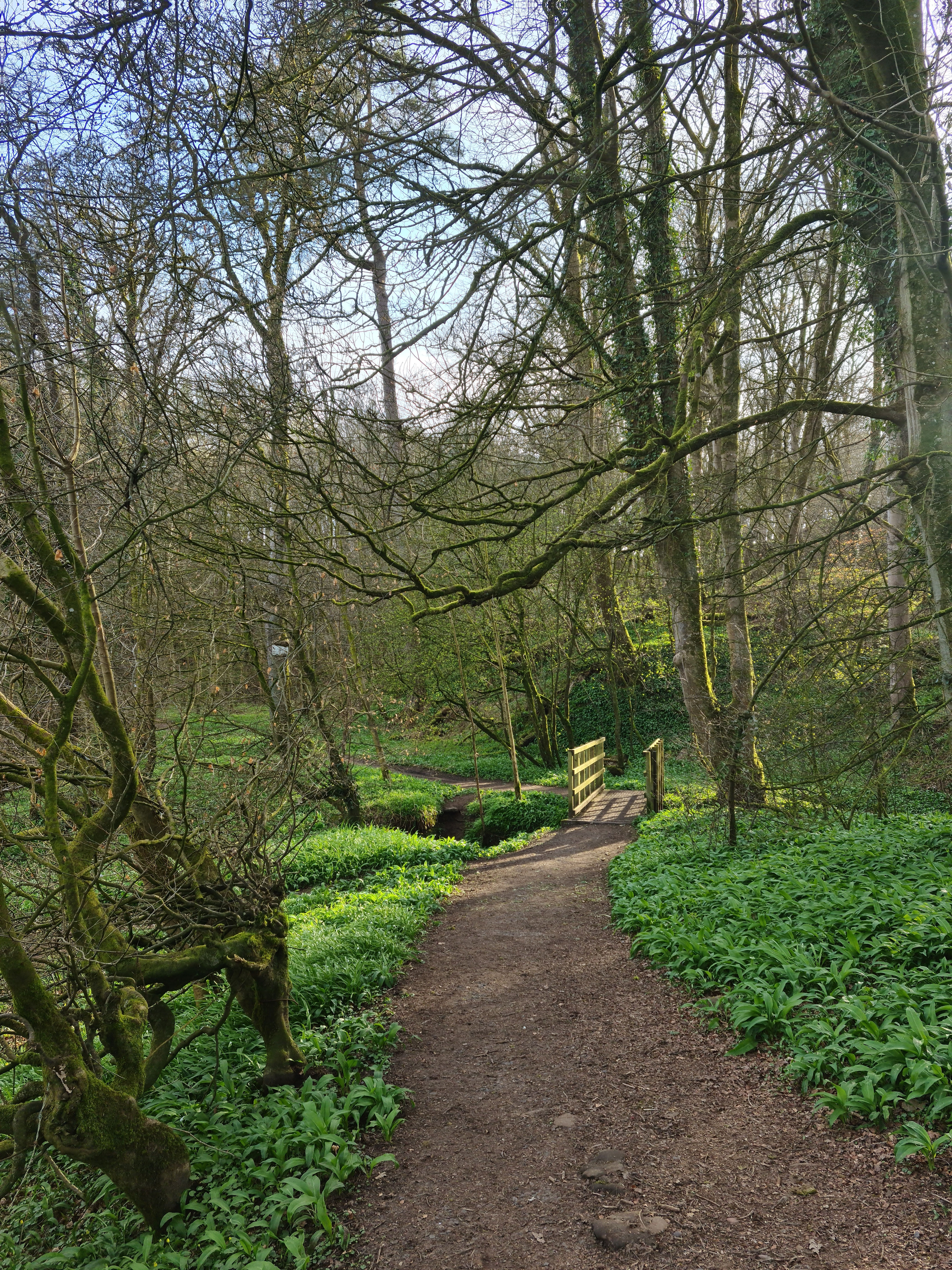
I crossed the tiny wooden footbridge which feels like the magical gateway to the Ayr Gorge woodlands to me, also reminding me of a movie I love called ‘Bridge to Terabithia (2007)’.
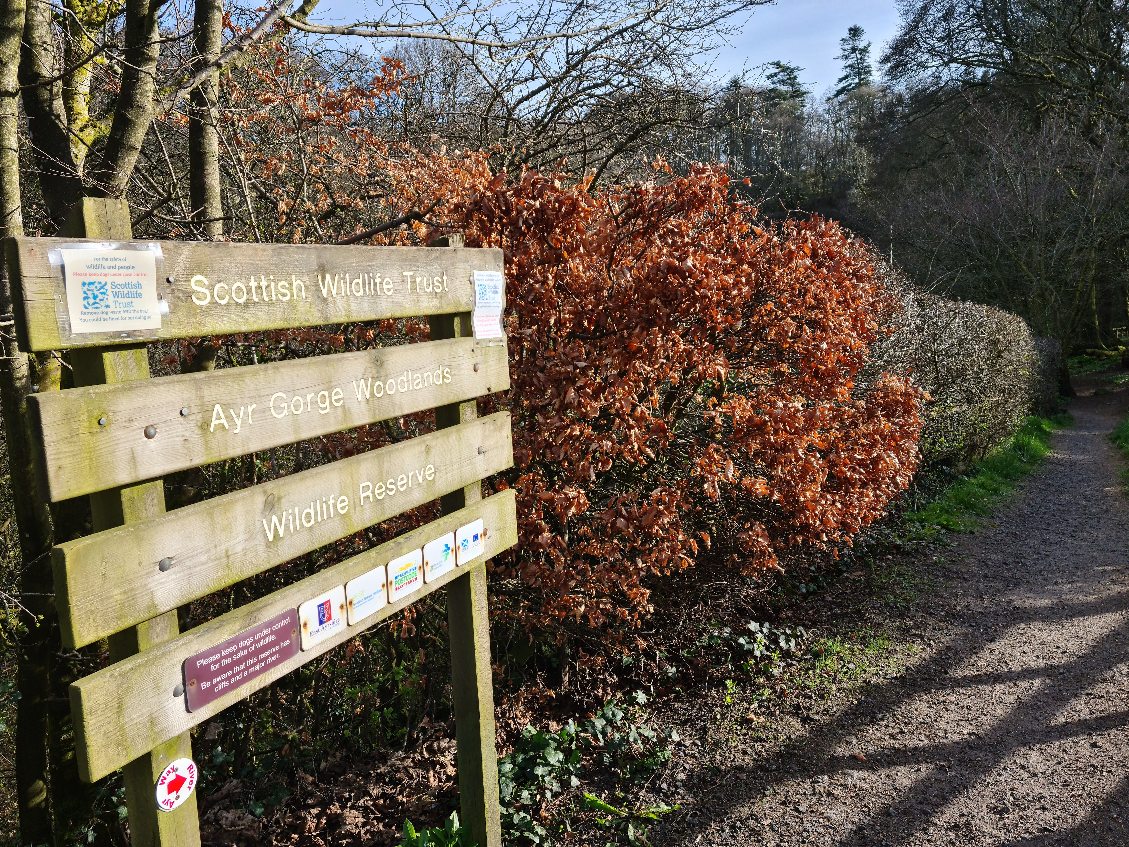
I soon reached an information sign about the River Ayr and the Ayr Gorge woodlands.
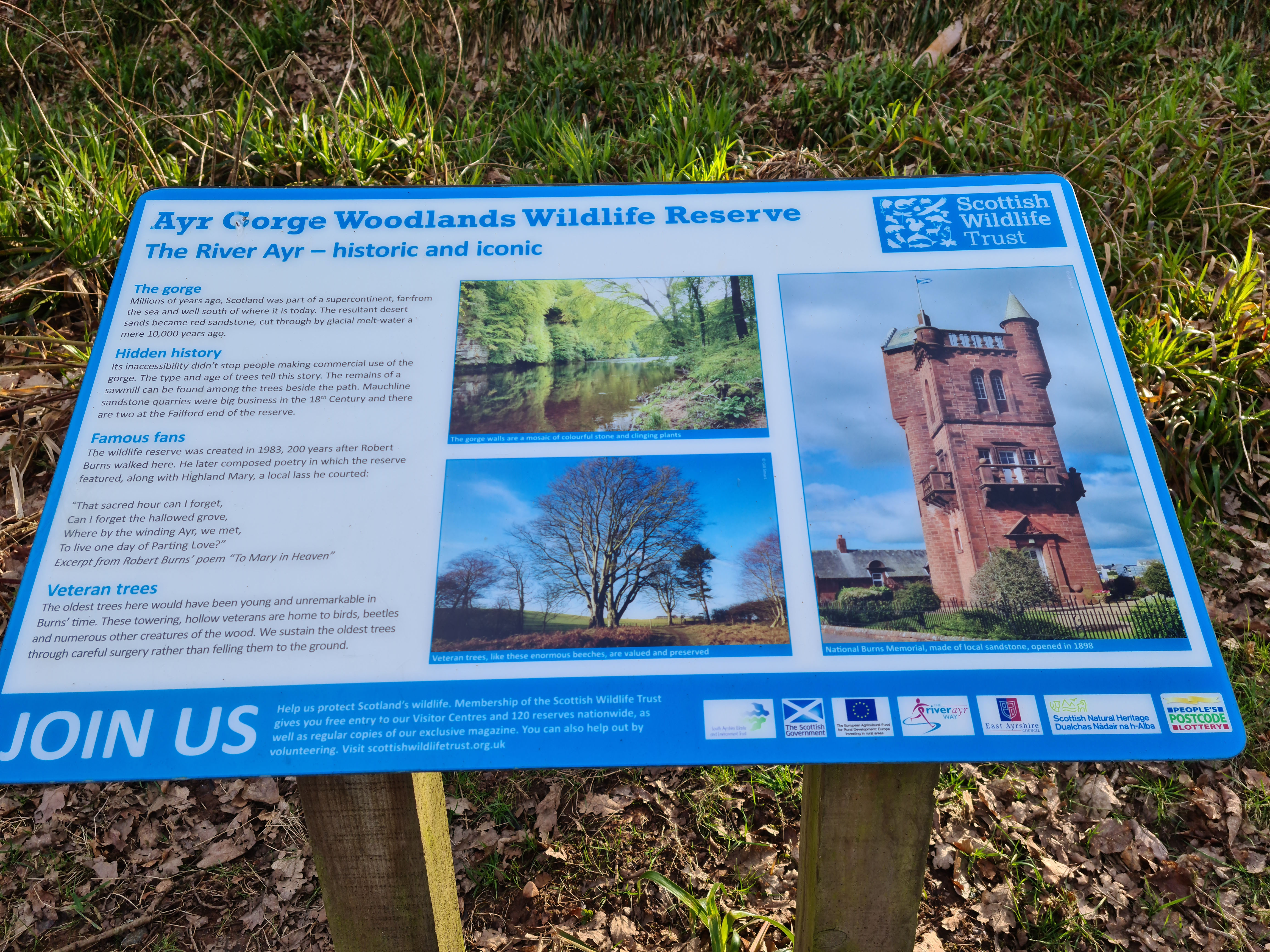
One extract about the gorge from the Scottish Wildlife Trust sign reads:
Millions of years ago, Scotland was part of a supercontinent, far from the sea and well south of where it is today. The resultant desert sands became red sandstone, cut through by glacial melt-water a mere 10,000 years ago.
Scottish Wildlife Trust
It’s mind-boggling how the ‘effects of time’ can create unique and stunning landscapes on our home Planet Earth. We’re really just visiting for a fleeting time … and ‘hopefully’ our beautiful home will continue to thrive forever in nature.
It was time to go up, up and up and I followed the path keeping left above the river. I was relieved I knew where I was going as inviting trodden paths pop up all over the place here!
Below are two similar photos in spring and summer when I was walking through the tree roots above ground.
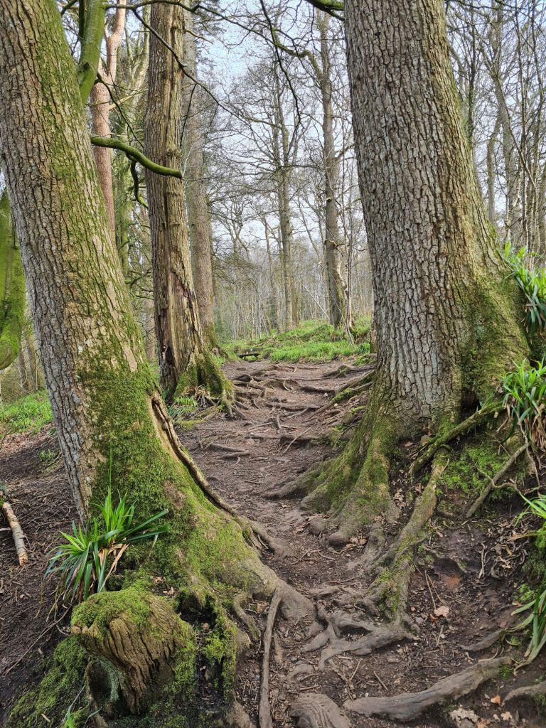
I’ve just realised I seem to have this habit when I revisit a place that I come back with similar scenes 😂. I’m not aware that I do this until I look back at the photos to write my blog. Is it strange that my mind and eyes unknowingly focus on the same scenes?
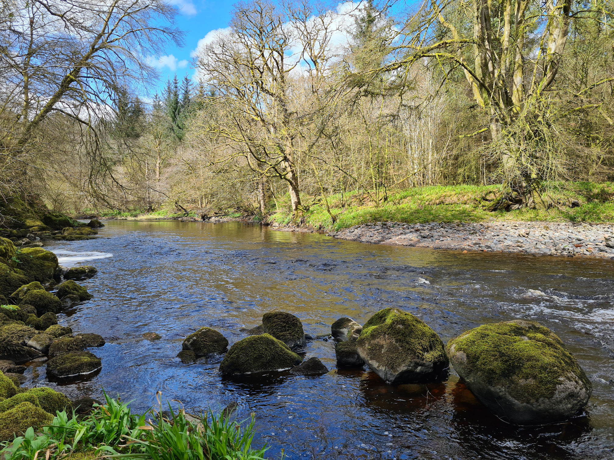
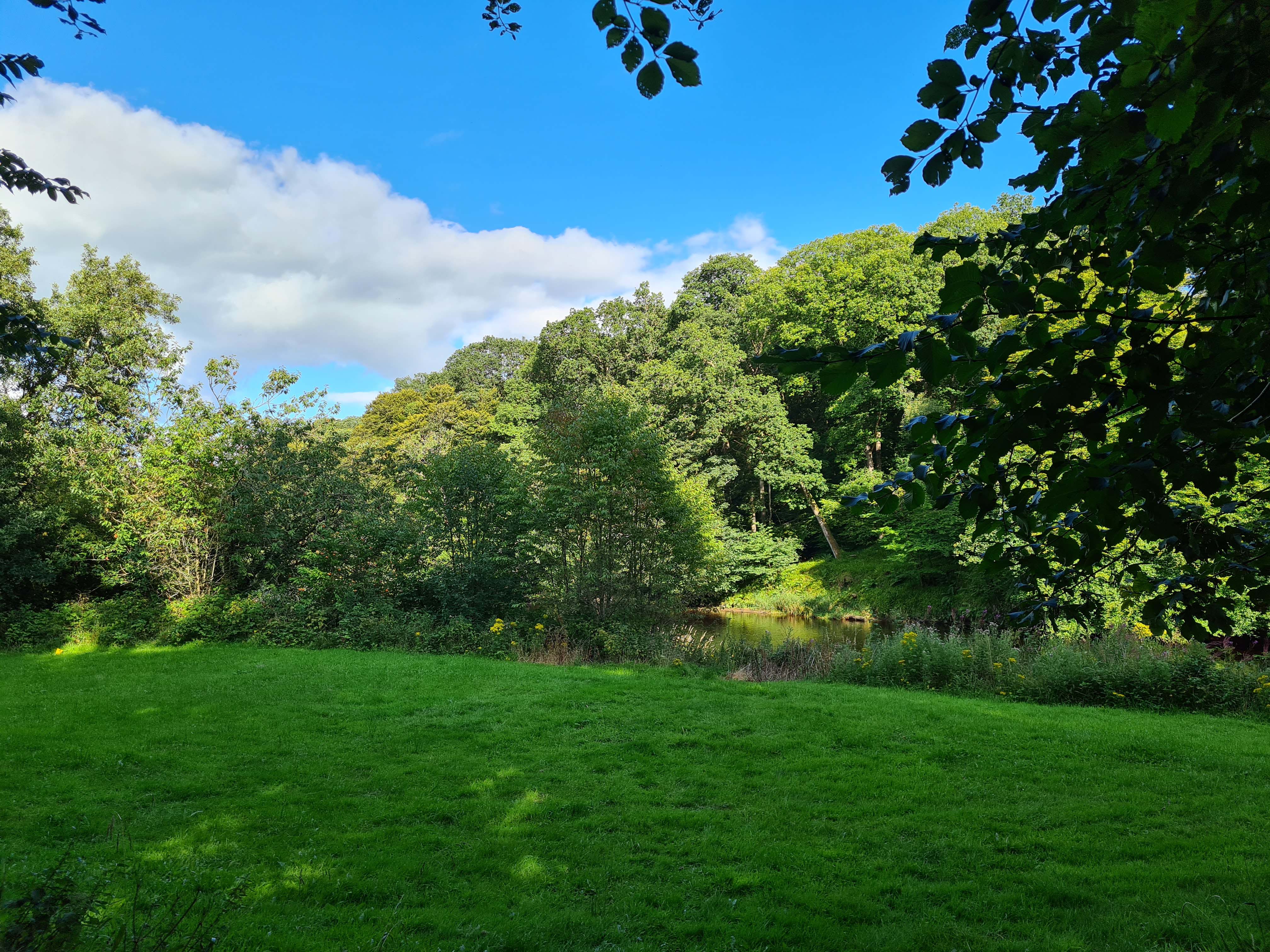
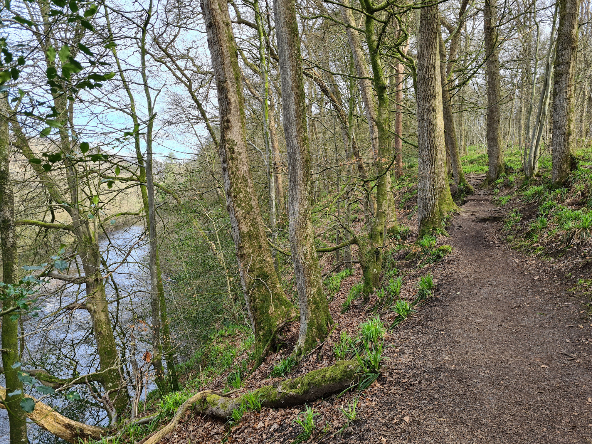
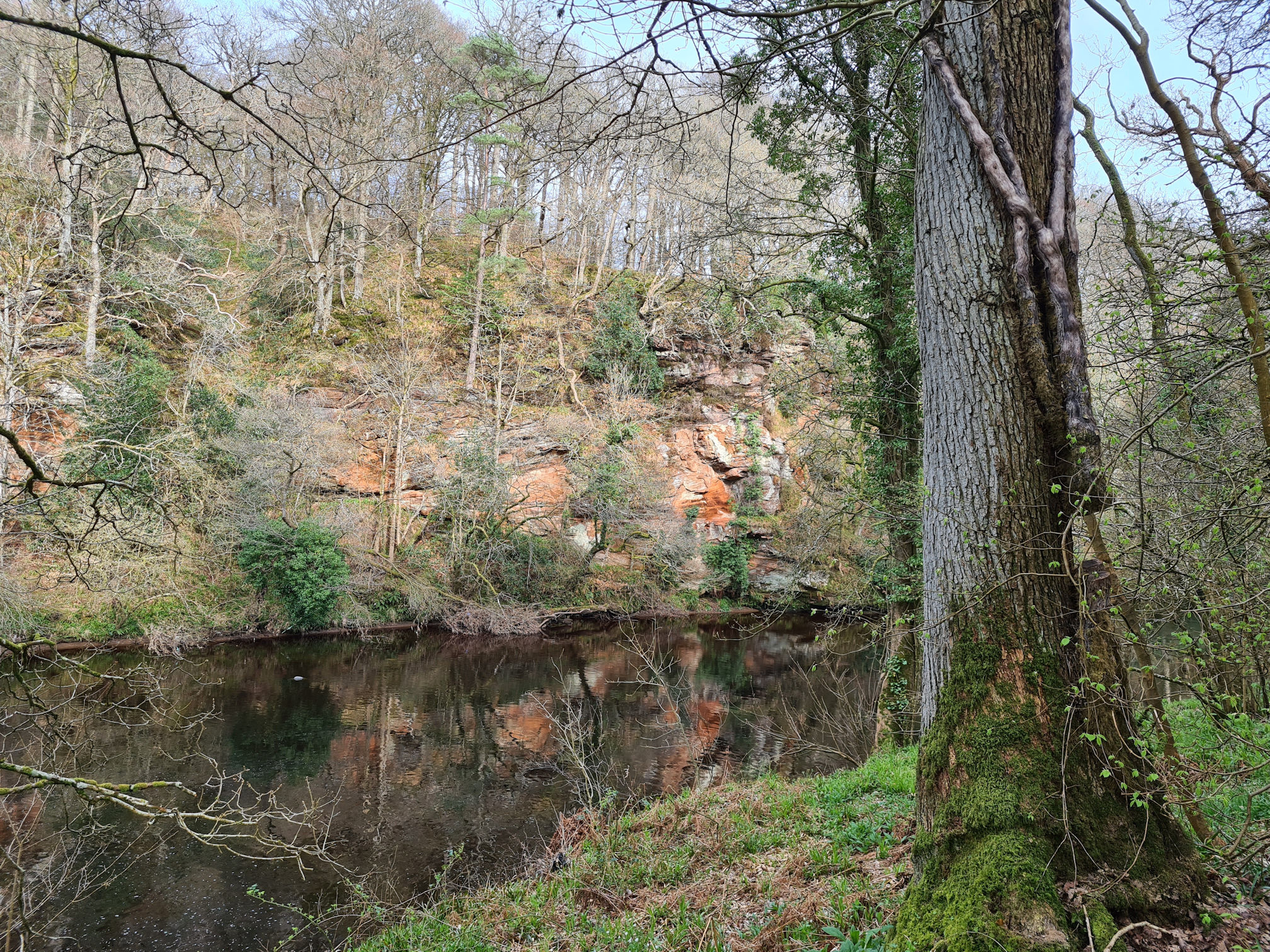
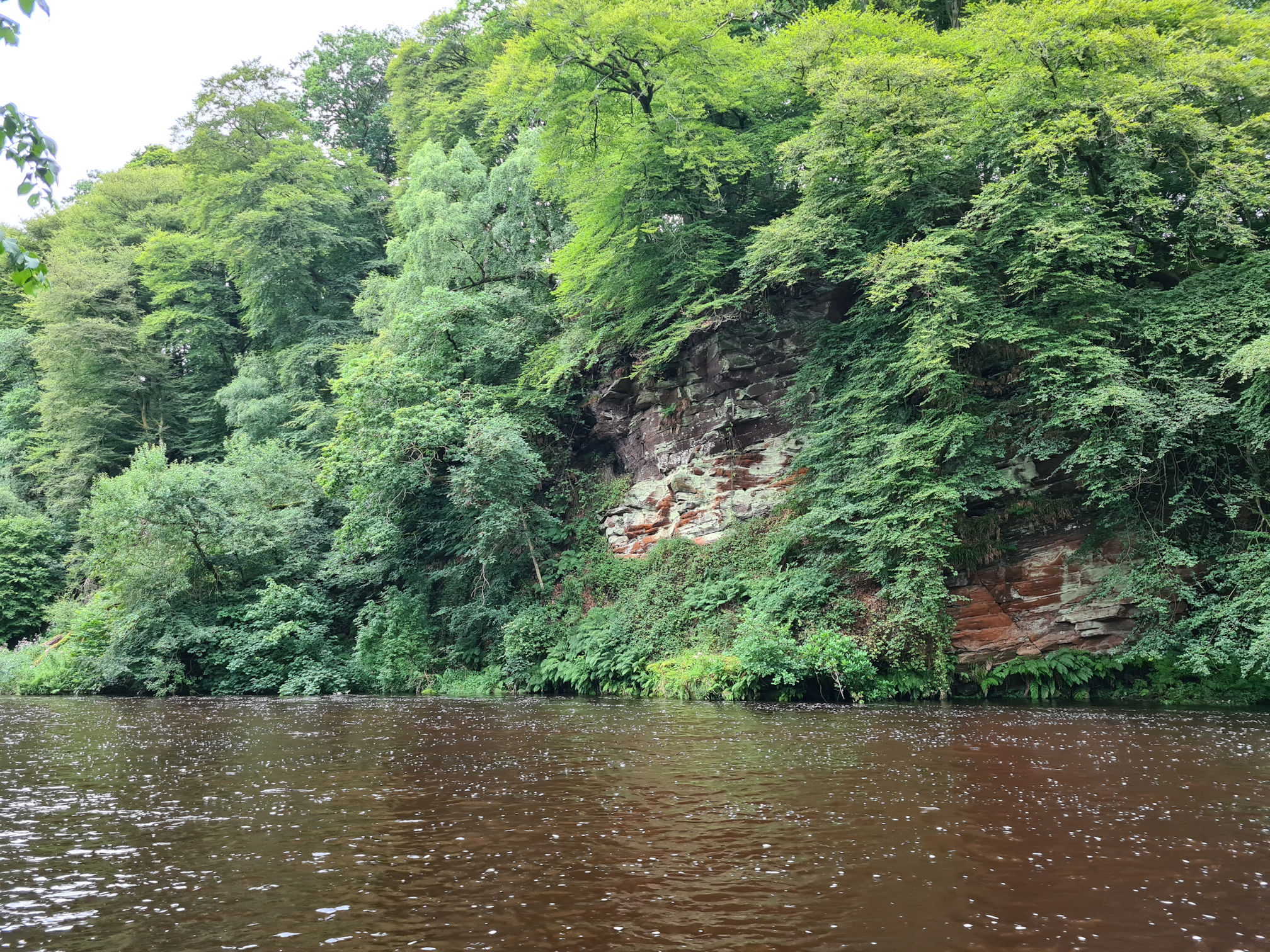
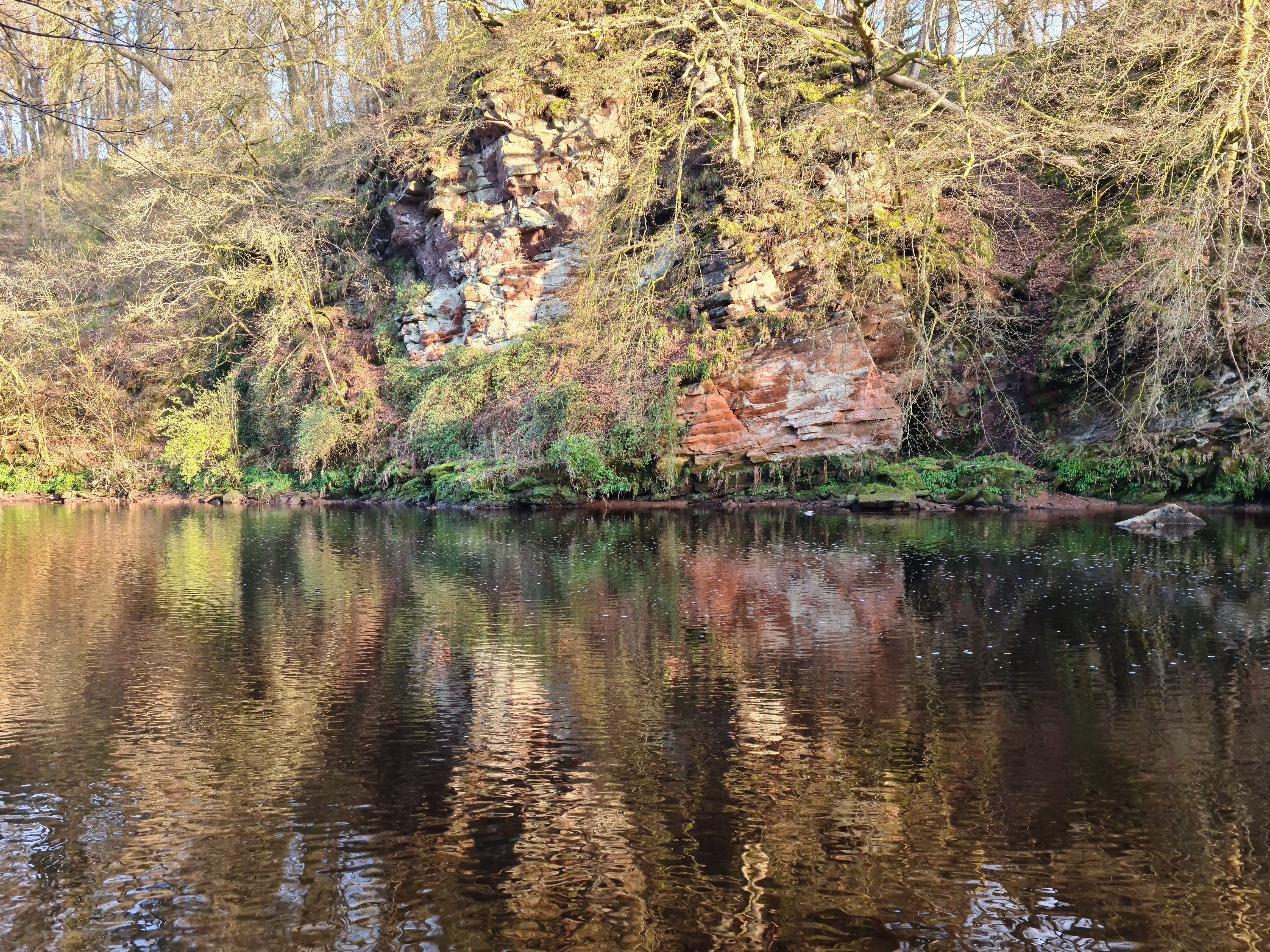
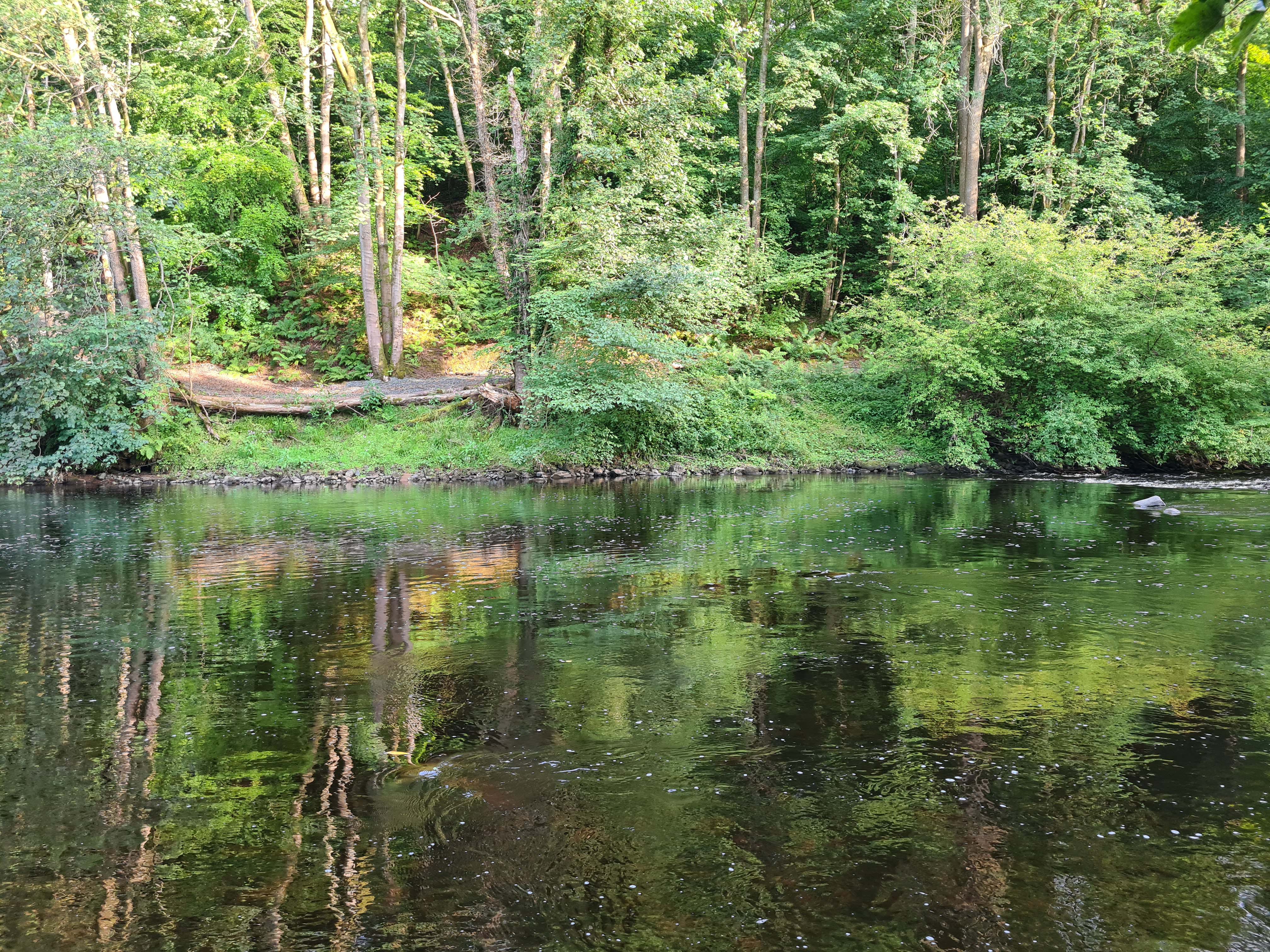
I was soon back down beside the river. It’s such a gorgeous gorge with the red sandstone cliffs reflecting on the River Ayr.
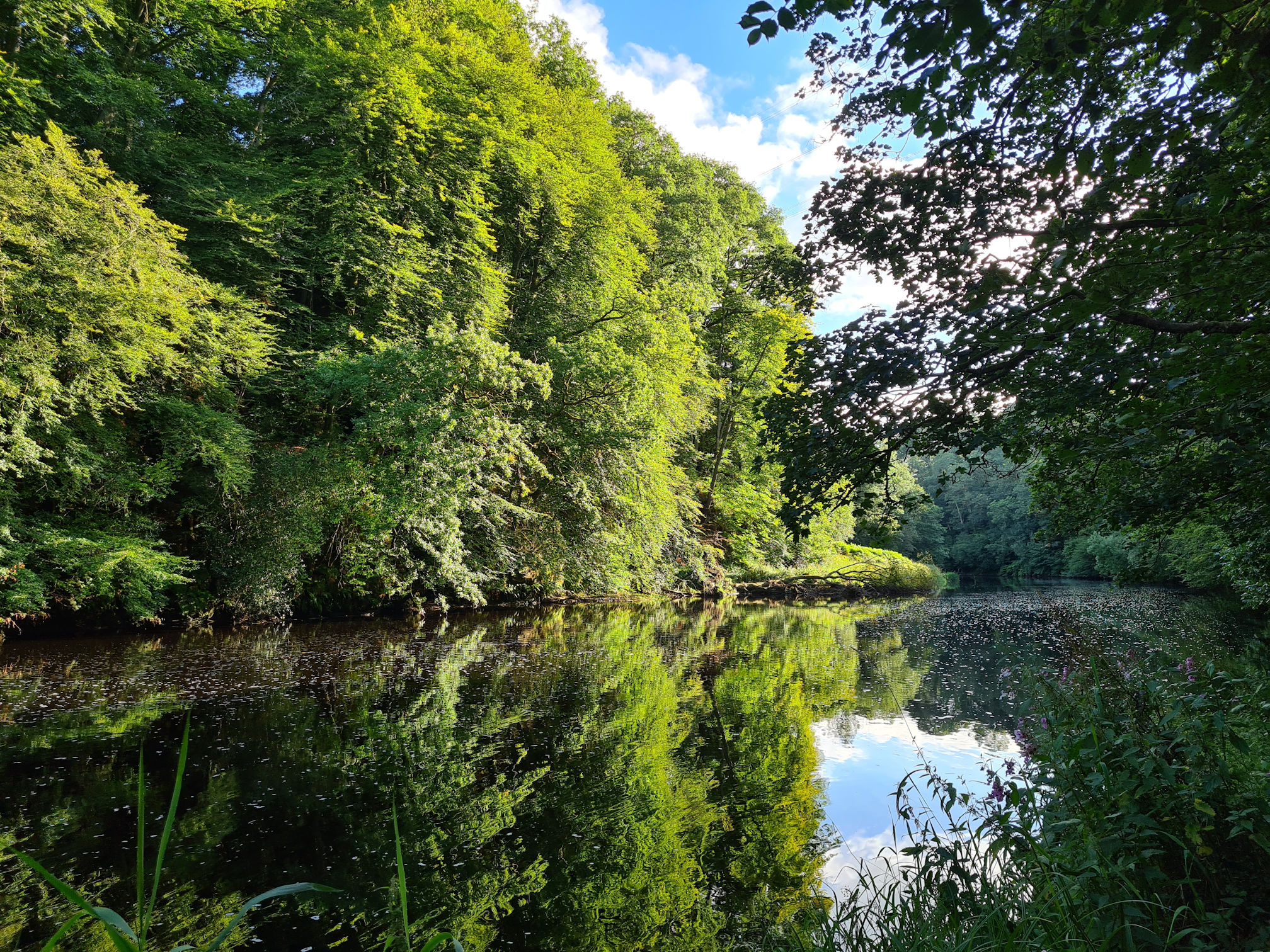
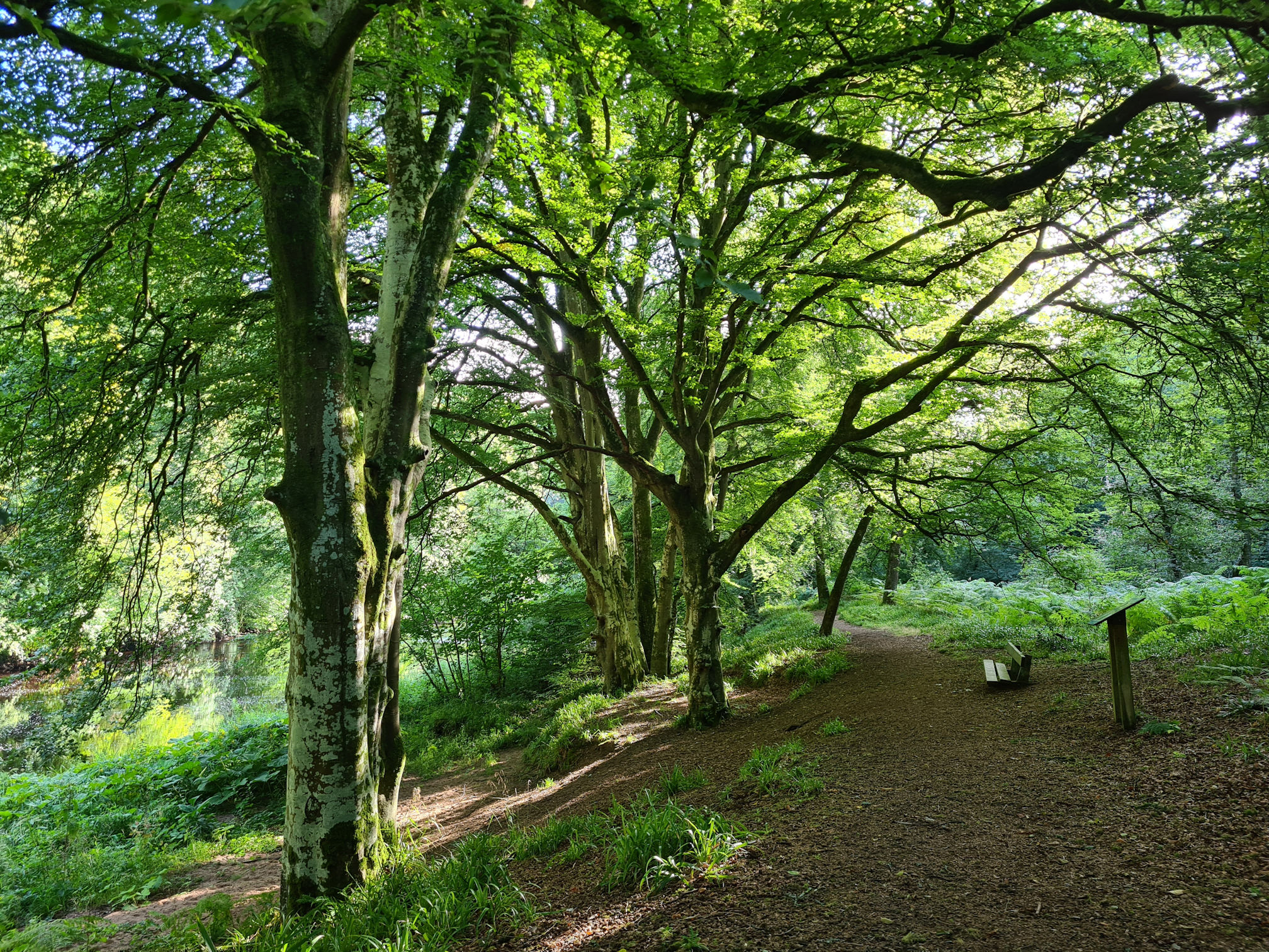
Summer is just as beautiful along the stunning Ayr Gorge Woodlands:
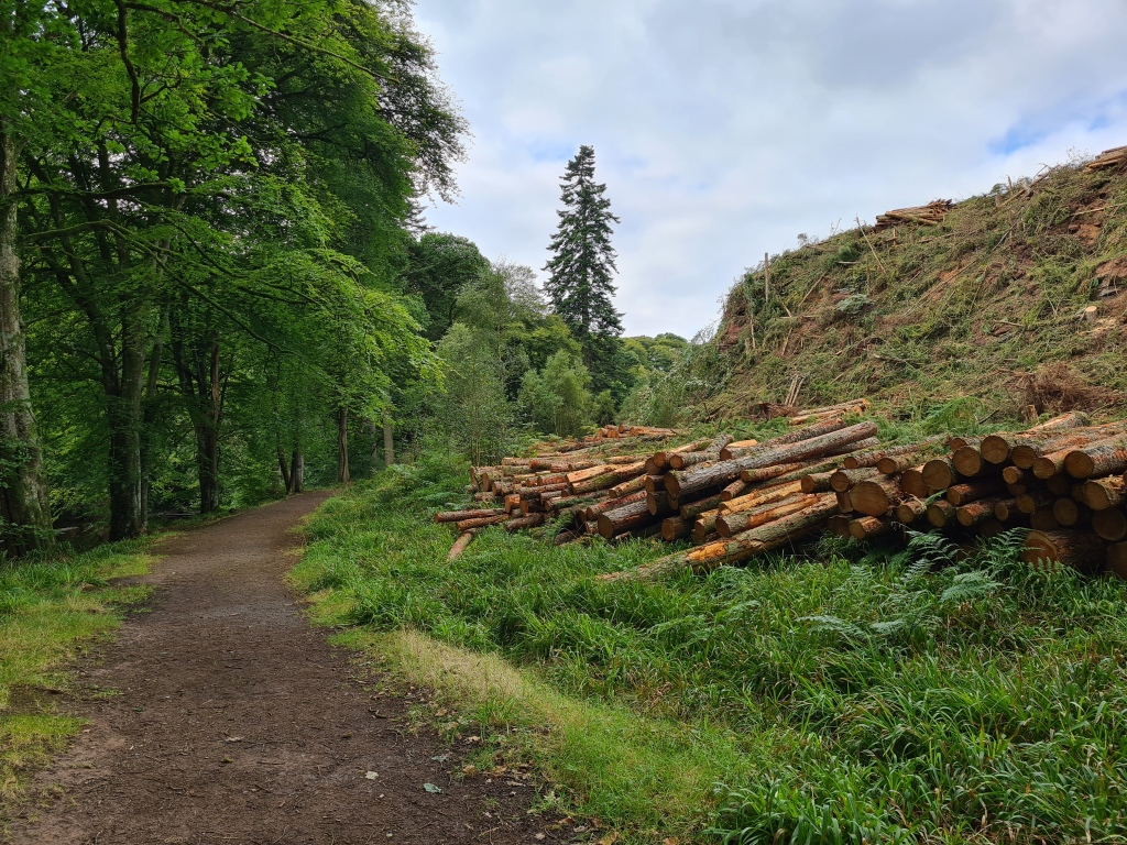
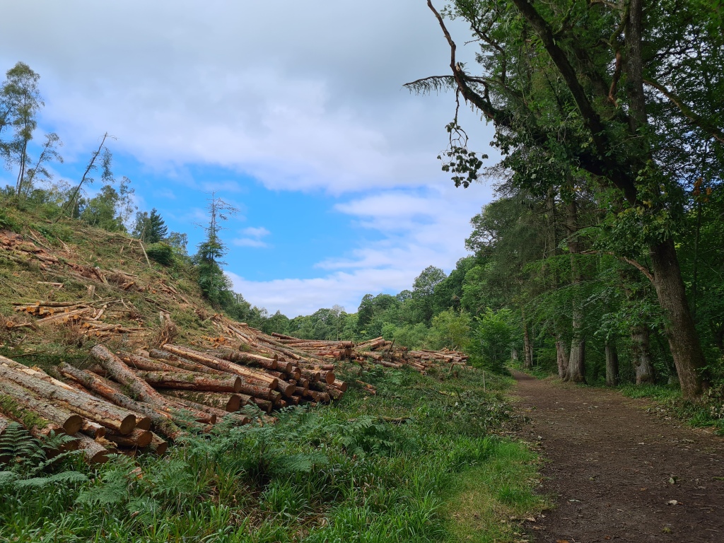
When I returned here with my friend in summer 2023, sadly a large section of larch trees along the footpath were being felled. The trees were diseased with phytopthora ramorum, which is an algae-like organism called a water mould and caused extensive damage.
The Scottish Wildlife Trust said:
“The long-term plan is to promote native woodland through natural regeneration and planting will plant native trees”
They also created this short video to show how the area looks now. The River Ayr and the trees that are thriving look amazing from above!
The felling has certainly opened up the light along the river path and nature will take over again.
There was an enchanting little woodland path in between the high path and low path that I loved, and I thought most of this was gone when I last visited. Looking at the above video there might still be parts of the path left! I’ll need to return this summer to check it out. It will be another exciting wander in the Ayr Gorge Woodlands. I wonder if I’ll take the same photos …
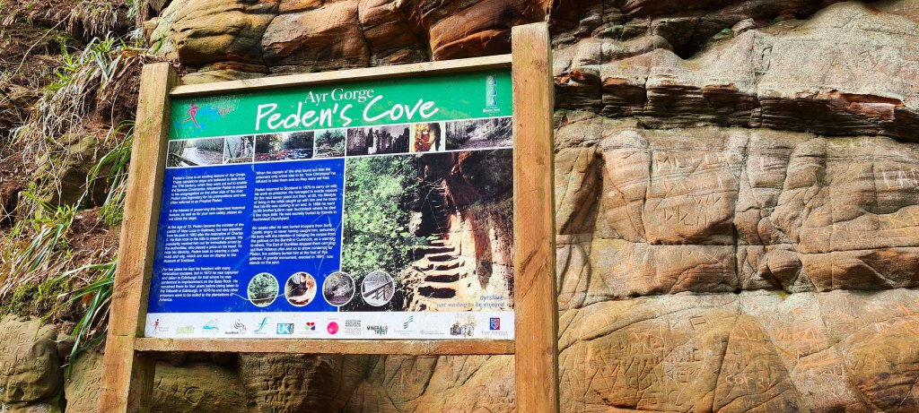
I reached a sign for the River Ayr Way to turn right away from the river, but there’s also a short detour straight ahead to Peden’s Cove that I mentioned in my Ayr Gorge Woodlands story.
I didn’t visit on this walking day though as it was dark and I still had a long way to walk.
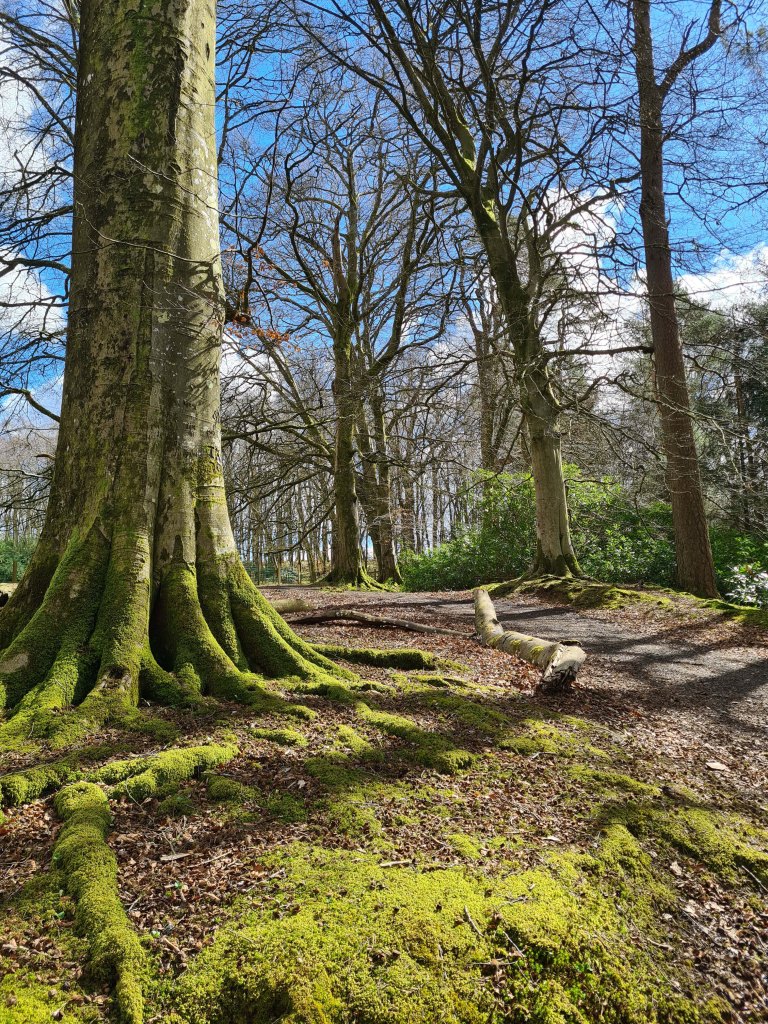
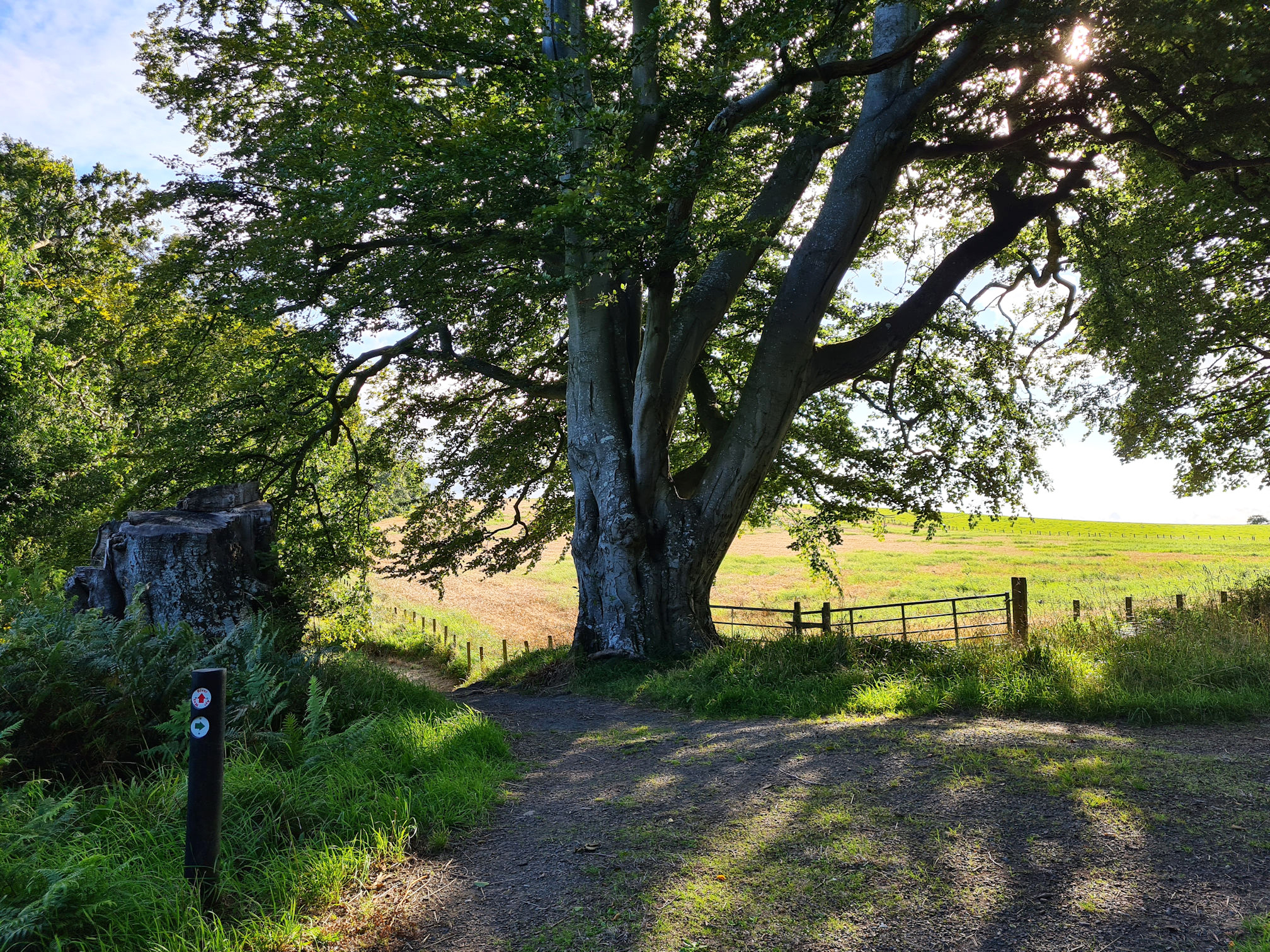
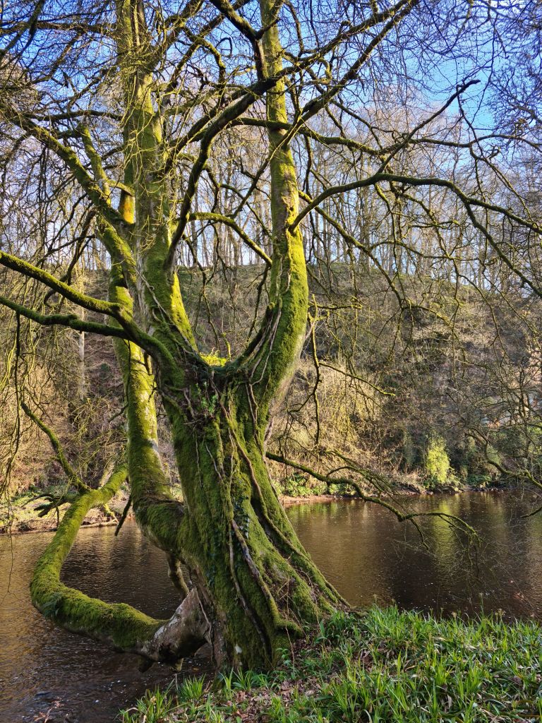
I followed the River Ayr Way arrow back up a hill to meet the beech trees, which are sadly now only one.
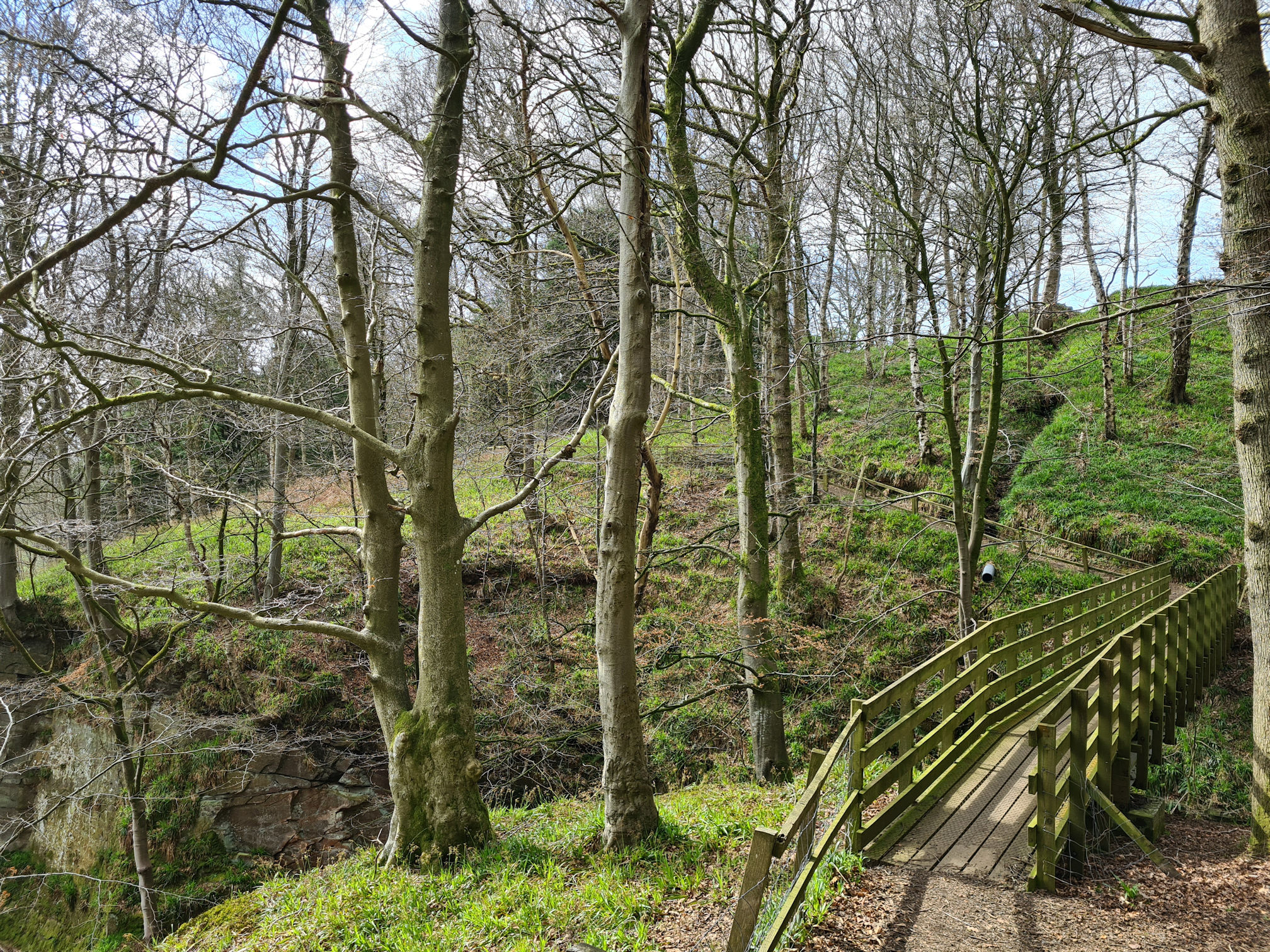
The high path continued through the woodlands until I reached another set of wooden steps. When I visited there was a sign that said ‘Caution, steps under construction’, but they were fine as walked down them.
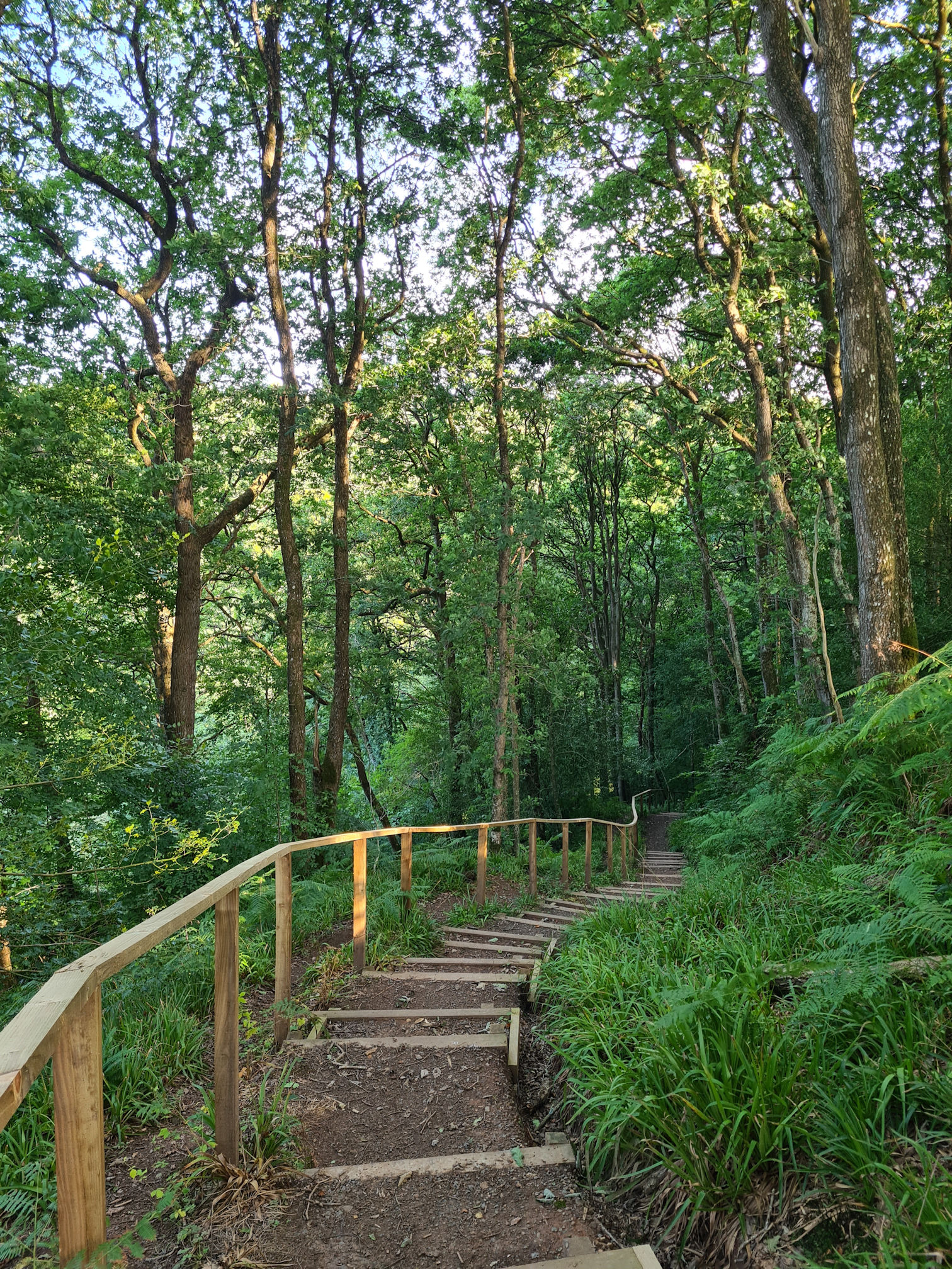
There’s also a path that goes straight on here and connects with the River Ayr Way path as well, but the official walk is back down to the river. It was down the giant steps I go and I knew I’d need to climb back up another set of steps at the other end.
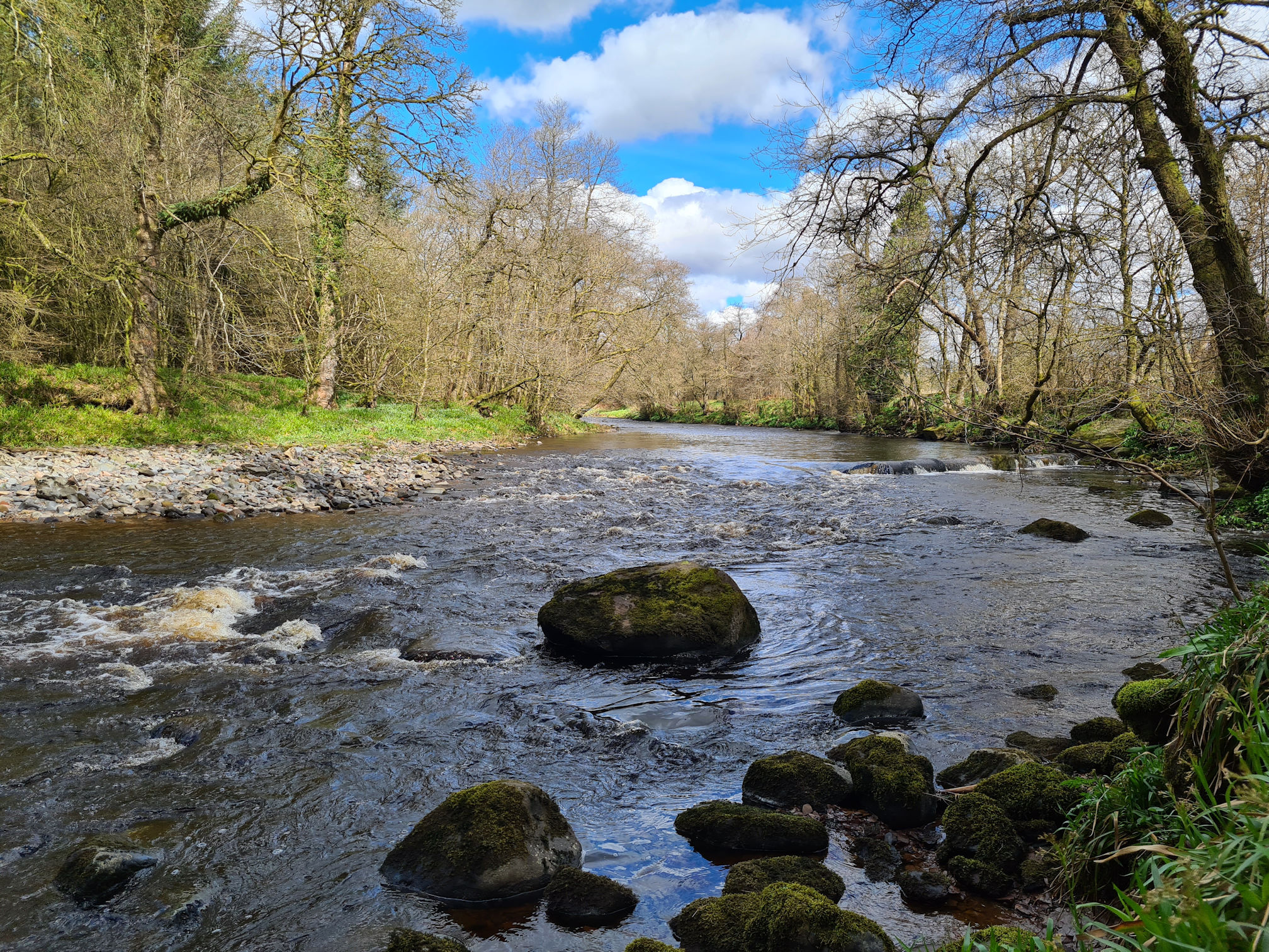
I was back beside the calming River Ayr again, which is similar to the last section I walked with more sandstone cliffs casting their lovely reflections on the water.
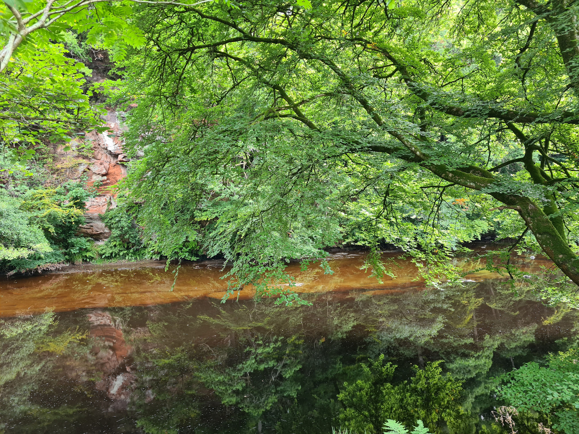
It looks like I picked the same location in this summer photo as well, but it’s more to the right … At least the rock in the foreground is different though 😂.
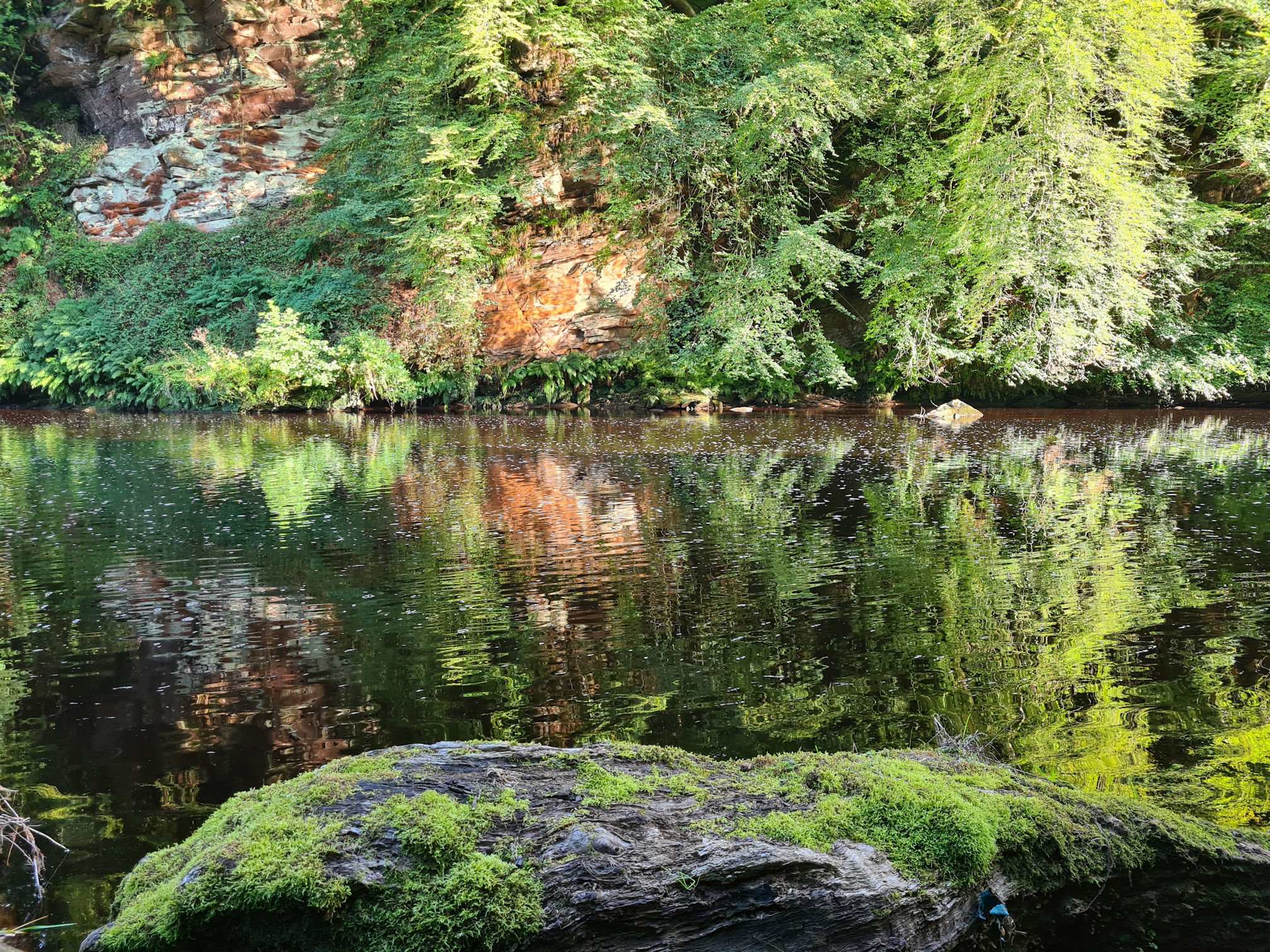
Oops, I did it again! How beautiful is this though, look at the difference in seasons.
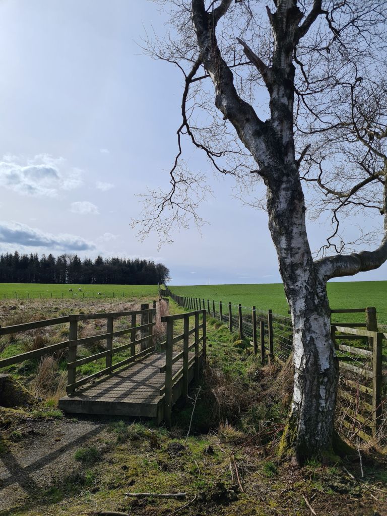
The next set of wooden steps took me back up through the woodlands and they were beginning to challenge my energy levels now. I reached a side path that goes left to continue the River Ayr Way to Stair. I already knew the path that continues upwards would take me to the high path and back in the direction I came from, so at least I didn’t have to try and work it all out when I was tired.
As I walked through the entrance from darkness to light, this area was all new to me and I wasn’t sure how far I had to go.
Walking to Stair
Some more photos of walk to Stair part of the walk:
I’d read on the Walkhighlands website there was a detour in place for Stair as a few years ago a landslide blocked the river path along the official route. I would have rather continued along the flat river path, but instead I had to go over a style and walk through a field at Daldorch Farm.
I was really sore now. When I reached the other side of the field and over another style onto the country road, I looked ahead at the steep hill and sighed. I think I actually said aloud “Whaat?”.
How far do I still need to walk I thought? Surely I must be close now.
The uphill country road felt like forever on my legs that were now shuffling baby steps. I carefully walked over the cattle grid mindful that tired legs can make mistakes!
It was still a beautiful walk though, and I think not knowing how far I had to go was making me feel even more tired.
I reached the end of the road, which joined with another country road. Left or right I wondered, as I completely missed the red arrow sign across the road. I looked at my printed Walkhighlands directions to check which way to turn. Left it was, as I kept shuffling up another hill …
When I think back now, I didn’t realise how much the Failford and Stair section was up and down like a yo-yo!
At last I reached the B730 main road, which was downhill, yay! My legs seemed to pick up their pace for this final stretch as it was ‘all downhill from here’, in a good way!
Even though the road wasn’t too busy with cars, when they did appear I had to stand off the road onto the grass edge. They were so fast, especially when they suddenly appeared around the bends on the road.
I ended up walking too far and reached the Stair road bridge, thinking this was where I should be. It made sense to me as the River Ayr flowed under the bridge. I think this is where I would have finished if the diversion wasn’t in place though.
Alan picked me up at the bridge as I didn’t have the energy walk back uphill, then we stopped off to check where I should start the next part of the walk from Stair to Ayr. I’d walked past the faintly signposted red arrow for the River Ayr Way beside a field access gate.
Trust me to add extra steps onto my already aching legs 😂.
My recorded distance and times:
- Distance: 11 miles (18 kilometres)
- Moving time: 5 hours
- Elapsed time: 6 hours
I walked Stair to Ayr after my Kiltwalk 2023, which I’m pleased to say I finished. The walking training certainly helped my legs cope with long distance walking.
Walking this route has shown me new places close to where I live. Ayrshire is so beautiful and I must appreciate it more as I do feel lucky to live here. I have a bad habit of visiting the same local places as I am comfortable and familiar with them.
Thanks for reading as always. I know it’s another long story, but it was a long walking day and I always have too much loveliness to share. 🥰
My next story will be the final section of the River Ayr Way walk from Stair to Ayr. It was another surprising beautiful walk!
Love, Dawn-Marie x
More information about this walk
- East Ayrshire Leisure: River Ayr Way
- Scotland’s Great Trails: River Ayr Way
- Walkhighlands: River Ayr Way
- Sorn Castle
- YouTube – Roger Griffith: Ballochmyle Neolithic and Bronze Age Rock Carvings
- Canmore: Ballochmyle Cup and Ring Marked Rock (Prehistoric)
- Ayr Gorge Woodlands
- Scottish Wildlife Trust
- Scottish Outdoor Access Code

Very nice ☺️.
LikeLiked by 1 person
Thank you so much 😊. It took me a while to write, but I finally finished it. One more to go for this long walk 🥰
LikeLiked by 1 person
You should publish these Dawn-Marie, they’re amazing! Xx
LikeLiked by 1 person
Aw thanks so much Julie, that’s a really lovely compliment! I needed that reassurance it was okay. I feel I ramble on saying the same thing, but that’s what a personal blog is all about as you know 🙂
It has taken me so long to write about this walk I’m starting to forget lol. One more to go though!
Thank you
DM x
LikeLiked by 1 person
😂😂 oh I know all about rambling don’t you worry but people will see jt as a true reflection of the walk and be really interested in it!! Xx
LikeLiked by 1 person