I set out to walk the Stair to Ayr stretch of the River Ayr Way the weekend after the 2023 Glasgow Kiltwalk. I had 14 wet, but proud Kiltwalk miles in my legs so this should be easier today I thought.
The River Ayr Way is Scotland’s first source to sea walk and is listed as one of Scotland’s Great Trails. Stretching from Glenbuck Loch to the sea at Ayr, it covers around 41 miles (66 kilometres), mostly following the flow of the River Ayr across East Ayrshire and South Ayrshire.
I split the River Ayr Way walk into three sections, following directions on the Walkhighlands website:
- Glenbuck to Sorn – I walked this over two different days in October 2023:
- Sorn to Stair – I walked this one day in April 2023
- Stair to Ayr – I walked this one day in May 2023
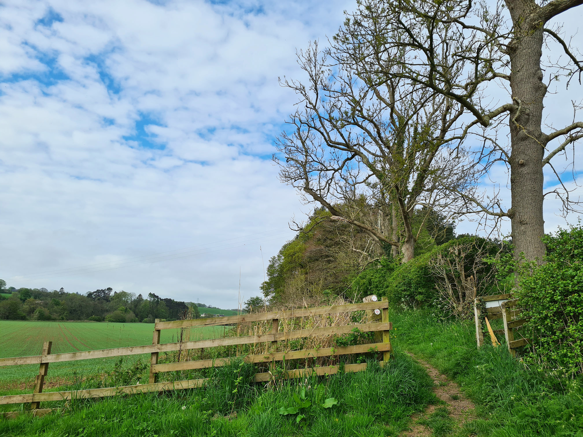
Stair
Alan dropped me off at the Stair starting point and off I went into the unknown. I was beginning to love these mystery trail adventures across Ayrshire, and I was excited to see what happens today.
As always, I was wondering if I could go the distance on another long walk so soon. There’s always that wee voice in my head that casts doubt. Mind you, I think I’ve proved myself wrong on other walks and I know I should stop thinking negatively before I start. It’s time to go with the flow.
As I was walking between the field and swaying trees, the wind was gently blowing in my face, a refreshing feeling that made me close my eyes and take a deep breath. My energy levels were boosted straight away. Nature is pure magic!
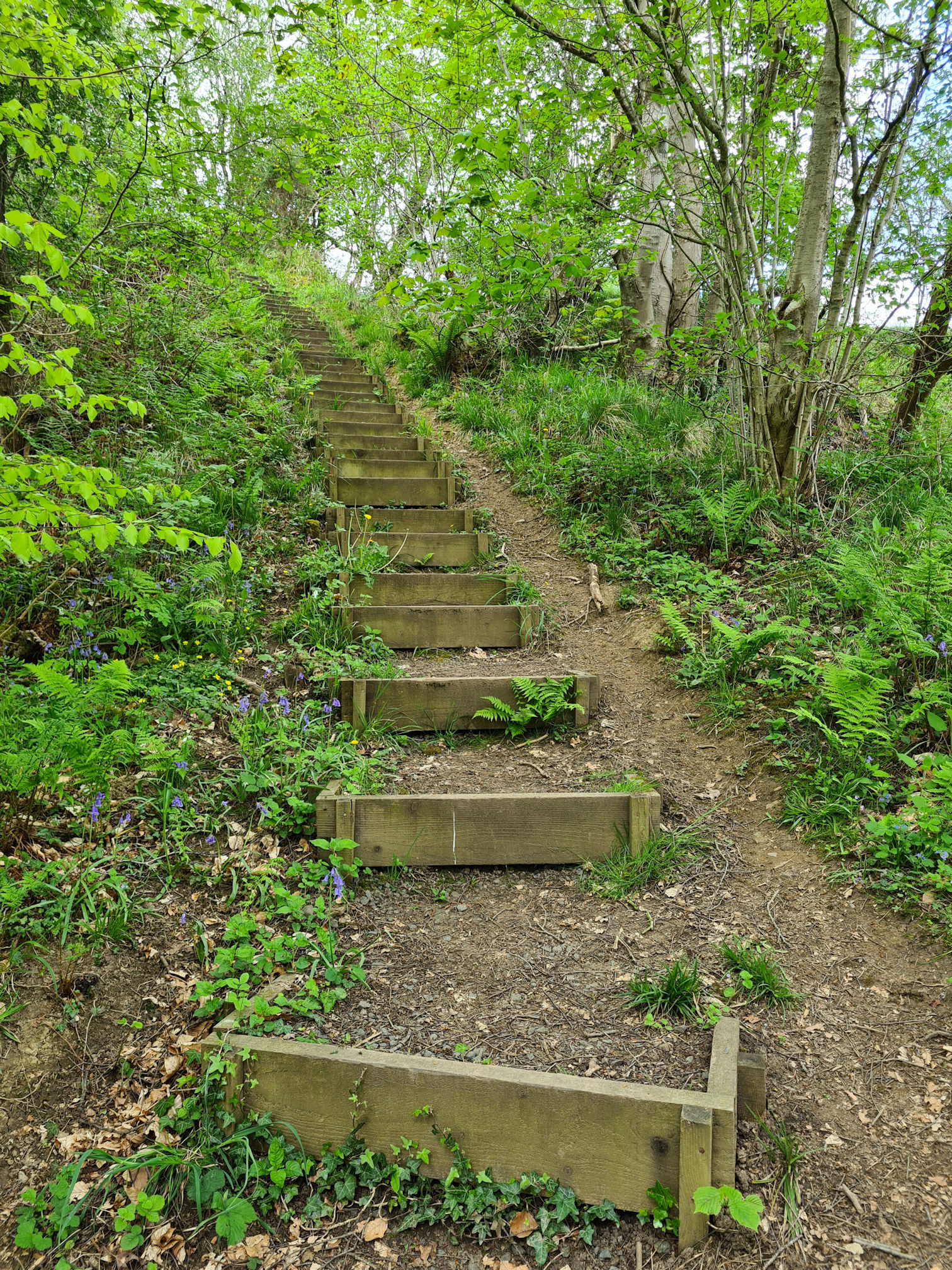
I soon turned a corner and I couldn’t believe my eyes…
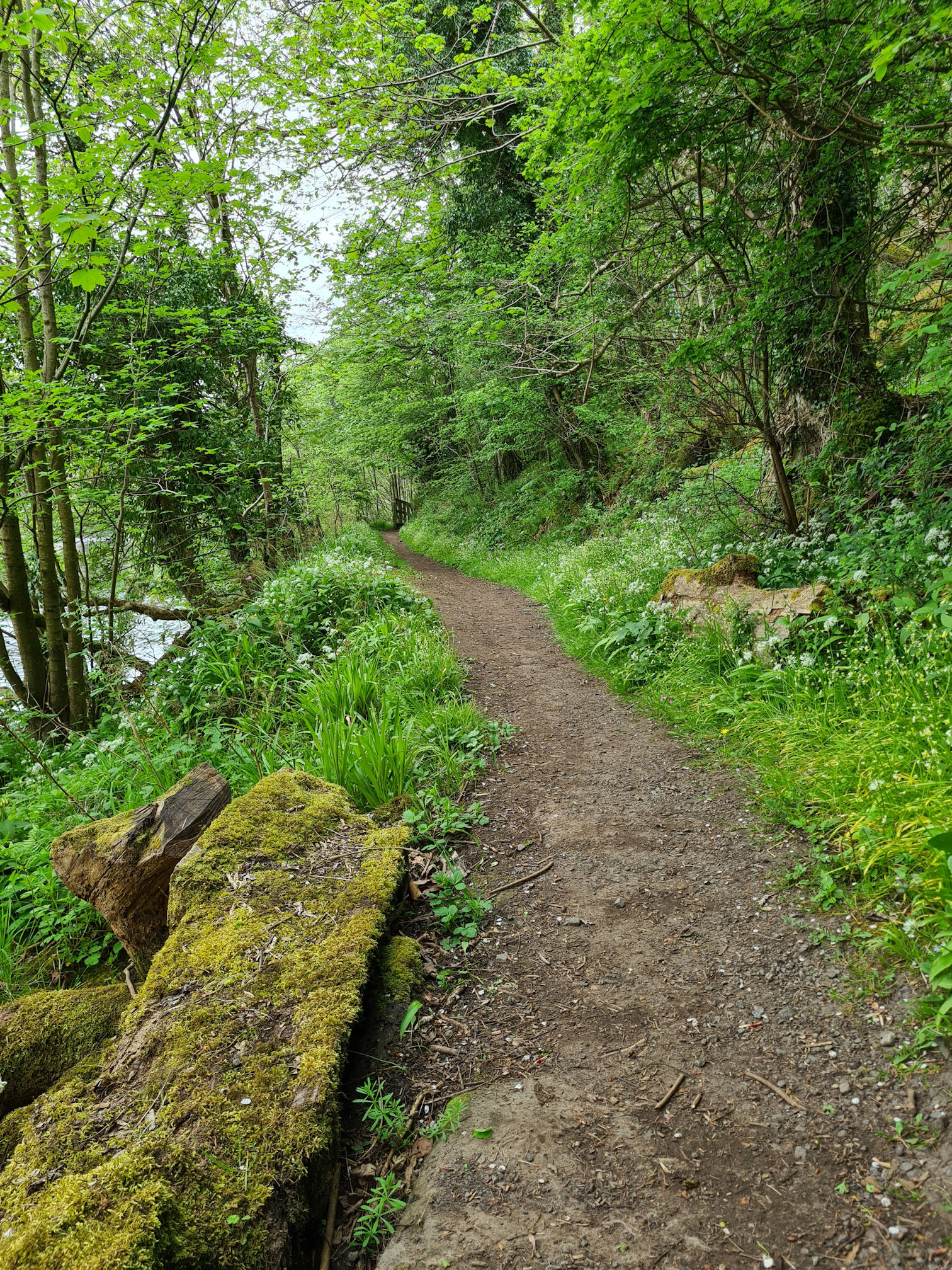
A lovely boggy bit was proudly lining the path in front of me. Now this wasn’t just any old boggy bit, this was a thick muddy obstacle course 😂.

I’ll try and walk along the edges I thought, usually it’s drier there as the water gathers in the middle. Desperately trying to hold on to the gaps between the jagged barbed wired fence to support myself wasn’t working as I’d hoped. My body swayed backwards towards the middle of the bog and I almost fell in completely! 😂
The thought of falling flat on my back and being attacked by barbed wired fence wasn’t part of my exciting adventure today, so I had to walk through the squidgy, squelchy, sinking brown mud path.
Hoping I didn’t sink down too far, I slowly stepped into the grassy side of the muddy abyss to test how deep I’d go, and walked on as fast as I could until I reached firmer ground. In fact I don’t think I would call it walking, but it was some kind of movement.
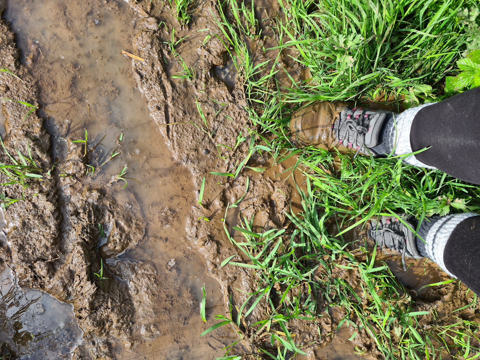
All was well in the end, apart from muddy, wet walking shoes which didn’t bother me too much. Gosh, that was the muddiest part of the River Ayr Way I’d came across so far. It made the water-like boggy bits from Glenbuck to Muirkirk look like beautiful puddles!
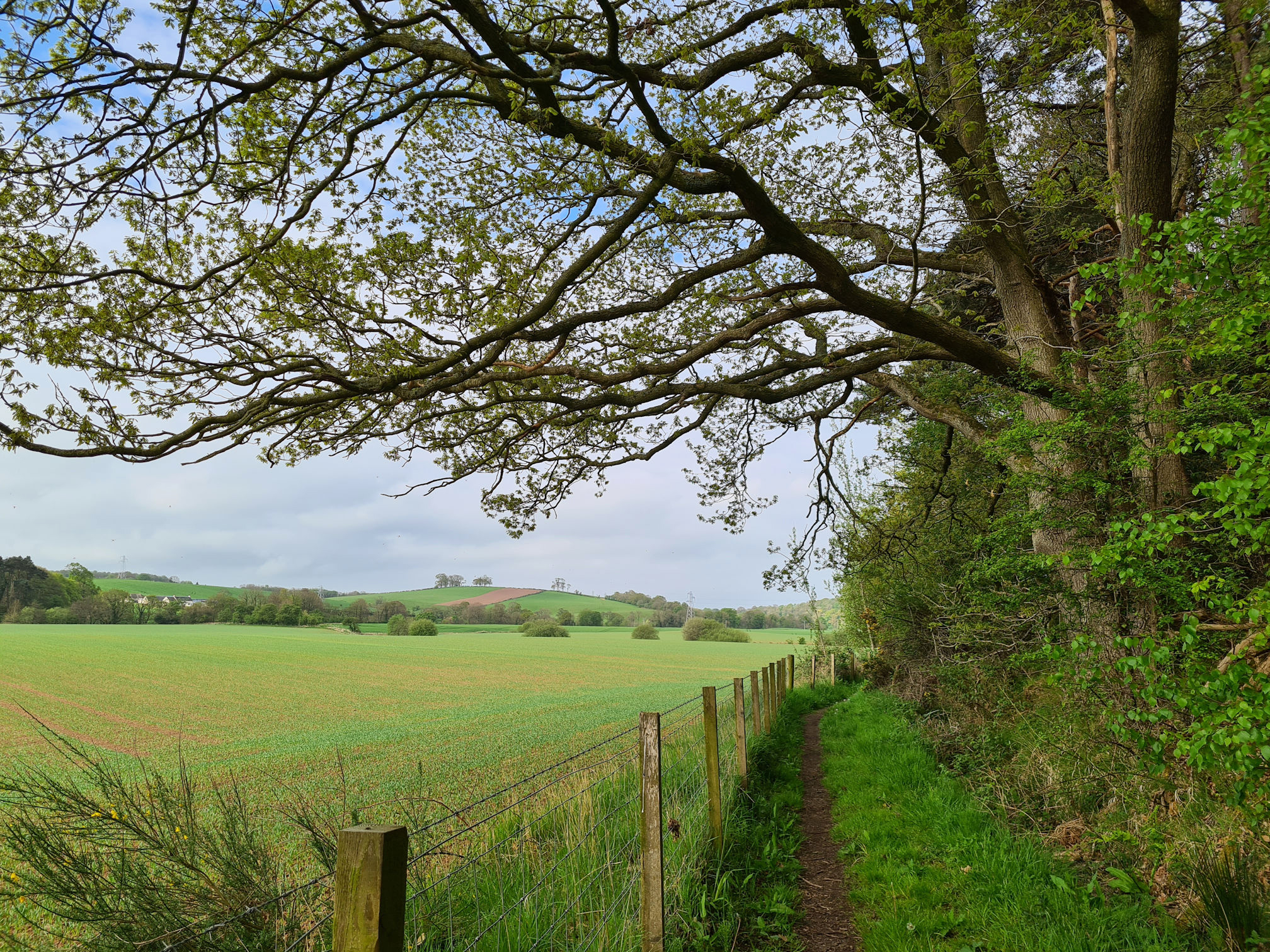
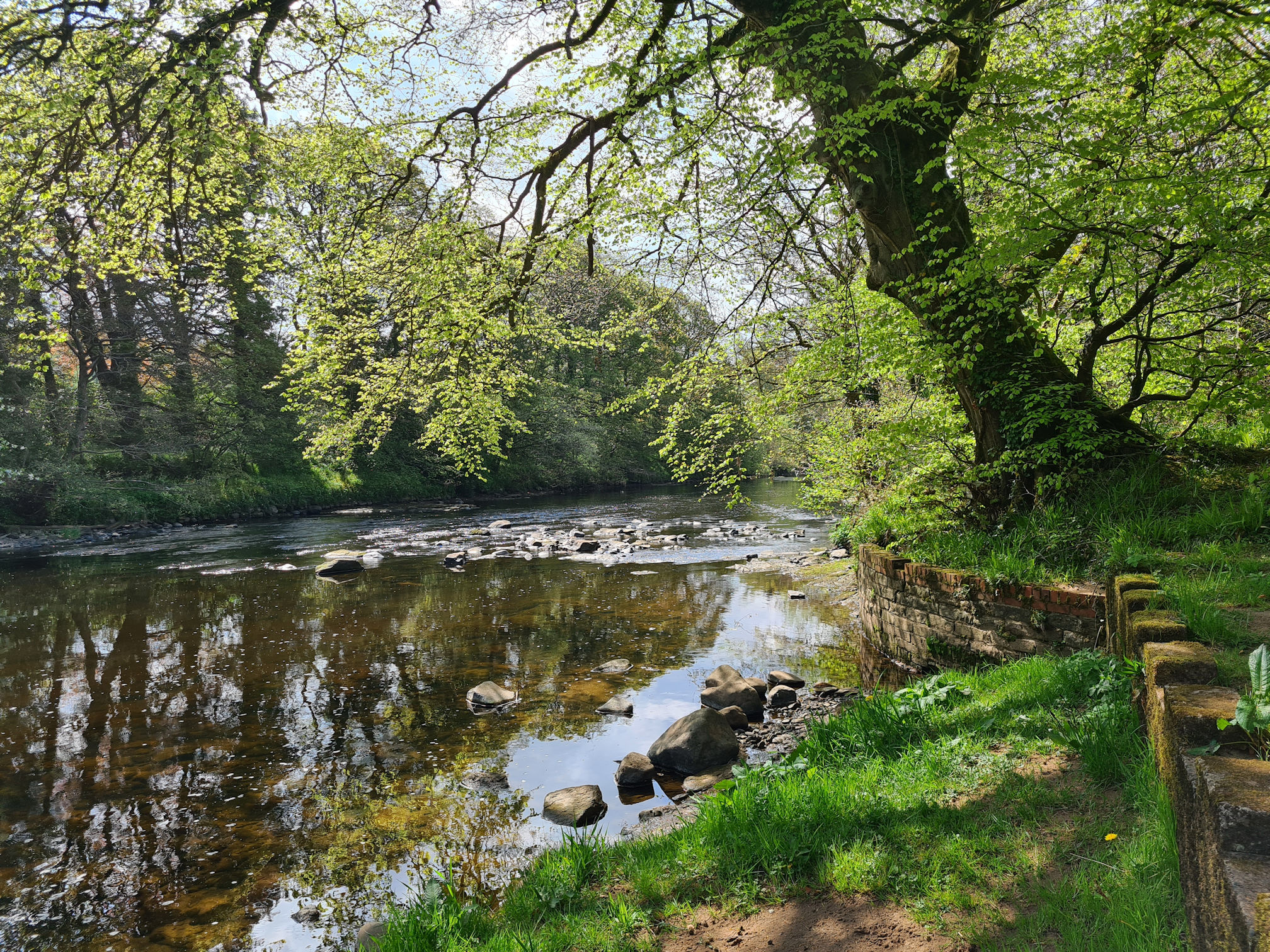
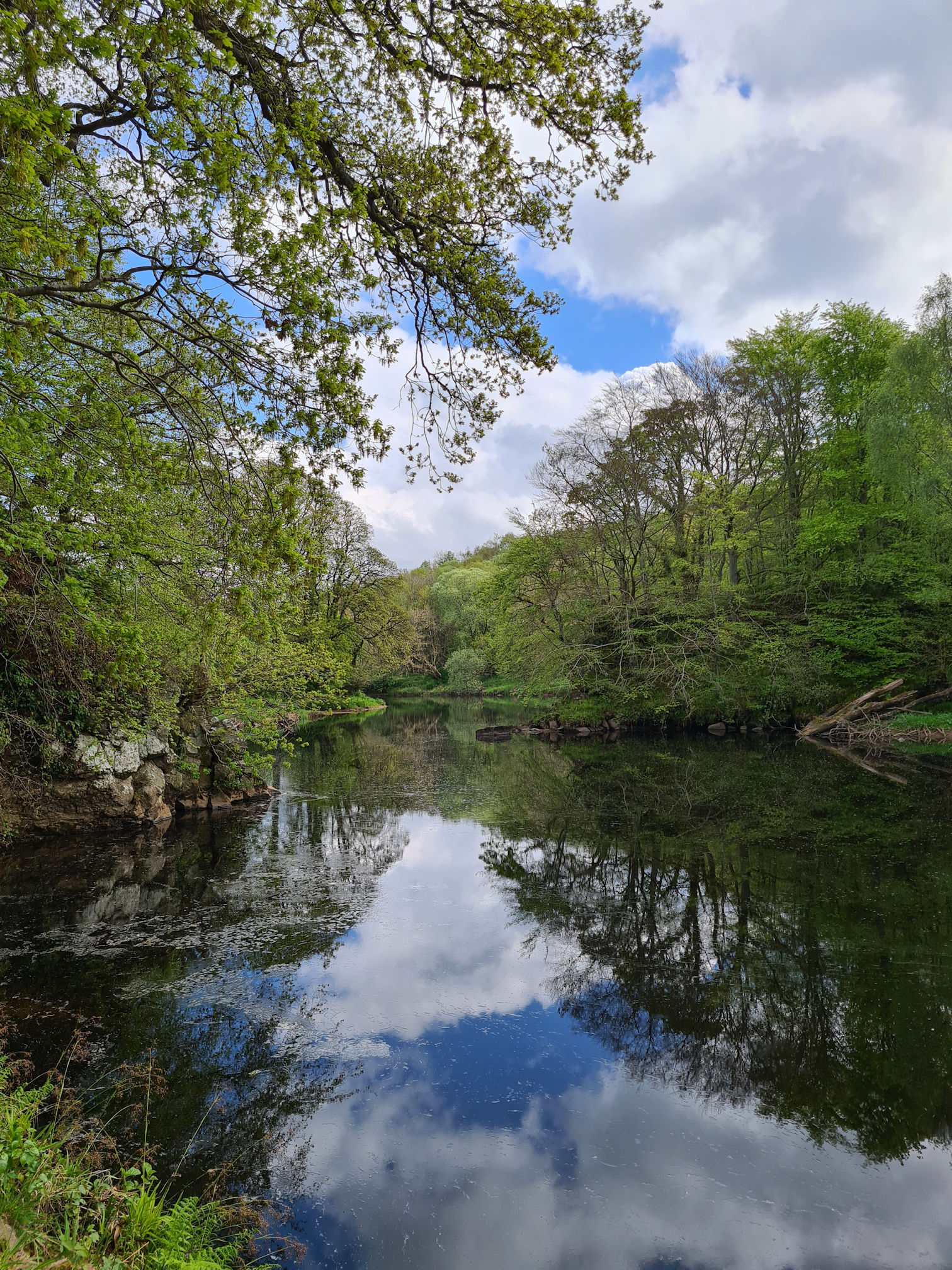
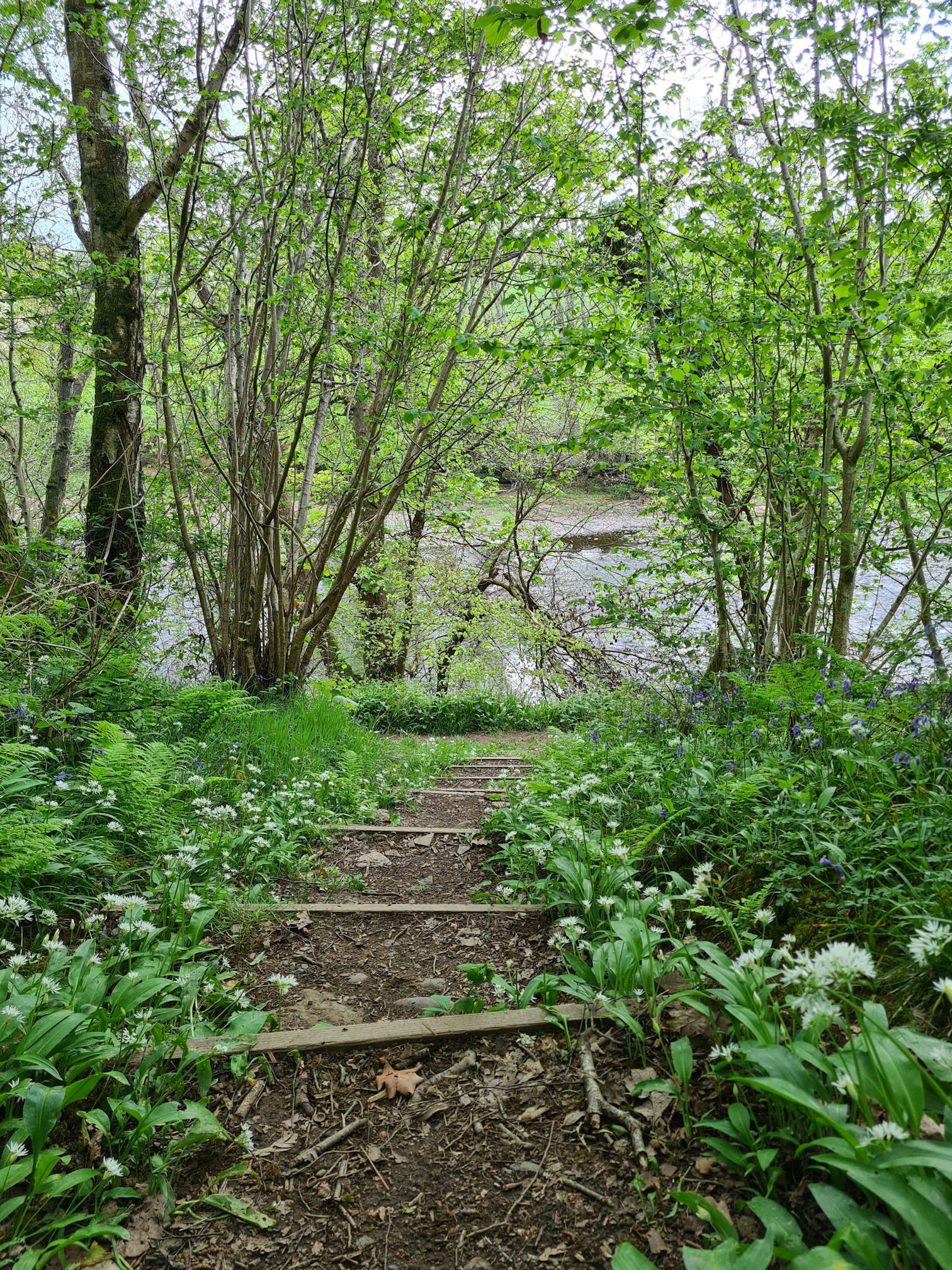
I was soon looking down the bonnie banks of the River Ayr and dipped my shoes in the water to try and clean the mud. It would dry and fall off eventually as this was going to be a long walk.
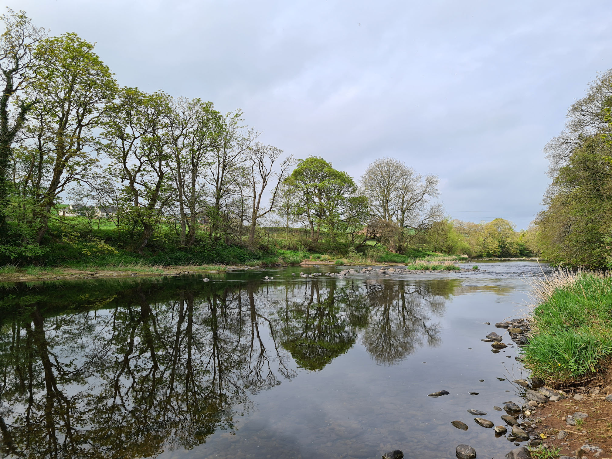
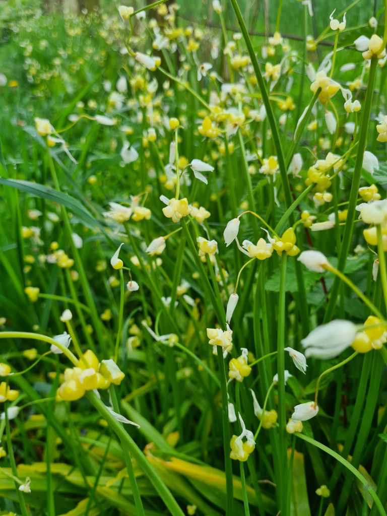
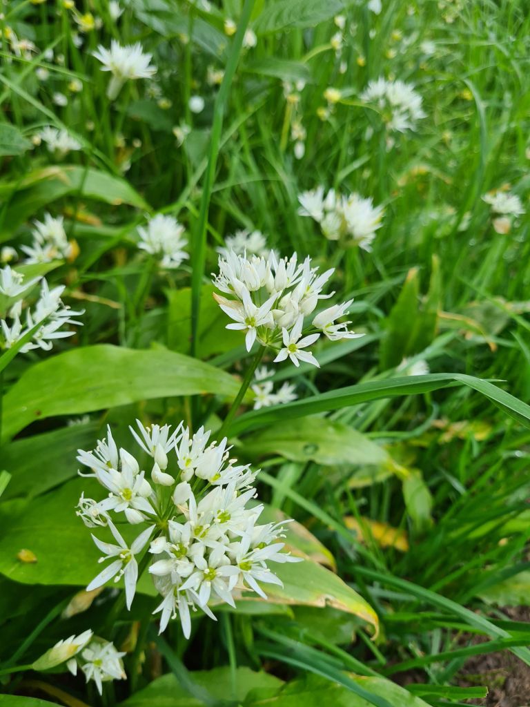
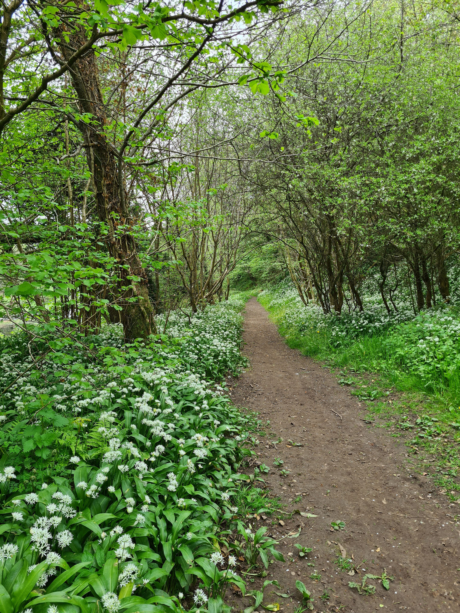
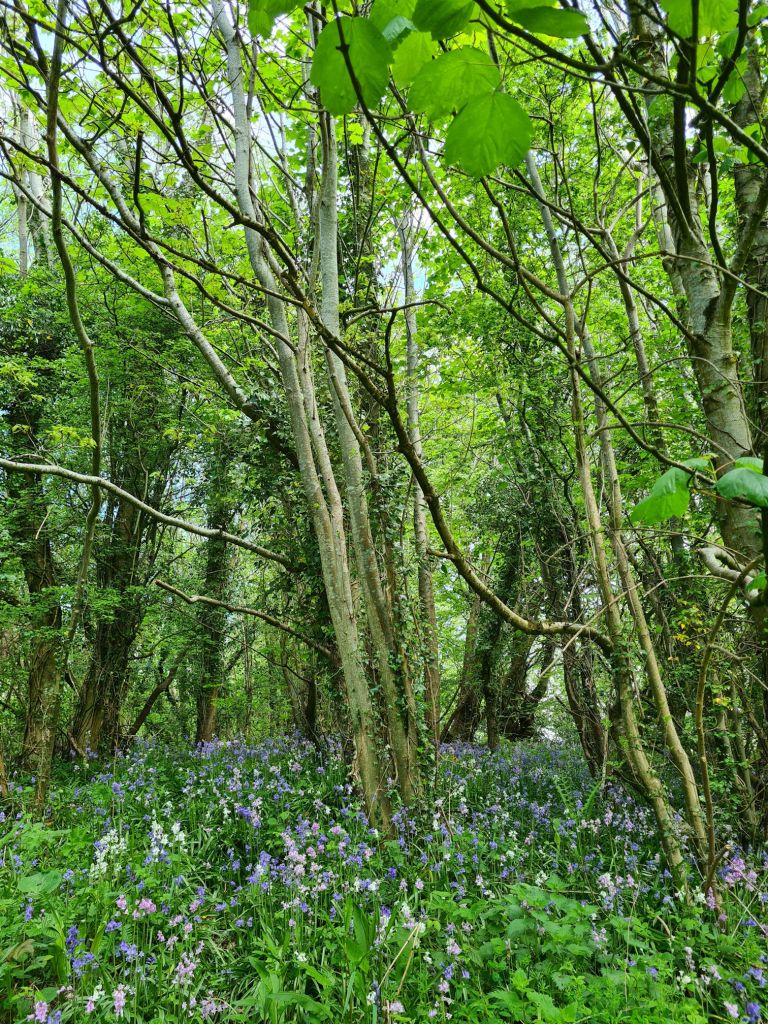
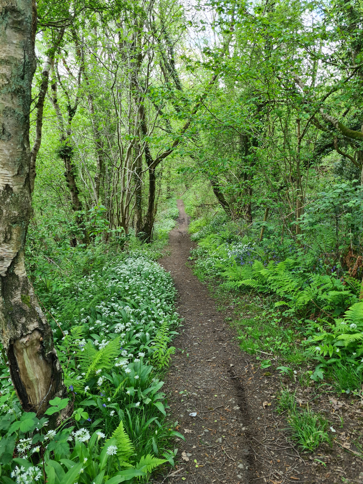
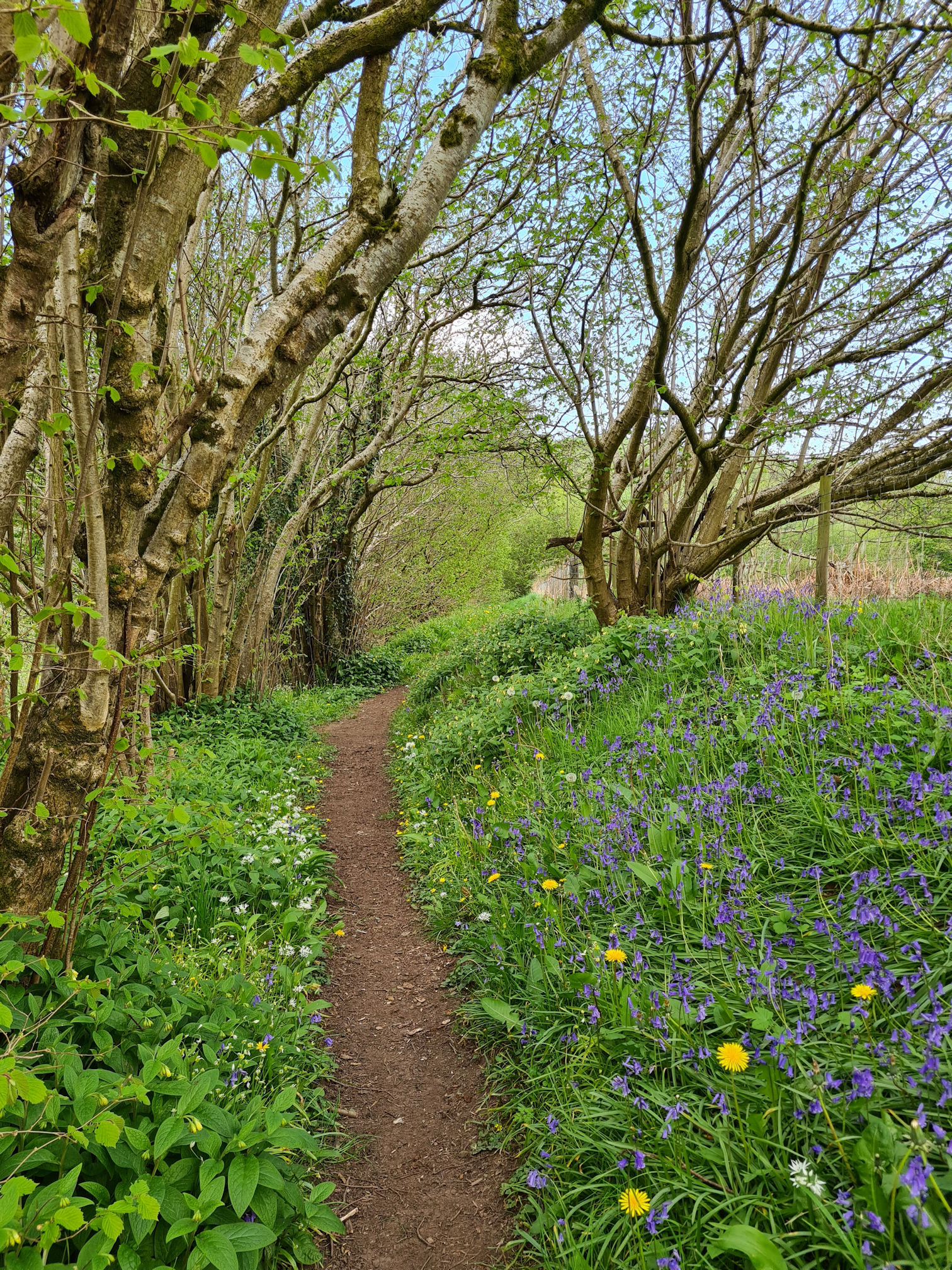
I welcomed the dry footpath beside the river lined with thriving wild garlic, bluebells and other pretty colours of flora. I was now in my element!

I often wonder why bluebells are called ‘bluebells’. They look more purple to me and on occasion I see pretty pink and white bells too.
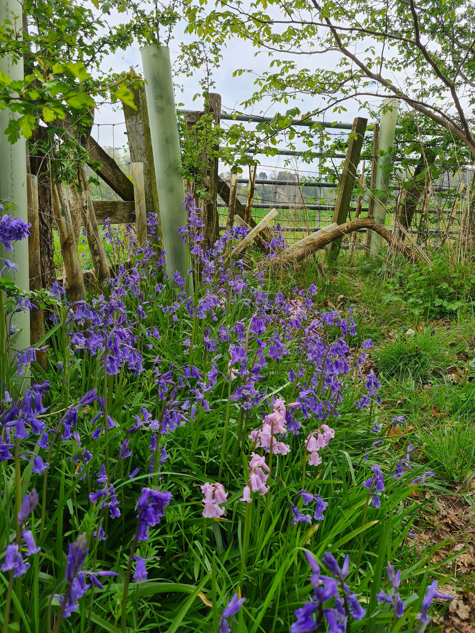
Native bluebells are protected in the United Kingdom under the Wildlife and Countryside Act (1981), which means it’s against the law to pick, destroy or dig them up.
I love walking through the woodlands with carpets of bluebells every year, and appreciate they are protected for us to enjoy every spring. If I visit at the right time, which can change every year, an abundance of bluebells feeds my soul after a dark winter of hibernation. The same with the first sighting of snowdrops, they’re pretty amazing if you’re lucky to find a carpet of tiny white warriors who also survived the winter months.
After looking down at all the flowers along the path for a while, a large white building perched high in the trees across a field caught my eye. I was thinking to myself, wow, what a beautiful place to live!
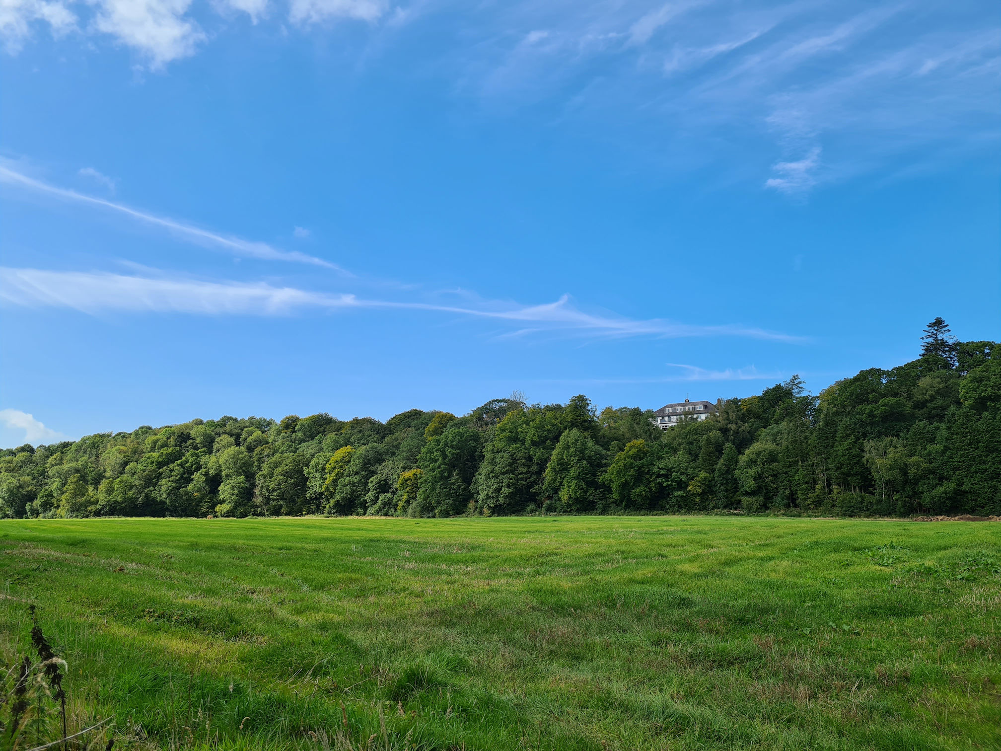
I found out later that this beautiful building is Enterkine Country House Resort, a 350-acre estate set in our beautiful Ayrshire countryside. The photo above was taken on a sunnier day when I shared this walk with my friend. We heard music and people talking, which we thought was a wedding taking place. It looks like an absolutely stunning location on their website!
Whenever I saw a side path that led to the river I tried to get closer for a view and photo. I spy with my little eye, something beginning with ‘B’!
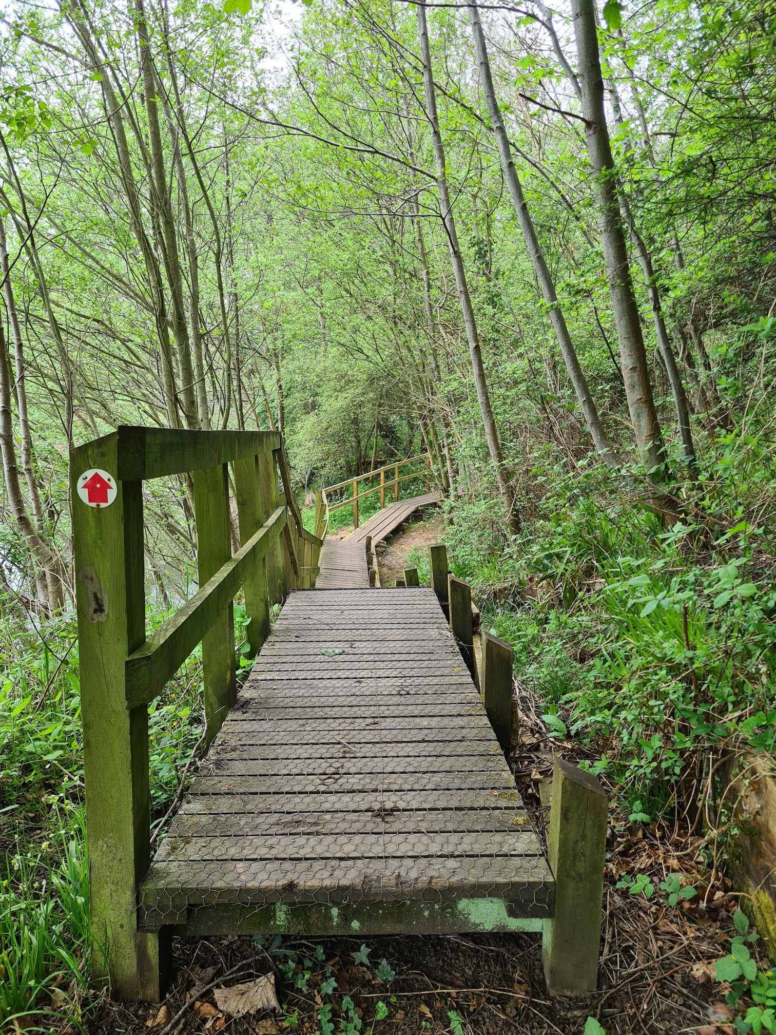
I continued along the path enjoying every step and reached a blissful boardwalk.
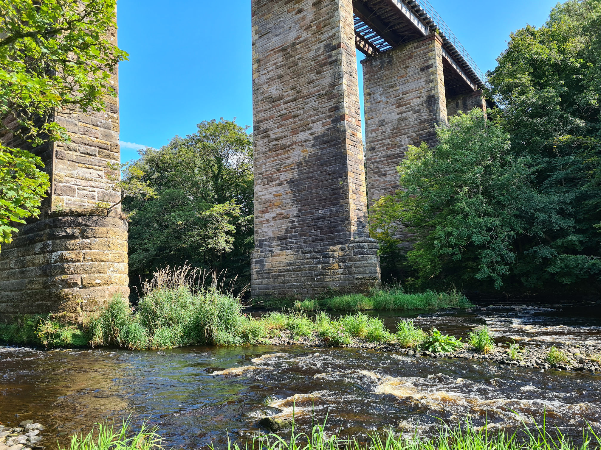
Ooh, there’s what I spied from the river earlier. Another very tall impressive bridge! This is the Enterkine Railway Viaduct, built in 1872.
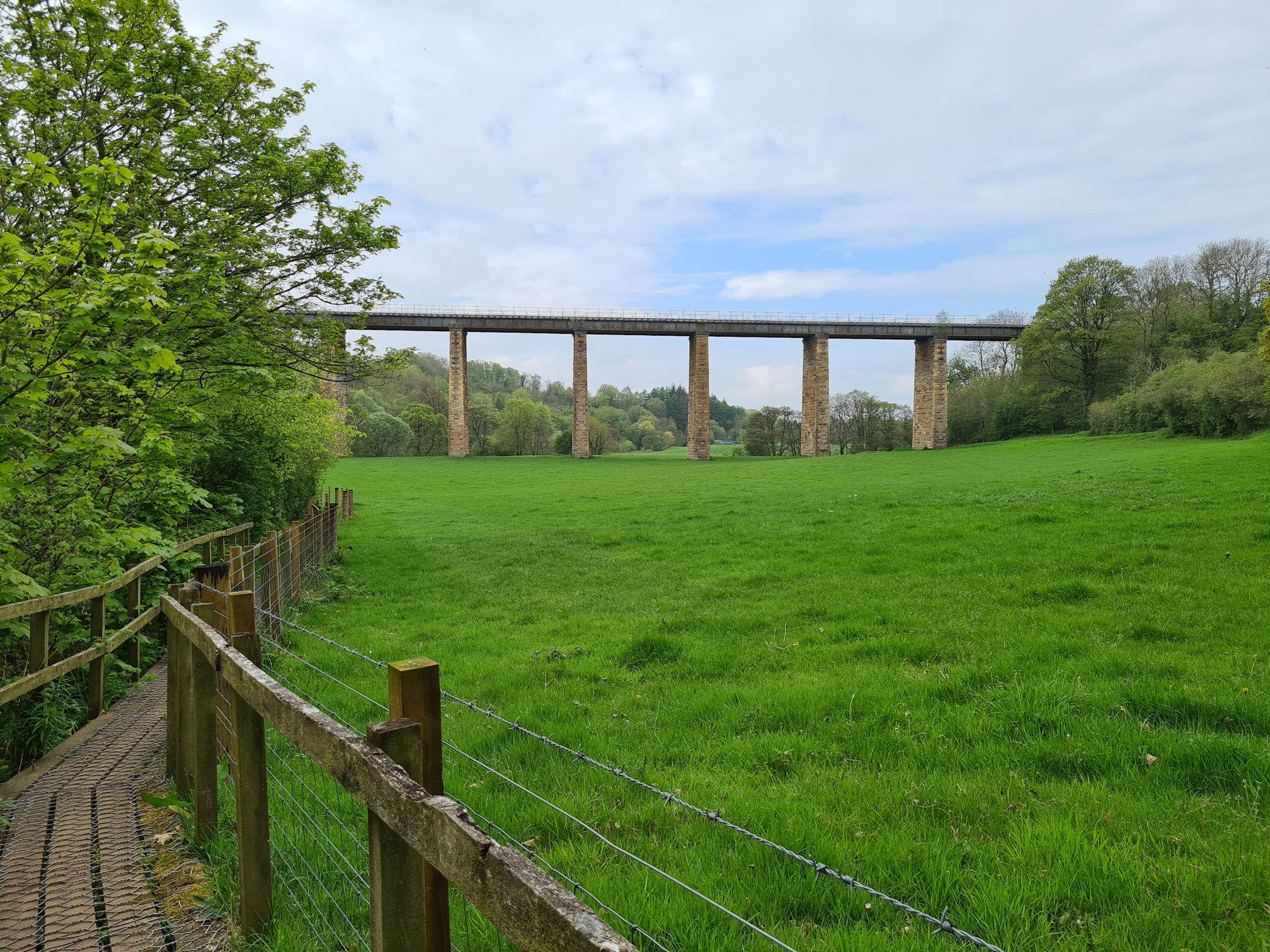
The viaduct is part of the old Ayr to Cumnock line and was built to transport coal, stone and other goods to the main rail network. I don’t know if the line is still used, but I read the viaduct was totally refurbished by Millar Callaghan Engineering Services Ltd in 2008.

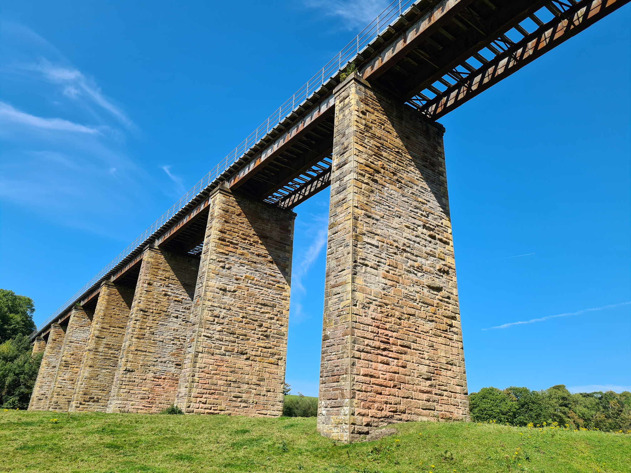
I found a way down to the river as I wanted to see the viaduct span across the water, watch the water flow underneath, and look up at its impressive structure. I liked being here listening to the water, but I wouldn’t be waiting for a train this time, as one may never pass!
I’ve lost count the number of unique bridges I’ve saw on this walk. It makes perfect sense though as I am following the flow of the River Ayr all the way on its journey from source to sea, and to cross a river bridge it needs to be built.
When I visited here with my friend in early autumn, she showed me her stone skimming across the water, and very well I must say! I recorded this for my video at the end, thanks for letting me share Anne-Marie!
I’m ashamed to say my stone skimming was a little bit pathetic 😂. Thinking about it, as a child I was hardly ever near a river. There was a small narrow burn in the countryside close to where I lived though, and we called it the ‘Red Burn’. I’m not sure why as it wasn’t red, but sometimes there was a tree swing across the burn which was fun.
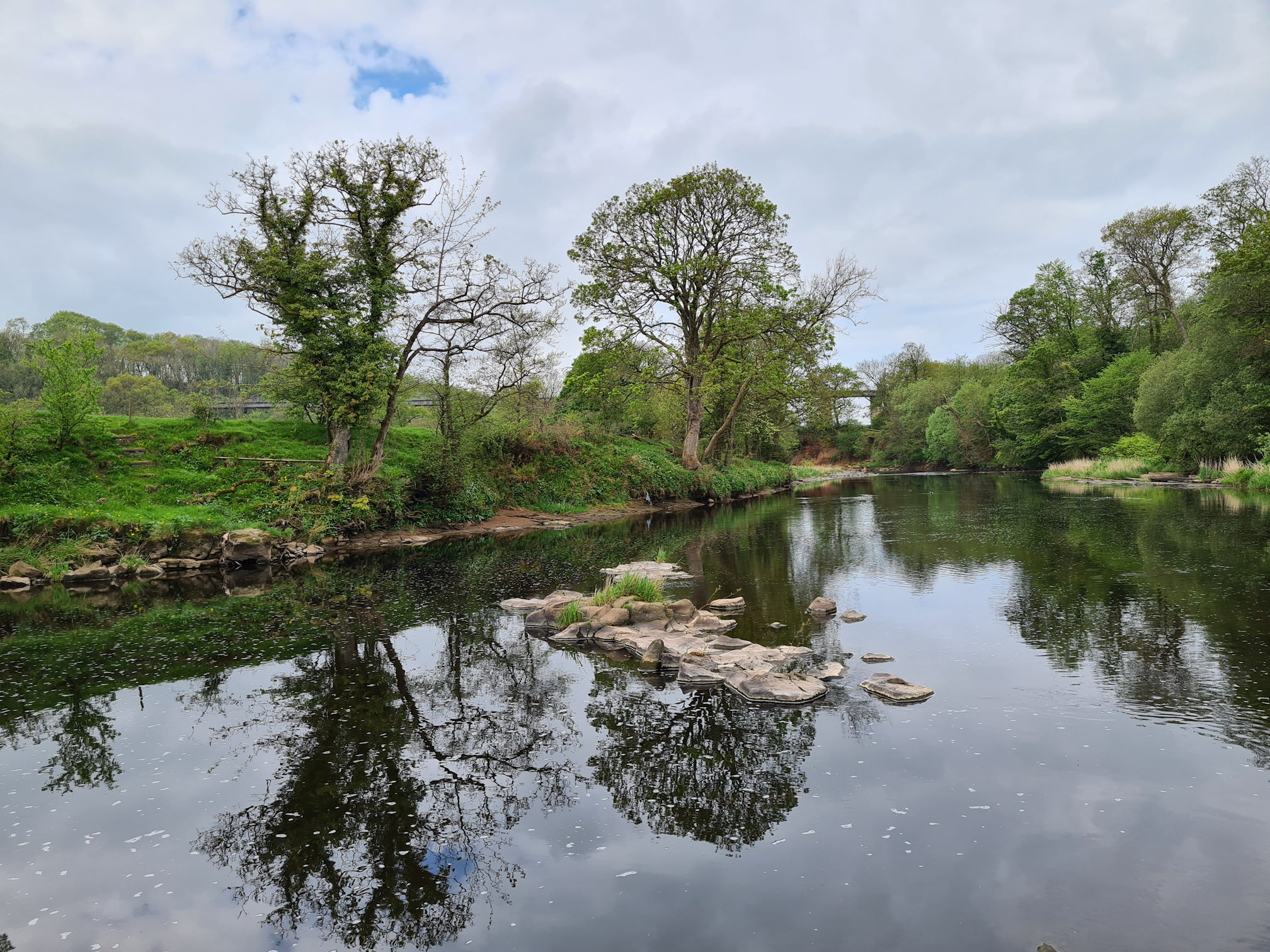
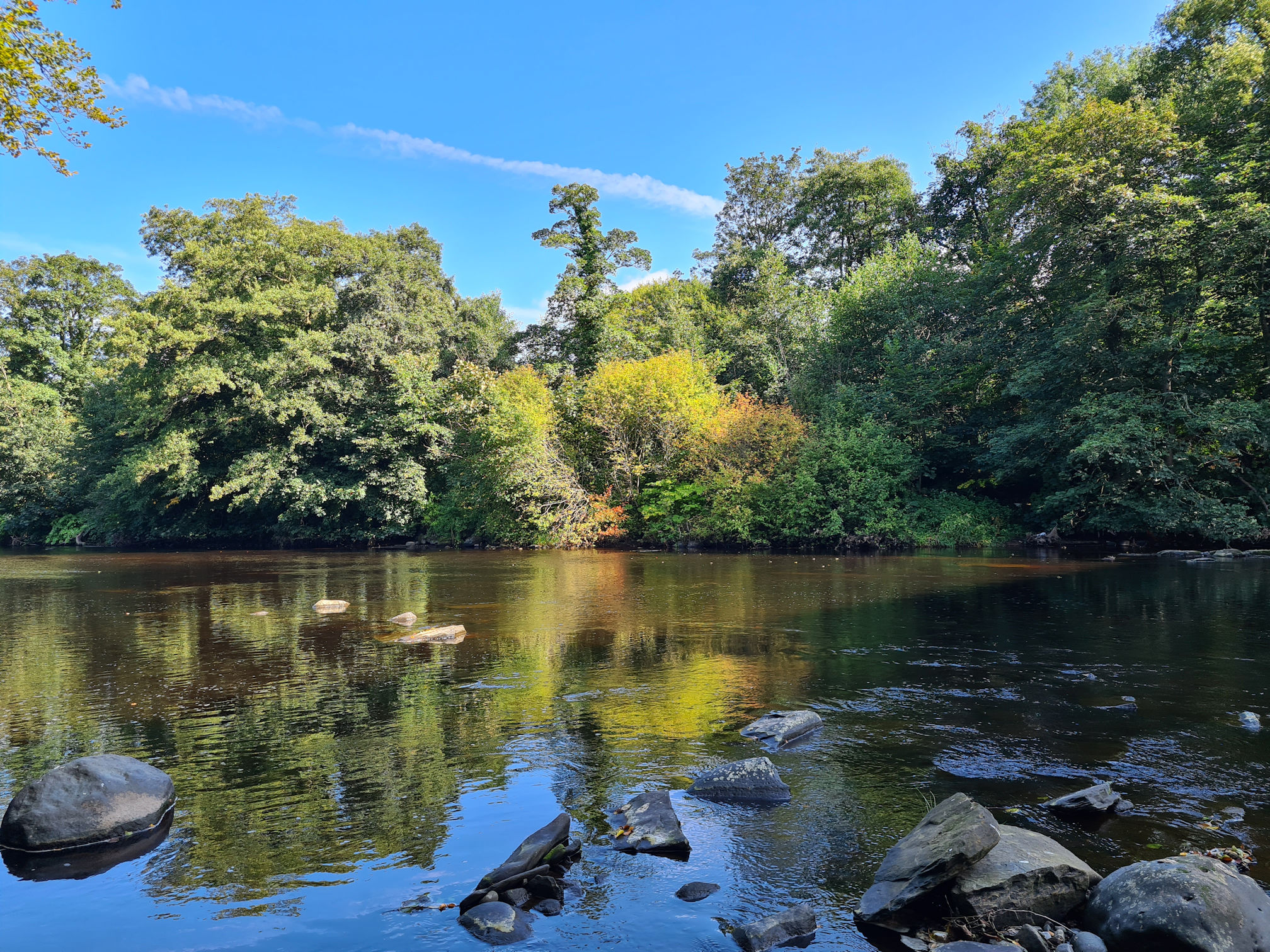
I have noticed along the River Ayr there’s sandy areas that look like little beaches. I loved these old trees on the sandy river bank with its mossy roots exposed.

I’m not sure if the sand has naturally gathered over time from the sandstone cliffs and rocks along the river bank, but it’s a nice area to sit and watch the river flow for a wee while. I was hoping I’d see a heron.
I soon approached another bridge, Gadgirth Road Bridge, which I crossed to continue the walk into another woodland towards Annbank.
Annbank
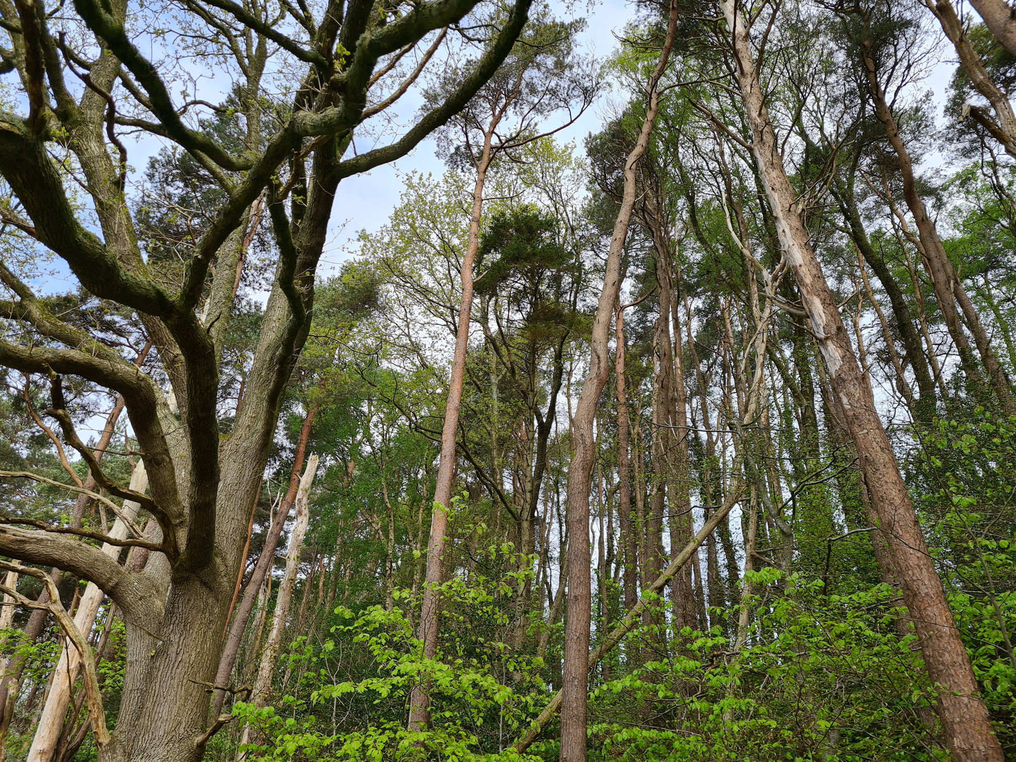
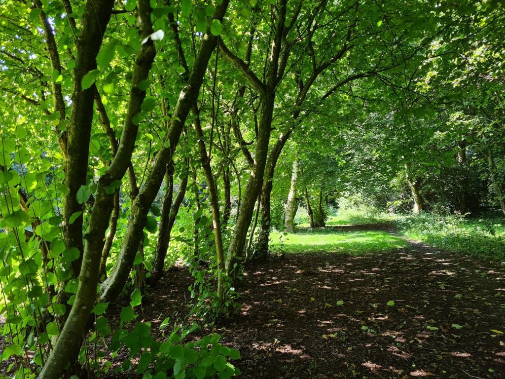
As I entered yet another beautiful woodland I was getting closer to the village of Annbank. I was thinking about how I was visiting the local woodlands of villages across Ayrshire. The people who live in the villages will walk through their woodlands regularly and know them very well, while for me it was a whole new adventure.
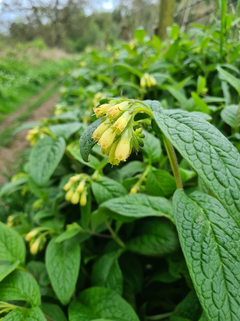
I didn’t know at the time what all the green plants were lining the woodland path, but on checking my app I think they are Pyrenees Butterbur.
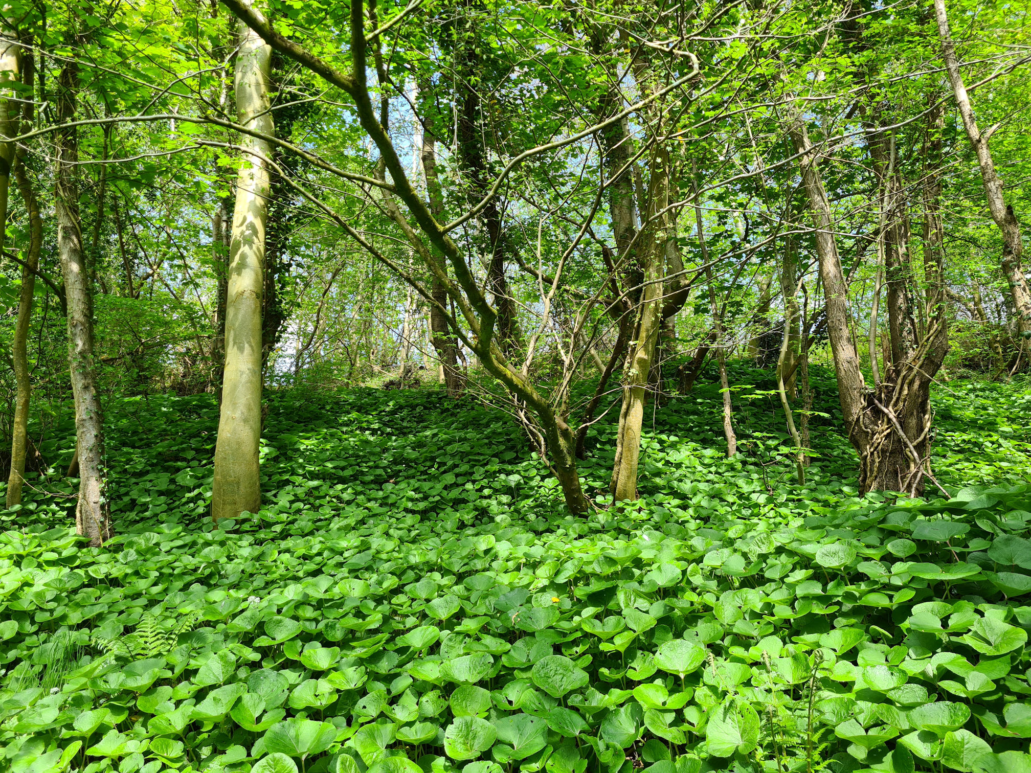
I saw a path going off to the right, but I walked straight on as per the Walkhighlands directions until I reached a picnic area.
According to Walkhighlands, this area or nearby, was the site of Annbank House, former dower house of the Cunninghames of Enterkine and demolished in the 1970s.
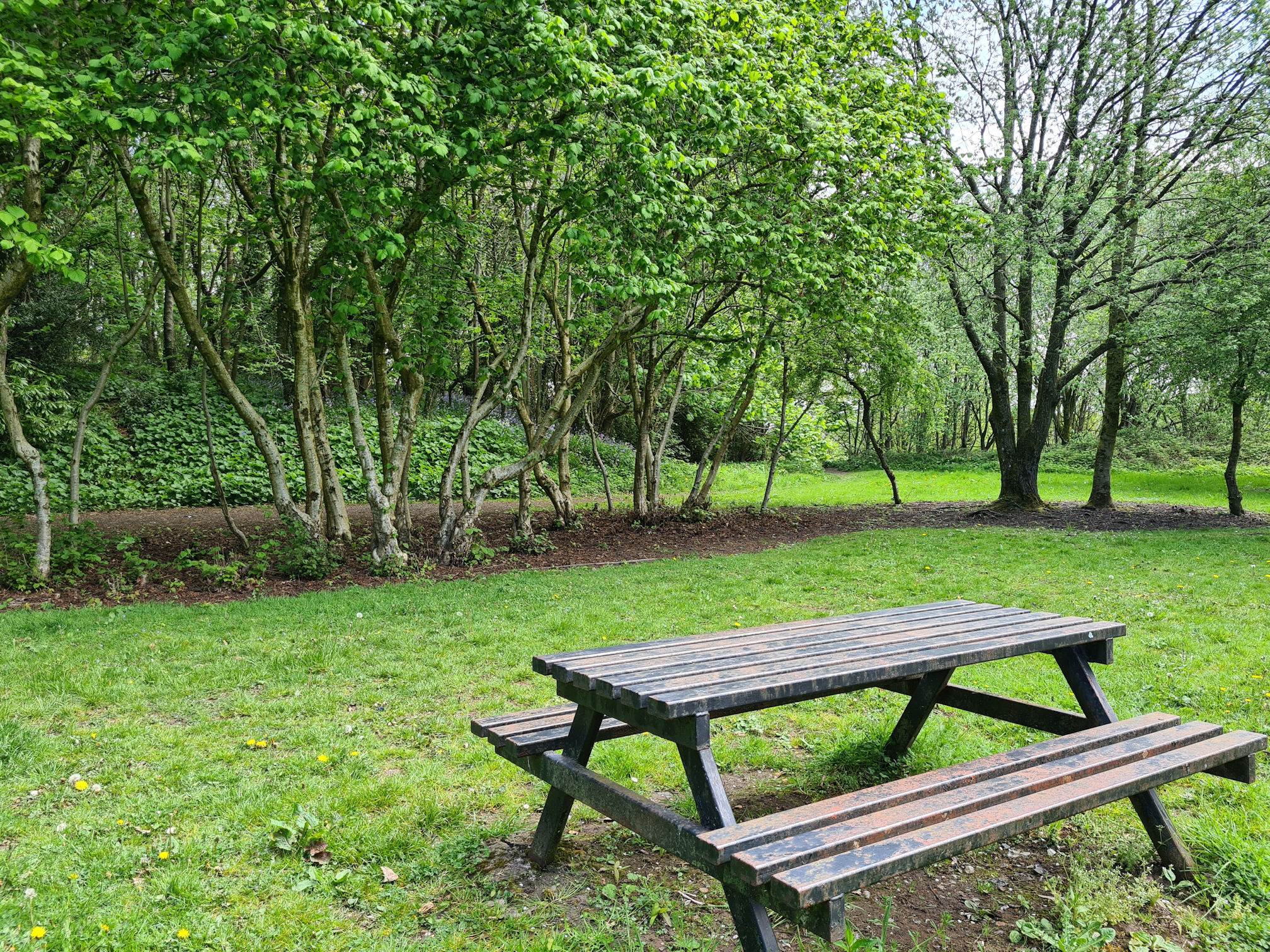
I sat at the picnic table for five minutes, took a sip of water and decided I shouldn’t stay too long. When I sit after walking my legs quickly stiffen up and become sore, so it was better to keep moving.
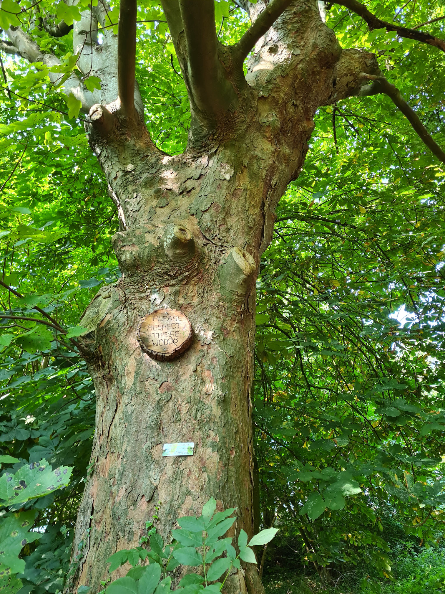
I saw houses through the trees, so I knew I was close to civilisation again. As I walked out of the woodland I passed this heartwarming message from the tree saying ‘Please respect these woods’.
When I walked into the village of Annbank I checked my printed directions. I almost thought I was going the wrong way but finally reached a River Ayr Way arrow near a bus stop beside the main road through the village.
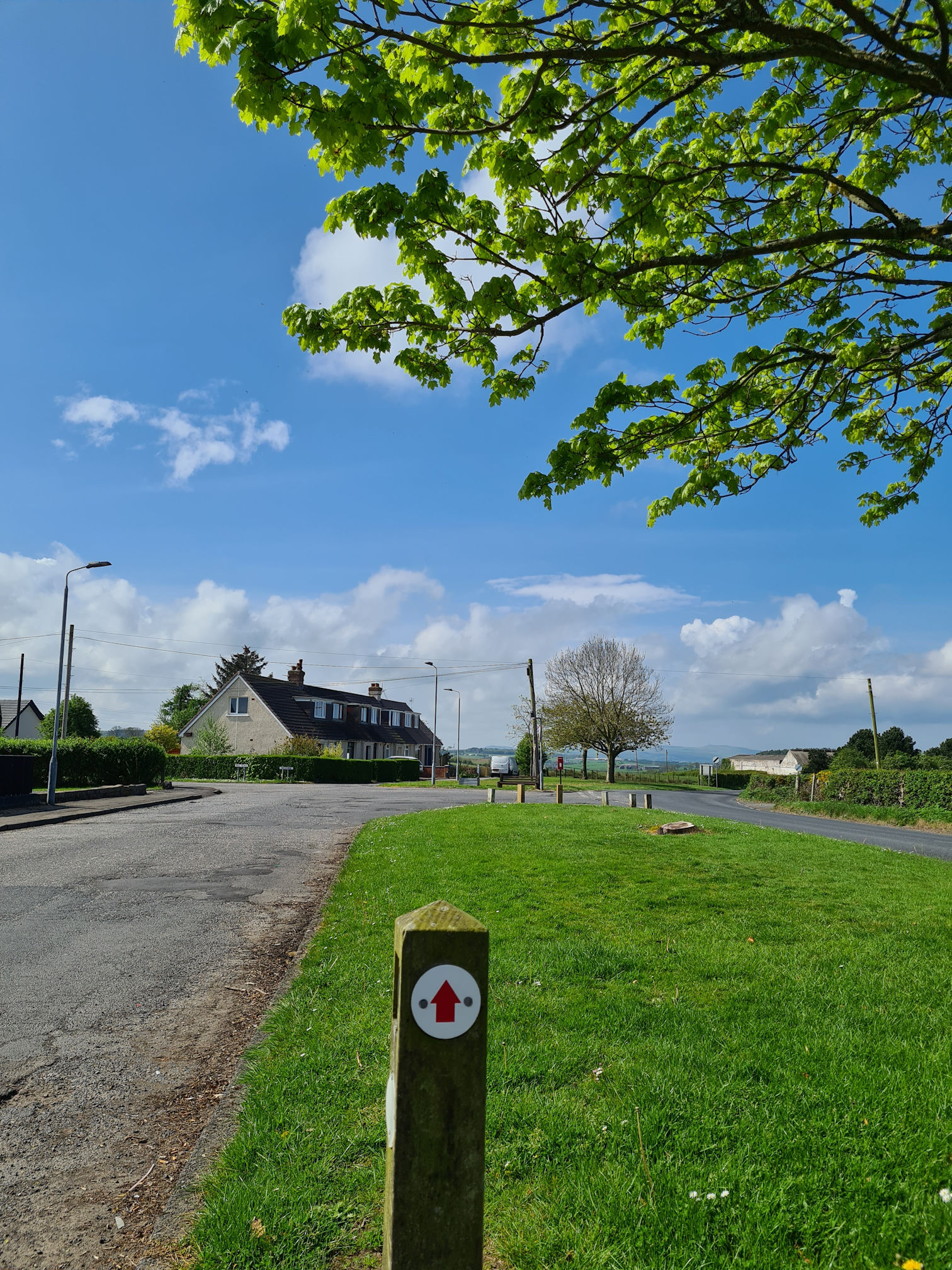
Then another red arrow appeared, and the street Mill Road which assured me I was also going in the right direction.
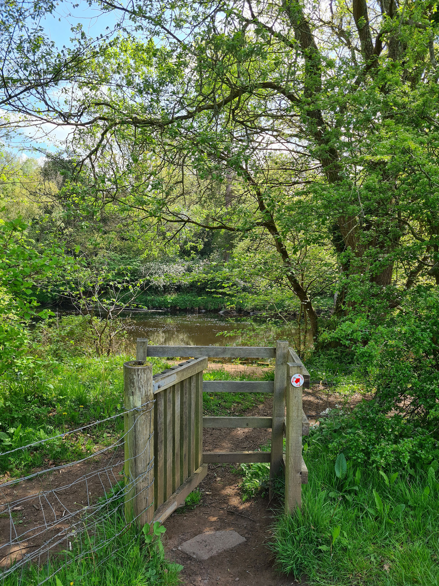
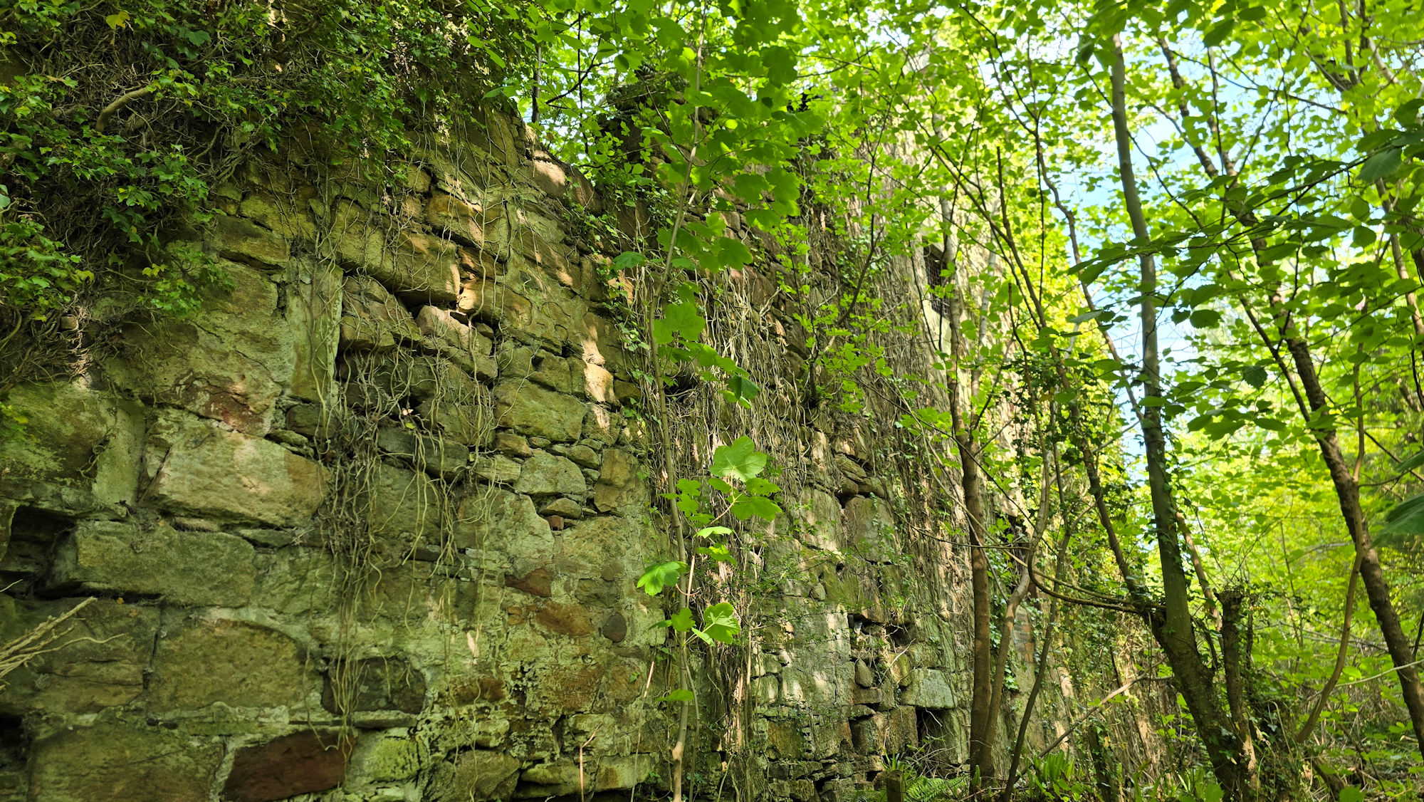
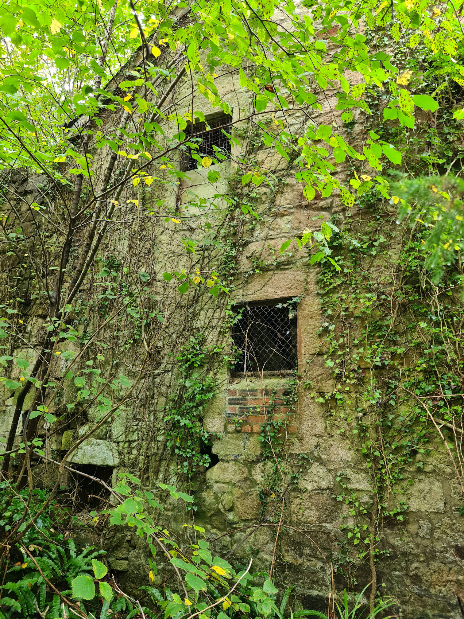
I reached the river again, and as I walked through the gate I saw a trodden path to the left. This wasn’t the way to go, but I took a wee wander to see what was there. I’m easily distracted.
I’m glad I was curious as I found an old ruined building which according to old maps was Privick Mill, more evidence of Ayrshire’s industrial past. I was only seeing one side of the ruin, which was now taken over by foliage and looking very atmospheric in the sunlight.
I retraced my steps back on to the main path but before I walked on I stepped across to the river bank to soak in the view.
When I looked up the river I saw what looked like little wooden huts in the distance and I wondered what they were used for. I think this is Gadgirth Estate Luxury Lodges, which I never knew about. What a beautiful setting and they look so luxurious on their website!

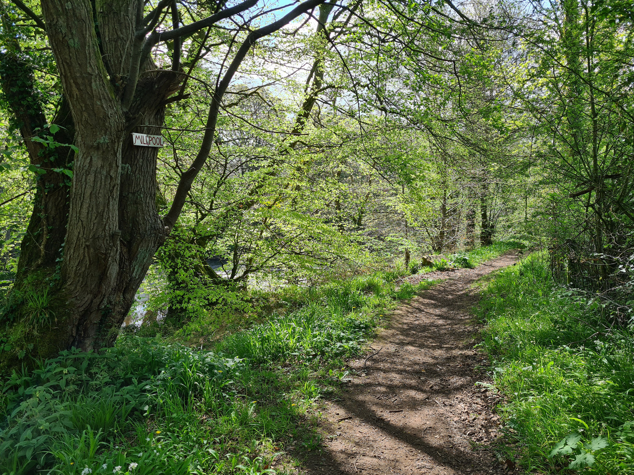
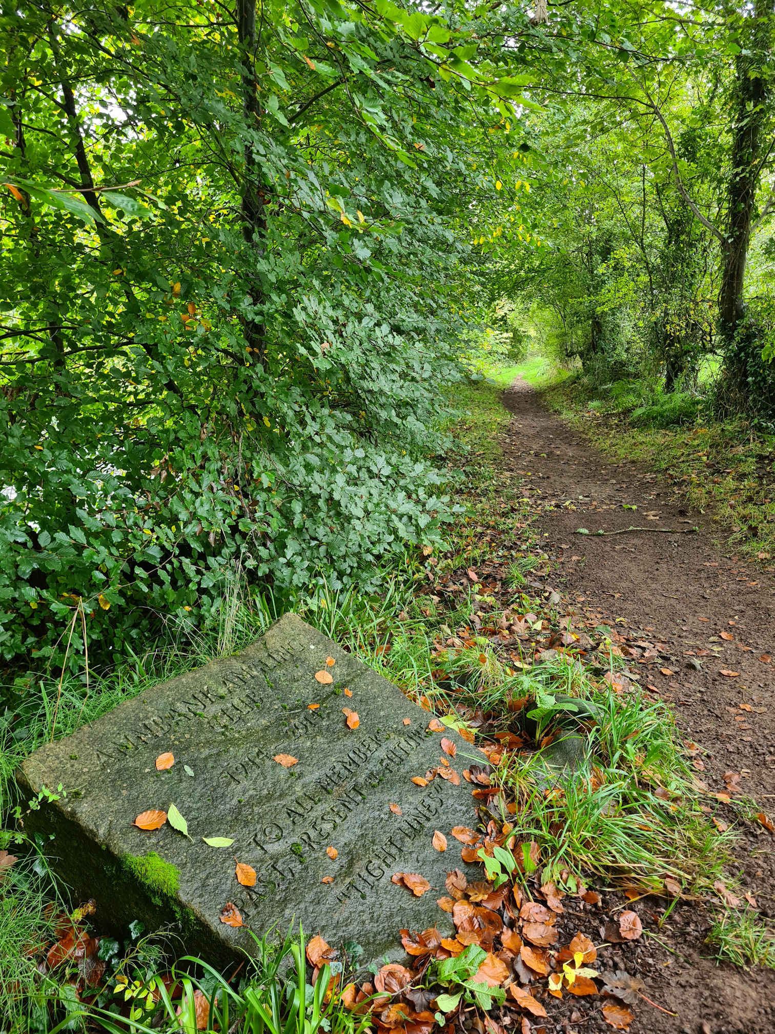
Back on the path I saw a sign attached to a tree that said ‘Millpool’. I wondered why, it must be there for a reason and linked to the old Mill.
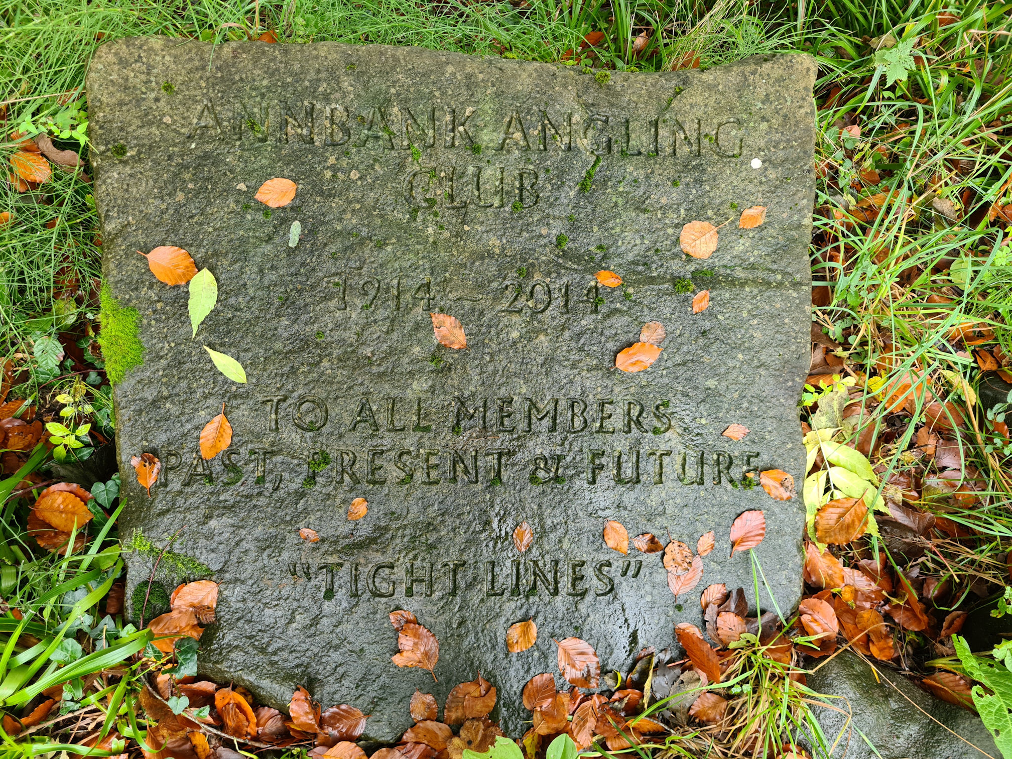
I then walked past a stone slab with an engraving for Annbank Angling Club from 1914 to 2014, 100 years of the club. It was dedicated to all members, past, present and future, and also says “Tight Lines”.
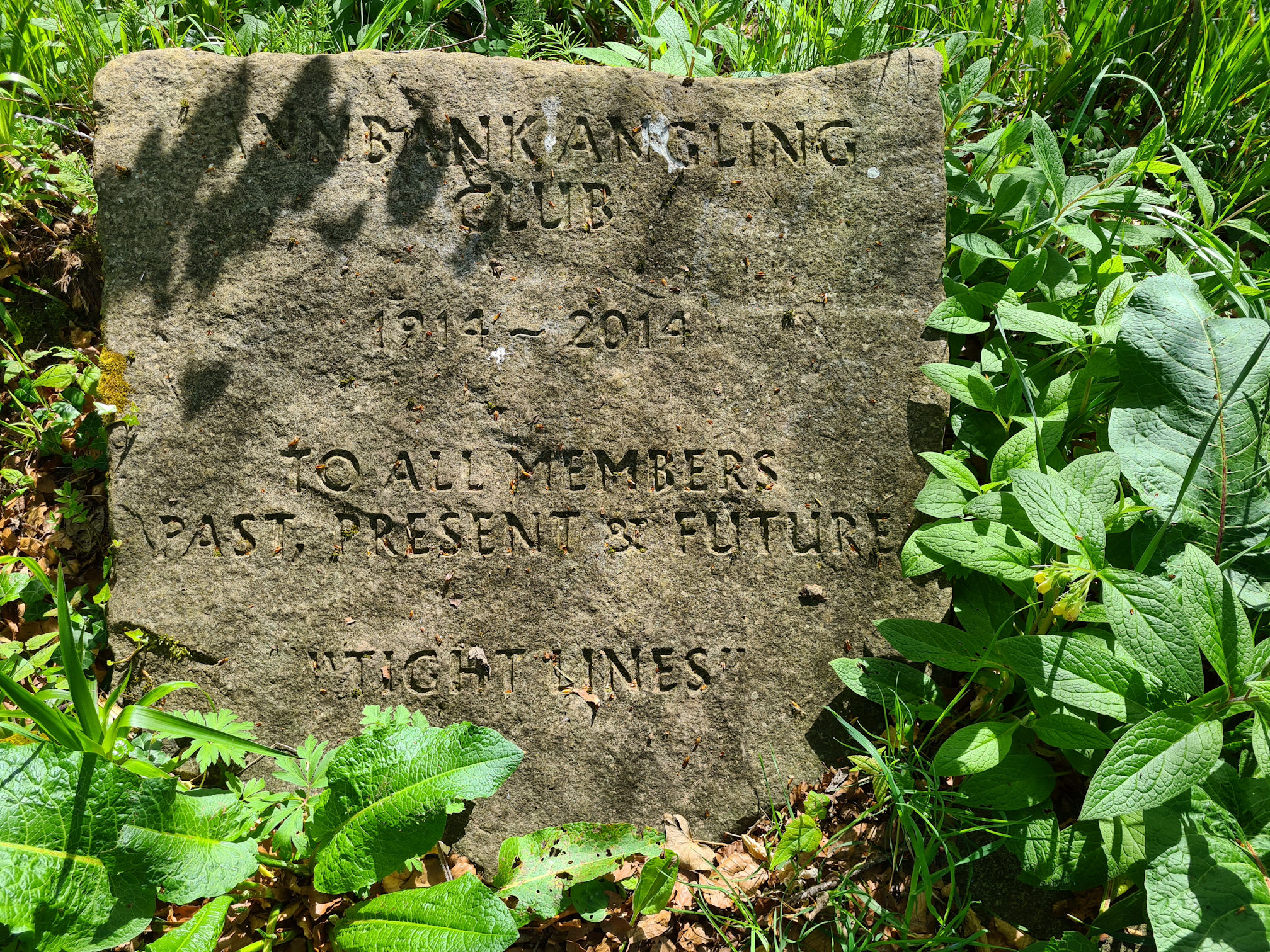
Ah, I now thought that the tree sign ‘Millpool’ was a named fishing area for the angling club.
When I returned here in early autumn, the writing stood out more on the wet stone slab with autumn leaves prettily framing it. I can imagine members of the angling club over the past 100 plus years enjoying the peace and tranquillity of the River Ayr while they waited patiently for a catch.
The River Ayr District Salmon Fishery Board website lists all the fishing clubs along the River Ayr and says:
“Fish species include salmon, sea trout, brown trout, grayling, eel, stickleback, minnow and stone loach.
River Ayr District Salmon Fishery Board
The River Ayr is the largest river in Ayrshire and currently classified as a ‘category 3’ river with 100% catch and release of salmon being mandatory as a conservation measure.”
Walking through the edge of an open field I was keeping my eye on the cows scattered across the far end. Thankfully I’ve never had any serious problems with cows, and anytime I didn’t feel safe I would find a quick exit or turn back. I know it’s best to be cautious with cows, especially if they have young calves.
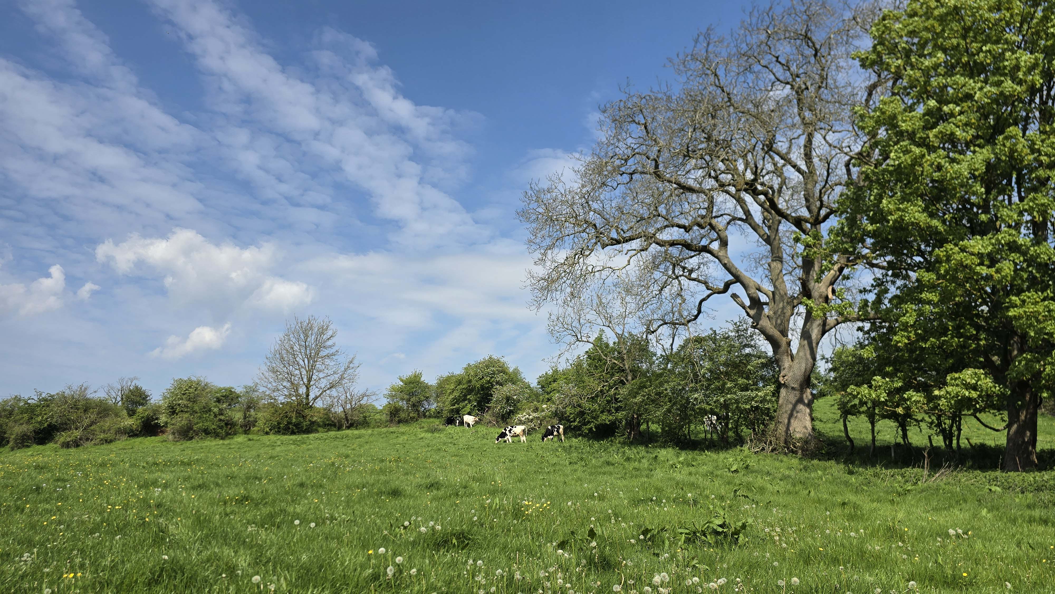
Another childhood memory has sprung to mind as talk about this! In my first story about the River Ayr Way I talked about when I was a child, and how I always wanted to go out exploring with my brothers who are five years older than me.
They were going to the ‘Red Burn’, the place I mentioned earlier, and of course I wanted to go too. Rather than walking the long way via the road, we took a shortcut across a field. I vaguely remember I was wearing a red top or maybe a jacket, and one of my brothers said something like:
“Dawn-Marie, you can’t come through the field, there’s a bull, it doesn’t like red and might charge you. You need to go back home or take it off.”
Still wanting to cross the field with them, I took off the red item of clothing and underneath I had a red vest on! I think I quickly followed them through the field hoping I would make it. I don’t remember the ‘Red Burn’ that day though, so maybe I had to turn back. I always remember the red clothing that could have been a bull chase though. 😂
The next place of curiosity was another tree sign called ‘Auldha’. Gosh, I felt like I was on mystery trail treasure hunt and was even more curious about these signs. Another named fishing area?
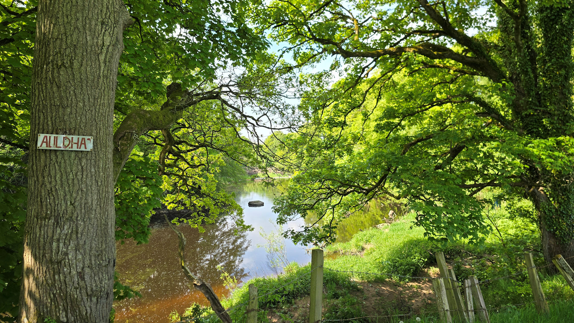
I was also wondering if castle ruins were here as the Walkhighlands website mentioned there once stood a castle in this area called ‘Old Ha’. The castle was built on a rocky outcrop that projected into the river, with only small sections of the wall remaining. The Canmore website lists the medieval castle remains as ‘Gadgirth, Old Ha’ or also known as ‘Old Hall’.
Walkhighlands also writes that beneath the rocky outcrop where the castle once stood, the river is forced between rocks creating a deep pool known as Auld Ha’ Weel. The pool is supposed to be the deepest part in the river at over 16 metres, and a popular area for fishing.
I was keen to stand at the edge of the river to look for evidence of the castle ruins, but a shoogly barbed wired fence stood between me and getting down there easily. If I remember right I saw a small gap under the fence that would have been a struggle to squeeze through without getting caught in the wire.
I quickly talked myself out of it and didn’t try to be adventurous today. I knew if I did I would be there forever taking photos and videos. I’d be finishing the walk in the dark of night if I kept straying off the path and fighting off barbed wire fences which seemed to be a popular theme today. 😂
I reached the end of the field and as I closed the gate behind me and looked back, my eyes gazed upon a pretty picture that I didn’t notice walking around the field.
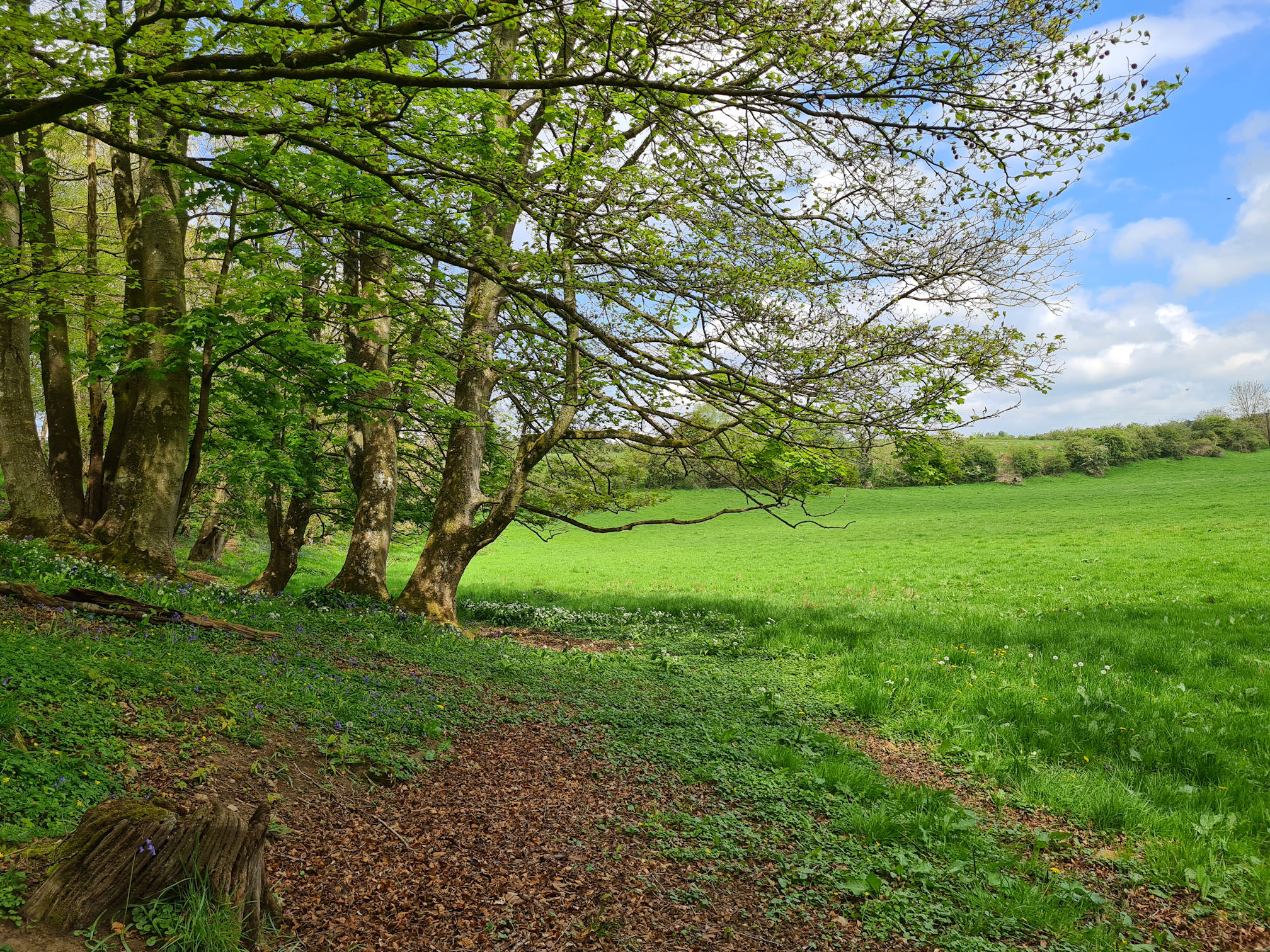
A cluster of trees beside the gate shaped the lush green field against a backdrop sky of blue and white. Always remember to look back as it can surprise you.
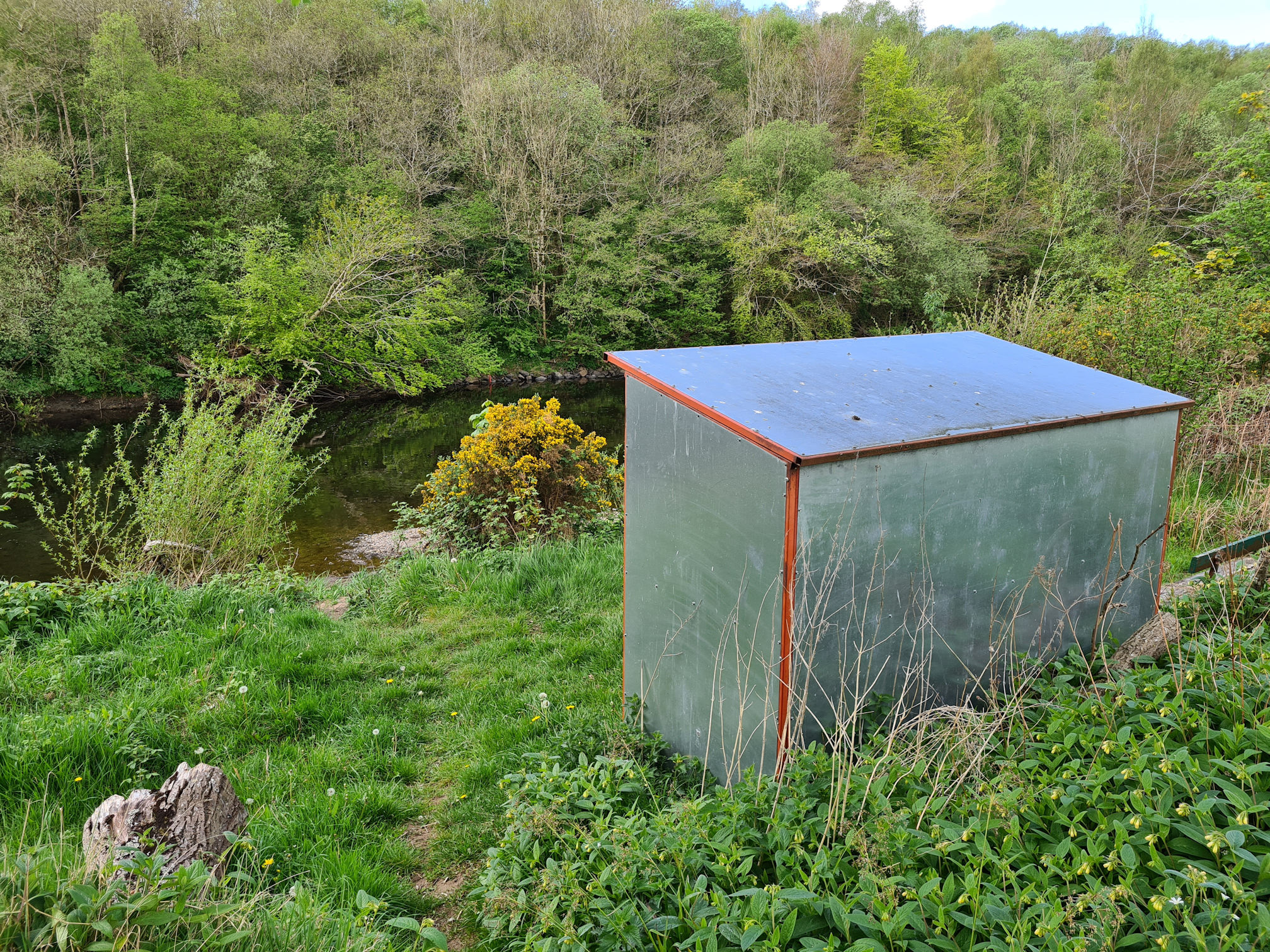
Oh look, steps going down to the river and a shelter, I must explore. Now this was easier than sliding underneath a barbed wire fence!
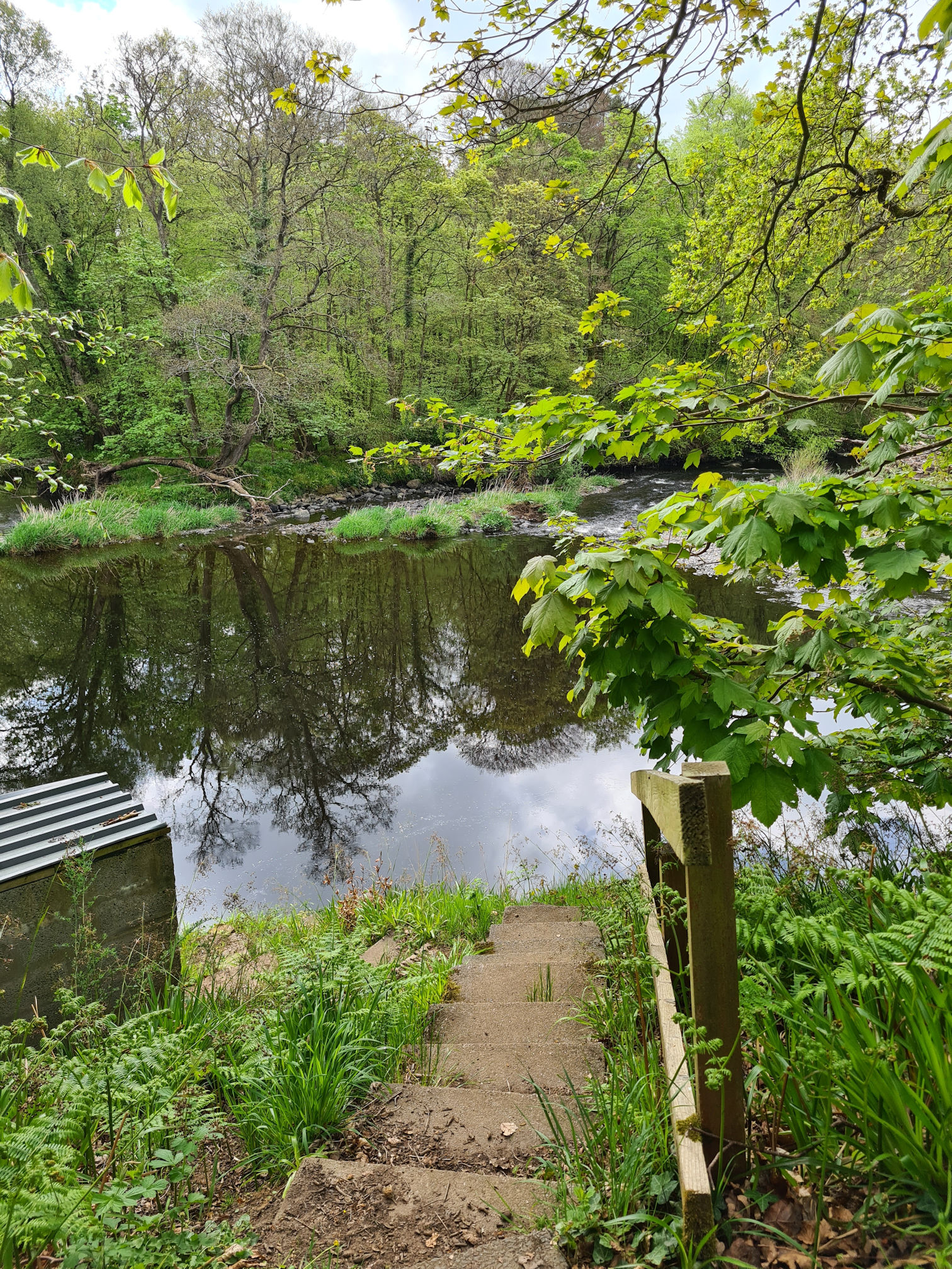
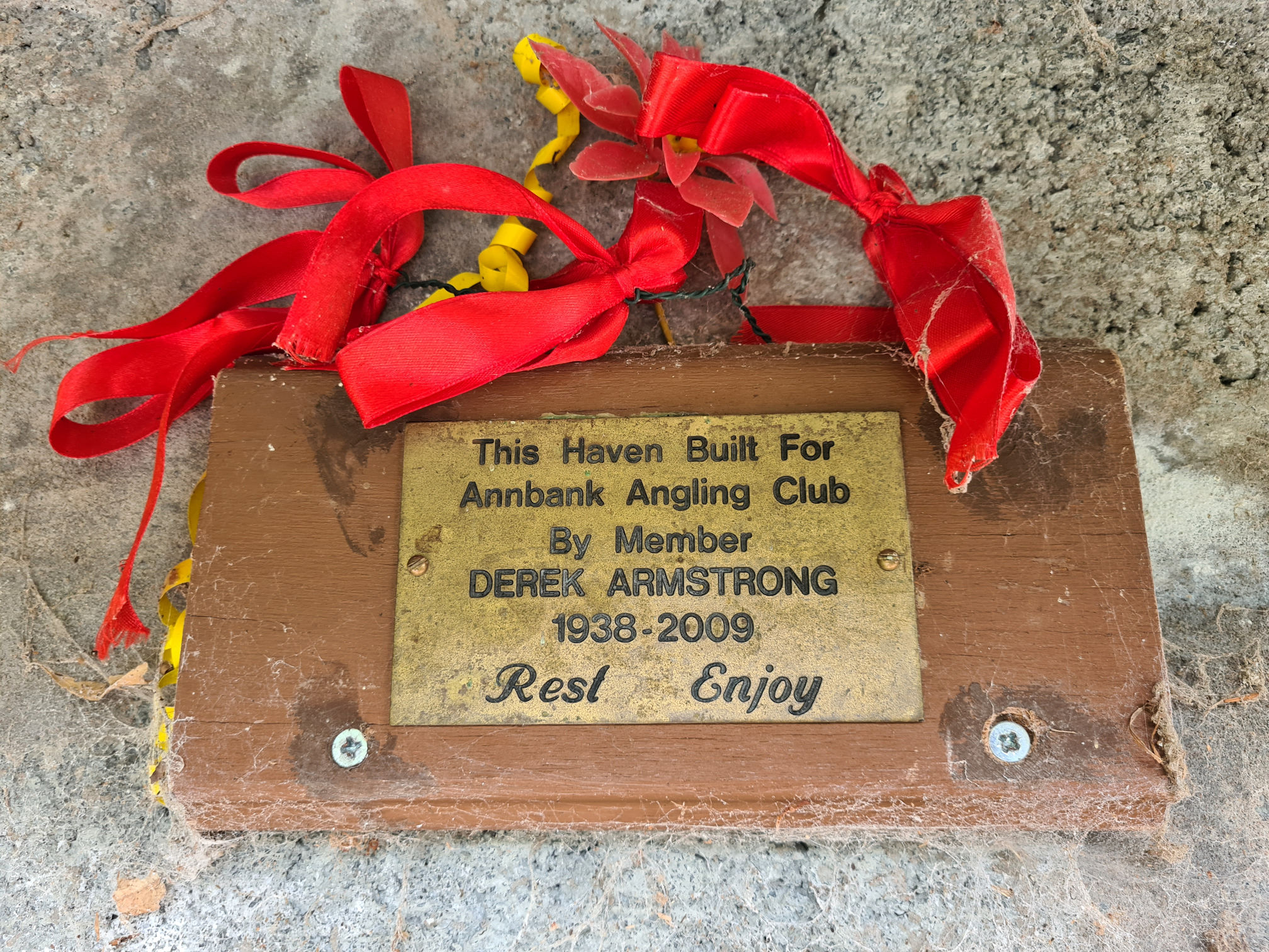
I carefully negotiated the steep steps and turned to look at the little brick fishing hut.

What a peaceful and beautiful location to relax for a while! What makes it even more special is that it was built for the Annbank Angling Club by member Derek Armstrong, 1938 to 2009, to rest and enjoy.
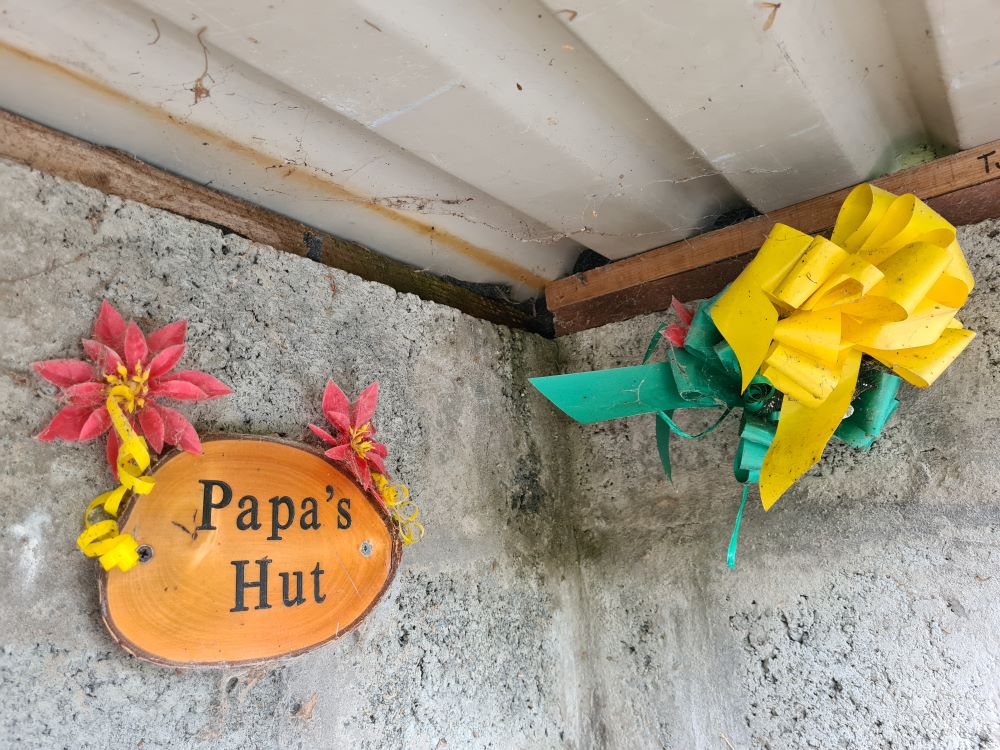
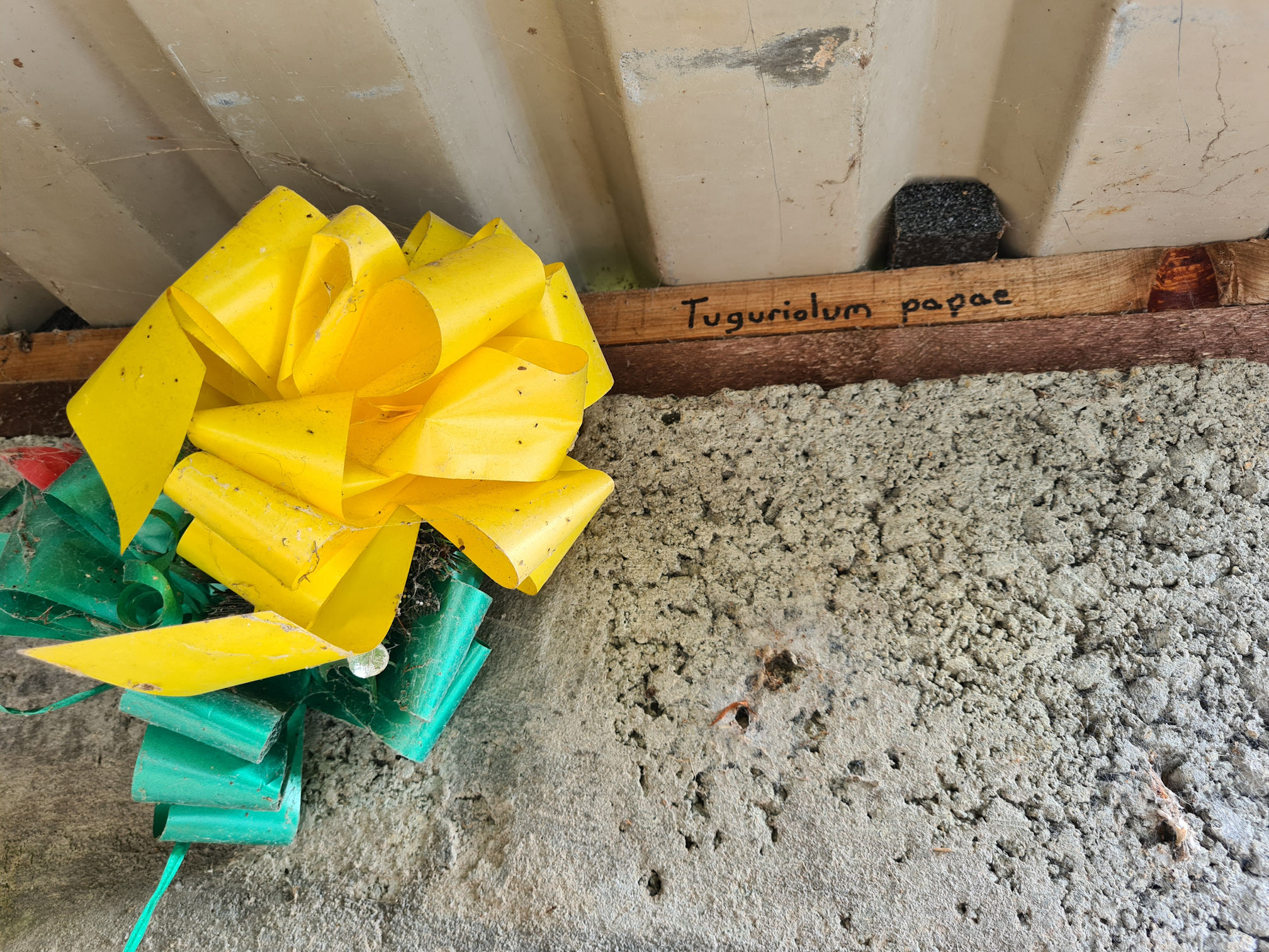
There’s a special mention for ‘Papa’ and ‘Tuguriolum papae’ is written on a strip of wood which is Latin for Pope’s Hut.
I sat for a while thinking about the anglers who would fish here, waiting for a catch, sheltering from the rain or enjoying their packed lunch.
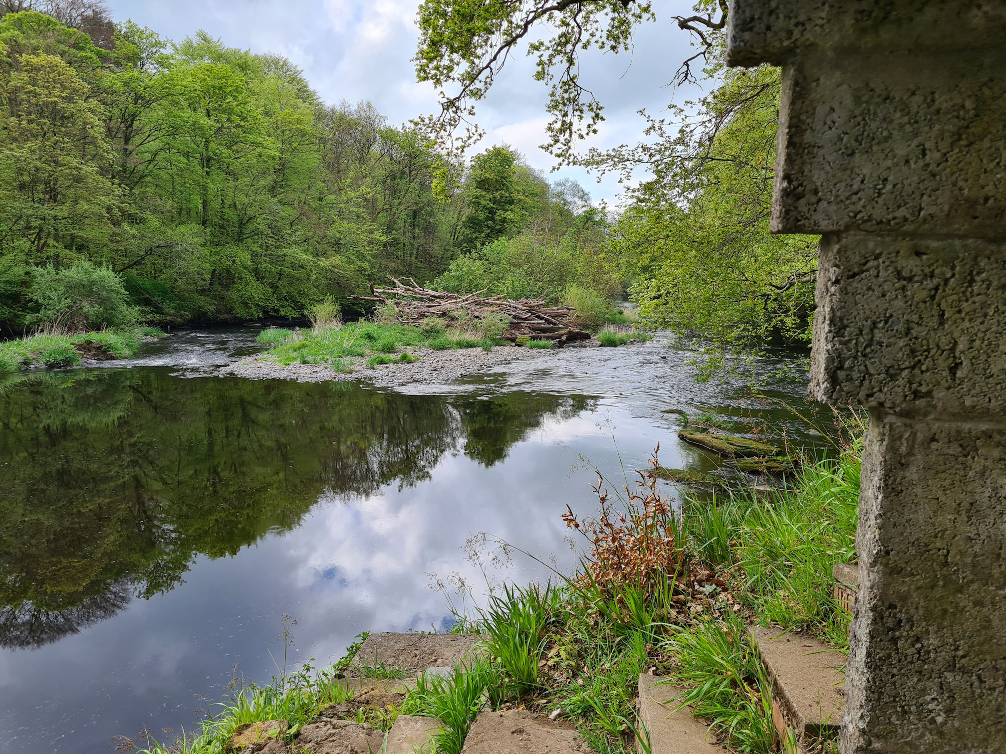

It was tranquil. I felt calm and loved sitting here.
As I write this I’ve noticed the above photo has what looks like a walled section on either side of the River Ayr. I wonder if one of these is where the original ‘Old Ha’ castle stood? I checked an old map on the National Library for Scotland website and it does mark “Old Hall, site of” on the right of the river, so maybe this is the place. The wall on the right would only visible when the river was low though.
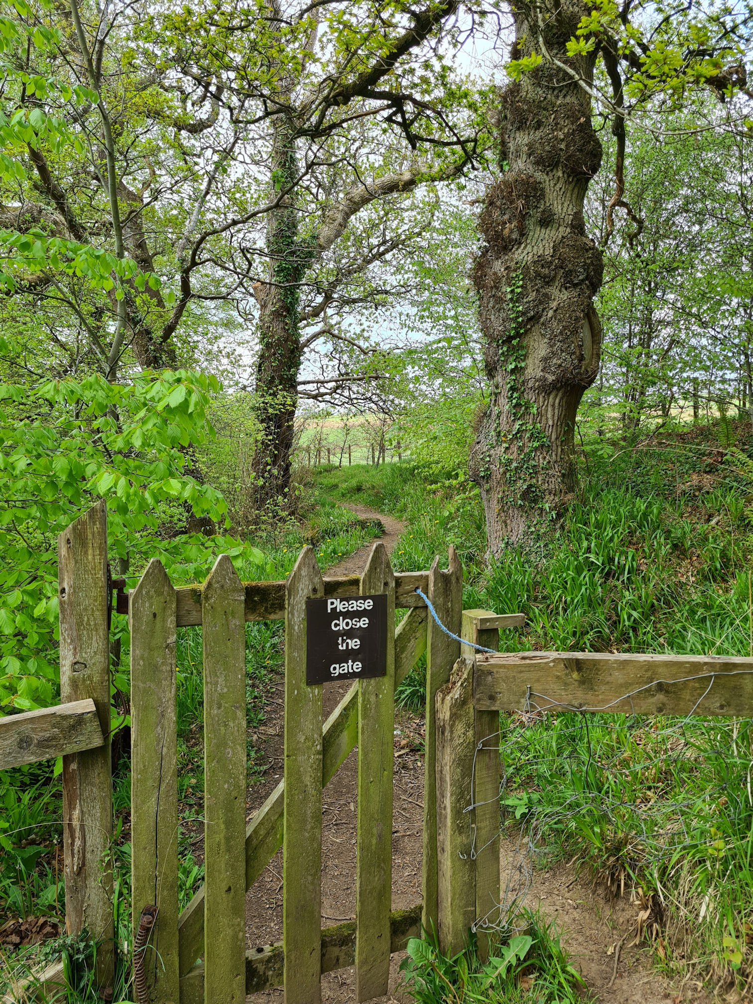
Back on the path, I reached another gate, but this one was being guarded by a tall knobbly tree warrior. As long as I closed the gate behind me I was allowed to pass.
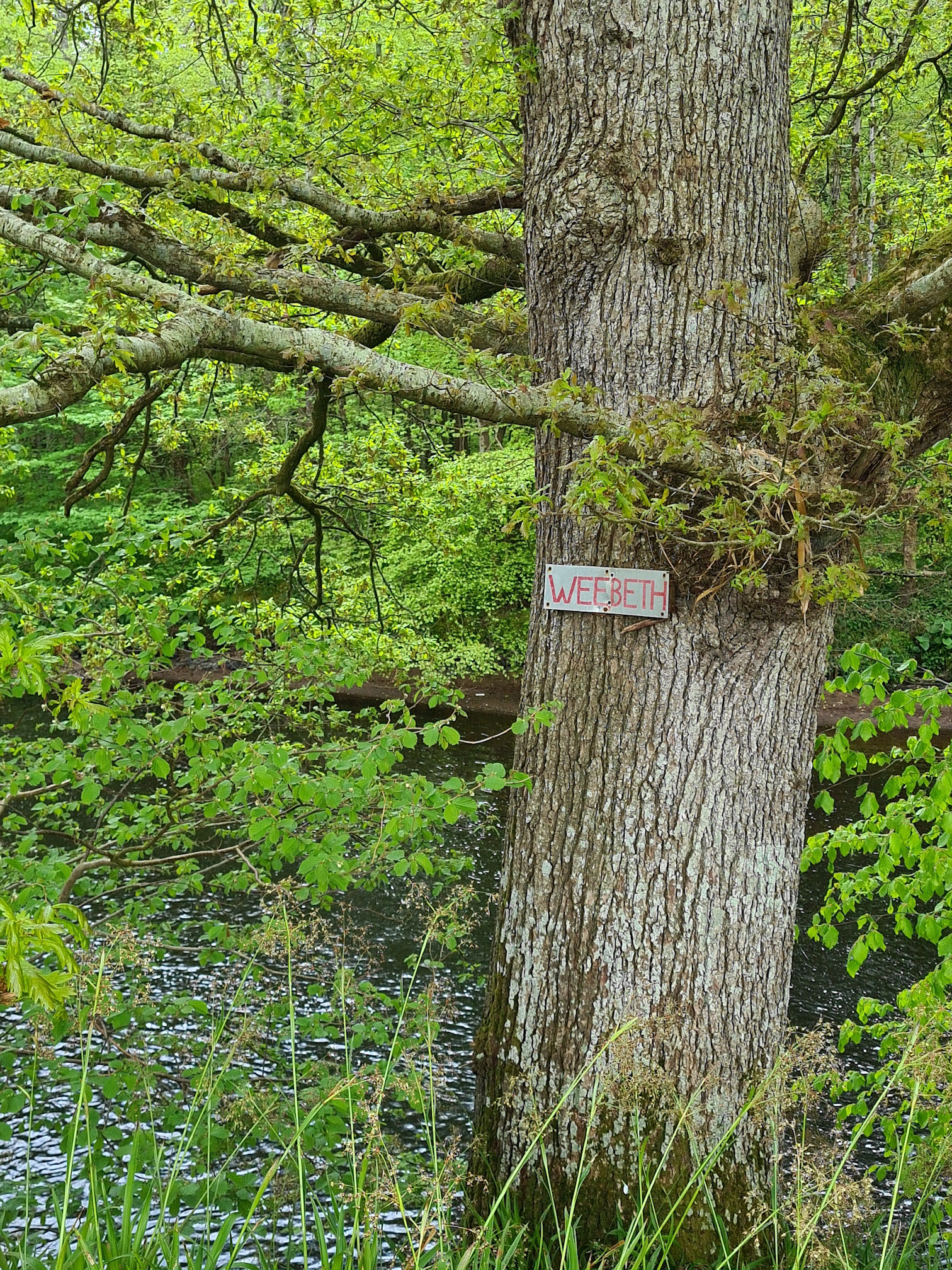
Another tree sign appeared beside the river, this one said ‘Wee Beth’. A moment of sadness came over me wondering if it was in memory of a child.
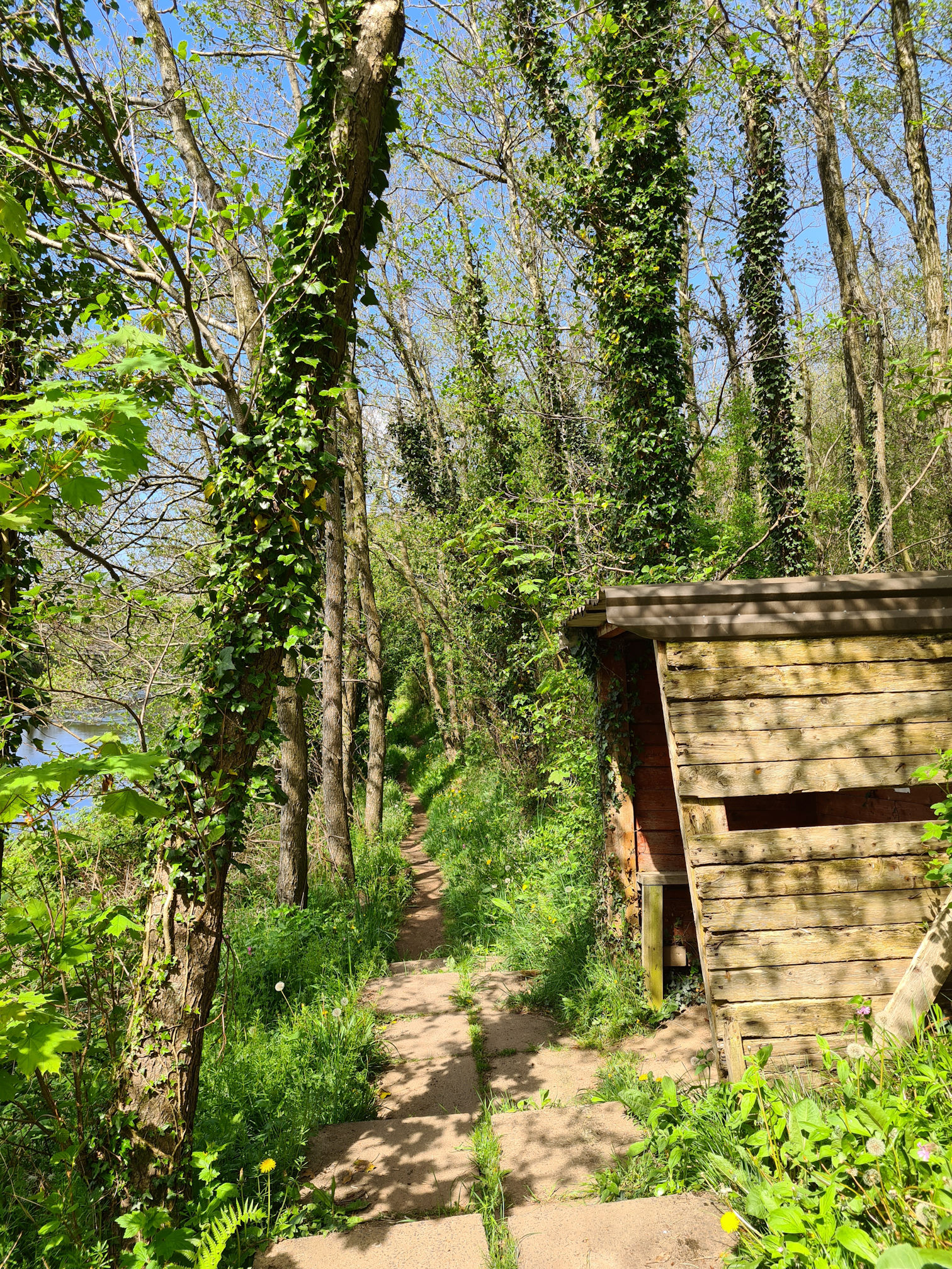
I reached a set of wooden steps where the River Ayr Way sign guided me to go up, yet there was a river path that also went straight ahead.
The river path at this section has deteriorated as far as I know, and it was safer to take the high path along the top then back down.
More shelters appeared along the path, some in better condition than others. I felt a real sense of pride in the fishing community here. There was definitely a more obvious fishing theme along this part of the River Ayr Way.
This warning sign surprised me for a moment, but I didn’t see any Giant Hogweed when I was walking.
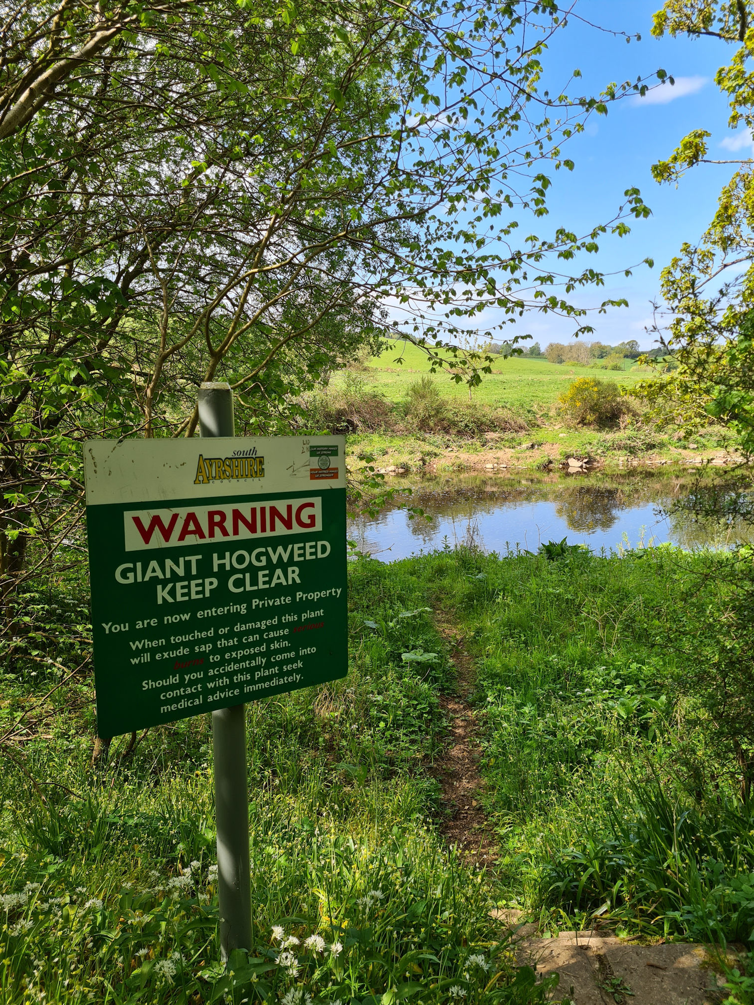
Now as an adult I know that Giant Hogweed is a plant to avoid contact with, but I do wonder how I survived childhood 😂.
I would wade through, touch and pick outdoor foliage often! I had no knowledge of the potential dangers as the only way to know was to read a book or be taught by a teacher, parent or sibling. I was told not to pick Dandelions though as they made you wet the bed, which I now think is silly as it’s known to be the most beautiful wildflower that represents the sun, moon and stars, and is also edible.
As a child I would join my friends and pick what we called ‘itchy-coos’, hairy seeds from a Dog Rose plant (also known as Rosehip), and put them down each other’s back as a joke, making us itchy and scratchy. Gosh when I think back that’s an awful joke, but as children we all thought it was funny to see our play pals jump and squirm in front of us. I remember it not being a nice experience but I had to laugh it off. I survived to tell the tale 😀.
It seemed to be a popular Scottish childhood joke when I was growing up. Thinking back we learned this from each other by ‘word of mouth’, passed down from grandparents, to parents to children.
Another hut appeared on the path with the usual notes and messages written inside.
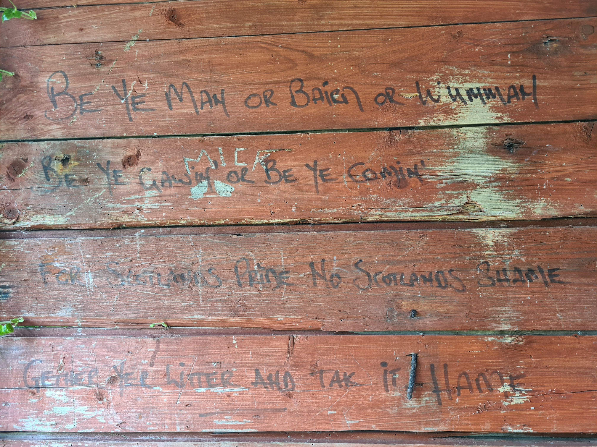
I like this important message to us all:
Be ye man or bairn or wumman
Be ye gawin or be ye comin’
For Scotland’s pride, no Scotland’s shame
Gether yer litter and tak it hame
I stopped to admire the ‘Forget-me-nots (Myosotis arvensis)’ clustered together at the side of the path. I wondered if someone planted this in memory of a loved one, or maybe it just grew naturally. I love these little flowers and their meaningful name.
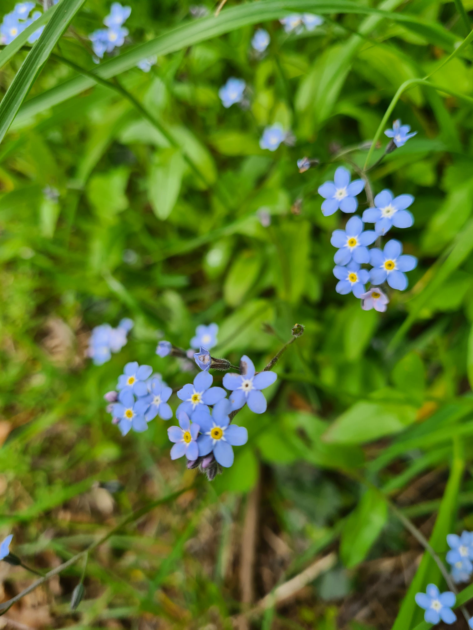
I read an amazing fact that if the yellow ring in the centre of the flower has turned white, it means it has been pollinated and there’s no nectar left. Insects learn to go to the yellow rings as seemingly they see yellow as black, and know the white ones have no nectar. Wow, I love learning something new.
After I wrote this paragraph I stopped what I was doing and drove to Dobbies Garden Centre to buy my own Forget-Me-Not seeds to plant at home. No wonder it takes me so long to write my blogs as I am easily distracted when I fact find. 😂
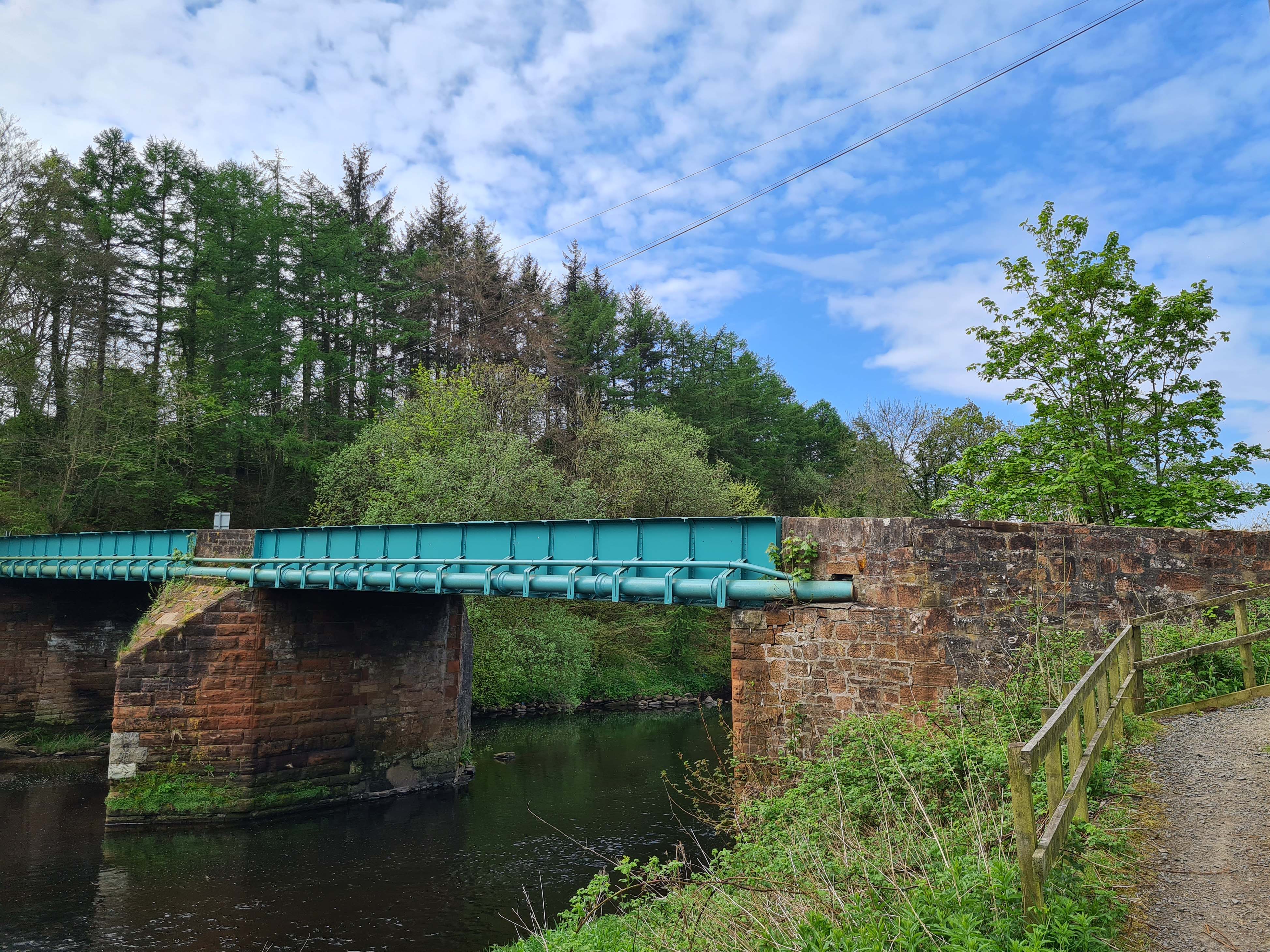
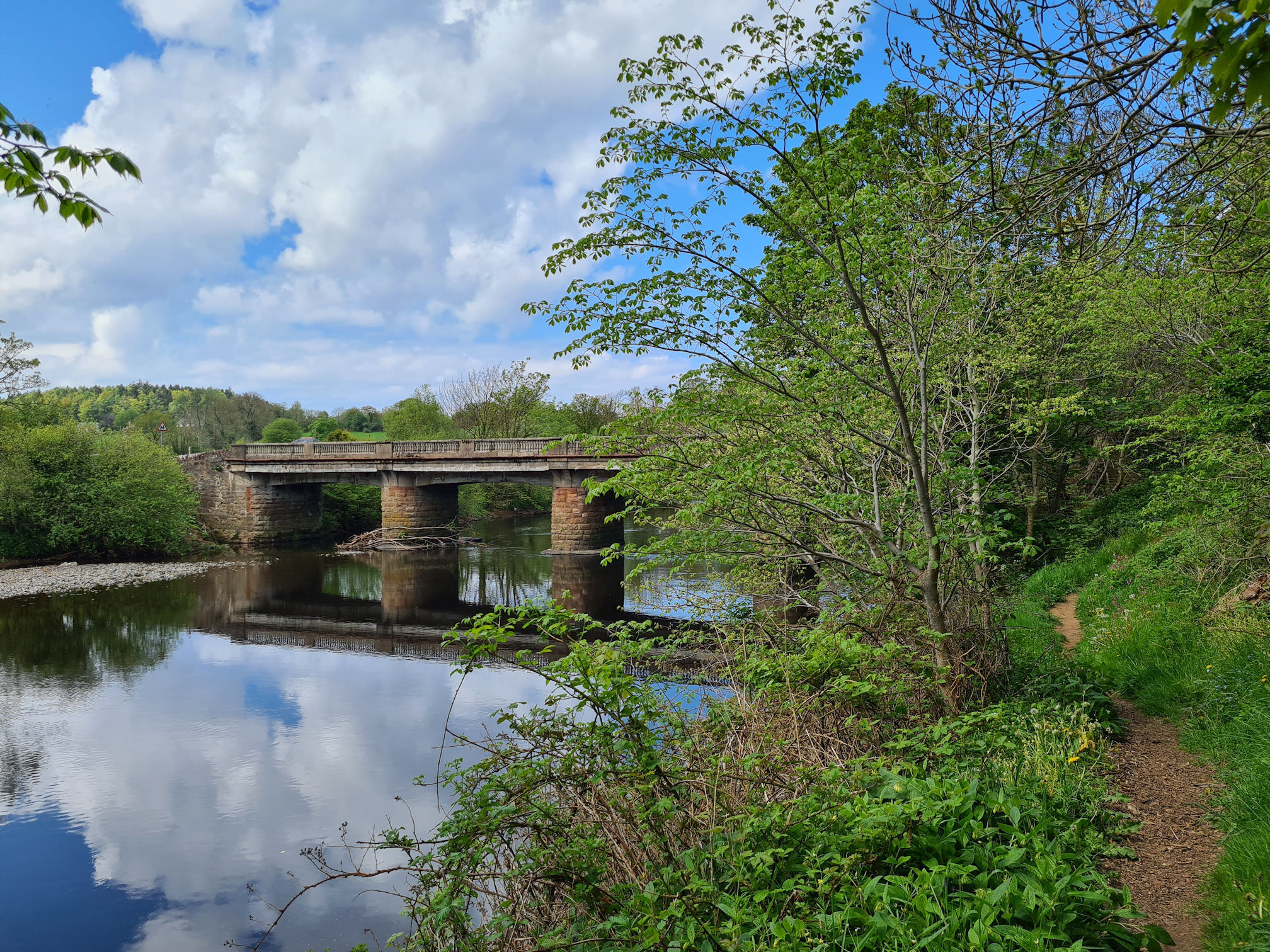
I soon reached another bridge, Tarholm Road Bridge, which led me across to the other side of the river.
I was planning to write this walking day all in one post, but as usual I’ve written too much as I keep straying off the path into my past memoirs. It must be an age thing.
It has been over a year since I walked this trail and I thought I’d forget what to say, but luckily my photos help me find the words and build my personal story. It has been such an interesting and beautiful journey so far, and I’m excited to finish writing the last part of my River Ayr Way walk.
My video from Stair to Ayr is below and also links to further information about this part of the walk.
Love, Dawn-Marie x
River Ayr Way: Stair to Ayr video
More information about this part of the River Ayr Way
- East Ayrshire Leisure: River Ayr Way
- Scotland’s Great Trails: River Ayr Way
- Walkhighlands: River Ayr Way
- Scottish Outdoor Access Code
- Ayrshire History
- Woodland Trust: Bluebells
- Enterkine Country House Resort
- Canmore: Enterkine Viaduct
- Millar Callaghan: Enterkine Viaduct Refurbishment
- River Ayr District Salmon Fishery Board
- Canmore: Gadgirth, Old Ha’
- YouTube video – Roger Griffith: The Gadgirth Estate and the River Ayr, Annbank
- National Library for Scotland: Annbank 1857 map
- Woodlands Trust: Dog Rose

most intetesting
many thanks will read over and over
LikeLiked by 1 person
Thank you, I loved walking the River Ayr Way and finding out about the history along the way 🙂
LikeLike