We chose the best day weather-wise to explore North Glen Sannox. Yes, another glen named ‘Sannox’ on the Isle of Arran and not to be confused with Glen Sannox we visited last year. They are two different glens and both so beautiful and unique in their own way. 💙
We also planned to hike further up into the Arran mountains to try and reach Caisteal Abhail, pronounced ‘Kashteel Avall’, also known as the Castles. Caisteal Abhail is one of four Corbetts (a mountain under 3000 feet) on the island, with an elevation of 859 metres (2,818 feet). I love castles, and I was excited to try and reach Arran’s castles in the sky.
I saw photos and videos online of the hike showing incredible views across the Arran mountains from the Castles. I knew I would love to stand there at least once in my lifetime. We’ve hiked up Goat Fell many times over the years, the highest mountain on the island, so it was time to try another mountain.
The sleeping warrior
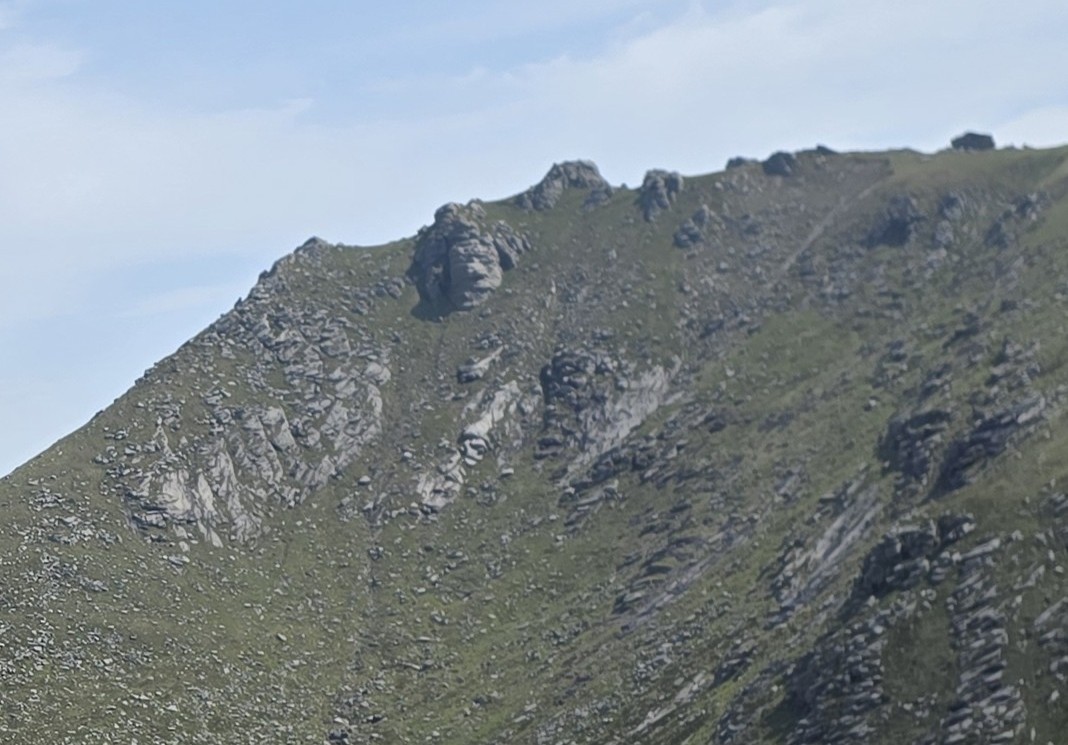
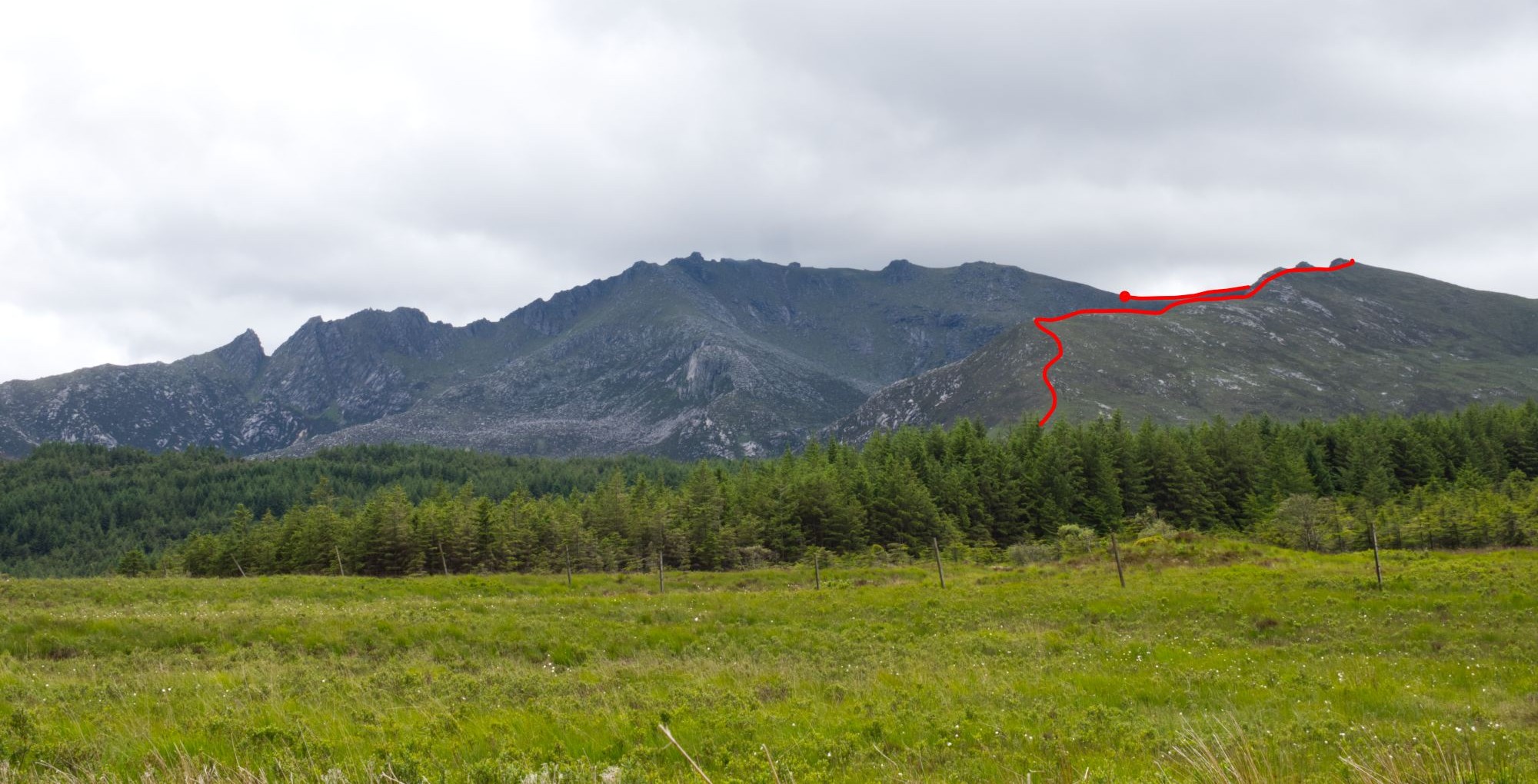
A few days before we stopped off at a layby on the road north to Lochranza to look at the mountain range also known as the Sleeping Warrior. Somewhere in there was the route to the Castles.

The line on the photo above roughly shows what we thought was the route, but the starting point is further down North Glen Sannox. It looks high, and difficult to know where the path will be and how far along the top it is to the Castles. We’ll soon find out though!
Can you see the Sleeping Warrior? Watch this clip to see an impression of a warrior lying on his back.
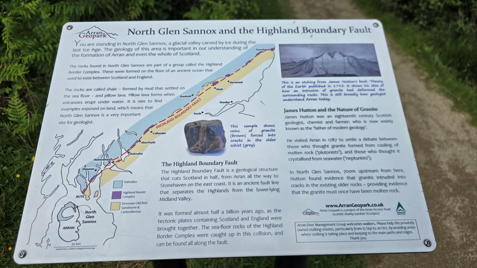
North Glen Sannox
A bright sunny morning welcomed us being such a contrast from our rainy anniversary day at the Arran Heritage Museum the day before.
The car was packed with everything we might need, and we were ready to go. Alan carries too much heavy gear as always, but I know he does this in case there’s an opportunity to fly the drone or capture a good quality photo with his big camera.
I use my mobile phone to take photos now and carry as light as I can. It’s hard enough carrying me at the moment! 😂 The heaviest backpack I’ve ever carried up a mountain was just over 10kg when we hiked and wild camped on Goat Fell in 2016 and it was a challenge back then.
It was a short drive from the cottage in Sannox to the car park at North Glen Sannox. We arrived at around 10am, later than we planned but we had all day.
As we were getting organised a campervan parked up beside us. A lovely elderly gentleman stepped out and said a friendly hello, then we got chatting. When I say elderly, I think he was in his 70s. He was from Gloucestershire in England and travelling solo for three months through England and Scotland. He offered me bread as he had too much, but I kindly declined as we had plenty back at the cottage.
I didn’t catch his name, but he was travelling with his cute little dog named ‘Puddles’. Today he was going for a walk up North Glen Sannox to see the waterfalls. I was in awe of his confidence and found out later he has more stamina than us.
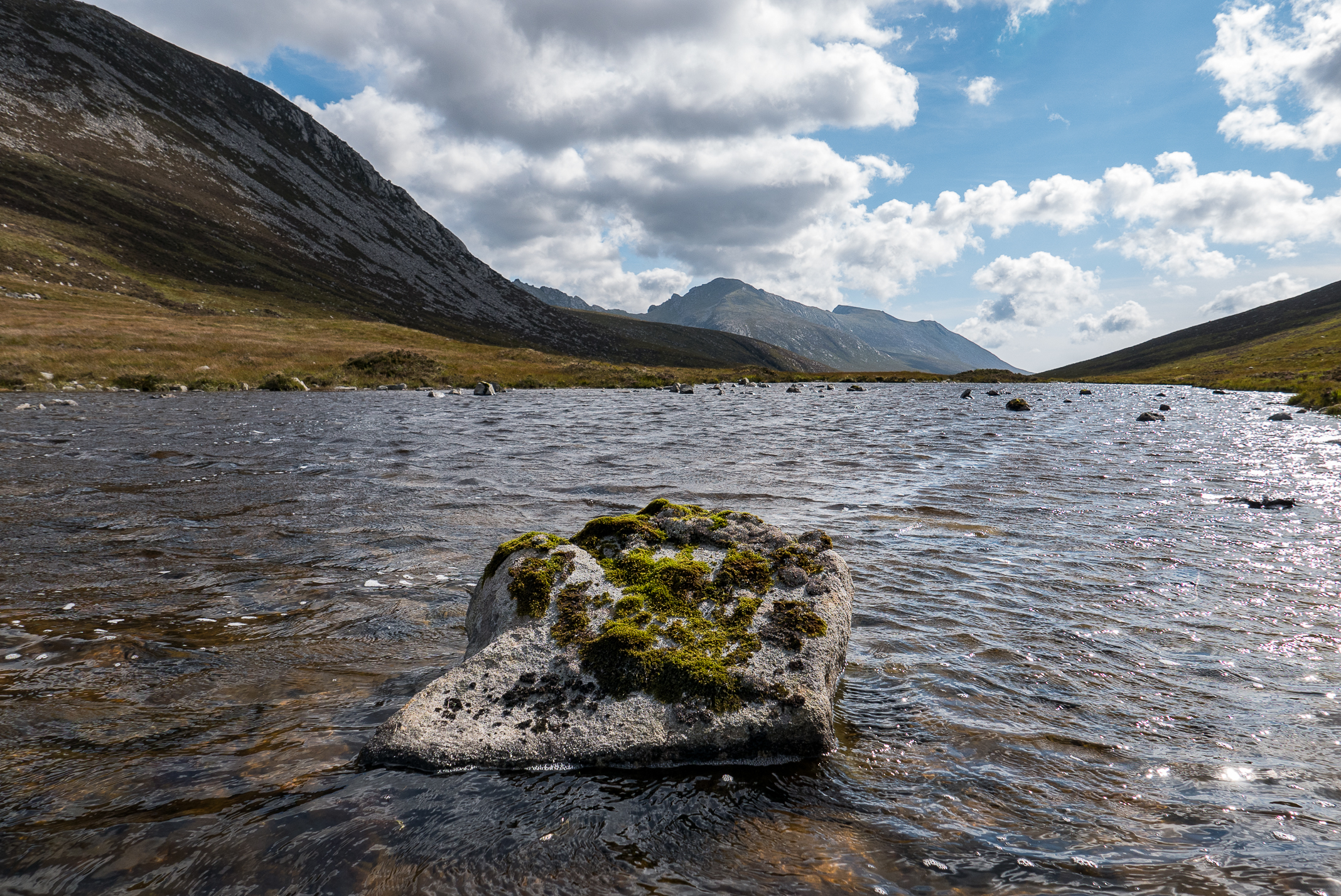
Before starting the walk, I wandered over to the road bridge over the North Sannox Burn. It’s so picturesque underneath, with the fast-flowing water running under the arch on its journey downstream to the sea.


I looked at the walking routes on the map. The path we would take is marked as ‘strenuous route – mountain skills and navigation aids recommended’. The Saddle hike was ‘strenuous’ last year, so hopefully we’ll manage.


I love that anyone can enjoy North Glen Sannox and not need to walk very far. The flat path at the start forks off to the right where you can quickly reach a seat beside the burn, the perfect place to sit and relax.
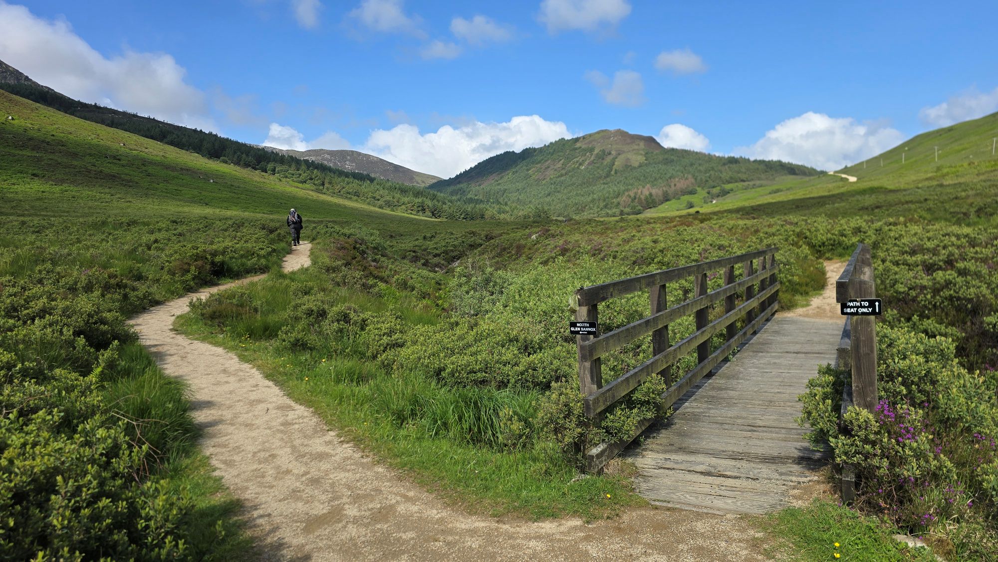
We were taking the path on the left today though, to walk higher up the glen towards the mountain range we saw on the road to Lochranza. Look how lush this place is in summer. Isn’t it beautiful!
My spirits were lifted, and I was feeling quite excited!
Alan spotted a heron in the water, and we walked past a pool of water where playful dragonflies were having fun chasing each other on this day of sunshine. Gosh dragonflies are fast, and difficult to capture on video, the heron as well actually! You can see these in my video at the end.
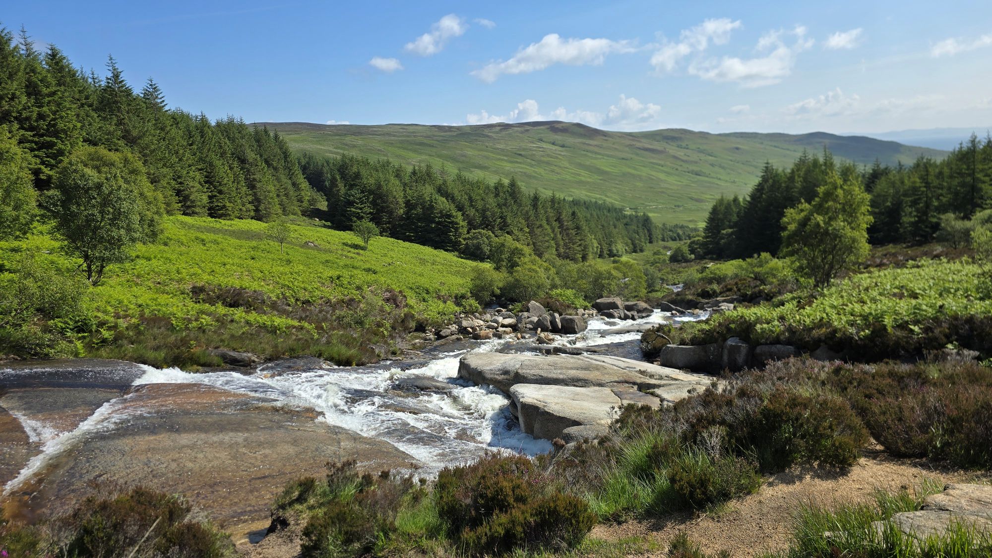
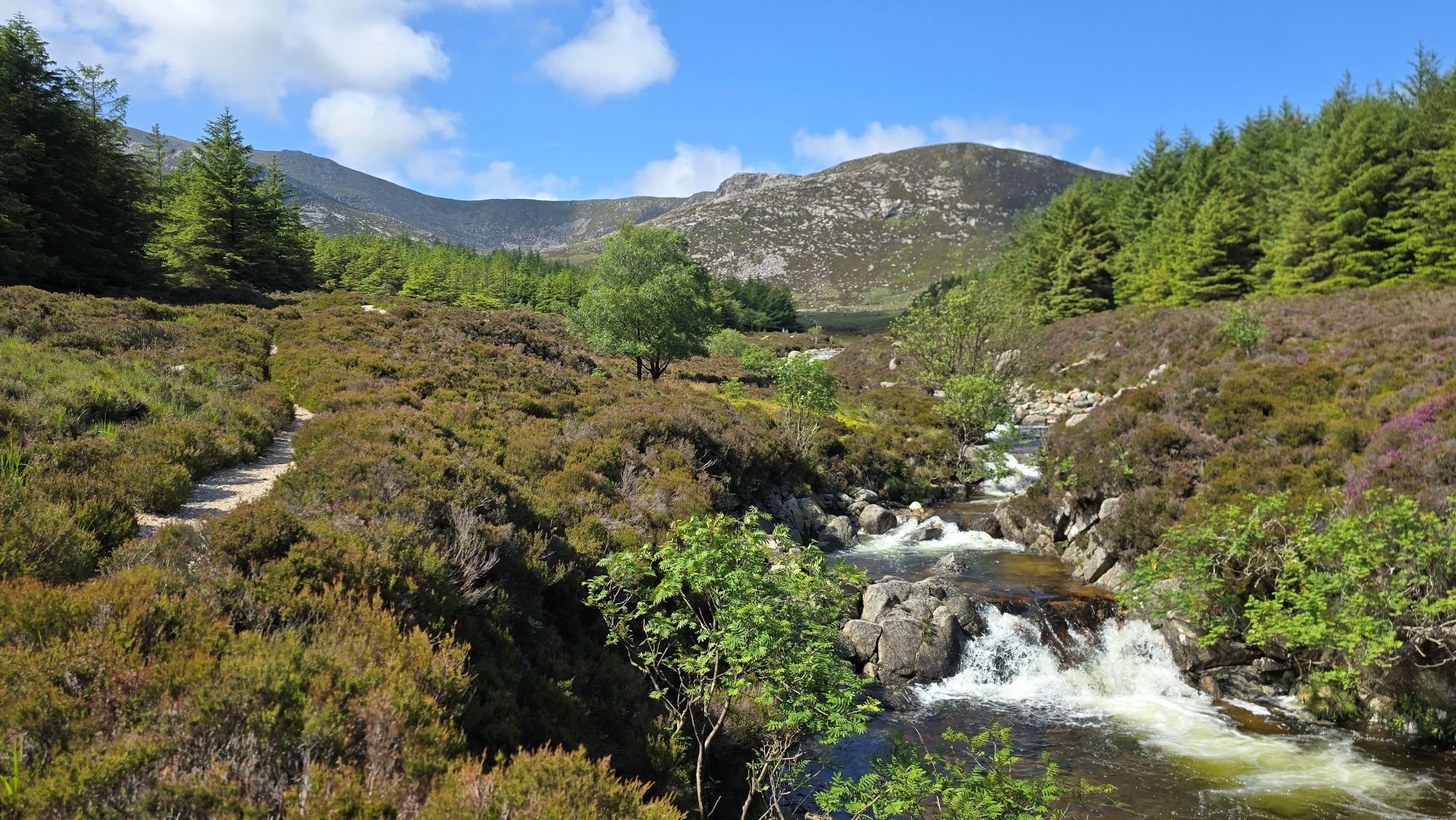
The further we walked up the glen, the more spectacular the waterfalls were becoming, in full spate after the rain the day before.


It was a gradual uphill climb, steep in parts, and we were both feeling it more than last year at Glen Sannox which is an easier stroll.
The gentleman with his dog we met earlier was now totally out of sight, faster than us. To be fair we were stopping for photos and video, but he was still fitter and faster. Hats off to you, kind sir! We met him later as well and he said he walks a long distance every day.
We reached a small stretch of woodlands. I was in my element loving the trees around me, the trickling sound of the stream with the sun shining through the trees casting shadows and light.

The first time we ever walked up North Glen Sannox was in July 2008. I remember a group of young people were jumping into a deep pool of water further down the glen and later sliding down these waterfalls like a waterslide.
I remember thinking it was so nice to see the young people enjoying the outdoors during their summer holidays.
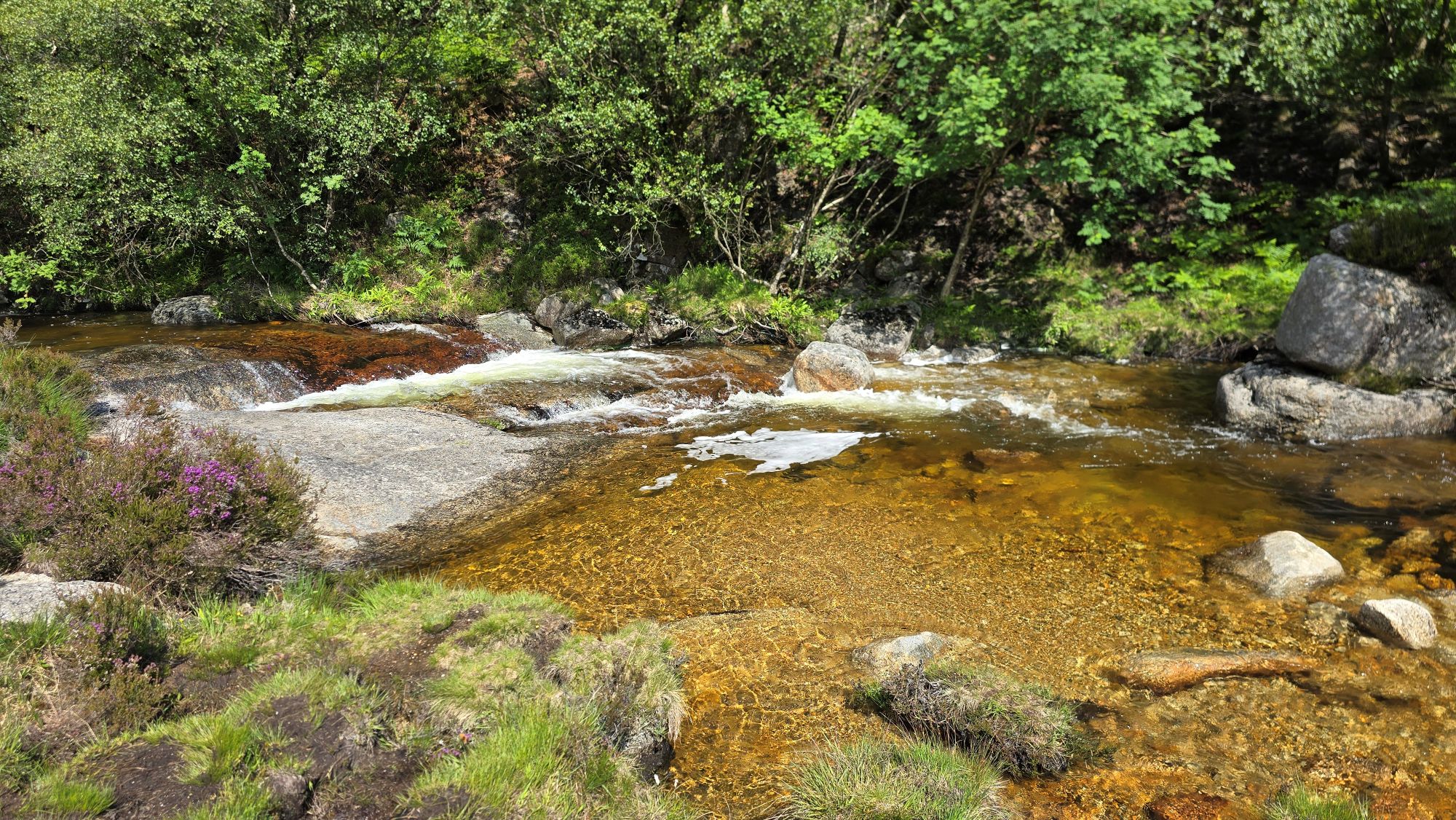
This scene captured my eye with the crystal-clear water shimmering in the sunlight. It was even more beautiful standing there than in the photo.
The view of the mountains began to open up the higher we walked, and wow. Look at the landscape that was beginning to appear before my eyes.

At this point I wasn’t sure visually what part of the mountain we would be climbing, but I knew we needed to cross the burn further up the glen and follow a trodden path from there.
Following the path alongside the North Glen Sannox Burn was just getting better and better! Around every corner my eyes were gazing upon a new scene, showing off the Isle of Arran’s picture-perfect landscape.
We were being spoiled again this year. I can understand why artists visit the island and feel inspired to paint pictures or create other types of art.
I found a photo similar to the one above from July 2008. It’s a different angle but shows how the trees have grown taller over the years and now cover part of the approaching view.

Continuing along the narrowing gravel path we reached where a fence and gate once stood, leading us to the crossing of the burn.
As I stood in the surrounding mountains, now gazing up at the Sleeping Warrior, it was easy for me to feel small in this environment. I am but a mere tiny human with no importance in this wild majestic landscape. I have no words.
Looking at the above photo, I was imagining a computer-generated animation of the Sleeping Warrior waking from his long sleep. He rises and stomps across the Firth of Clyde to the Ayrshire mainland to wake up Magnus the Viking who stands tall on the Largs promenade. They both stomp together south to the Irvine coastline to slay the Stone Dragon perched high on the sand dunes. Or they could all be the ‘Allies of Ayrshire and Arran’. I like that scenario better. 😂
He might not be too happy if I wake him up, so I moved on quickly to find the crossing.

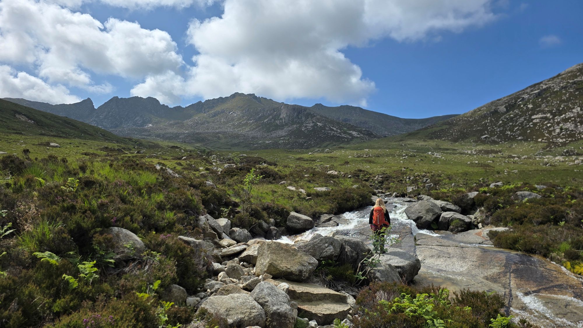
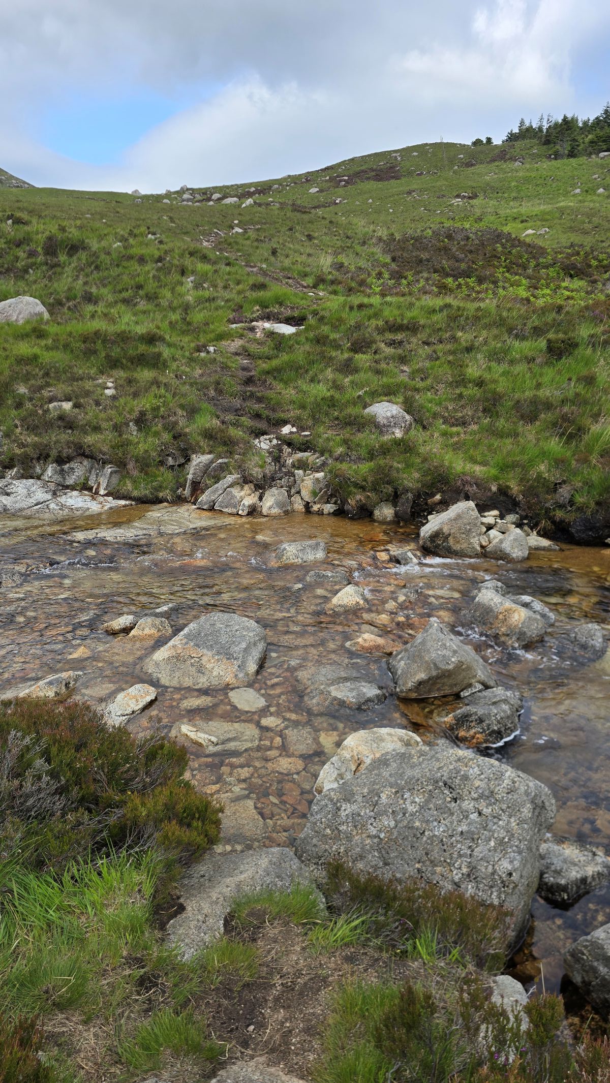
We reached the crossing point, but today the water was flowing fast across the rocks so we couldn’t use them as stepping stones.
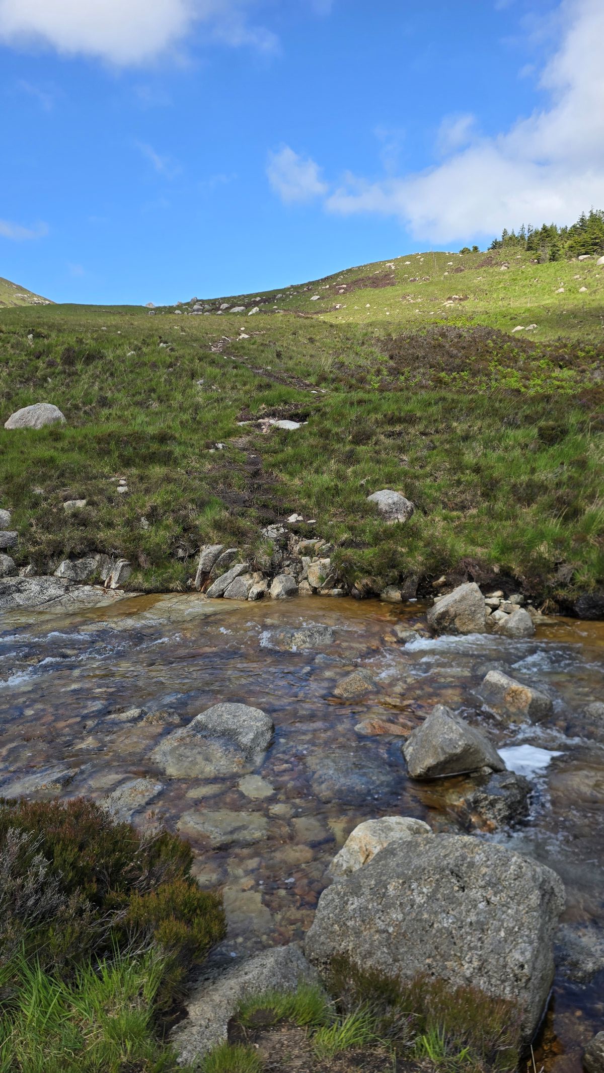
It doesn’t look as bad in the photo, but with the fast flow I was wary of slipping and the water was more than ankle deep in places. We don’t mind getting our feet wet, I was more worried about slipping or twisting an ankle. We could have taken our shoes and socks off, and I did consider this.
We met a family with their two dogs who also wanted to cross over. They tried further up the glen as they knew another route but came back down as it wasn’t easy. The lady lives on the island so knows the area well. We eventually saw them taking their shoes and socks off and crossed over to the other side of the burn. I was so happy they made it across safely as her family were leaving the island the next day and they wanted to hike up to the Castles.
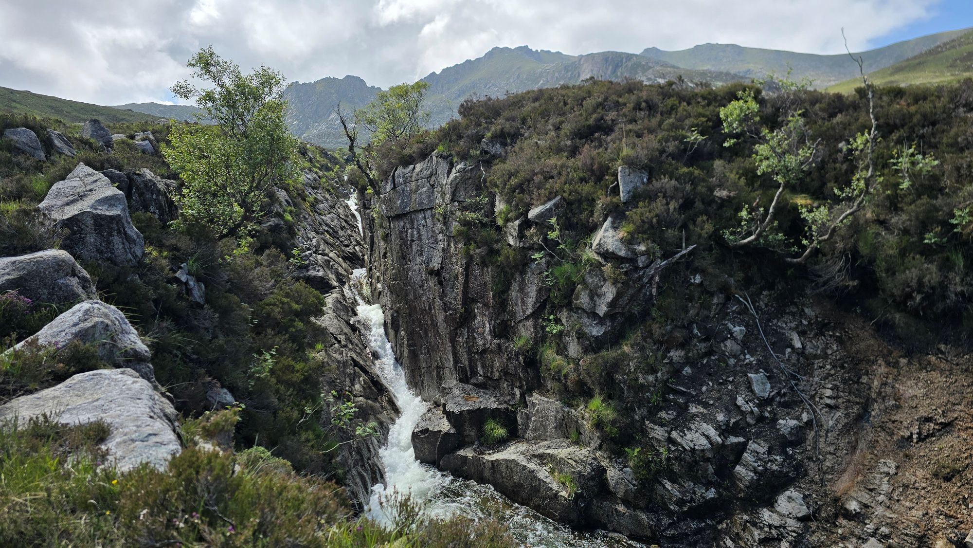
Other walkers coming down the glen said there was a beautiful gorge further up the burn, so we walked on before deciding what to do next. We couldn’t see any other safe ways to cross over.
It wasn’t long before we met the gorge, a gorgeous one at that! North Glen Sannox just keeps giving and giving.

I then came to the decision that we wouldn’t be hiking further today. Apart from the high water to cross, time was passing quickly, and I was feeling rather tired.
I was happy and loved what we saw today, so we would try again tomorrow when the water levels should be lower.

We turned back and enjoyed an easier downhill trek beside the falling water of the North Glen Sannox Burn.


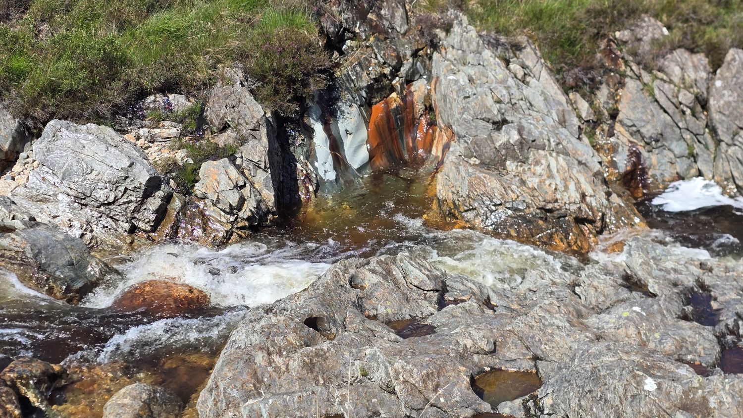
The sunshine and water made these rock formations stand out, catching my eye.
Today we walked around 6 kilometres (3.7 miles):
- Moving time around 2 hours
- Elapsed time around 5 hours – stopping too much 😂
This was a good warm-up for our hike the following day.
North Glen Sannox – Day two
The next morning, we started earlier at around 9:30am. This time we didn’t stop for photos and videos and reached the stepping stones quicker. The water was slightly lower with rocks now above water, but it was still wet feet time so off we went.
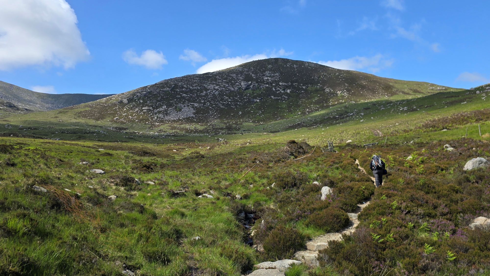
We made it safely across and followed an uphill trodden path which was boggy in places. The North Glen Sannox Burn was slowly disappearing from my view, but the giant mountains kept changing their perspective the higher we hiked. I was keeping a watchful eye on the Sleeping Warrior!

As we plodded on the hill became steeper, and I quickly realised how difficult the ascent was for us both. At one point my heart rate jumped up to 170 beats per minute!

I think we were hiking a hill called ‘Sail an Im’, but I’m not sure exactly where it starts and ends.
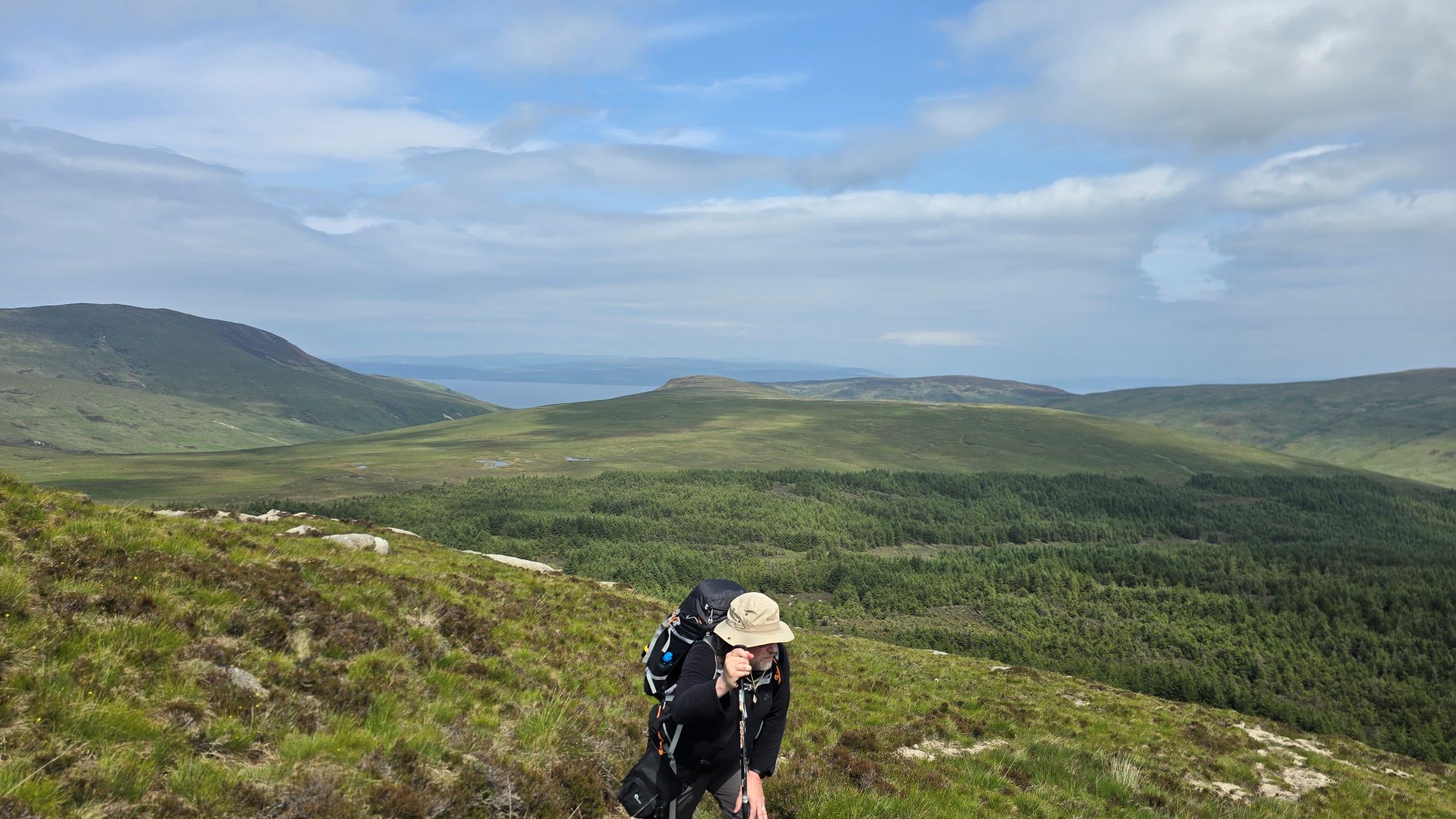
Alan’s backpack was too heavy, and I offered to carry something to help, but as always, he battles on with it. Determined as ever, we both kept going. Surely we must be near the top of the first hill. It felt like the never-ending hill with no summit appearing any time soon.
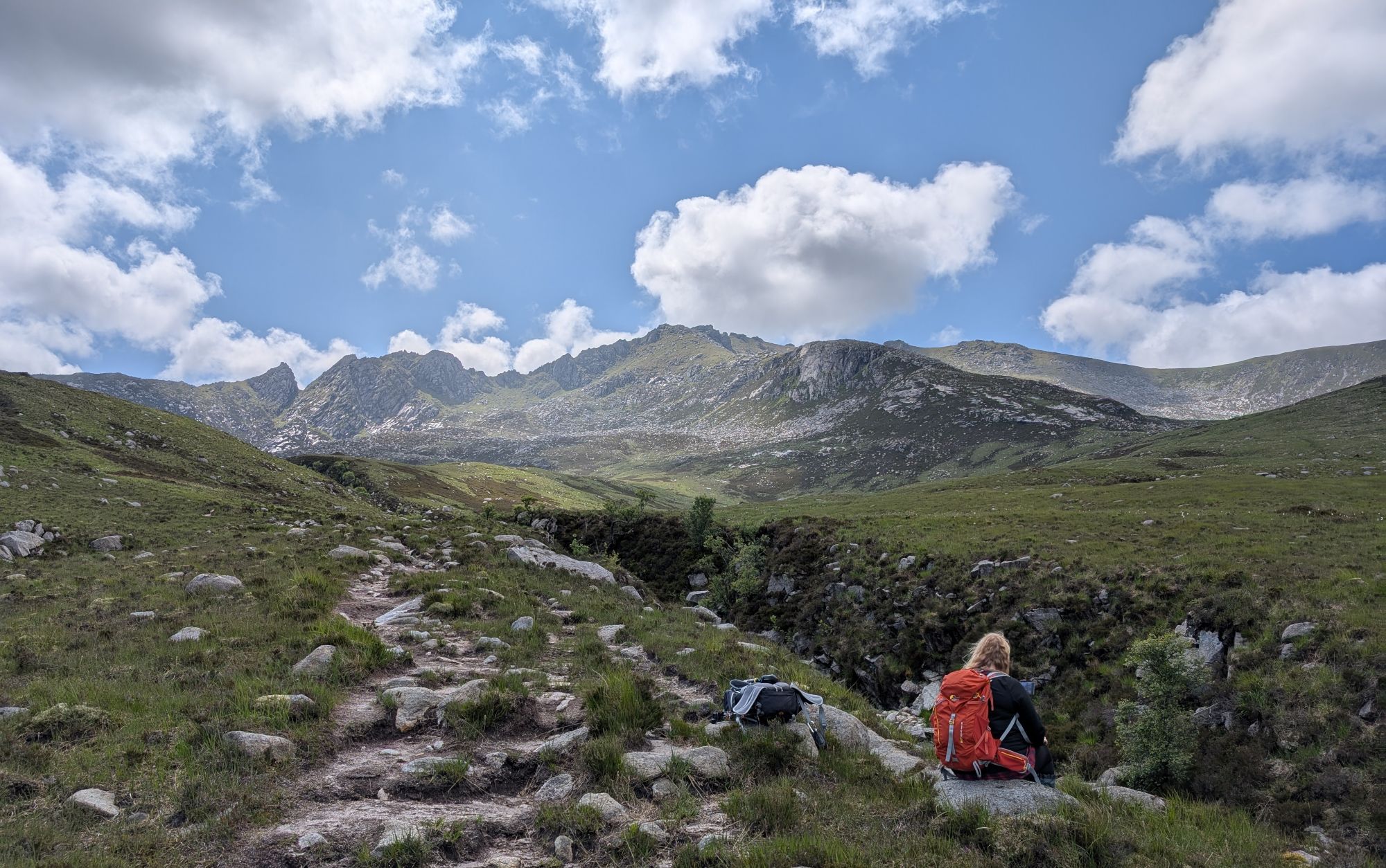
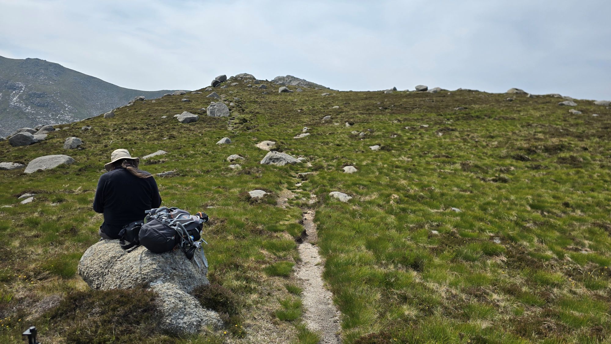
We finally reached a flat area where we stopped for a little while as both of us were out of puff and our heart rates were still racing.
It was a cloudier day today, so it was hazy views across sea to the mainland. I could see a tiny North Glen Sannox Burn below us and the path we walked up, showing how far we had hiked already.

I could also see the lovely Lochranza and Gleann Easan Biorach where we hiked in 2017 up to Loch na Davie, the water source for Arran whisky.

This is a photo of us standing at Loch na Davie looking up to where I was standing now.
I love that I can recognise more places on Arran now, but there are still many areas we haven’t explored, even after 19 years of visiting.
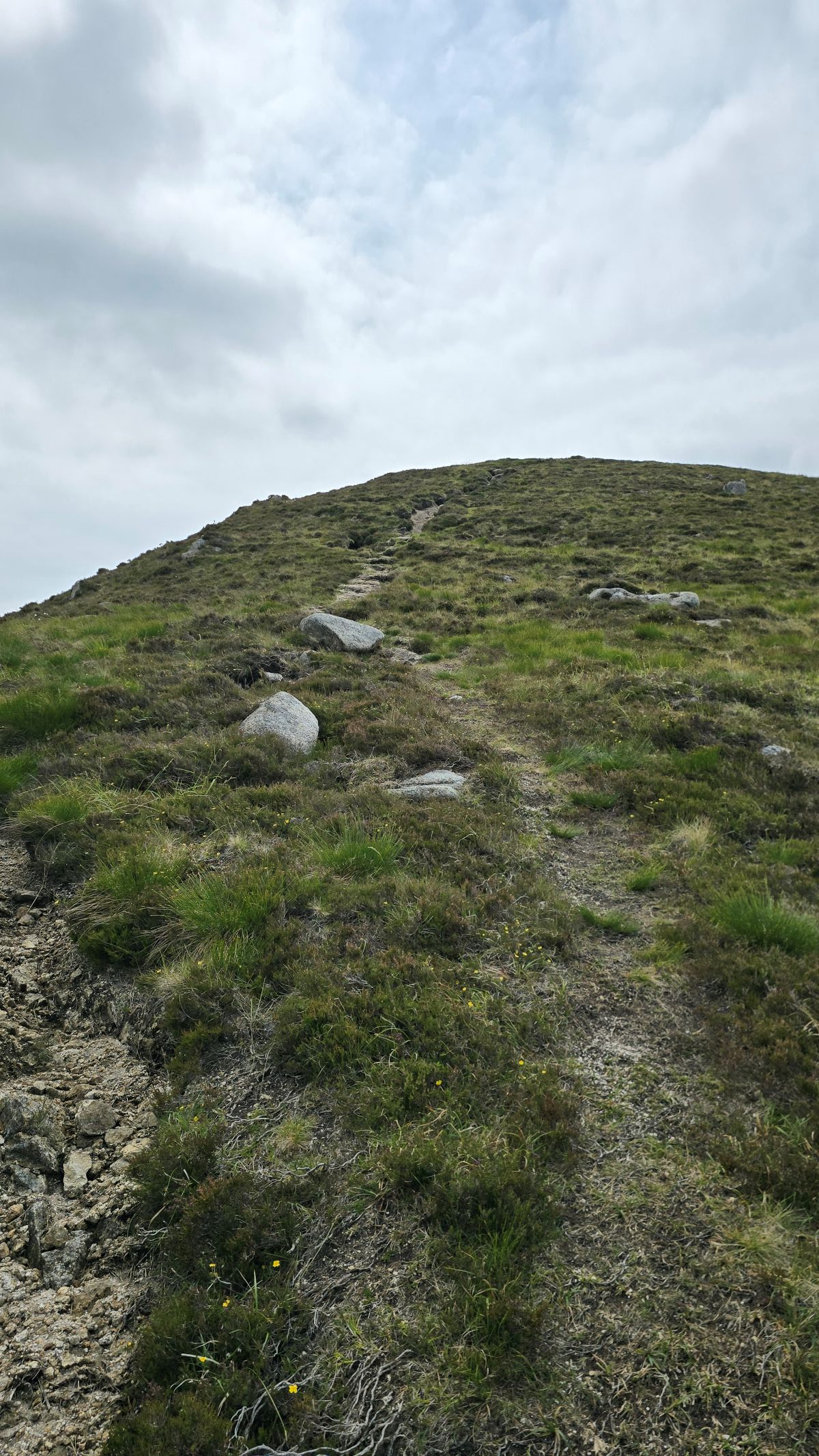
When we arrived at the first flat area in the photo below there was another small hill in front of us, so Alan wandered up to have a look at the route.
In my mind I thought it would now be a fairly flatter ridge over the hill until the final climb up to the summit of the Castles, but I was so wrong. Alan’s face said it all when he walked back. We still had a long way to go.
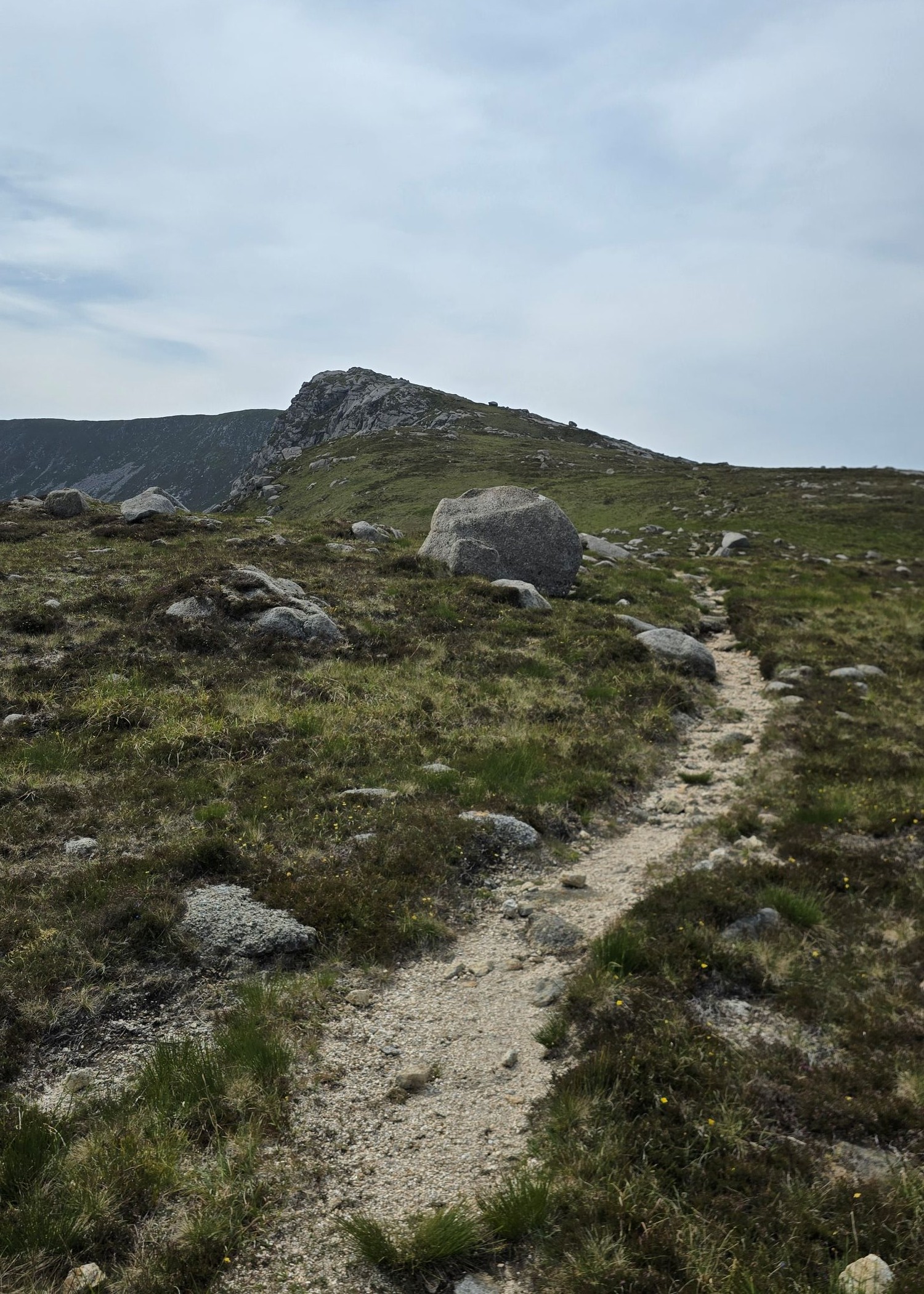
Another steep mountain path appeared before us, with the Castles still faraway.
I was still enjoying the hike even though it was tough going. How could I not, just look at these mountains and views!

We plodded on wondering what the path was like after the top of this mountain. There was no one else in sight, just us, occasional gusts of wind, then silence.
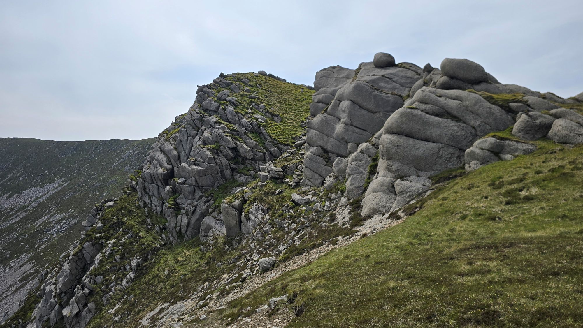
This part is where it got scary though. I was in front following a gravel path that took me close to the edge of the mountain, and it came to a dead end. Large slabs of curved granite on the right seemed like the only way to clamber up which I was going to try until I saw another way. I retraced my steps to climb up the boulders further away from the edge and waited for Alan at the top.
As Alan approached, I shouted to him come up the other way, but he didn’t hear me as his head was down, and it was windy. He followed the same path I did close to the edge. I couldn’t understand at the time what was happening, but he started crawling up the boulders using his hands and knees in a panic, and a few swear words that is very unlike him. I reached down to try and help him up and steadied him when he was up in a safer area.
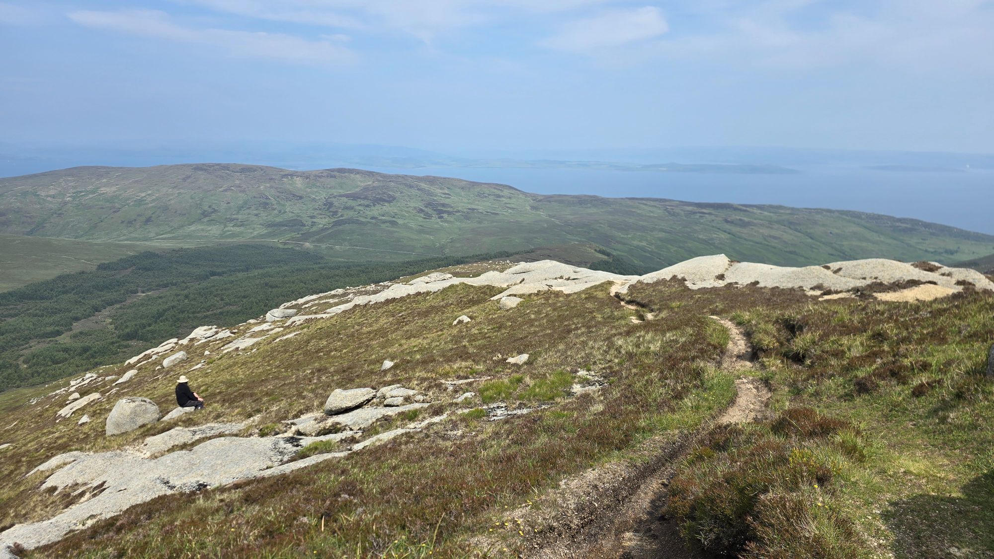
He thought he was going to fall off the edge as his heavy camera bag had swung round and made him lose his balance. The heavy backpack didn’t help either. All he could see was a sheer drop which really scared him, more than I thought as I found out later. After this he walked to a flatter inland area and sat beside a boulder not wanting to go any further today.
I didn’t realise at the time how it affected him, as he said I should go on up to the Castles by myself and he would just stay there. I didn’t want to reach the Castles without him, but I did walk a little further up to check out the route, hoping he would follow after a rest.
The path was much better now and not too close to any sheer drops thankfully.

Now walking alone, I was worried about him, and he was worried about me. I checked my phone and thankfully I had a signal to message him to check he was okay. He wasn’t great and this is when I realised how anxious he was feeling and wouldn’t be joining me. I wasn’t going much further and let him know I’d be heading back down soon.
The views were looking pretty impressive as I followed the path, with gaps appearing where I could walk out a little further to see the shape of the mountains.

Everywhere I looked the picture kept changing, framed by massive boulders and sheer drops which I kept safely away from.


In the photo above, I was sure I could see a rocky face peeking out from the mountain at me. Can you see it in the photo below, top left?
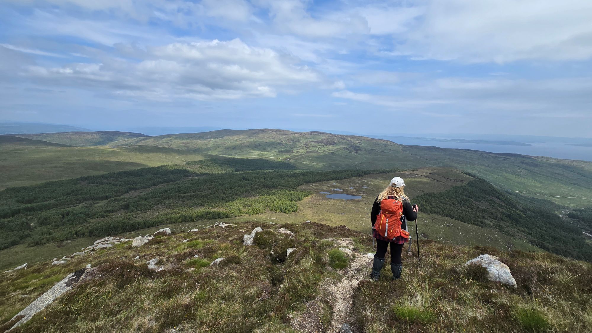
I could now see the ridge and thought about stopping here but pushed on up the hill to the flat area so I could hopefully see more of the Arran mountains.
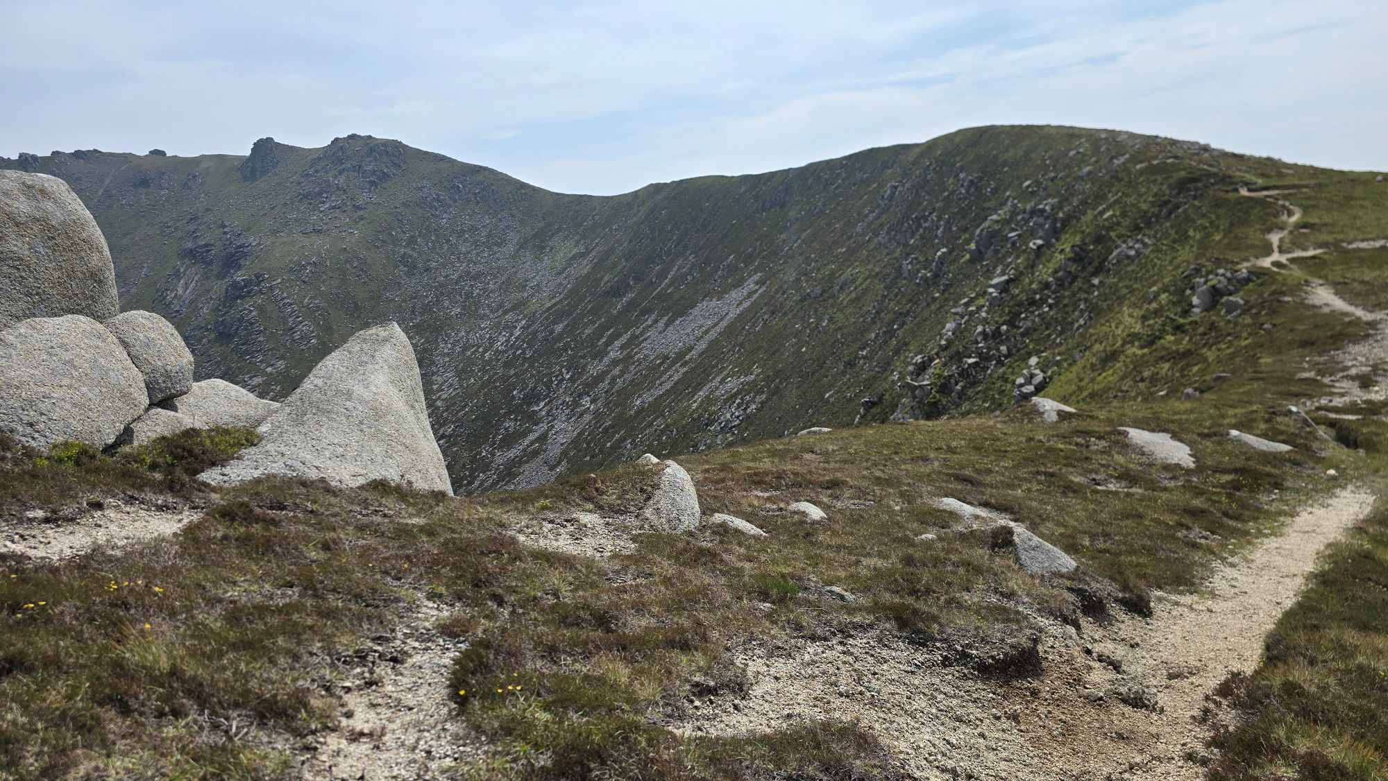
It wasn’t very far now to the top of the ridge.
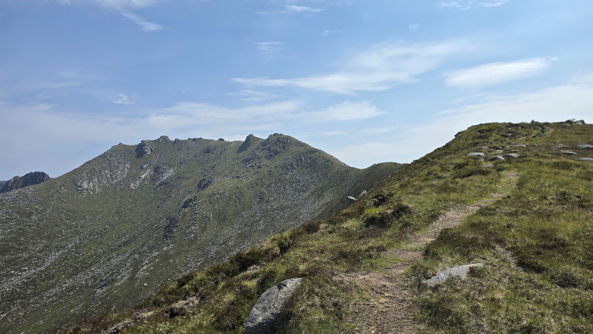
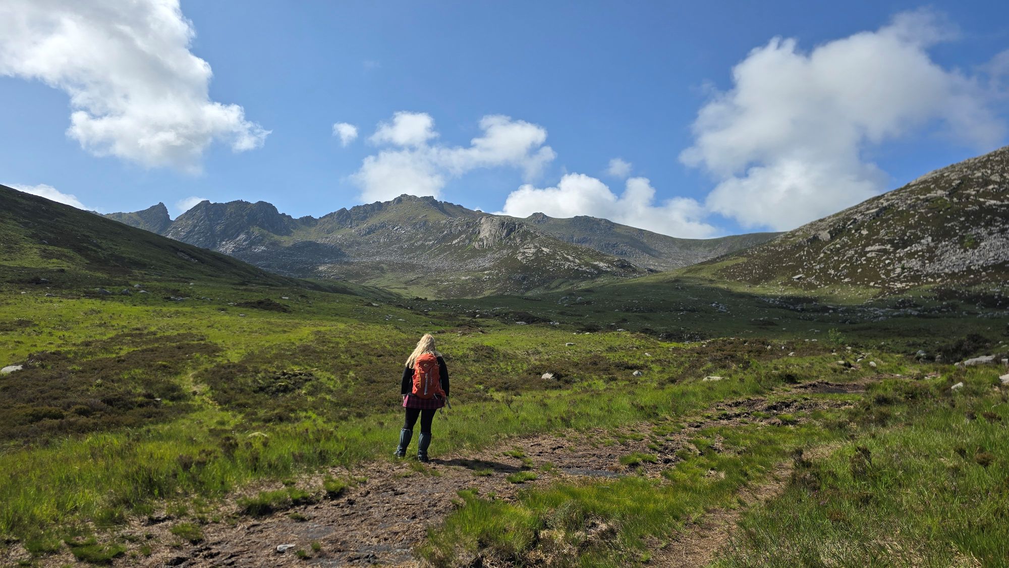
I made it! Even though it was hazy I could see more Arran hills, mountains and a view down Glen Iorsa where we would be walking before we leave the island.

The path to the Castles still looked so far away and I wasn’t going any further on my own. This is where I sensibly stopped. It’s a stunning place to be standing on a clear day with favourable weather.

As this was the end of my hike I set up my tripod for photos and video, pointing towards the Castles as in the photo above. It was quiet, eerily quiet as I was on my own within the surrounding mountains.
Suddenly, the silence was broken as I heard a faint noise in the distance that sounded like a plane or helicopter approaching. As it got louder and louder and seemed to be close to me, I still didn’t know what it was until suddenly woosh, my hat was flipped off my head and flew away across the heather. I couldn’t believe a strong random gust of wind came towards me face on, as if it travelled down the mountain path from the Castles.
I took this as a sign from the mountain not to go any further, and if Alan had been standing there with me, he would have felt the same. I wouldn’t have liked to experience this walking up the ridge. The scary part was that it just came from nowhere. I’ve never experienced anything like this before.
Luckily, I manage to retrieve my special ‘Outlander’ hat as it blew in the opposite direct of the mountain edge.
I’m not even sure either of us would have gone further at this point. At our pace, it would have taken us even longer to get up to the summit. Then the time we would have spent up there and the return journey.
I messaged Alan to let him know I was on my way back down. When I turned around, I could now properly see the shape of the mountain edges and how steep they are.

We took this image with our Insta360 camera and made it look like a portal to take us quickly off the mountain. If only!

I soon reached Alan, and we slowly made our way back down. Alan struggled though and was very wary of where he was stepping, more than usual. He said at the time he doesn’t want to climb high mountains anymore or be near sheer drops again. I understand as I would be anxious if it happened to me.
We knew this hike would be a challenge, but as we managed The Saddle via Glen Sannox last year, we thought we could also hike this at our own pace. The Castles is a grade four hike on the Walkhighlands website, Goat Fell is a grade three hike and a better path.
We underestimated how difficult the Castles hike would be for us. We don’t go out hiking at home and my low-level walking isn’t regular, so we were not prepared. We both need to train properly if there is a next time.
Today we walked around 10.9 kilometres (6.7 miles):
- Moving time around: 4 hours, 15 minutes
- Elapsed time around: 8 hours, 20 minutes
This is how far I hiked compared to the full route we guessed earlier when we were looking at the Sleeping Warrior.
My final Arran story of this 2025 series will be walking along Glen Iorsa to Loch Iorsa, a short, easier and safer walk for us.
Thanks for reading as always and I hope you like the photos and video. Links to more information are also below.
Love, Dawn-Marie x

I always look forward to your Arran adventures. You’ve seen more of the island than most people who live here! Can’t thank you enough for generously sharing your amazing photos and videos.
LikeLiked by 1 person
Thank you Barb 😀
It makes me happy when others enjoy my photos and video too, and my moans about how difficult hikes are becoming as I get older 😂.
Arran shines no matter the weather. It’s hard to believe there’s a lifetime of exploring on one small island.
Take care x
LikeLike