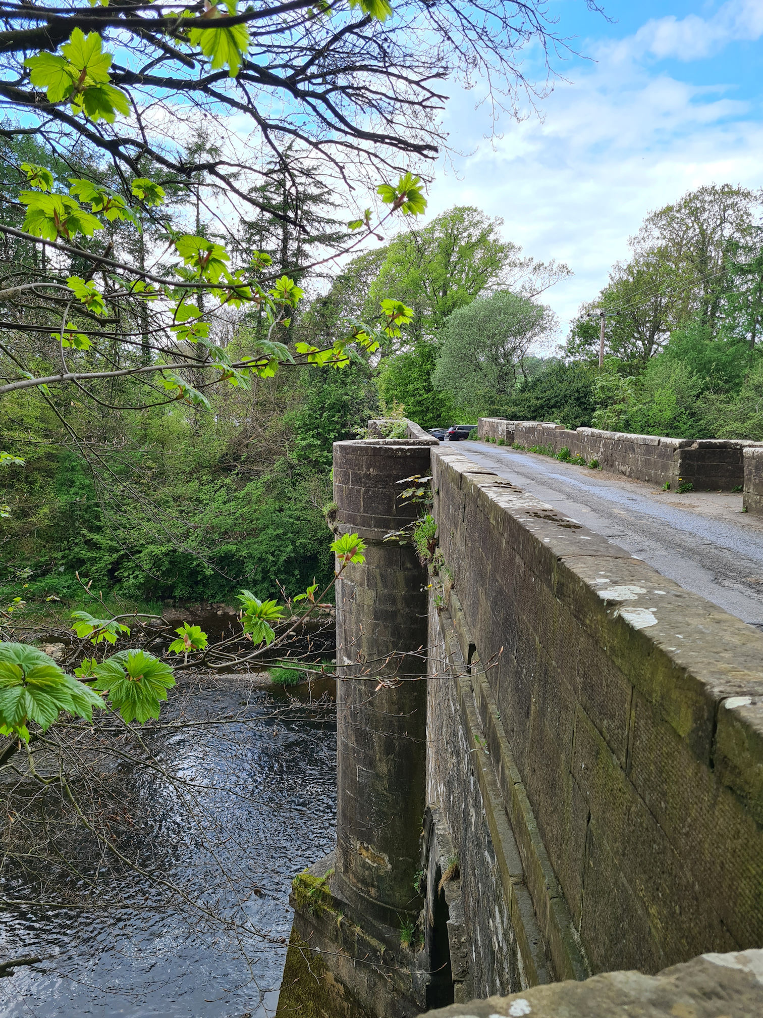
As I walked over the Tarholm Road Bridge, I stopped for a moment to look up the river at the winding tree-lined trail along the banks of the River Ayr where I had just walked from. I really enjoyed this section of the River Ayr Way.
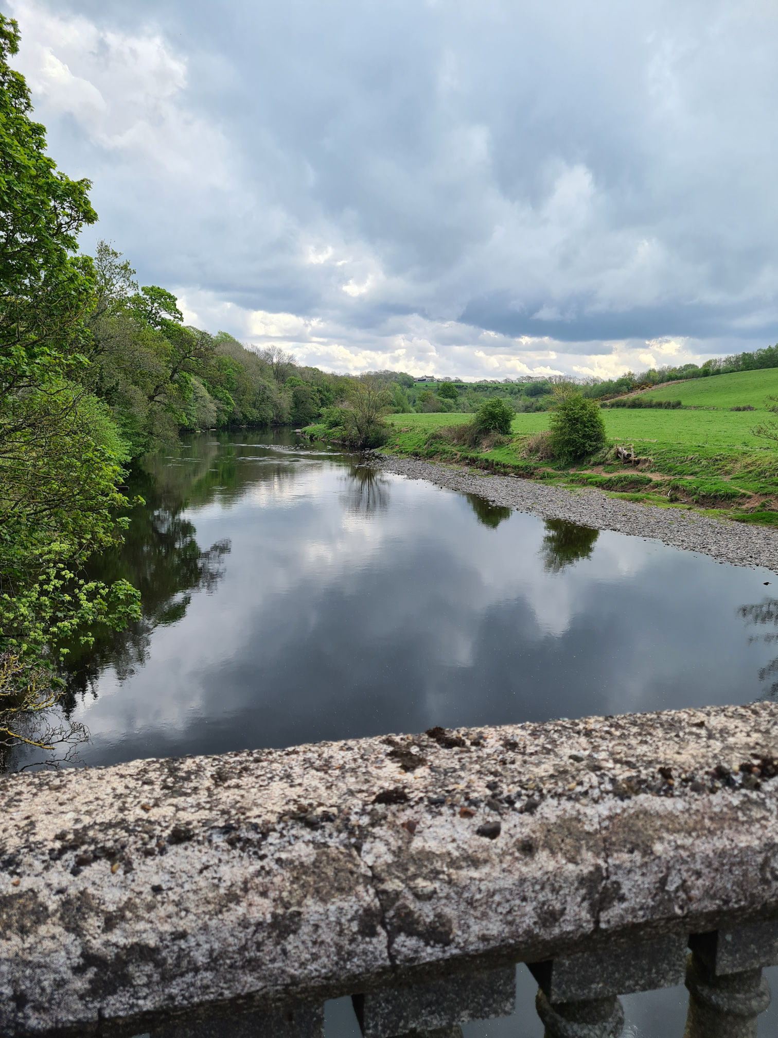
I was thinking how unique Tarholm Bridge looked with its decorative concrete spindles. The photo below was taken later in the year in early October.

The River Ayr Way is Scotland’s first source to sea walk and is listed as one of Scotland’s Great Trails. Stretching from Glenbuck Loch to the sea at Ayr, it covers around 41 miles (66 kilometres), mostly following the flow of the River Ayr across East Ayrshire and South Ayrshire.
I split the River Ayr Way walk into three sections, following directions on the Walkhighlands website:
- Glenbuck to Sorn – I walked this over two different days in October 2023:
- Sorn to Stair – I walked this one day in April 2023
- Stair to Ayr – I walked this one day in May 2023
I turned left walking across the bridge and followed a bend on the road, carefully watching and listening for traffic. I soon noticed a River Ayr Way sign across the road and I was now walking on the opposite side of the river from where I was previously walking. At this point I had only walked around 7.5 kilometres (4.5 miles) and still had a long way to go.
Auchincruive Estate
I walked through the gate and stopped in my tracks. Oh no, a herd of cows were gathered in a confined space and close to the path with no fence between us.

At first I thought they had escaped from their field but saw the gate beside the road was closed. I walked very slowly along the path as I didn’t want to scare them. Hopefully they didn’t want to scare me either.
I was visualising the cows running away in front of me along the River Ayr Way path into the woodlands which would be an awful dilemma to be in, for the cows and myself!
This has happened to me before when I used to run along my local country road. A small herd of cows were loose on the road and every time I slowly moved forward they ran in front of me along the road that would eventually reach a busy main road. I also remember my friend and I were happily walking in Dundonald woodlands and turned a corner to meet a herd of cows on the path. They all scattered through woods with fright at meeting us.
I stopped for a few seconds to snap a photo, so thinking back I must not have been too worried about it. They had cute friendly faces and were not moving fast. One curious cow began to approach me though, so I moved on hoping they wouldn’t follow.

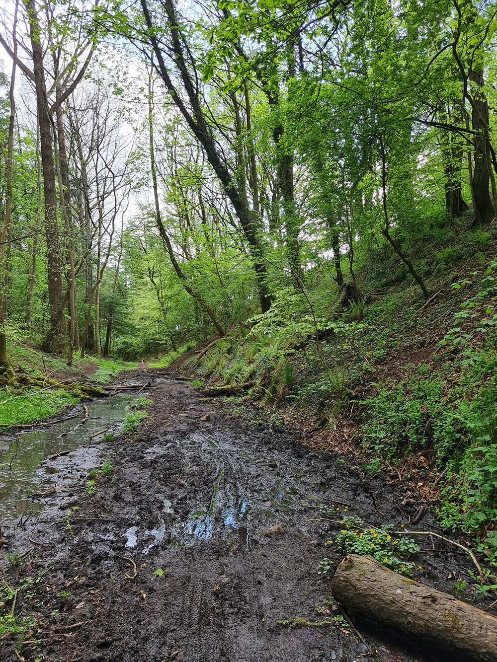
As I approached a wooden footbridge into the woodlands I was surprised at the broken slats and wary where I was stepping. It would take some force to break the wood and now that I look back at the photos the breaks look fresh. Maybe the cows had already been exploring the woods!


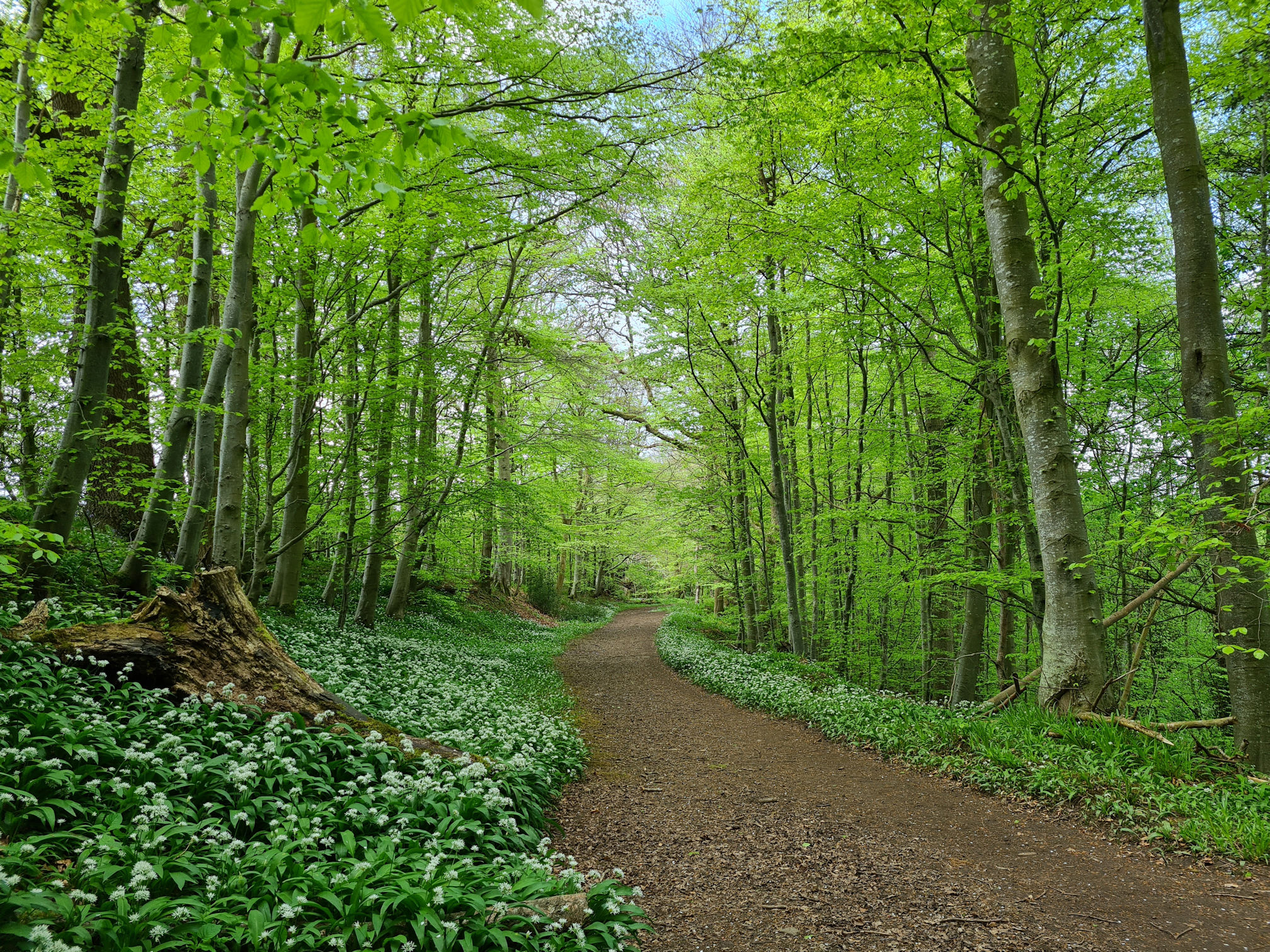
The scent of garlic tickled my nose the further I walked into the woodlands. The path I was now walking on was lined with thriving wild garlic. I love it, it looks so pretty!
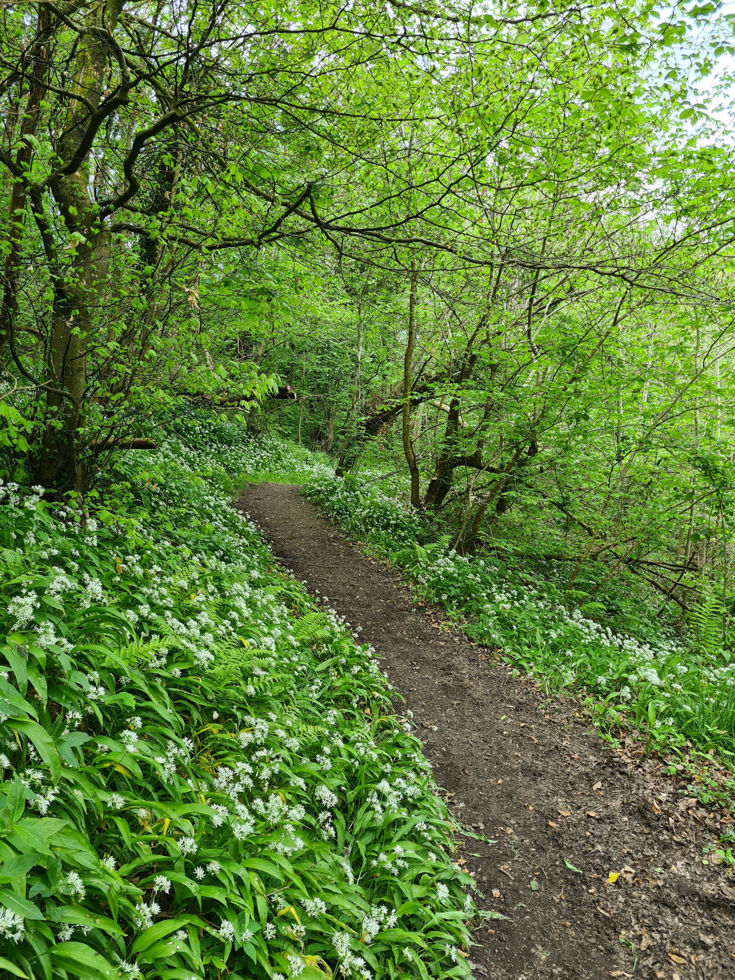
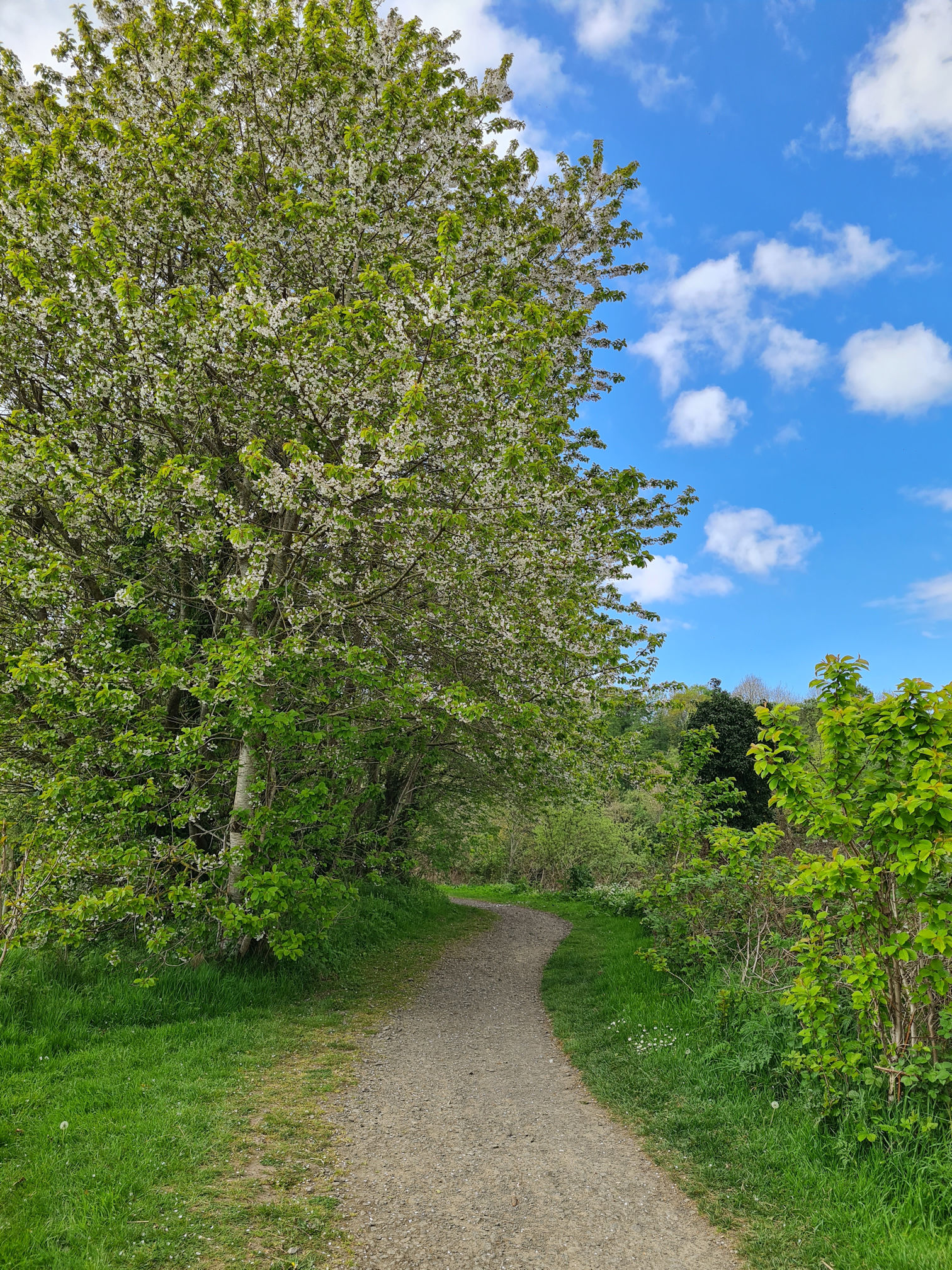
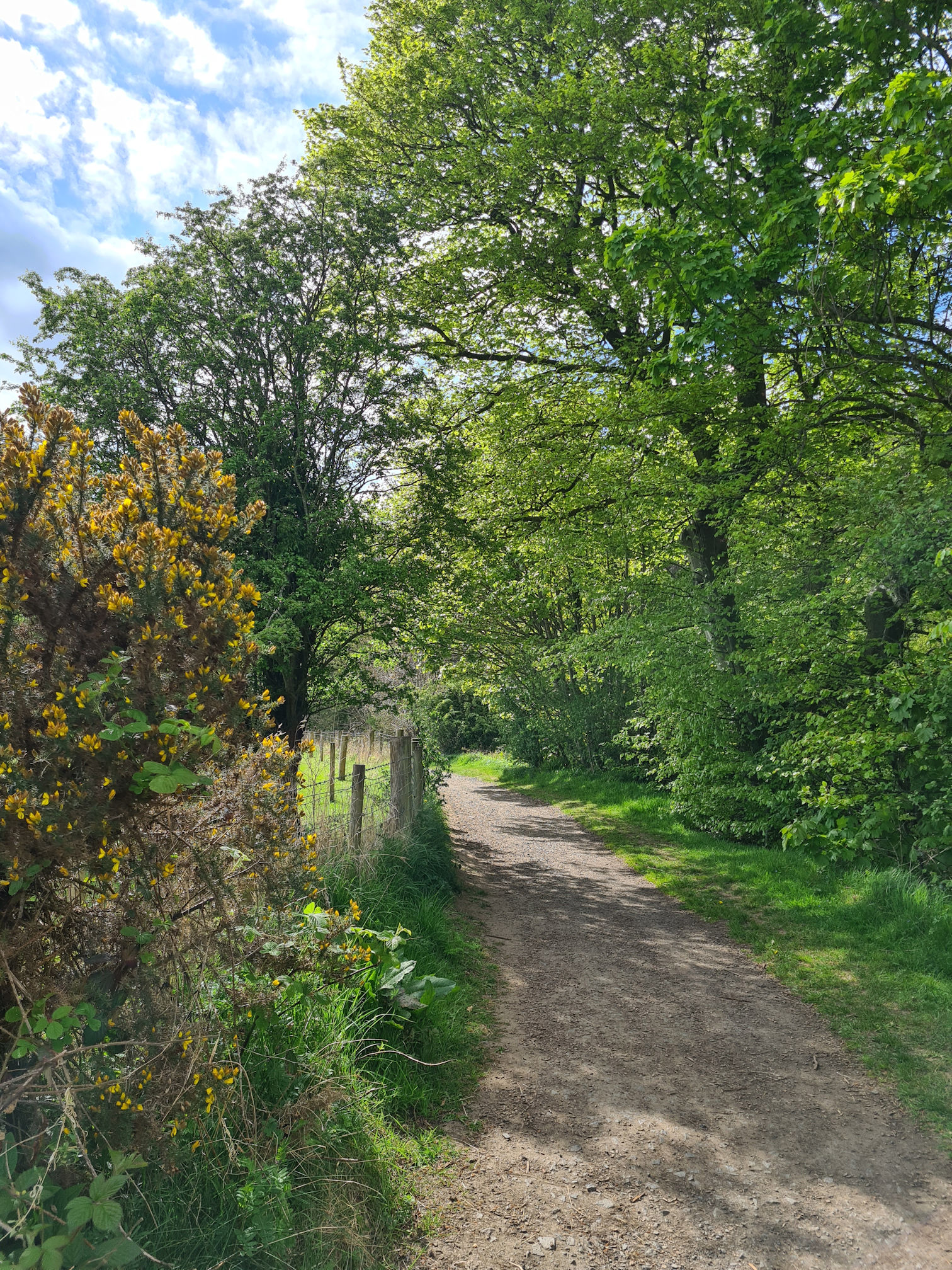
The ever-changing landscape along the River Ayr Way excited me, wandering and wondering what I would see around the next corner. As I left the garlic woodlands I stepped into a new realm of trees, fields and my friend the River Ayr.

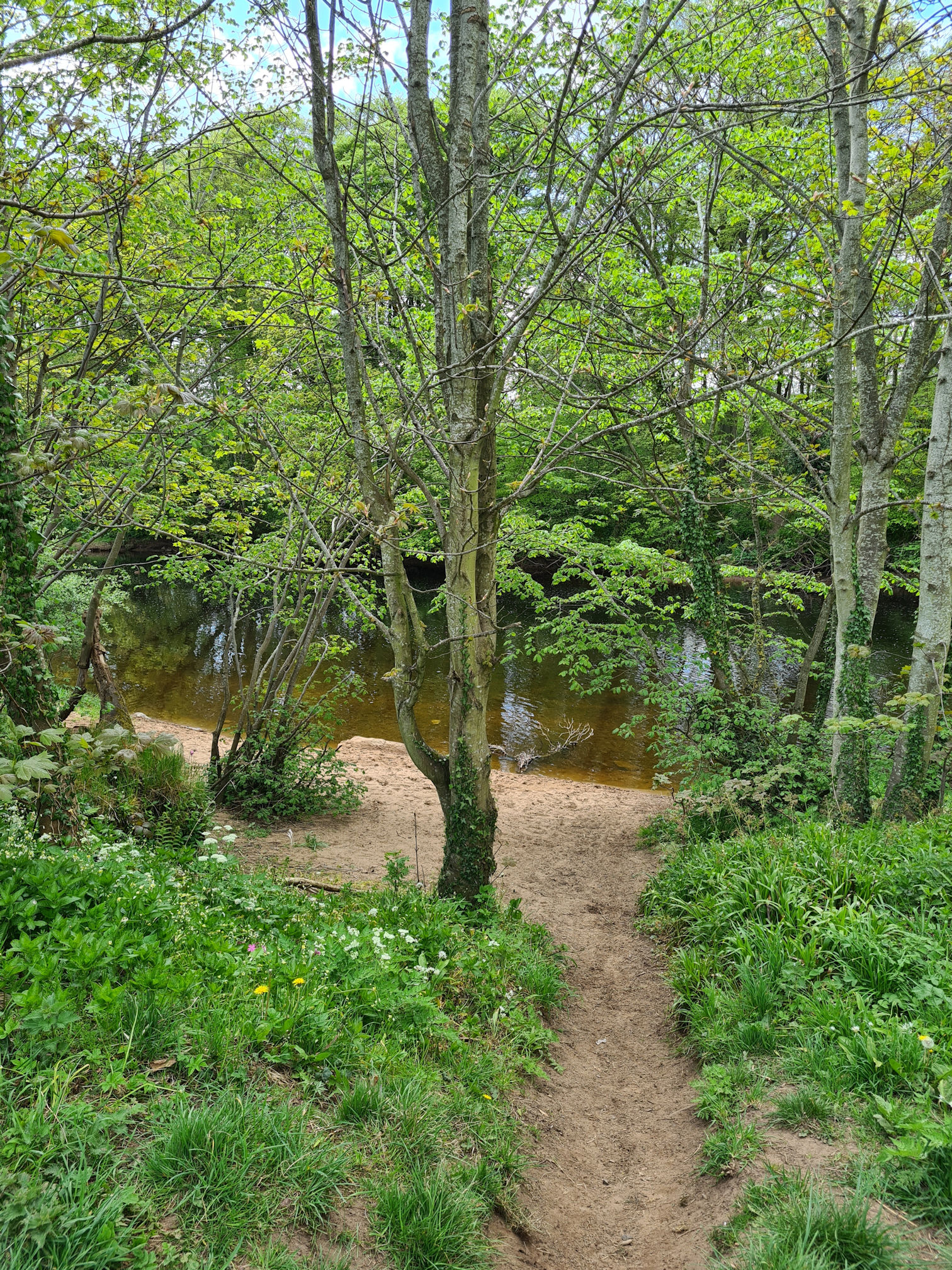
I saw a side path that led me down to the banks of the river so I walked down to say hello. I like to stop and look at the water where I can, as this walk is about following the river on its own journey through Ayrshire.
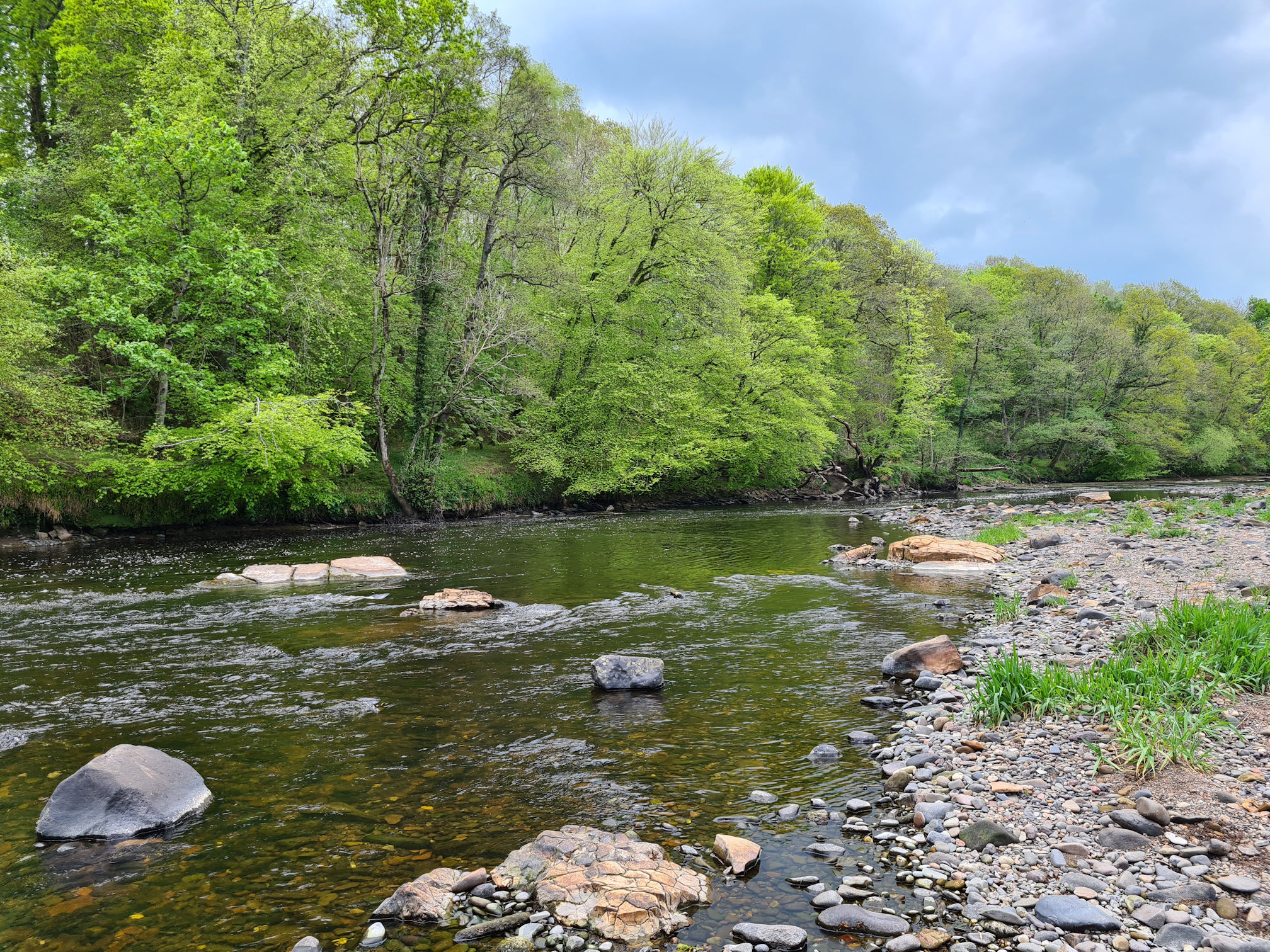
What a beautiful scene to gaze upon as I listened to the tune of the water flowing downstream, this way, and that way through rocks, boulders, and anything in its course.

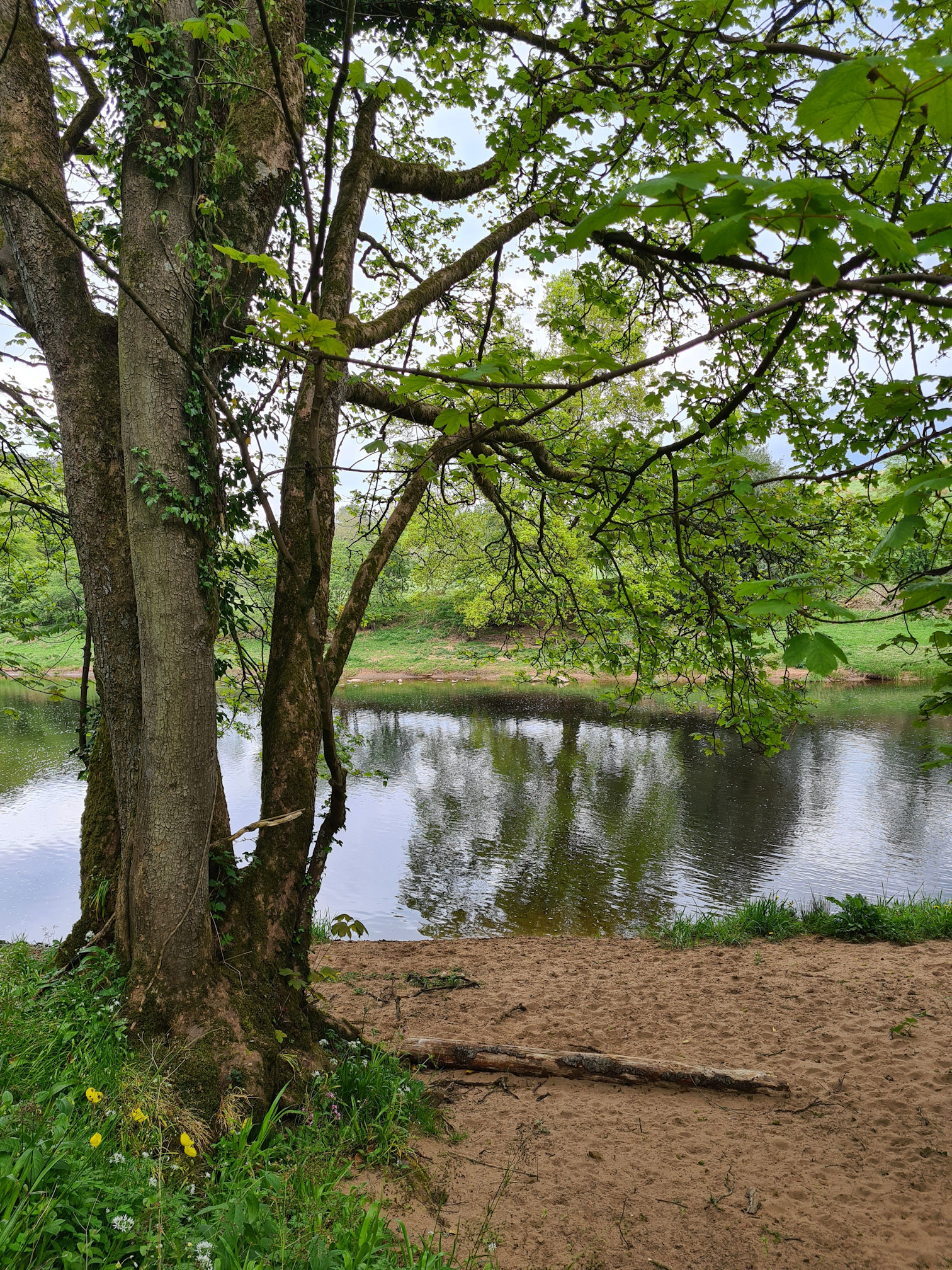
Back on the path I was approaching another garlic woodland trail and the sandy banks of the River Ayr appearing now and then.

The steep wooden steps leading up into the woodlands were muddy, but I didn’t care, I had already been through worse.


I reached a River Ayr Way red arrow, yay! Reassured I was going the right way, I stepped over the broken style into another magical woodland realm.
I’d read on the Walkhighlands website there was an area in these woodlands called “Wallace’s Seat”. In the 13th century William Wallace would sit here, pondering about the battles with the English.
I think this might be the place, but there was no information sign to confirm this. The path descends to a promontory overlooking the river, a dead end viewpoint.

I remember debating whether I should go down the hill as I felt a little weary, but I had to or I would regret not having a look. I couldn’t see much of the river as the trees obscured the open view. Maybe in William Wallace’s day there were no trees at all, and the landscape very different.

I was wishing the lush green field across water was more visible and wondered if the trodden trail I spied across the grass led to another walk I could explore. Mm, I feel another adventure soon to check this out. It will be gorgeous in autumn just now.
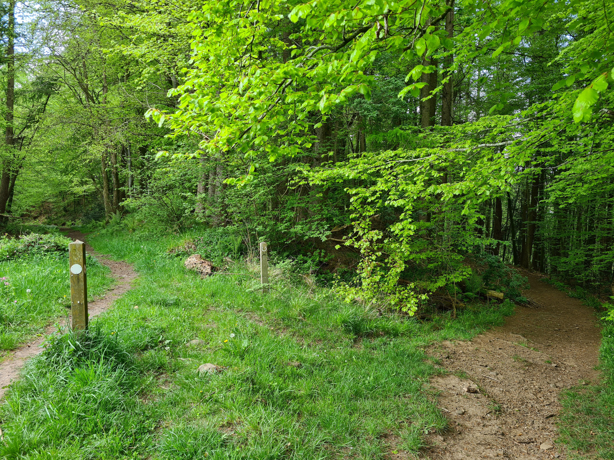
I slowly shuffled back up the short steep hill to the main path, huffing and puffing included. I arrived at a woodland junction, a path going uphill and a path going downhill. Luckily the downhill path was signposted with a red arrow, but my brain was battling the usual thoughts of “I wonder where that other path goes? Will I miss something beautiful there? I must return and explore! “

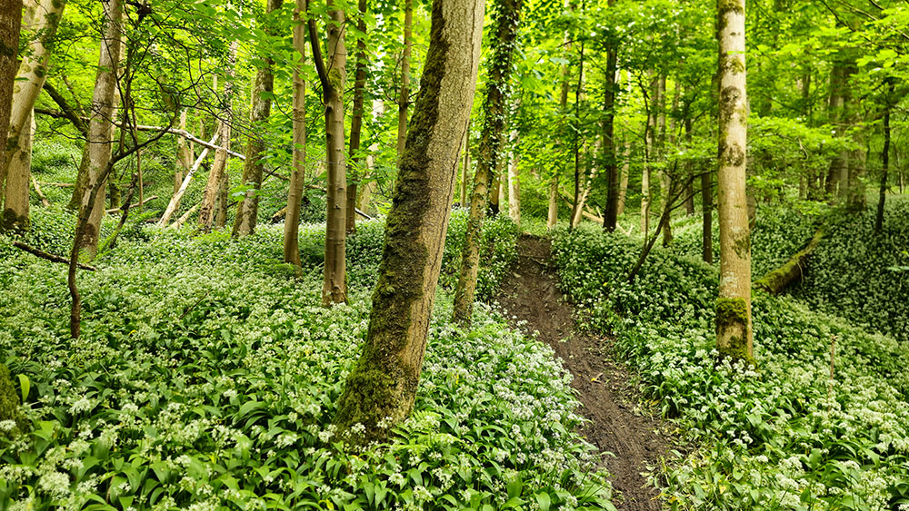
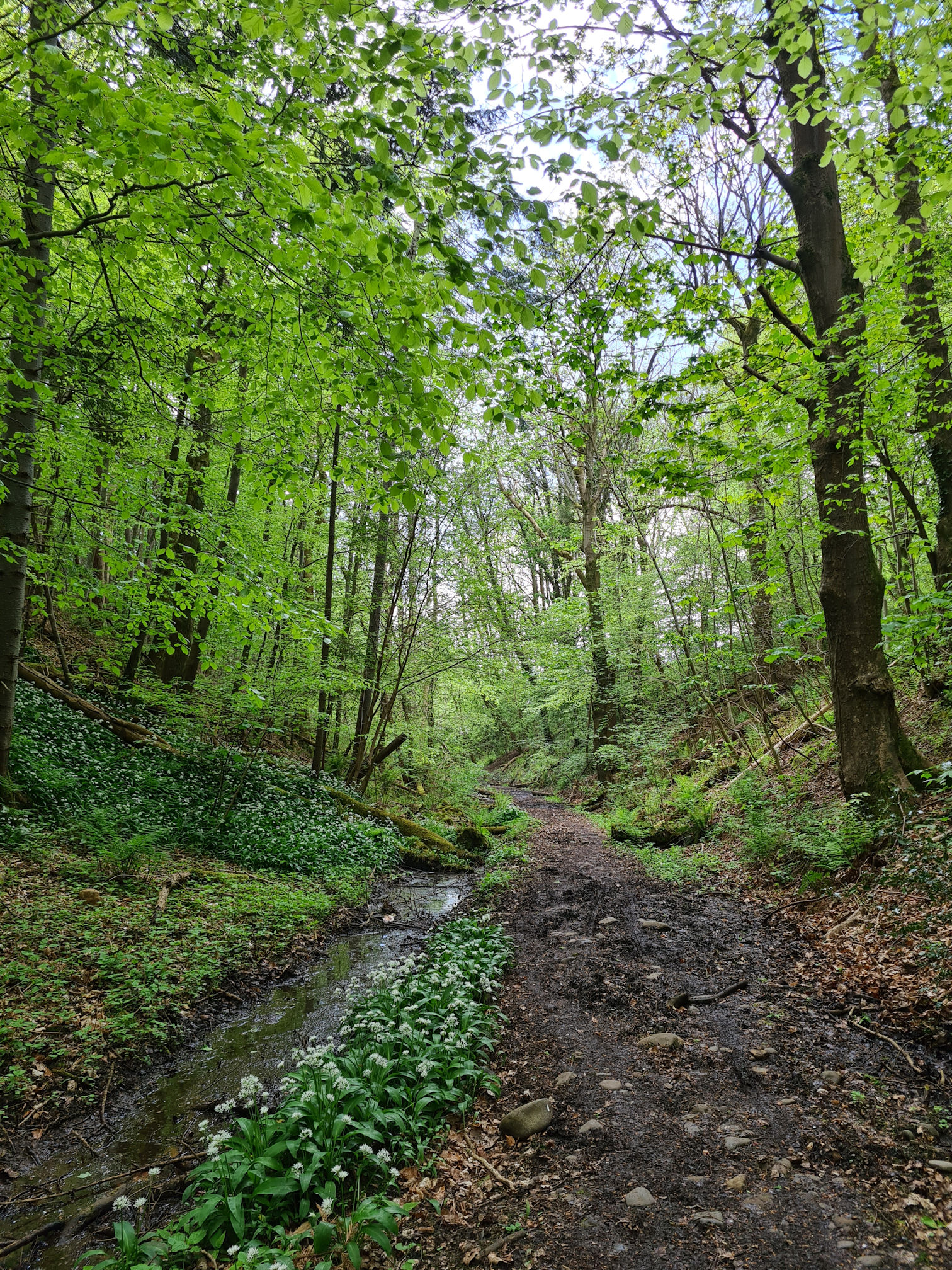
I was back down beside the river again and transported into another wild garlic and bluebells magical realm. I thought I’d already seen the most beautiful garlic trails, but this woodland kept giving me more and more. Wow!

Narrower side paths into the fairy realm were popping up all over the place! Carpets of the white wild garlic spread as far as my eyes could see. Oh I so wanted to follow the paths deeper into the woodlands, but alas not this day.

Back to the main path it was, which was just as beautiful though!
I returned here in mid-May 2024 to explore more of the trails, also hoping the wild garlic would be in full bloom again. I followed a high path that took me to an abundance of wild garlic and bluebells. I also ended up at the junction I mentioned earlier and it was exciting connecting the paths in my head. That moment when I say aloud: “Ah, I know where I am now” is very satisfying.
I was in awe of this place, bringing tears to my eyes as I stood there soaking in its magical beauty. I’m so glad I managed to walk the River Ayr Way or I would never have known about these woodlands.

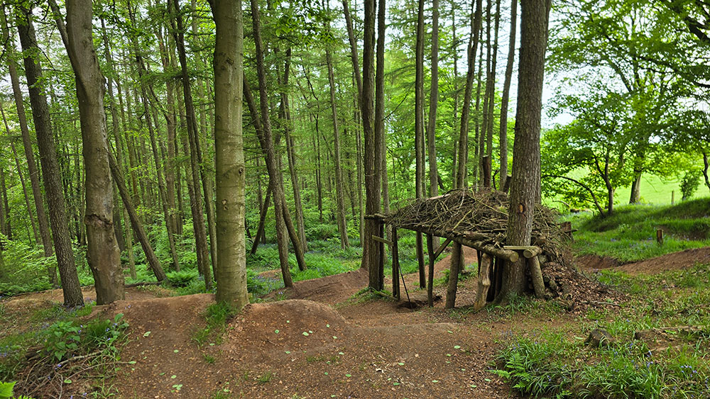
Another new find was a wooden shelter with mountain bike tracks. I wasn’t sure if I should be walking on some of the narrower paths near the main footpath now. If a bike came whizzing down it could be disastrous for us both! I could imagine myself jumping into a carpet of wild garlic, disastrous for the garlic plants 😂.
I could easily spend a full day exploring these woods and there’s still more trails to explore.
I sadly left the magical realms continuing walking through these beautiful woodlands until I had a decision to make. Which way now? Straight ahead or down the hill on the right?
I was beginning to feel like I was in one of those adventure books where you could choose your own path and experience a different ending 😂.
It made sense to go down the hill towards the river. I checked my printed directions which said: “At a path junction keep right to continue along the riverside, before leaving the woods.”
This confused me as I couldn’t see or hear the river at this point. The red arrow on the wooden post facing the high path on the left was faded and I couldn’t make out what way it was pointing. My mind wanted to go down towards the river but I walked straight on, still doubting I was on the official route.
The path turned very boggy and not much of a path, so I turned back thinking it must be the wrong way.
When I returned to the junction and looked at the other the red arrow facing the low path, if I was walking up from that direction, it was pointing to go right or left which meant take the high path, so I walked back again.

My legs were not happy with my indecisiveness 😂. Off I went back along the muddy path wondering where my destiny lies.
It wasn’t very far when I reached a gate that opened up into a field, and low and behold there was a River Ayr Way sign on the gate. Yay!

Thankfully the family of black and white cows were behind a fence. Look at their wee curious cute faces.

I followed the worn path across the field and soon reached a road beside Oswald’s Bridge, which was the next part I was excited to see for the first time.

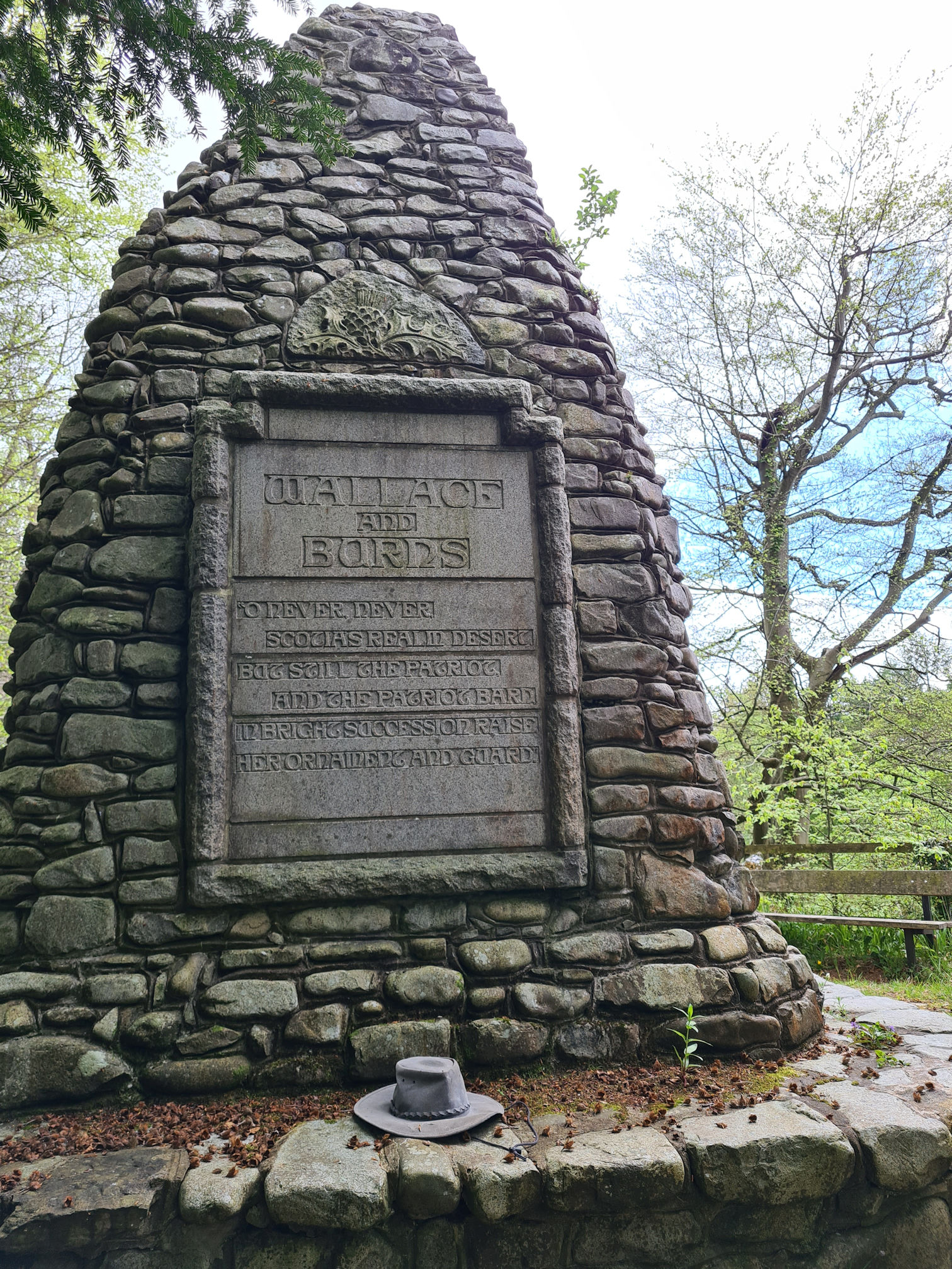
Before heading towards the bridge though, I crossed the road to look at the cairn dedicated to William Wallace and Robert Burns. The beautiful black iron gate was donated by Calgary Burns Club to commemorate the 250th Anniversary of Robert Burns.

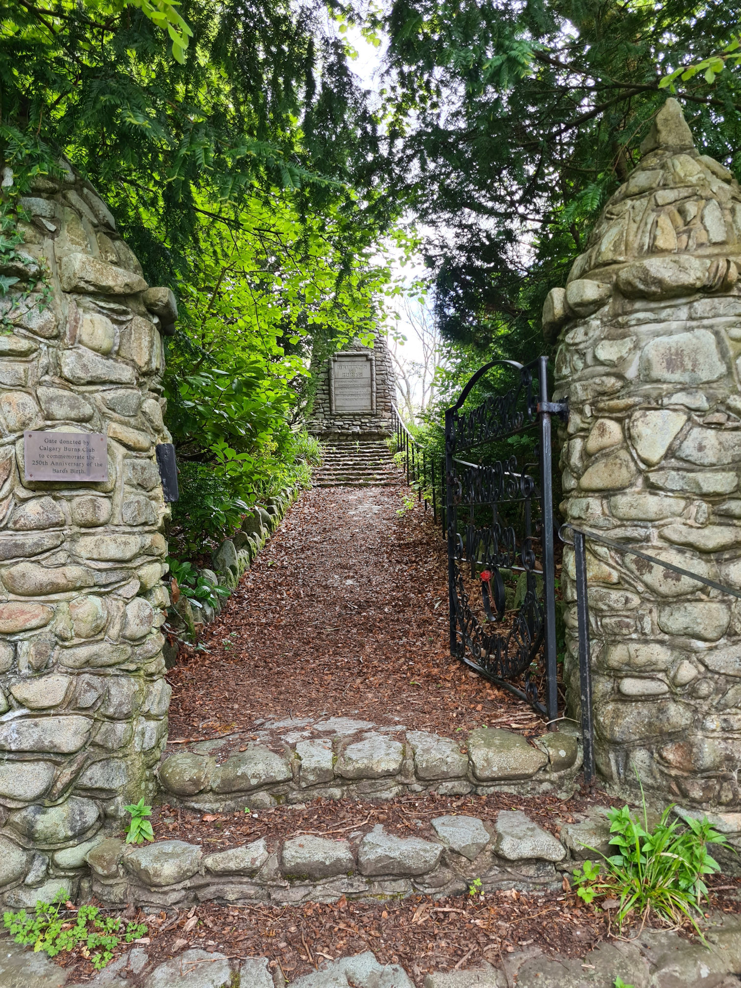
What a lovely cairn, I love the thistle. Looks like someone forgot their hat!
I noticed yet another footpath here that led down to the river into a woodland called Leglen Wood where William Wallace hid from English soldiers after a fight that took place at Riccarton in Kilmarnock. I’ll add a link to the information source at the end if you want to know more about the history of William Wallace and Robert Burns at Leglen Wood.
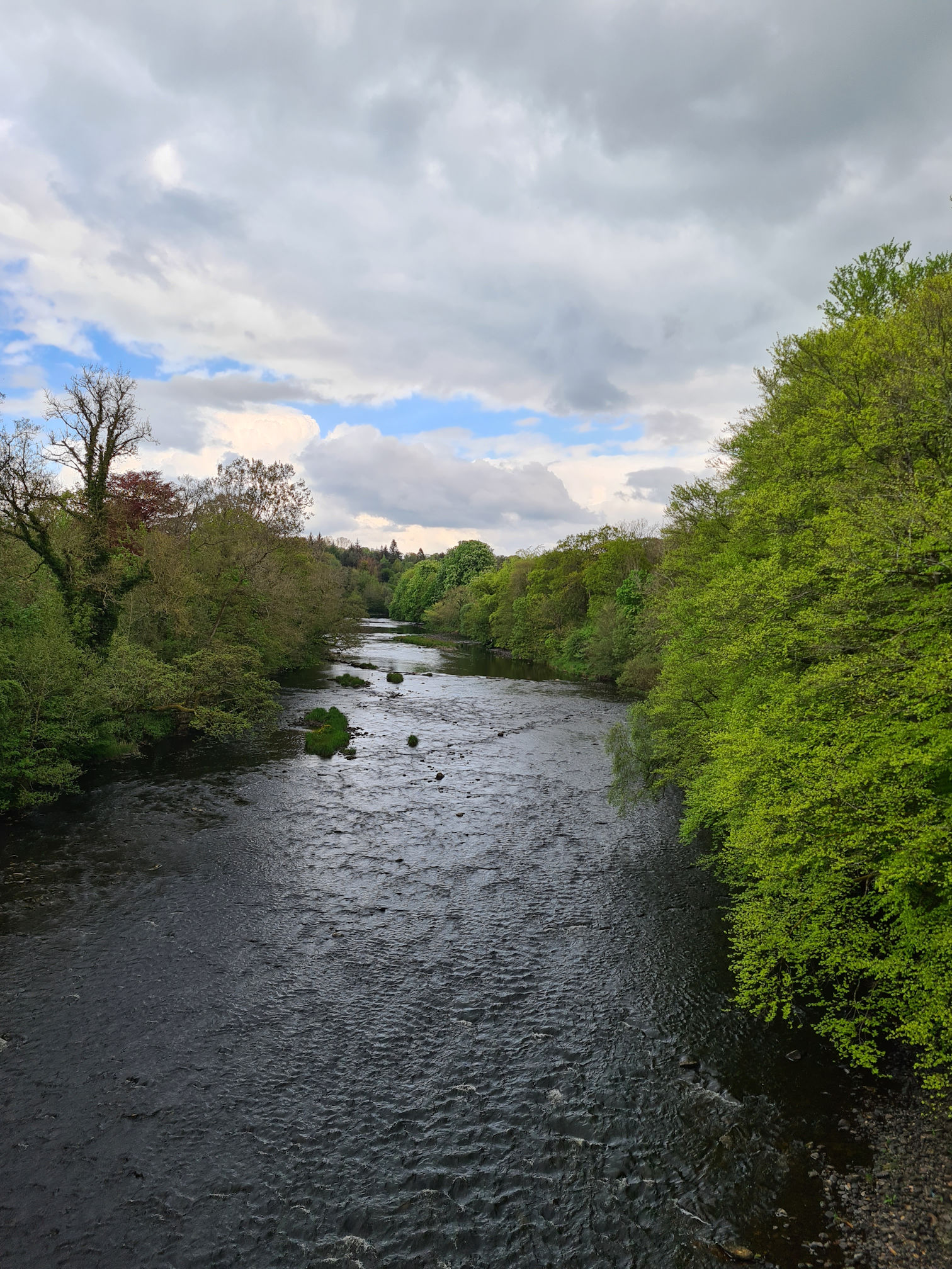
It was time to walk across Oswald’s Bridge. I love the little curved areas where I could stand in off the road safely to take photos, and handy if a car was passing.

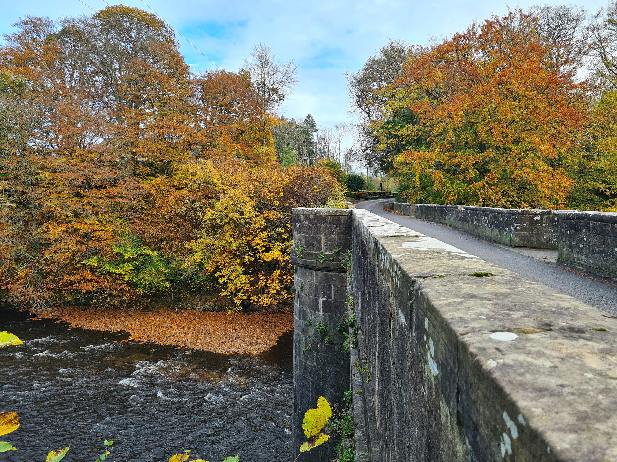
I peeked over the bridge at both sides of the river, and knew I would return here in autumn as I could imagine the colours being stunning.

I have returned a few times now, so here are some photos of autumn in all its glory, the time for letting go.
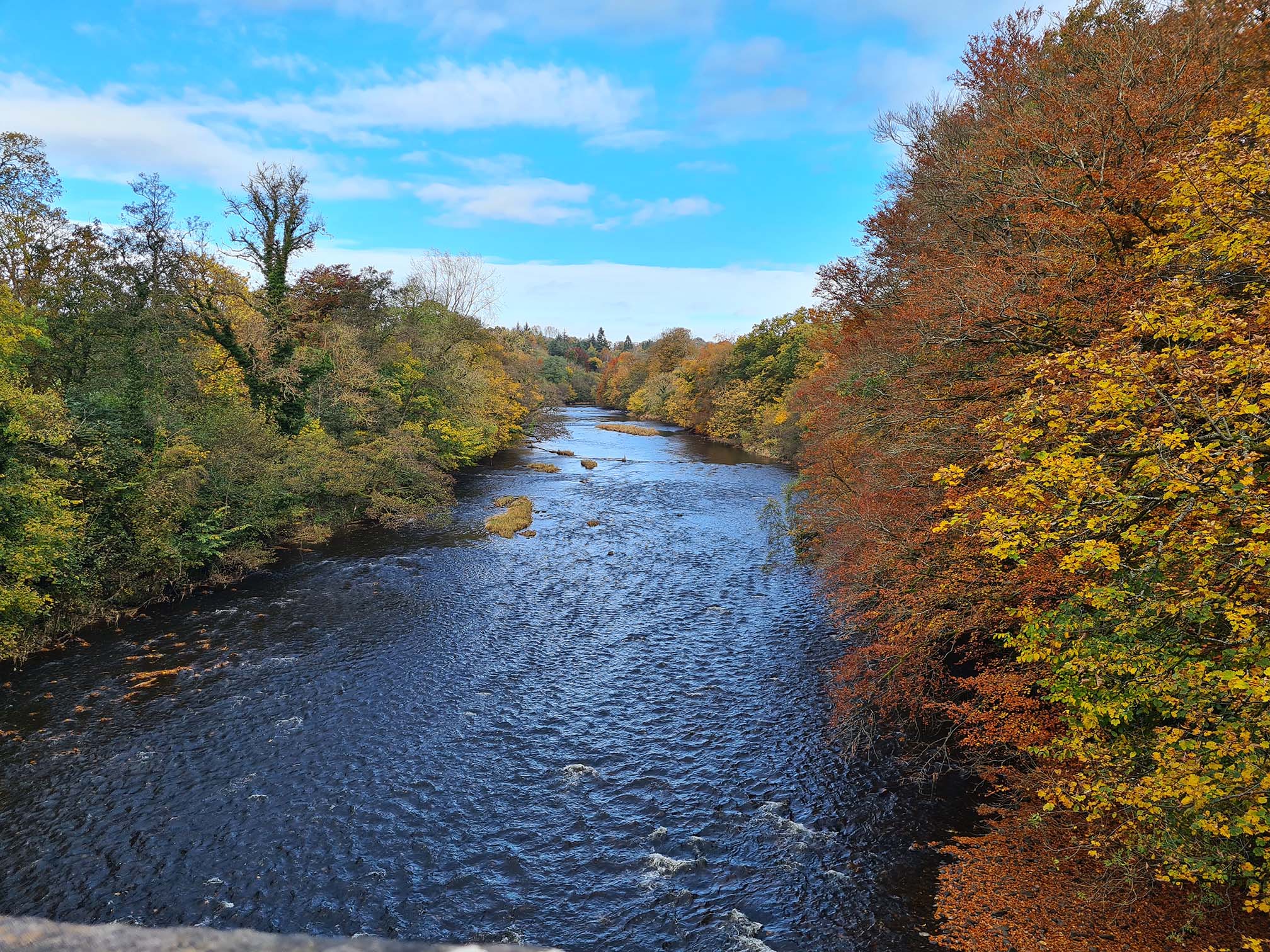
I think my phone camera at the time has slightly enhanced the colour of the blue sky, but the autumn colours are what it’s really like by eye.

There’s more walking trails on the other side of the river from where I was walking the River Ayr Way. I have already explored some of them, so beautiful they are. This is short video on my Instagram, autumn at Auchincruive Estate.
I can’t believe it has taken me so long in my life to see the Auchincruive Estate in Ayr. It’s not even far from where I live. Probably one of the reasons is that over the years I lost my confidence in driving to new places on my own, and we had an unreliable car. The past few years I’ve been more adventurous as we now have a better car with Sat Nav, and it helps me checking out places on Google Maps first to get a visual of the route, and where to park.
After I crossed the impressive Oswald’s Bridge, I was now following a footpath alongside a road. Gaps in the hedge beside me let me glance across a lush green field at buildings in the Auchincruive Estate and I was wondering if they were private houses or business premises.
The scene looked so pretty with the dramatic sky in the background, and of course I loved the tree which looked so tiny in this huge open space.

One tree in the field wasn’t thriving, but to me it stood out so beautifully.

I kept walking looking for a cycle path signpost to Ayr, and it wasn’t long until I reached this. I was now on the road to Ayr, the final stretch!
Road to Ayr
Sadly, my friend the River Ayr left me, but I knew we would meet again very soon. I was now enjoying the country scenery, and the clouds were being very creative for me today. How could I not be distracted by their presence.

I love looking at clouds of all colours, shapes and sizes. I vaguely remember when I was walking home from primary school with a friend, if the clouds were moving fast in the sky we would each choose one and have a race, running along with them as well. It’s another snippet of a memory that sticks in my mind from a very young age, and strange how I remember these tiny moments in time.
My little legs were beginning to weary, but I plodded on along the country road.


When I heard the noise of traffic I knew I was close to the busy A77 road. When I reached the road I knew exactly where I was. I walked towards the Overmills Road Bridge and looked over to see my friend the River Ayr again.
I drive over this bridge often but had never visited the stepping stones below and always wanted to. When the river is high you can’t see the stones, and also unsafe to cross when they are wet and slippery.

This was an ideal time for a short detour to the stepping stones, before continuing my walk along the River Ayr.
Mm, the stones are dry and the river is low, should I try to cross them I thought. I’d watched other people crossing when I was up on the bridge about five minutes ago, and they managed fine.
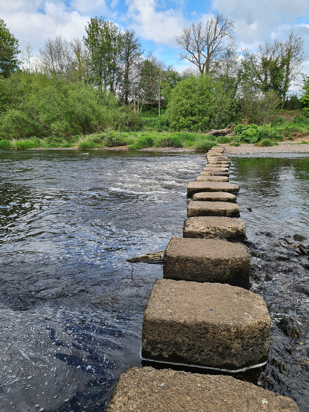
My balancing skills aren’t what they used to be as you know, but I just had to step across them. Gosh I was wobbly as you’ll see in the video clip below.
It was more nerve wracking than I thought because of the large gaps between the stones, and the river flowing speedily between them. Tired legs and holding my phone was interesting, but relieved to say I didn’t fall in!

The stepping stones don’t seem to go anywhere, just a small island in the river and then they continue across the river to a grassy bank. There was previously a Ford across the river, and different Mills located here from 1594, with the last one being demolished when the Ayr A77 by-pass was constructed.
I didn’t stay long to investigate properly, and slowly stepped my way back across the river and onto the River Ayr Way path.

As I walked under the Overmills Road Bridge, I felt happy that I managed the stepping stones and was getting closer to the town of Ayr.
The river was now moving slow and calm compared to the fast flow at the stepping stones. Such a contrast, and it’s always nice to gaze upon the upside down tree reflections.


As I approached a small footbridge I noticed a ruined building ahead, an old Limekiln structure.

The Old Holmston Limekiln has three arches and was built by the Wallaces of Craigie to supply lime and neutralise the acidity of soil and fields to improve crops.


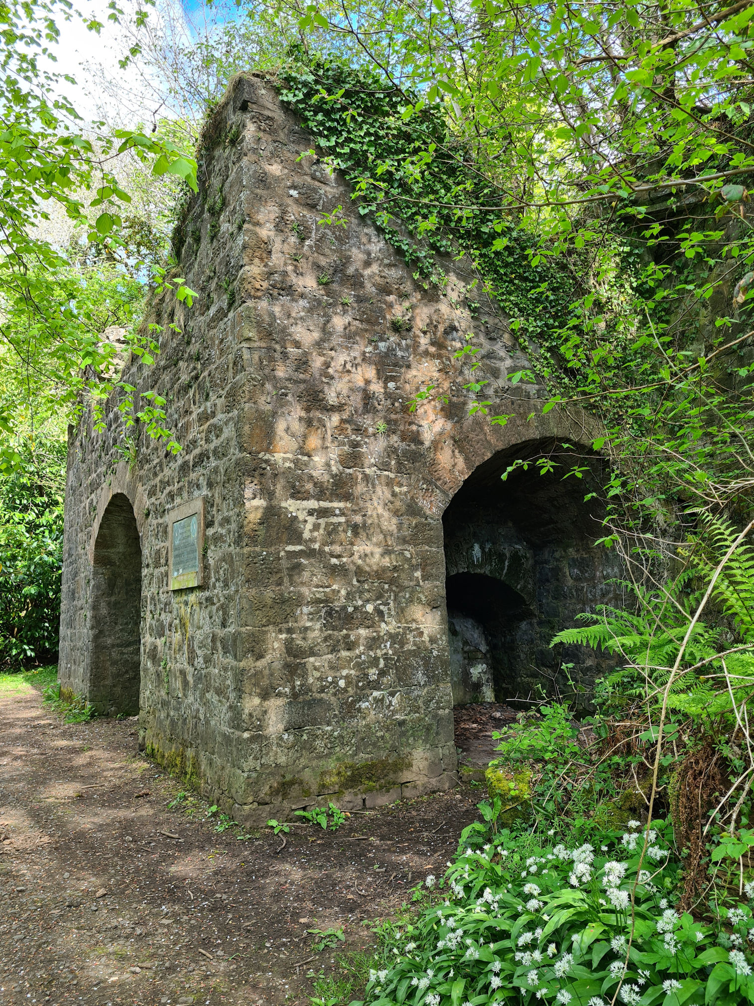
The plaque on the old Limekiln structure is dedicated to the ‘Ayr River Walk’ opened on 24 August 1910.
A welcoming bench beside the Limekiln invited me to sit and watch the river for a wee while, but I kept moving as always.


As I was walking alongside Holmston Road towards Ayr, I saw a few exits to the pavement next to the road, but I knew not to go this way and should be crossing to the other side of the river soon, away from the traffic noise.


It was time to go downwards towards the river again, across the Craigholm Bridge.
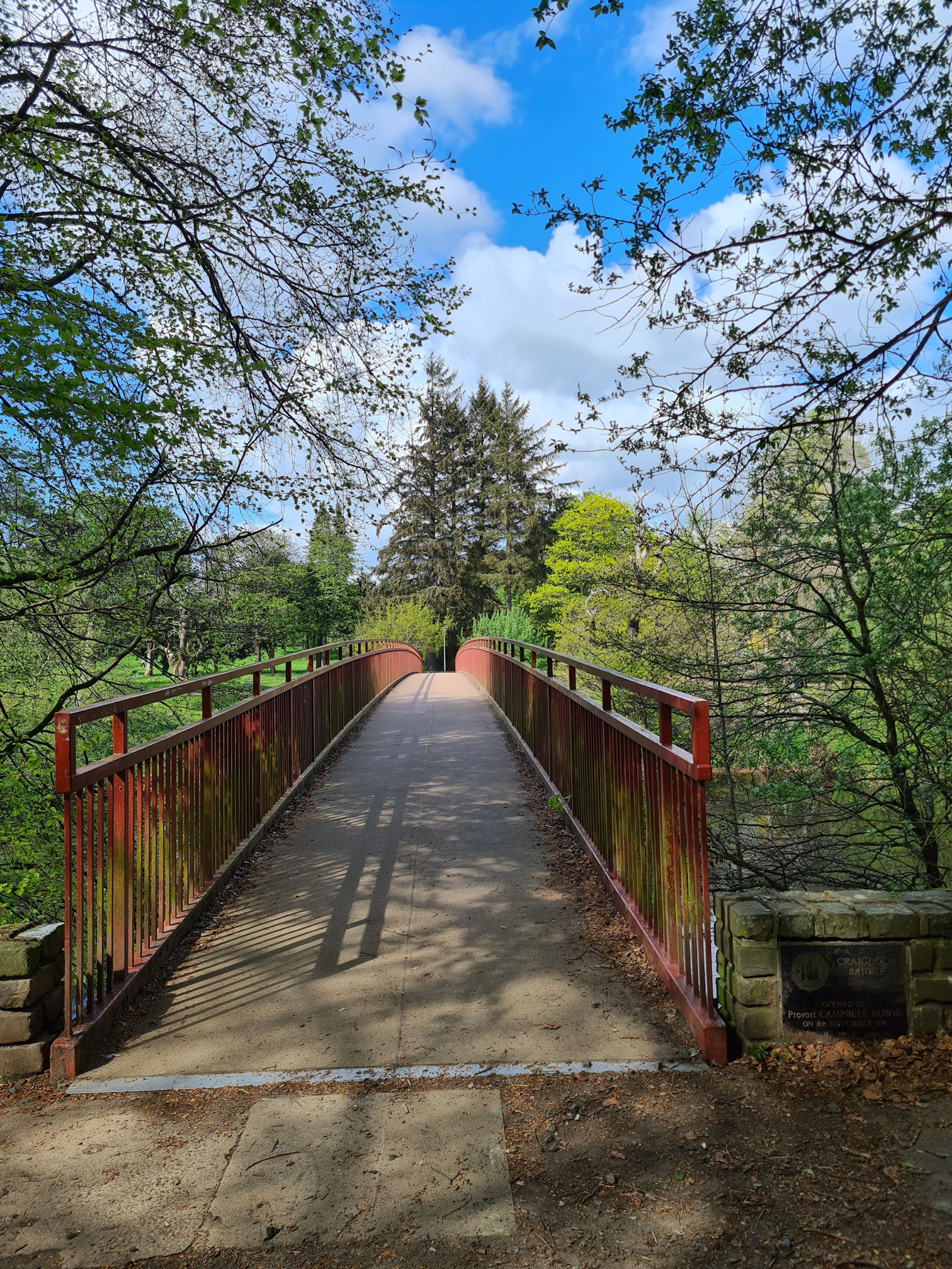
The name Craigholm Bridge comes from ‘Craigie’ and ‘Holmston’, the two districts of Ayr the bridge connects, and opened on 8 November 1974. Gosh, it’s almost the same age as me!
I’ve really enjoyed seeing all of the bridges on this walk, connecting different places that would have been difficult to get to if they were never built. The picturesque view up and down the River Ayr was glorious!
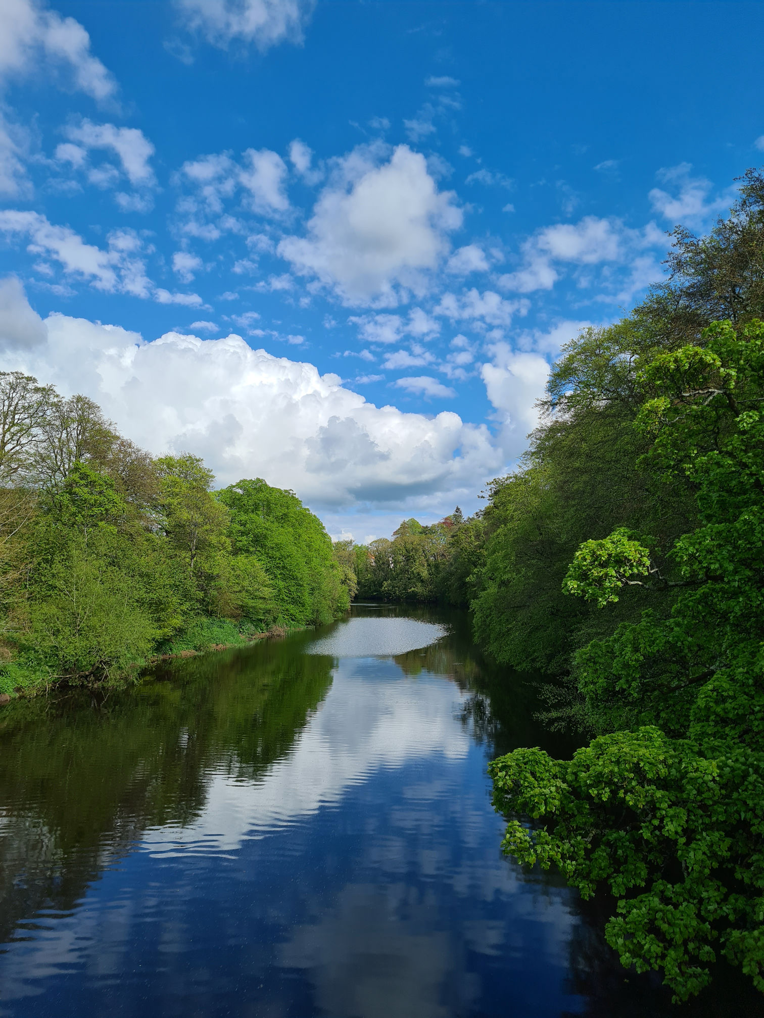
The photo below was taken from the bridge on a different day. Early one sunny morning I returned to this part of the River Ayr Way to capture more photos and video clips I needed for my blogs and videos.

I loved returning again as I was fresh with new energy, and could take in everything around me much better, as on this solo walking day I was at the tired stage and just quickly snapping photos as I go.
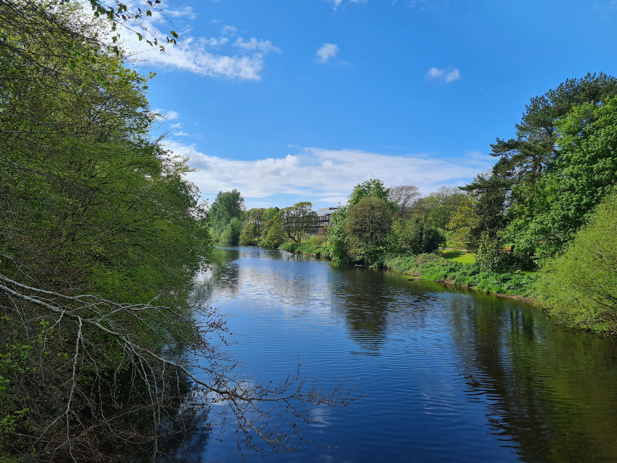
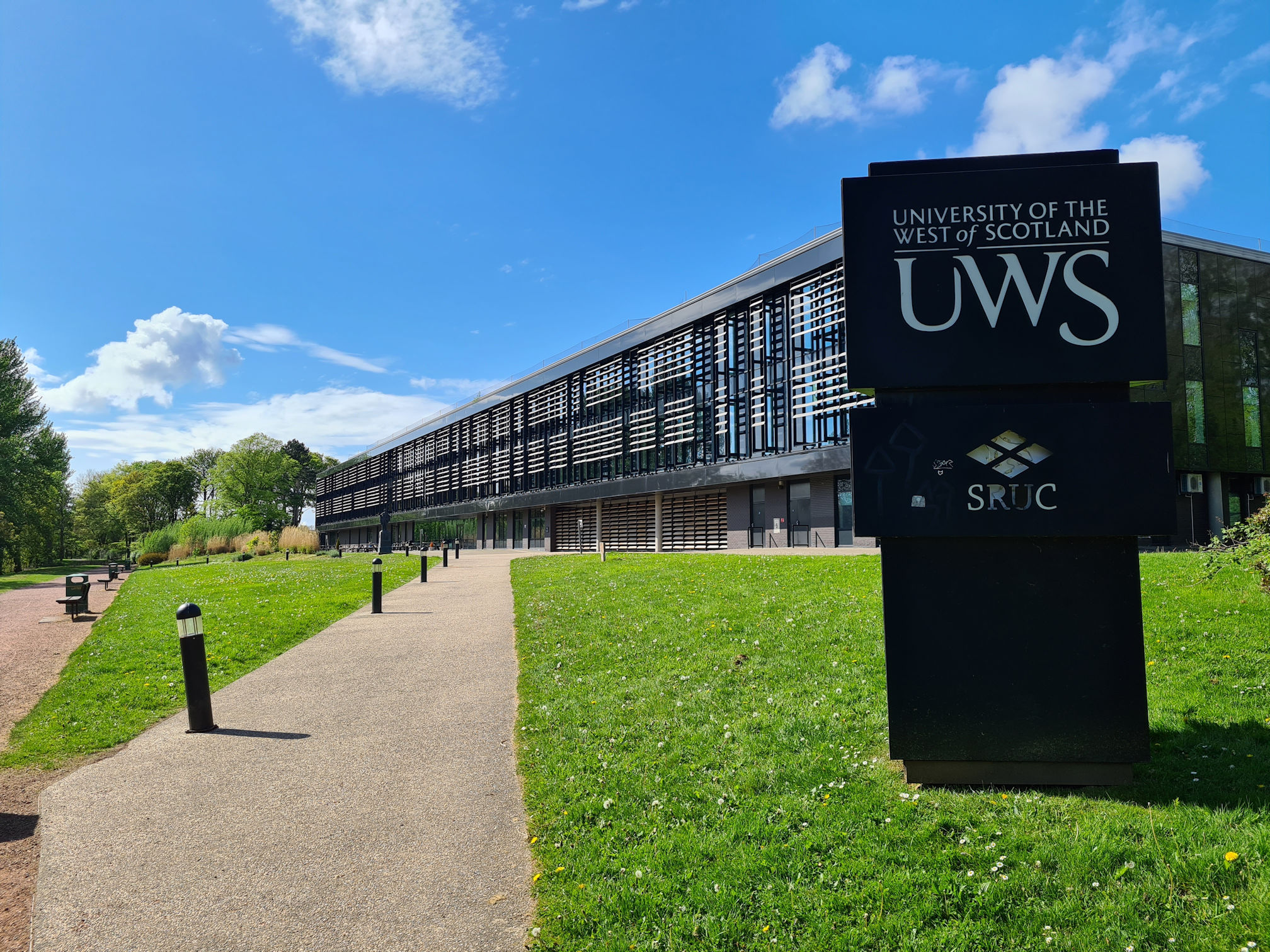
I passed the University of West of Scotland building and thought wow, what a great location for a University beside the River Ayr.


As I was approaching the Ayrshire College buildings, I stopped to look down the river and capture the tree which was framing the scene in front of me quite nicely.

My legs were definitely now saying: “Are we nearly there yet?”, and my attention to detail was deteriorating 😂.
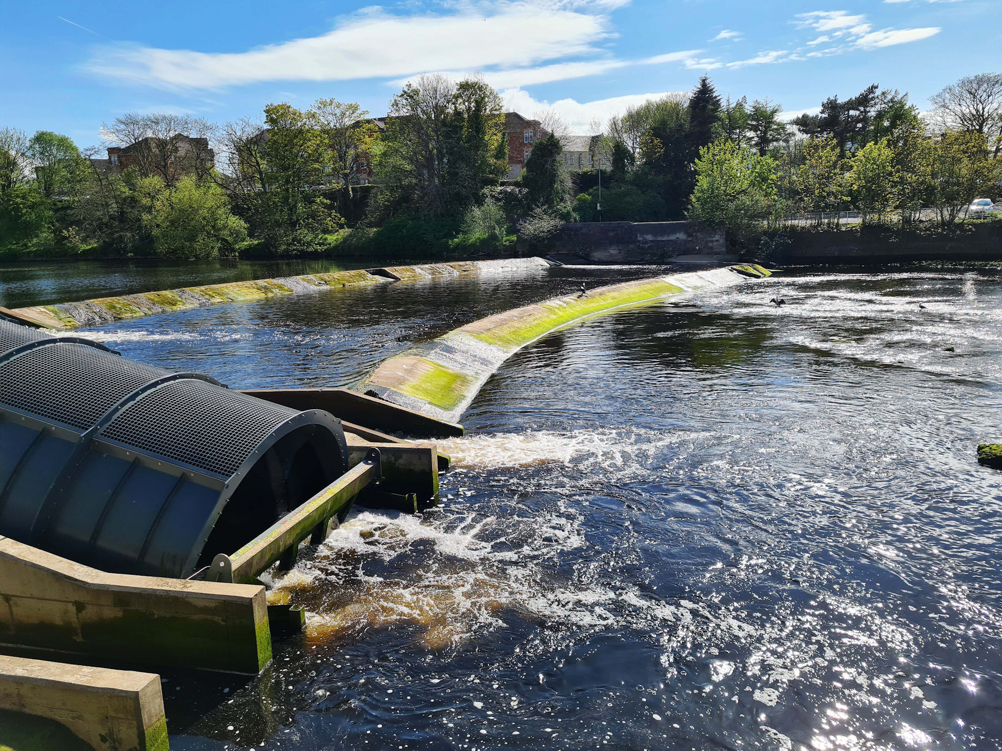
Beside the Ayrshire College is the Nethermills Hydroelectric Power Scheme which opened in February 2022. The hydro scheme was built by Energy Agency Renewables Ltd, based locally at Auchincruive. They also own and operate the scheme, supplying green electricity to Ayrshire College with none of this electricity being sent to the grid.
I love this, brilliant idea and keeping it local.

I was now walking with more unique bridges of Ayrshire, the first one being the Victoria Road Bridge pictured above, opened in 1961 and widened in 1977.
Next it was the Ayr Railway Viaduct, built in 1878. The river reflections were looking picturesque on this calm day. The viaduct also has a cage walk footbridge on the other side.
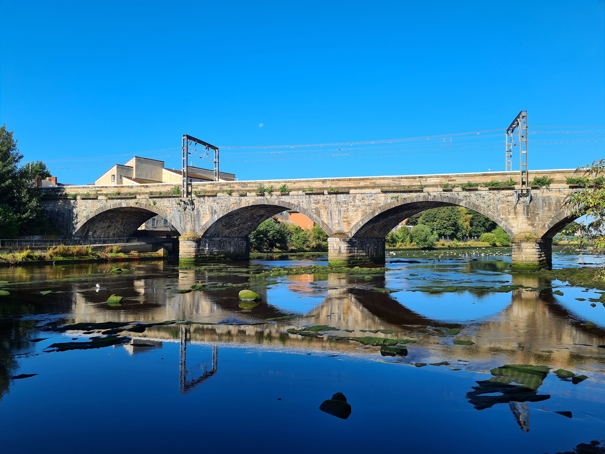
I waited for a train to record for my video, so this photo is from the video clip.

The river was slow moving and calm, with ducks, swans and gulls having fun splashing about in the water.

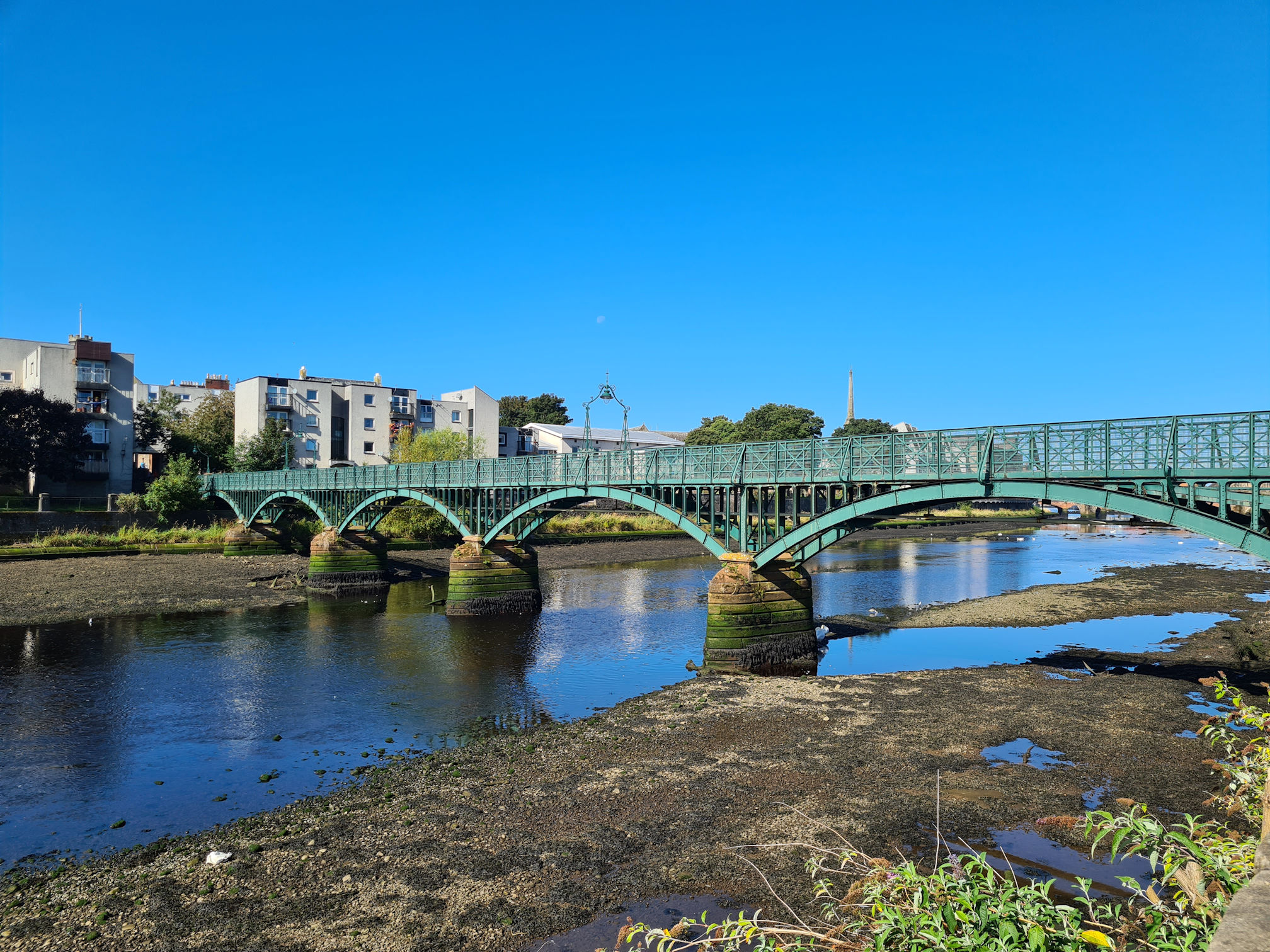
The next bridge was Turner’s Bridge, a steel and iron footbridge across the River Ayr, built in the 1900s.
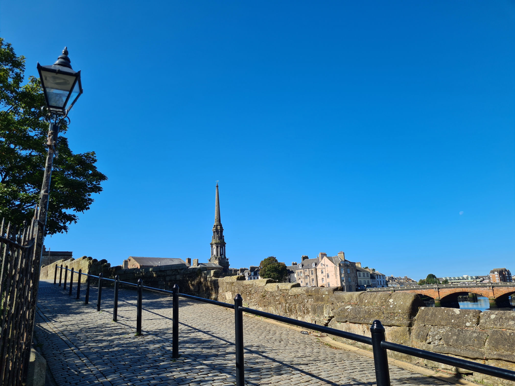
And I finally reached the footbridge I should now cross over, the Auld Brig on Old Bridge Street. The Canmore website says: “Old Bridge of Ayr, was built 1470-1525, and extensively repaired in 1910.”

Peeking under the Auld Bridge, is the New Bridge on New Bridge Street which carries the A719 and replaced the Auld Bridge.
As I stepped onto the Auld Brig, I passed a lamp post and wondered if it glowed magically at night. I loved this style of street lighting as it reminds me of the book and movie ‘The Lion, The Witch and The Wardrobe’. Of course there was no wardrobe or lion in sight, but there may well be ghostly witches wandering in the dark of night…
I almost walked past this information sign as it’s behind an iron railing.
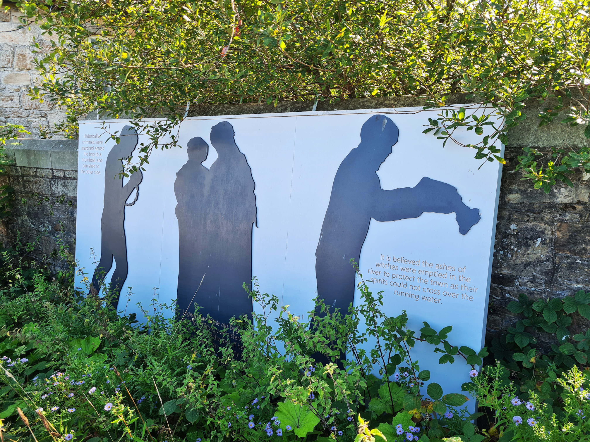
The information board reads from left to right:
Historically criminals were marched across the brig to a drumbeat and banished to the other side.
Legend has it, the old brig was paid for in the 13th century by the Lowe sisters as one mourned the loss of her love to the rapids on a stormy night.
It is believed the ashes of witches were emptied in the river to protect the town as their spirits could not cross over the running water.

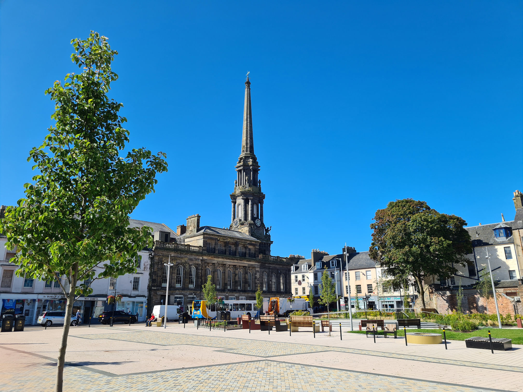
Looking across the river I could see the new events area which is used for local art, history and culture, including a new community building. It looked so nice from where I was standing, so once I crossed the bridge and turned right down the High Street, I stopped off to see more.
I love the large open space and benches where I could have sat and chilled for a while, away from the town traffic.

It was another short stop though and then I walked down to the end of the High Street, crossed the busy road at the traffic lights, and reached the courtyard of Loudoun Hall, one of the oldest houses in Ayr.

As well as being one of the oldest houses, it’s also one of the few houses remaining from the 15th century in any Scottish burgh.

It was built in 1513 by James Tait who was a wealthy local ship-owner of Ayr. Mary Queen of Scots is known to have toured many places in Scotland, and it is likely that she stayed at Loudoun Hall in Ayr.
The statue of a man pointing down towards the ground portrays the Reverend William Adair, a Covenanter, judging a woman to be a witch.


The townhouse was saved from demolition in 1937 by Lord Bute, and in 1952 the building was restored and opened as a cultural centre for Ayr. It’s a beautiful building, but unfortunately it’s not open to the public as far as I know. It was nice just standing in the courtyard on a sunny day though.
My next stop was the Citadel wall ruins of what was the Cromwell barracks, originally built in 1650s on the command of Oliver Cromwell. The Ayr Citadel was one of five forts and could house up to 1000 Cromwellian soldiers.

The information sign says the upper part with large windows in the photo above was built after 1850 by John “Baron” Miller, a rich eccentric. This is known as Miller’s Folly.

The remains of the Folly looks like a giant face to me, but I can also see a person inside the top left alcove-like area. It looks like the head and shoulders of a young man, with the top half of his face deformed.
Can you see it? Maybe it’s just me, I can’t unsee it now 😂.

I continued walking along South Harbour Street wondering where the official finishing point would be. I knew I should be looking for the sculpture mentioned at the beginning of the walk at Glenbuck Loch.
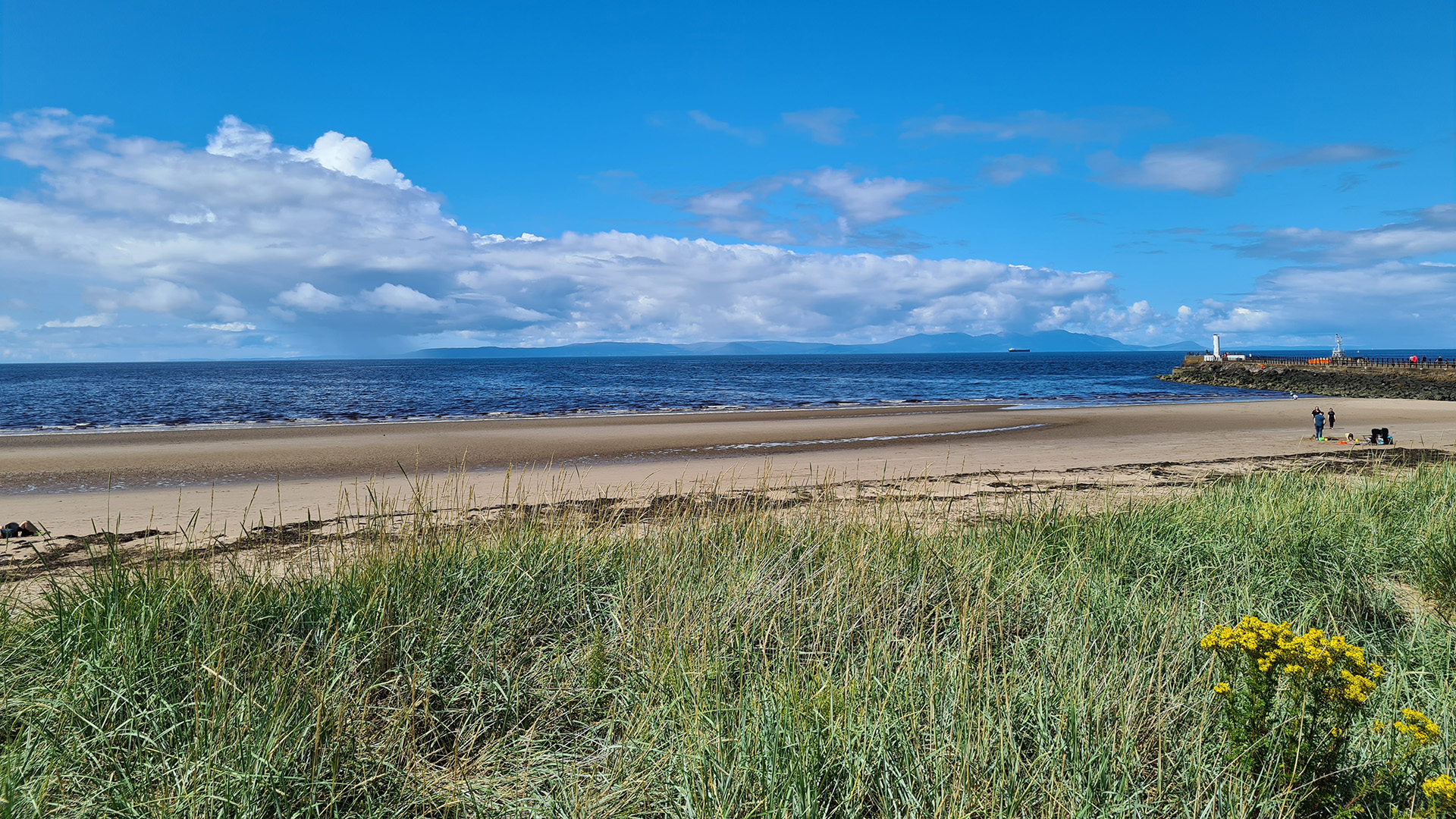
When I reached the Ayr promenade, I turned right and walked towards the footbridge. The Isle of Arran was looking beautiful across the Firth of Clyde.

After I crossed the bridge I saw the information sign for the end of the River Ayr Way displayed beside the promenade.
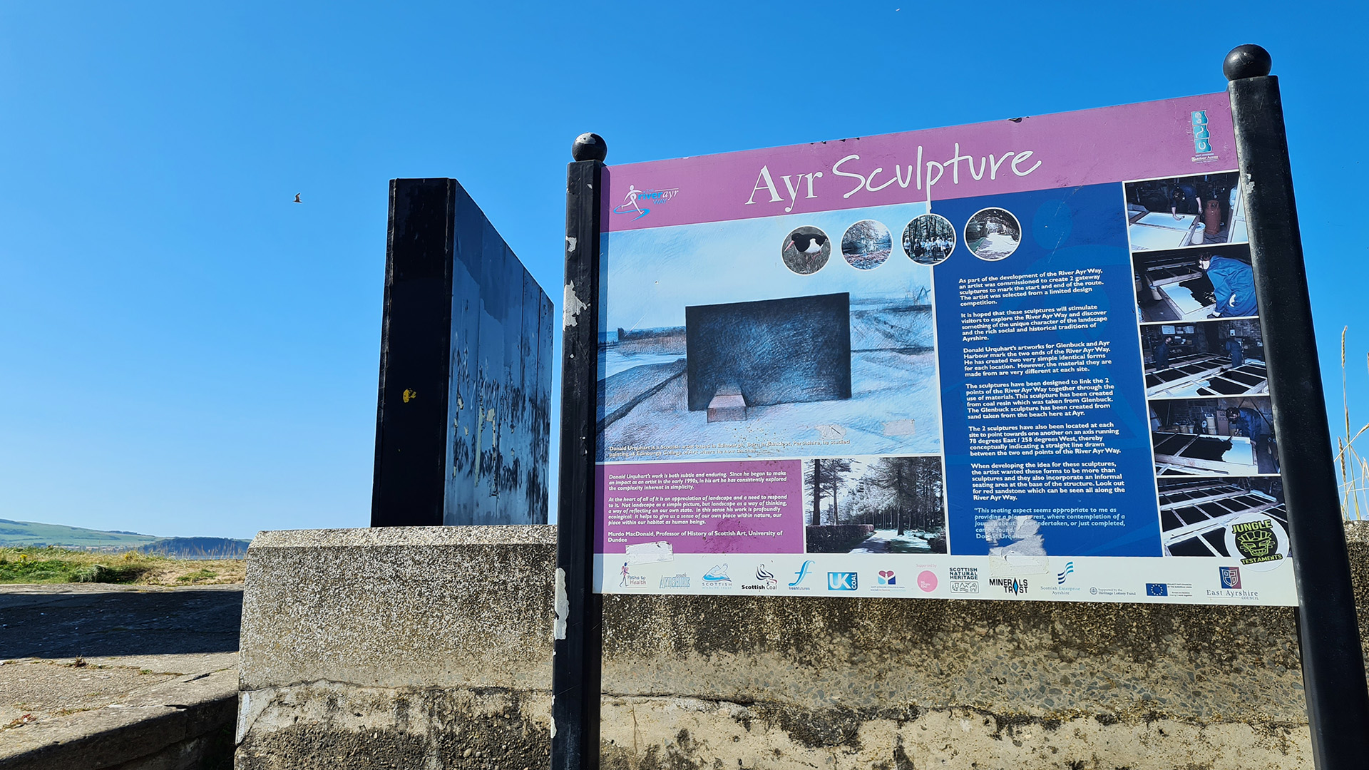
I walked up the steps to have a look at the large monolith shaped sculpture.
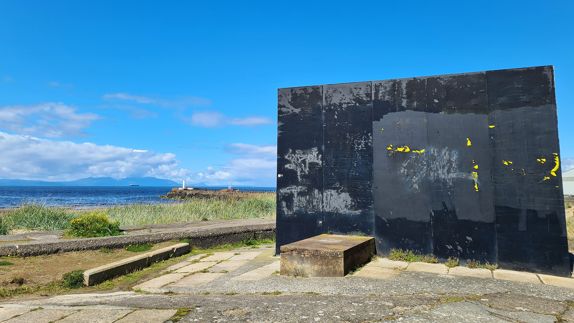
The sculpture is made from cast coal dust from an opencast mine at Glenbuck, with its twin at the starting point made from cast sand from Ayr beach. The two sculptures are aligned with each other at 78 degrees east and 258 degrees west.
The sculpture was looking a bit worn when I visited in 2023, but the stunning views of Ayr Beach and across the Firth of Clyde to Ailsa Craig and the Isle of Arran made up for it.

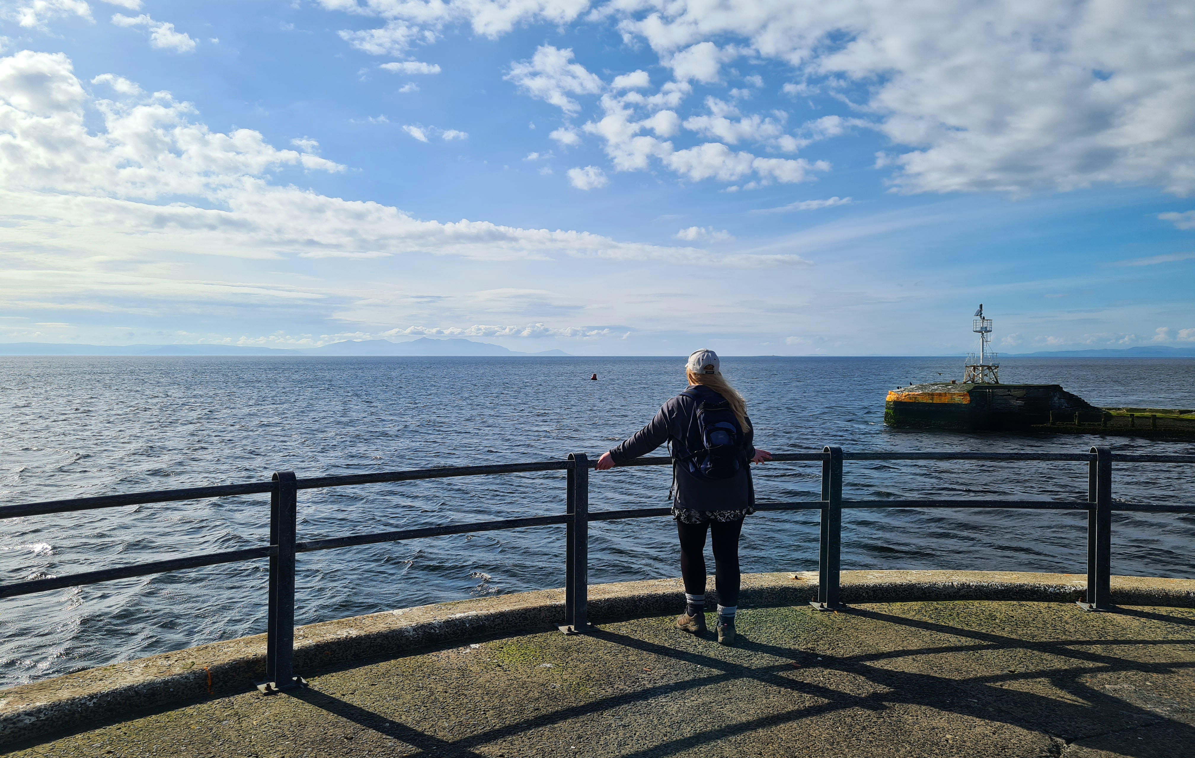
I’d reached the new home of the River Ayr, now joining with the Firth of Clyde. I wasn’t quite finished though … the little white lighthouse perched on the south pier was calling me to go further.
So off I went determined to reach the end of the pier. I had already called Alan to pick me up and he met me there.


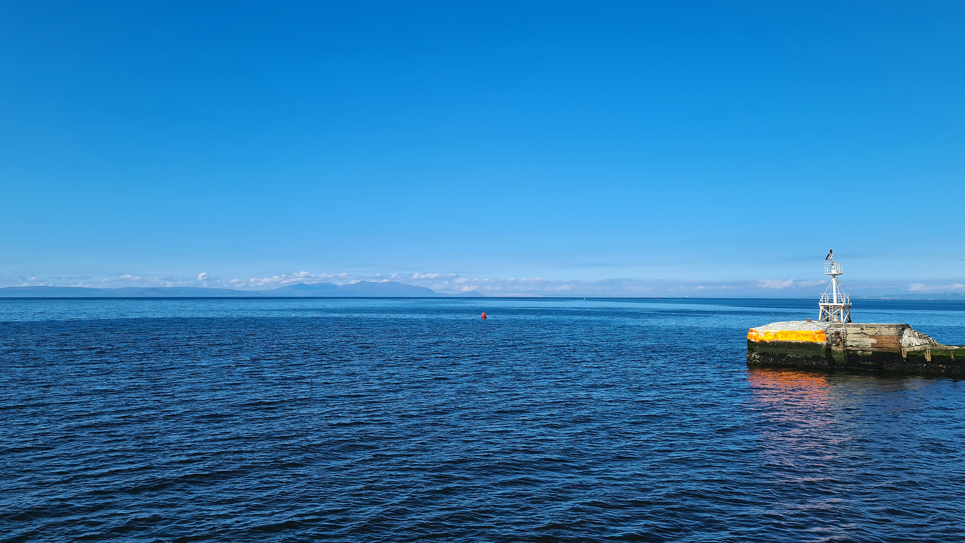

Now this is what I call a stunning finishing point! I stood at the end of the pier, gazed across to Arran, feeling tired but very happy.
Ayrshire, you are a beautiful and magical shire indeed!
My recorded distance and times including my earlier blog from Stair to Ayr:
- 21 kilometres (13 miles)
- Moving time: 5 hours 40 minutes
- Elapsed time: 8 hours
My Garmin watch recorded around 73 kilometres (45 miles) all in from Glenbuck to Ayr, but I did stray off the official path in some places, and the route included detours. I’m not sure what the official distance is as it varies across different websites and blogs, from 41 miles to 44 miles.
I can now confidently share this walk with friends and family, and not get lost. I’ve already returned to places where I was curious about the paths on the trail as well. Thanks also to my husband for being my chauffeur, dropping me off at my starting points and coming back for me when I finished. I wouldn’t have been able to walk this solo without his support.
The East Ayrshire Leisure website linked below also has more information about the history along this walk, including a route breakdown in shorter distances, walking from two to seven days. Every September there’s also the River Ayr Way Challenge, an Ultra Marathon and Relay following this beautiful route.
If you would prefer to walk the River Ayr Way in the opposite direction from Ayr to Glenbuck Loch, and split the walk into shorter distances, check out the Gillian’s Walks website linked below. Gillian also has over 200 walking routes on her website across Ayrshire and beyond!
I hope you enjoyed walking with me and my random thoughts, what a wonderful adventure to look back on. My video from Stair to Ayr and links to further information about this walk are below.
My next blog story will be about our annual anniversary visit to the Isle of Arran in June 2024. We stayed for a whole week in a cottage this time which was bliss. I loved it as always, and we even surprised ourselves and managed a new challenging hike!
Take care
Love, Dawn-Marie x
River Ayr Way: Stair to Ayr video
More information about this part of the River Ayr Way
- East Ayrshire Leisure: River Ayr Way
- Scotland’s Great Trails: River Ayr Way
- Walkhighlands: River Ayr Way
- Gillian’s Walks: River Ayr Way
- Scottish Outdoor Access Code
- Ayrshire History
- Destination South Ayrshire: Auchincruive Trails
- Destination South Ayrshire: The Burning
- Calgary Burns Club: Wallace and Burns at Leglen Wood (PDF 20.6 MB)
- Ayrshire History Facebook: Overmills Stepping Stones and the Mills
- Roger Griffith YouTube: The Old Holmston Lime Kiln, Ayr, Scotland
- Ayrshire College: Nethermills Hydro Scheme on the River Ayr
- Canmore: Loudoun Hall
- Canmore: Cromwell’s Fort

Thank you! I think it is the least favourite run she’s ever done… as you said the path is not always clear or mud or cow free and she is terrified of cows! Have a good week! Xx
LikeLiked by 1 person
This is amazing! Your photos are stunning and your commitment to the walk and your love of the place shine through! Well done you! X
LikeLiked by 1 person
Hi Julie 🙂
Thank you so much, really appreciate it! It took me so long to pull everything together, I felt like I was walking it all over again and loved finding out more about the history of the walk.
My mind is now happy that I’ve finished writing this, wonderful to look back on and I hope it inspires others too.
Thanks again
Dawn-Marie x
LikeLiked by 1 person
I’m sure it will!! My friend Claire ran about 14 miles of it once. I should let her read it too. Well done you xxx
LikeLiked by 1 person
Wow, that’s a great distance to run cross-country! Well over a half marathon :-). I miss running sometimes, walking for me at the moment. Well done on all your running too! xxx
LikeLiked by 1 person